Someone is. The question is where.
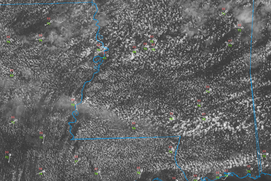
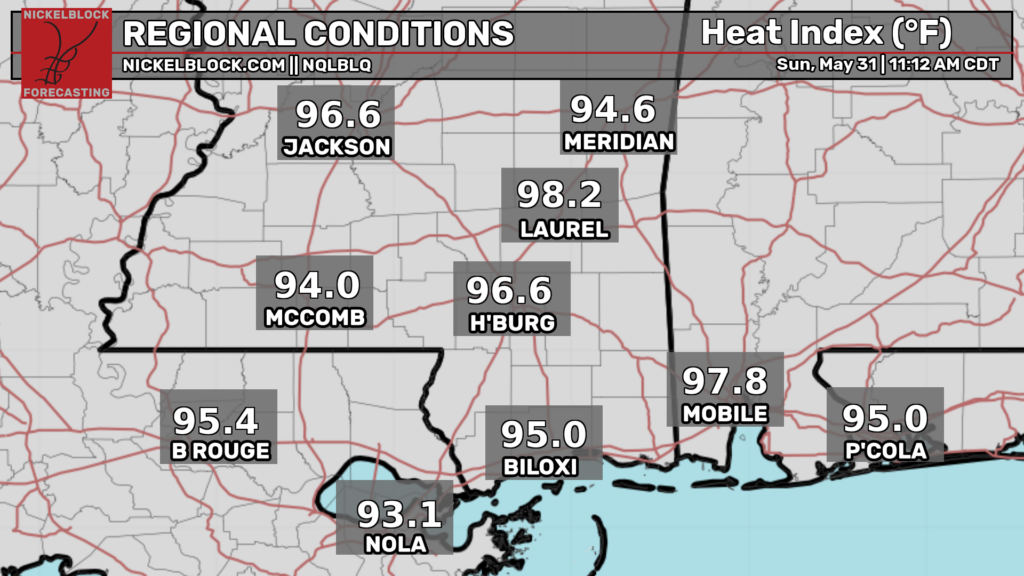
Satellite imagery shows popcorn cumulus slowly deepening across southern Mississippi with temperatures in the upper 80s. Dew points are in the upper 70s leading to extreme humidity. Heat indexes are in the mid 90s. These values are expected to increase further (potentially reaching 105).
This will provide enough fuel for isolated thunderstorms to develop wherever surface convergence is maximized. These storms won’t be anything noteworthy but will still be capable of heavy rain, frequent lightning, and maybe some gusty winds as they collapse. Given the lack of vertical wind shear, convection will be slow moving and short lived (pulse storms).
For the areas that do not get any storms, the combination of low 90s temperatures and 75+ dew points will create dangerous heat for anyone who spends significant time outside. Make sure to take breaks in air conditioning, wear loose fitting clothing, and drink plenty of water. Today WILL be a great day to take a dip in the pool (assuming your area is not experiencing lightning).
The forecast gets more difficult tomorrow. While some models indicate another another humid day with a few pulse storms, it appears that there may be a chance for a loosely organized convective cluster to sink south into our area.
If this occurs, the threat for widespread storms with damaging wind potential will increase.
We know that a complex of thunderstorms will develop over southern Missouri this evening. The uncertain part is whether this will be able to persist through the night as instability weakens. If it does, a reservoir of extreme buoyancy (MLCAPE > 3500 J/KG) and a puff of upper level flow will allow for strong straight line winds to occur.
For any areas that are able to stay dry and relatively cloud free, it will be another very hot (temps in the low 90s) and humid day (dewpoints in the 70s). Avoid spending more time than necessary in the sun (especially if doing strenuous labor) and drink plenty of fluids.


