Looking ahead to the weekend, the most significant weather event I’m concerned about is the winter storm expected to impact the Northeast on Sunday. The system is currently developing over New Mexico and Colorado, and as it moves eastward, snowfall can be expected in the central Plains on Friday, the Midwest Friday night into Saturday, the Mid Atlantic on Saturday, and the Northeast Saturday night and Sunday. The biggest impacts are expected in the Northeast as the system reaches the Atlantic coast and strengthens into a Nor’easter. A few places may see up to a foot of snow.
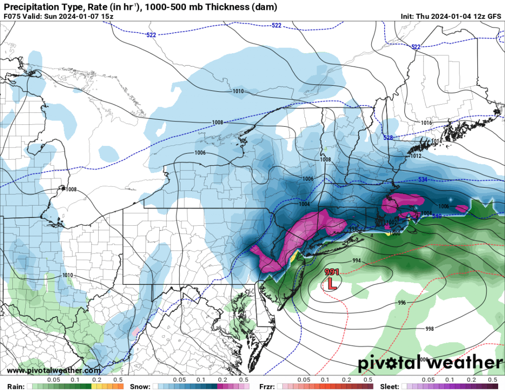
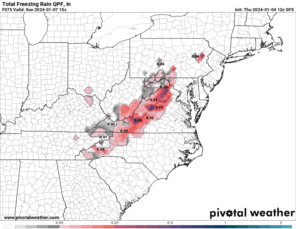
Besides the the significant snowfall in the Northeast, a threat for ice appears possible Saturday in some of the Appalachian states, particularly Virginia, West Virginia, and North Carolina. People in these areas should monitor their forecast and road conditions, as traveling in ice is even more dangerous than snow.
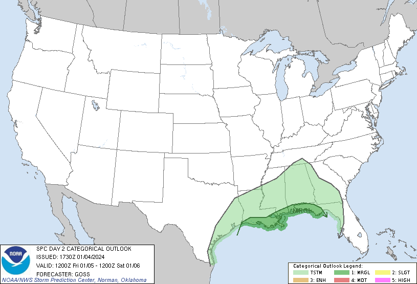
The system will produce a fair amount of rain in the southern states. The Southeast and Gulf Coast states may see heavy rain Friday into Saturday in some places. The SPC currently has a Marginal Risk out for the Gulf Coast on Friday and much of the Florida peninsula and far southern Georgia on Saturday. The main threats are isolated tornadoes and damaging winds. The most recent model runs aren’t too excited about the instability, but the favorable wind shear profiles would support an isolated severe threat should any pockets of higher instability develop.
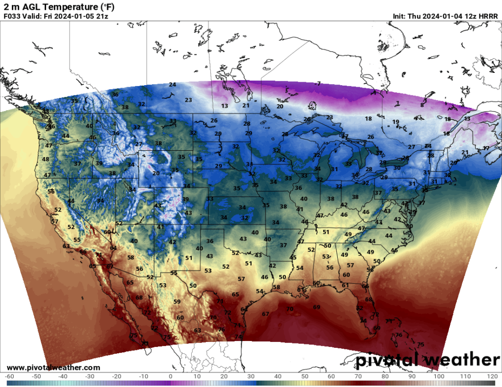
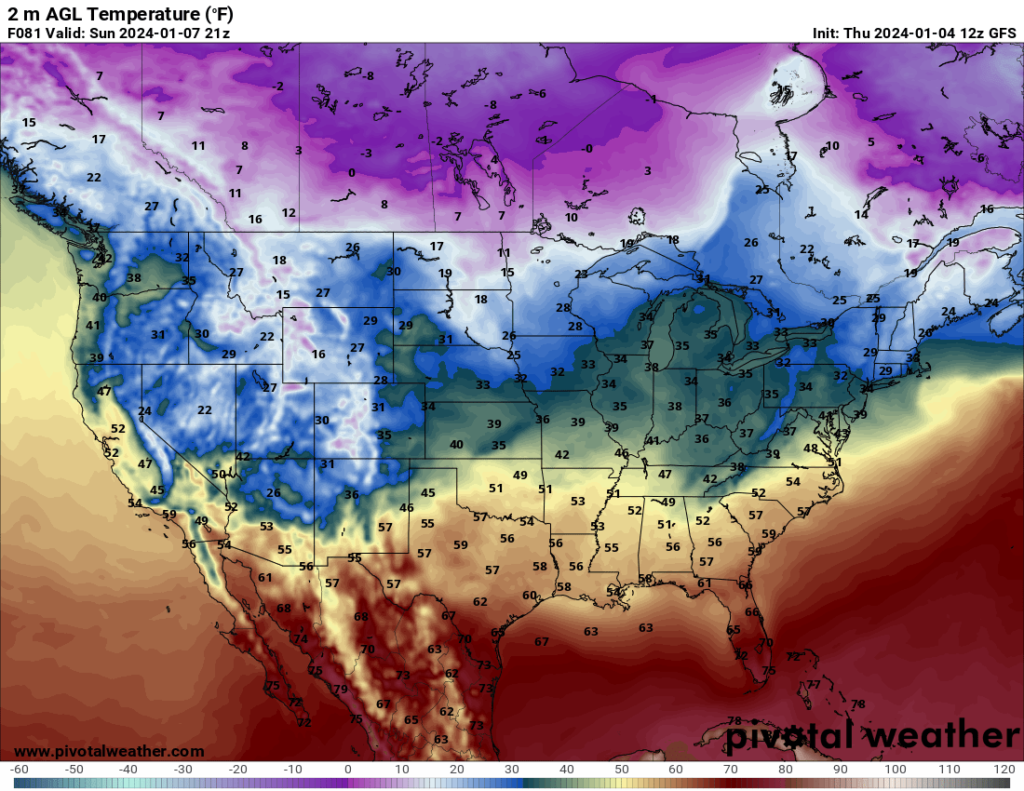
As for temperatures across the country, it’s pretty much what you’d expect in January: cold. The worst of the cold will be in the northern Plains and Minnesota, particularly later in the weekend, where some places may see highs in the teens and lows in the single digits.