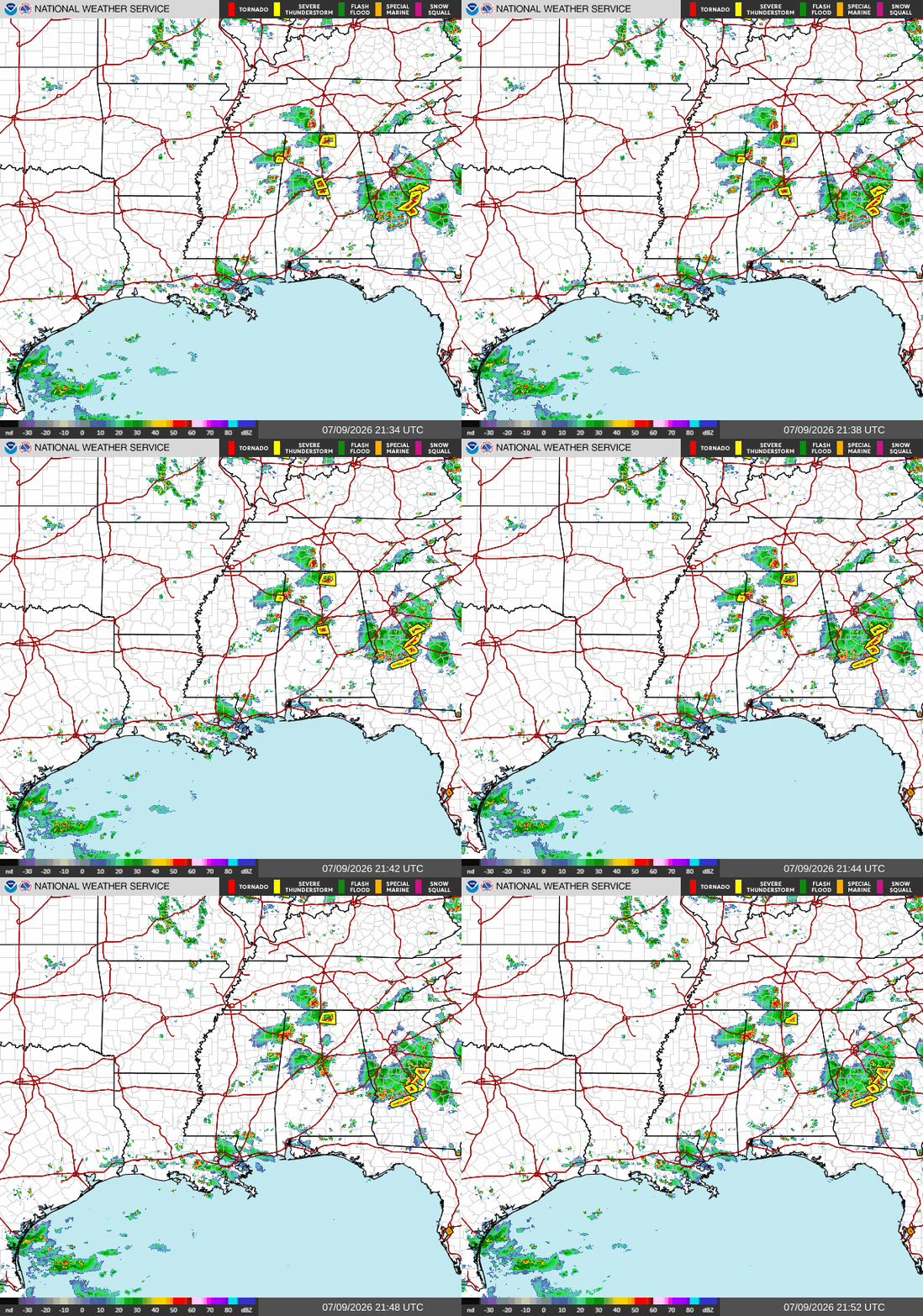
Good afternoon! As I’m writing this at 5p CDT, we have a few areas of storminess in our region. One is in northern Alabama and Mississippi, south of Birmingham and north of Columbus, MS. These storms are moving to the east. The other area of storms is in southeastern Louisiana, mostly between New Orleans and Baton Rouge. These storms are more stationary moving.
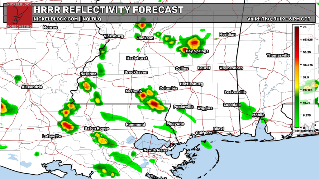
Later tonight, these storms will continue to strengthen a bit, but not too much, with 6p being the most widespread hour. These storms should be gone by 9 tonight. Rainfall totals will likely be no more than a quarter inch for most places, but some locations that get hit directly by a thunderstorm may see more than that.

Tomorrow
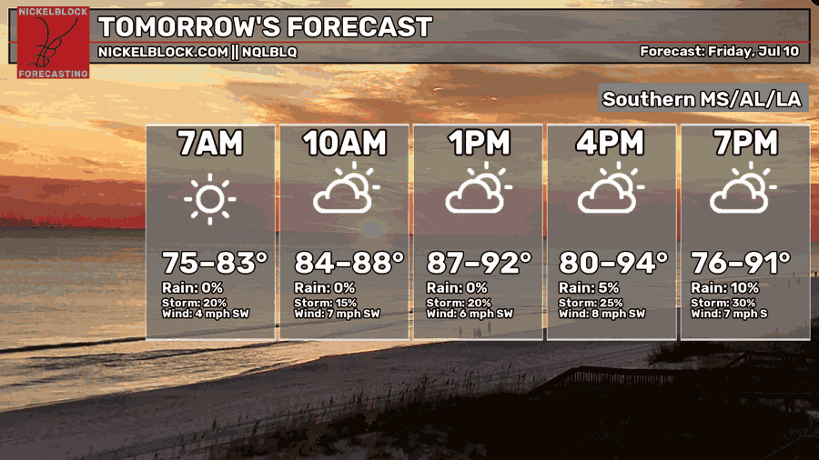
We’re in for a warmer than average day tomorrow, with afternoon high temperatures most likely to be in the upper 80s and low-mid 90s. In the morning, temperatures will bottom out in the mid 70s. Dew points tomorrow will be oppressive for the entire day, so make sure to drink enough water and wear cool clothing if you will be outside for an extended period of time tomorrow.
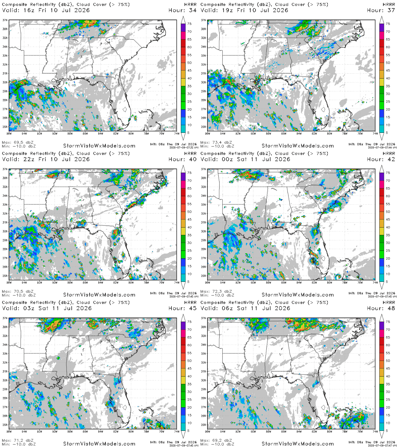
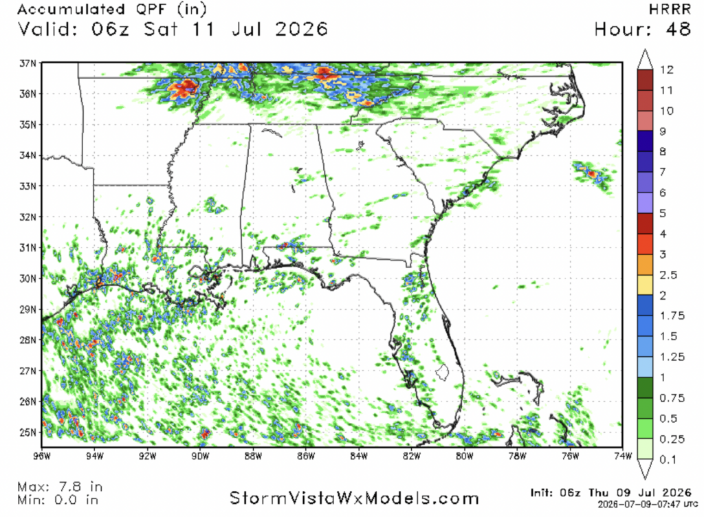
As for storms, some scattered ones are likely closer to the coast, mainly in Louisiana. These storms will begin in the early evening and should be gone by 8 tomorrow night. Rainfall totals will likely be very small for most places, with southern and southwestern Louisiana likely to see the highest totals.

Saturday
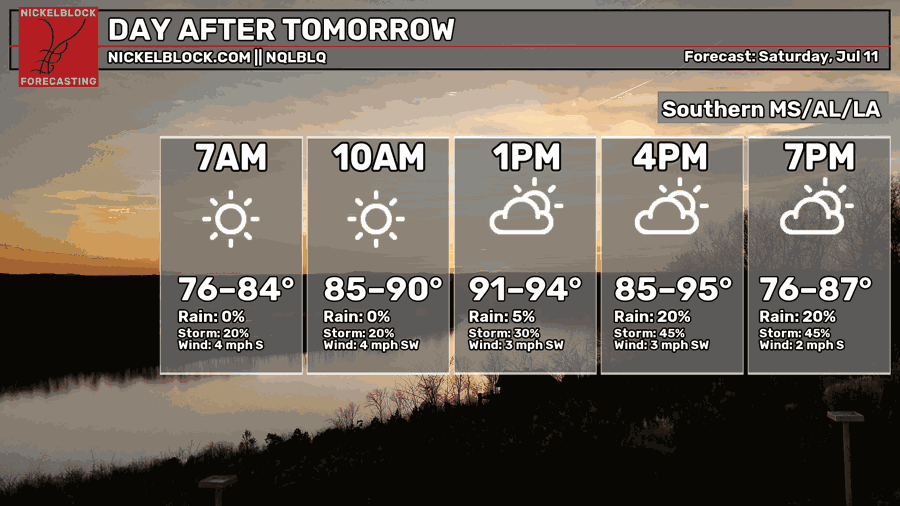
Moving into Saturday, you can expect temperatures that will be even hotter than tomorrow. Afternoon highs are expected to be in the low-mid 90s for most places, and morning lows will only fall into the mid-upper 70s. The weather will be perfect for jumping in the pool and driving down to the beach on your Saturday.
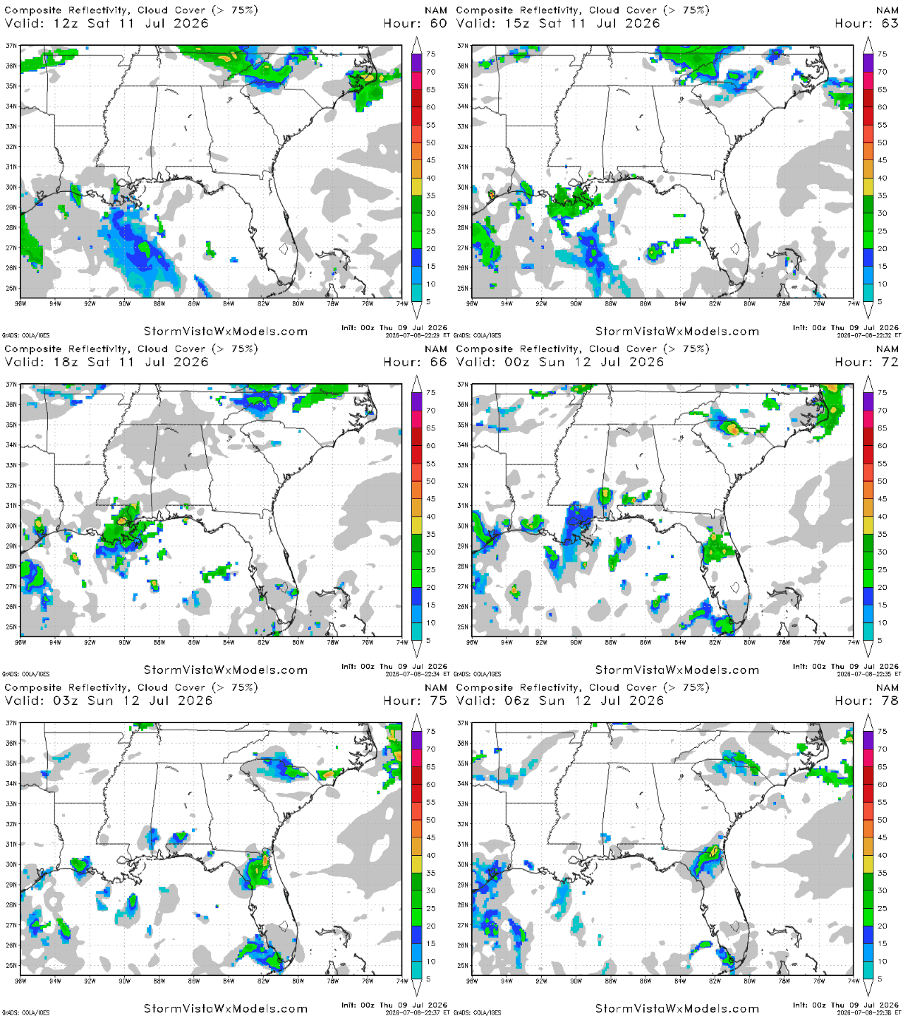
Some storms are possible on Saturday afternoon and evening, with the NAM showing southeastern Louisiana and the Mississippi coast being the most likely places to see storms. For most places, these storms will not be widespread and will be mostly scattered and disorganized.
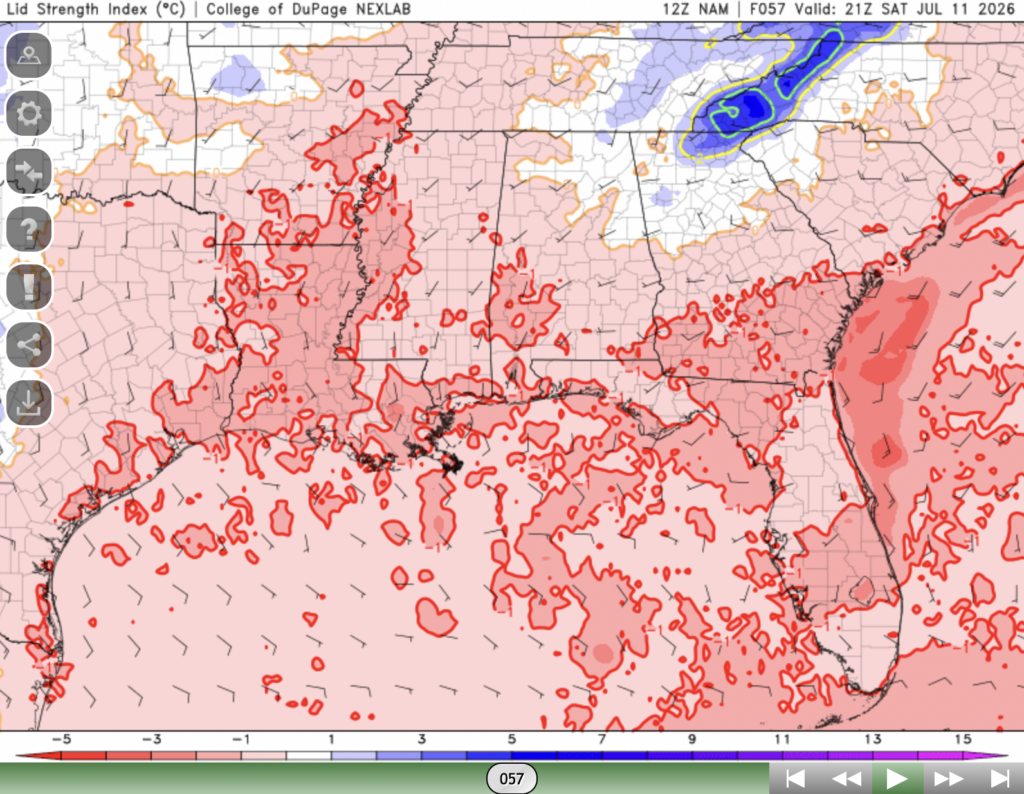
One way to determine if storms will be organized and powerful or disorganized and weak is looking at the lid strength index, which is what the picture above is depicting. Lid strength indices of less than 0 indicate that the “lid” on convective storms is very weak, so storms will pop up quickly and everywhere, which prevents them from becoming strong since they use their energy too quickly.
Our area is covered with lid strength indices of less than 0 which would indicate that storms on Saturday will be mostly weak disorganized.
Extended Outlook
Be sure to watch Summer’s video forecast above!
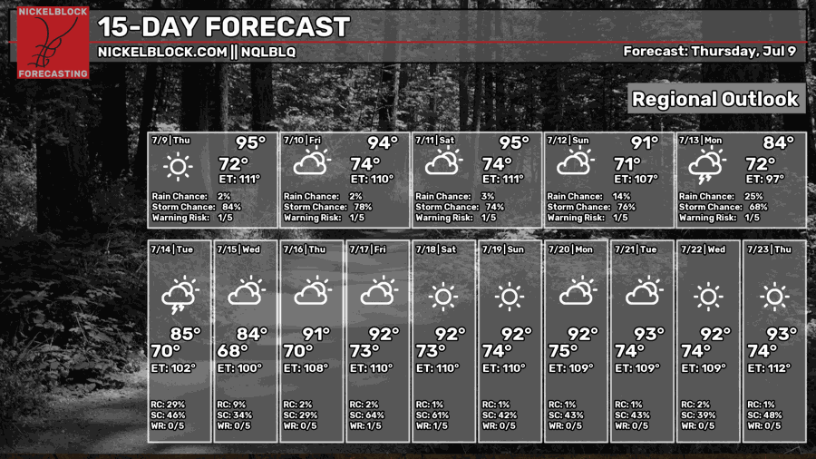
Early next week, temperatures are expected to be below normal with a decent chance of rain from Monday-Wednesday.
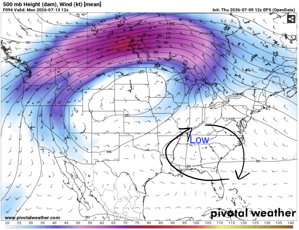
This is happening because an area of low pressure will set up to our north, allowing cooler and moister air to make its way into our region. This will bring us more consistent chances of rain and cloud cover, preventing temperatures from warming up too much during the day.
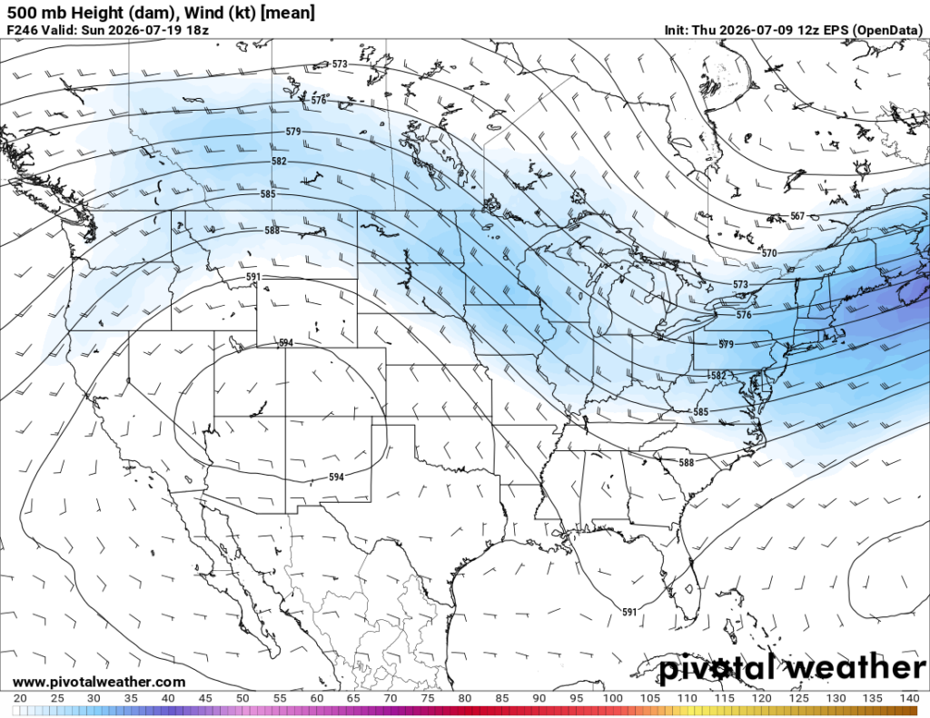
After that, we’re back to a more typical summer pattern. The models are hinting at a ridge of high pressure forming over the southwestern United States in the middle of this month, bringing them hot and dry conditions, and a trough of low pressure forming over the upper midwest and Canada.
Our region isn’t really in any pronounced trough or ridge, so we can expect temperatures and precipitation to be fairly close to normal.


