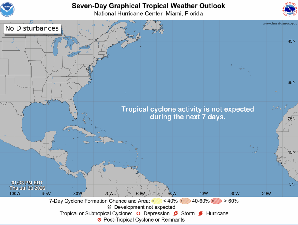
Things look pretty quiet on the tropical front, with the NHC noting that no tropical cyclone activity is expected within the Atlantic basin in the next 7 days.
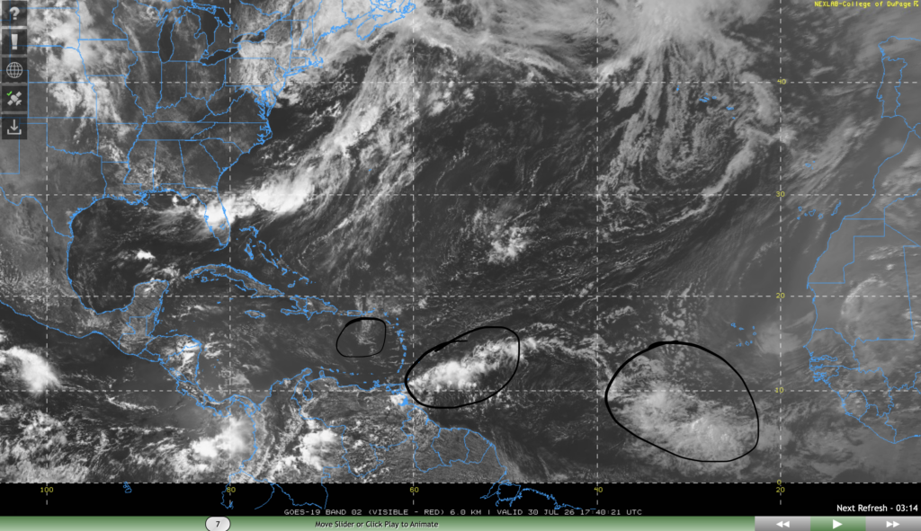
In their tropical weather discussion, the NHC has noted 3 tropical waves in the basin. They are circled in the above image. The first one is in the east Atlantic southwest of Cape Verde moving west at 15 kts with noted strong convection. The second is east of the Lesser Antilles moving west at 15-20 kts with moderate convection. The last one is situated in the Caribbean sea south of Puerto Rico moving west at 15 kts with only light showers and no convection.
None of these waves are expected to turn into tropical invests and then into tropical cyclones, so our area has nothing to worry about. While we are still a bit aways from the peak of hurricane season, we’re gradually getting there. August is usually when tropical cyclone activity increases dramatically, and that’s only 2 days away, so take the necessary hurricane precautions early.
Extended Tropical Outlook
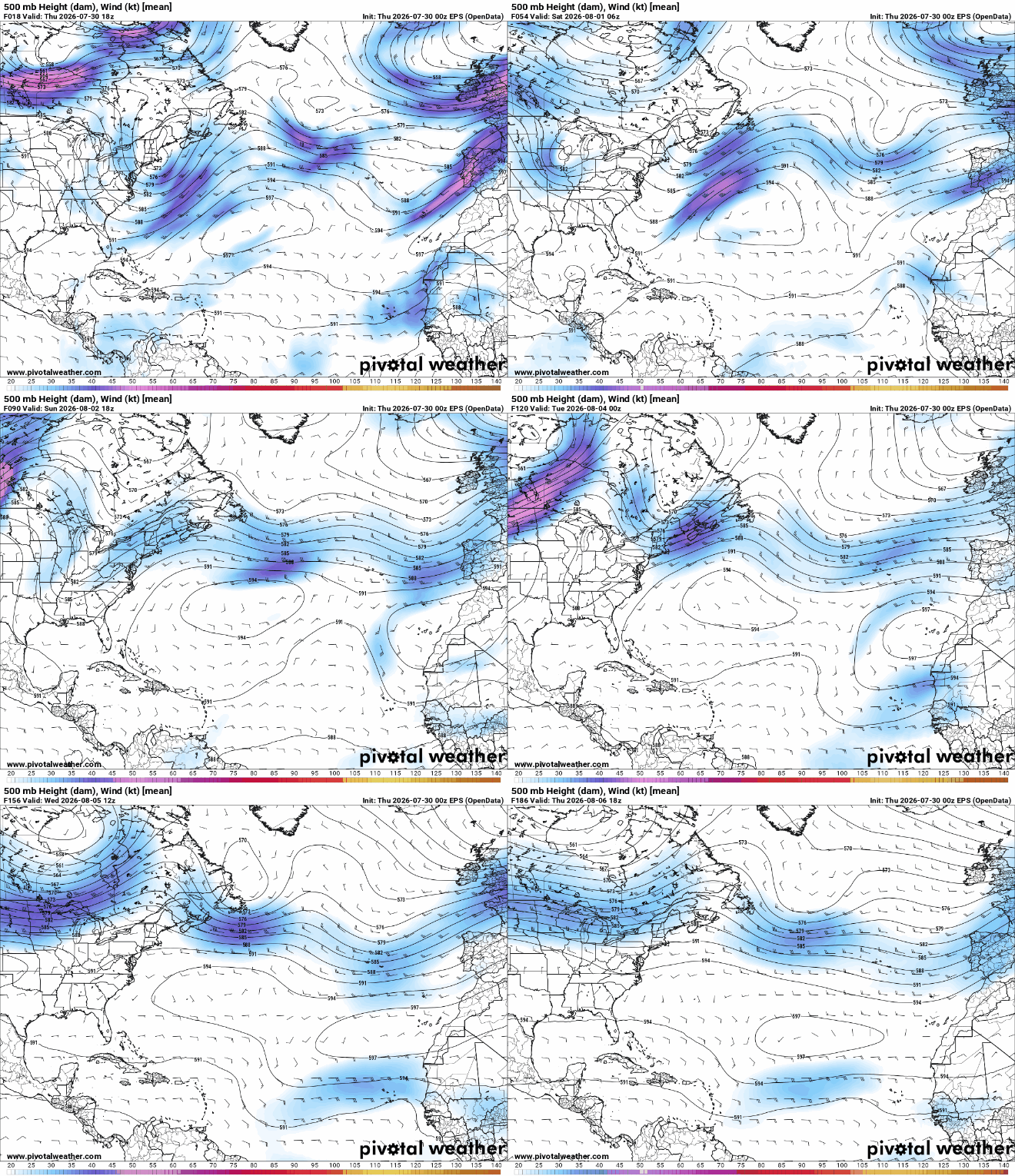
Over the next week, subtropical high pressure looks to dominate the central Atlantic ocean. This high pressure will steer tropical waves and areas of convection originating over Africa to the west, and areas of convection that originate off the southeastern U.S. coast to the northeast. This is a typical pattern for hurricane season.
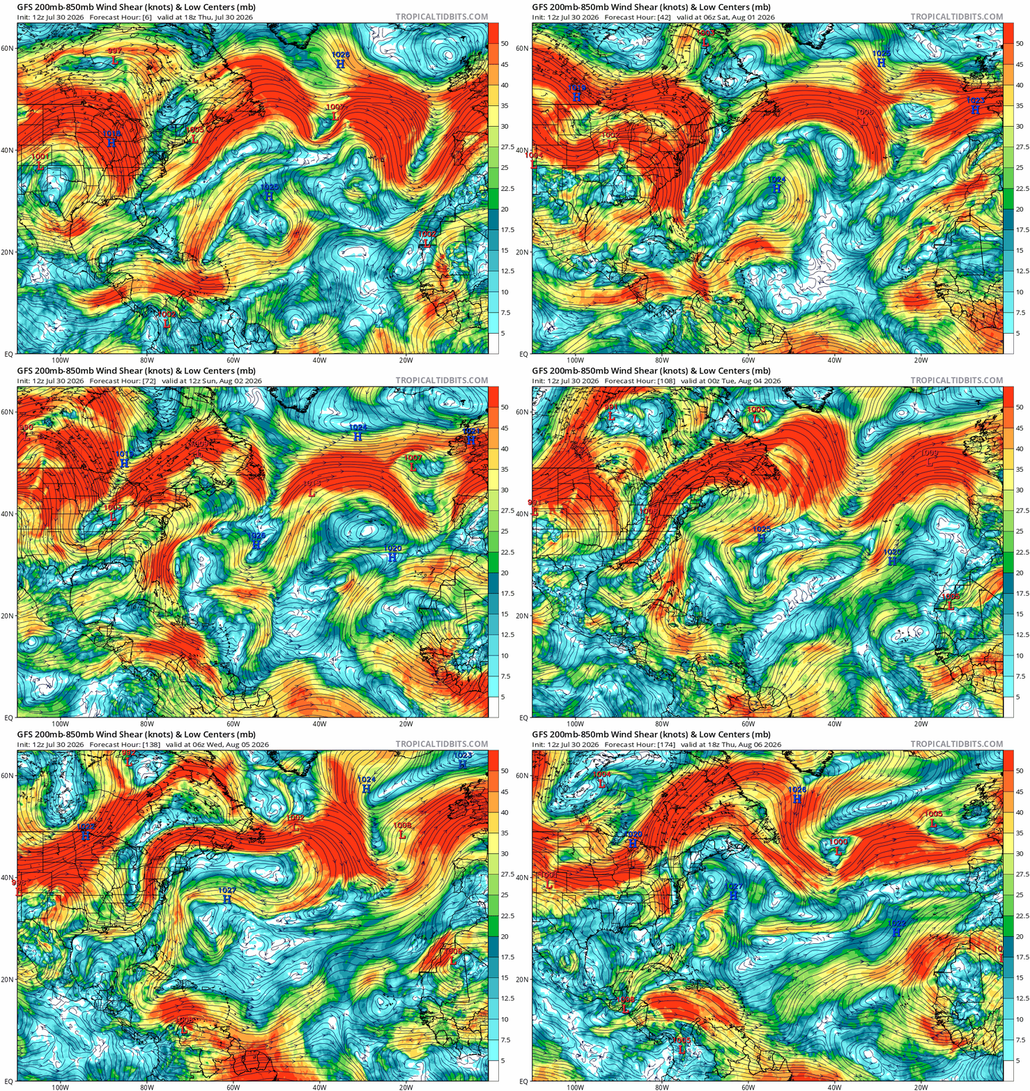
Another important factor in tropical development is wind shear. Wind shear looks moderate to low in the main development region (area of the Atlantic ocean between Africa and the Caribbean) and off the coast of the southeast United States.
The GFS even shows a storm developing off the coast of the Carolinas around August 6th. Take that with a grain of salt as the GFS has been known to over exaggerate future weather events, and August 6th is still a week away. Over the Caribbean sea, shear looks to be very high over the next week.
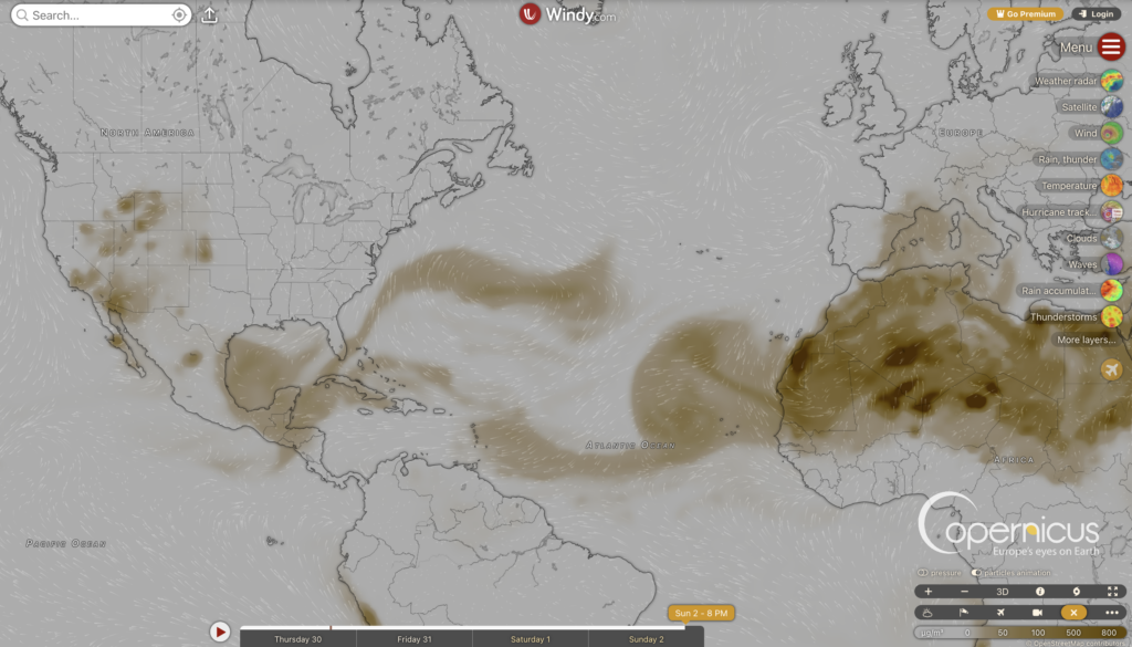
Another underrated factor in tropical cyclone development is dust coming off of the Sahara desert. In the next week, dust will make its way westward into the main development region. While it won’t completely prevent tropical cyclone development, it will suppress some development by getting into areas of convection and drying out the air, causing it to sink.
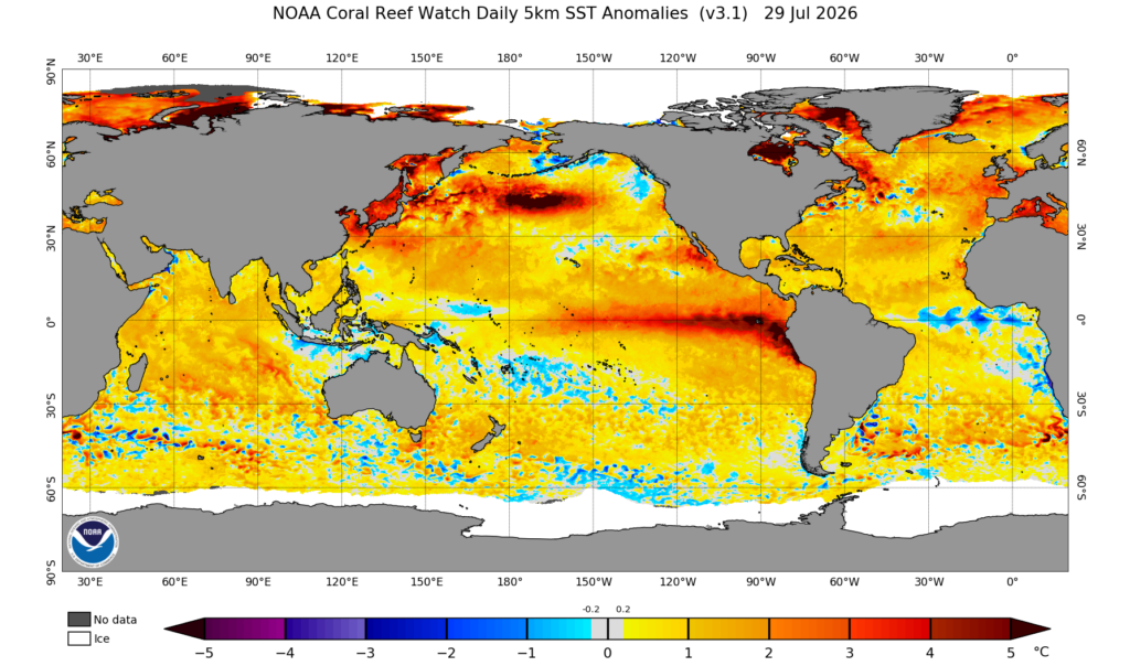
Finally, let’s take a look at the sea surface temperature anomalies. Throughout the Atlantic basin, SST’s are abnormally warm pretty much everywhere, which will aid tropical cyclone development. As the summer goes on, the ocean water will continue to heat up, eventually reaching a peak around September.


One thought on “07/30/26 Tropical Forecast: Quiet Times Ahead”
Comments are closed.