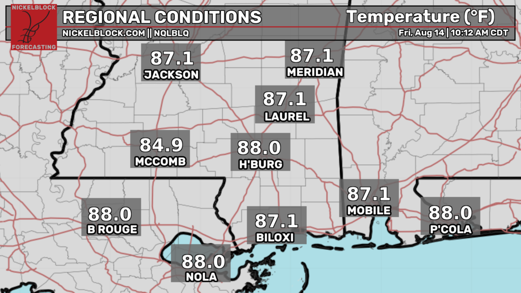
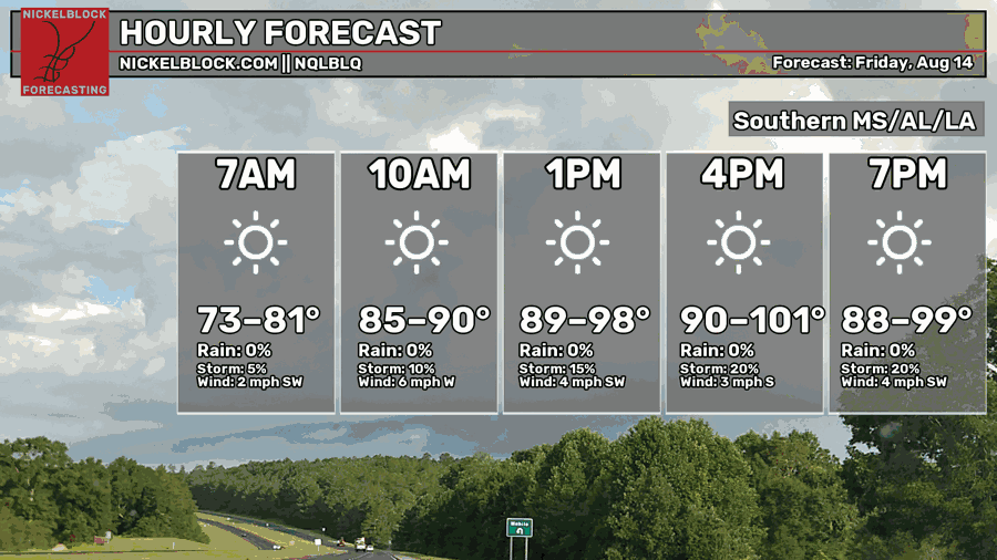
Good morning! As of 11a CDT, the temperatures are climbing as we speak. Conditions are already pretty hot, in the upper 80s approaching the 90s in many spots. These temperatures will continue to climb until the late afternoon today, when highs in some spots could hit the triple digits, while most other places will see highs in the upper 90s. Sky conditions will be sunny throughout the day for the most part, with sunnier conditions the further west you go in our forecast region.
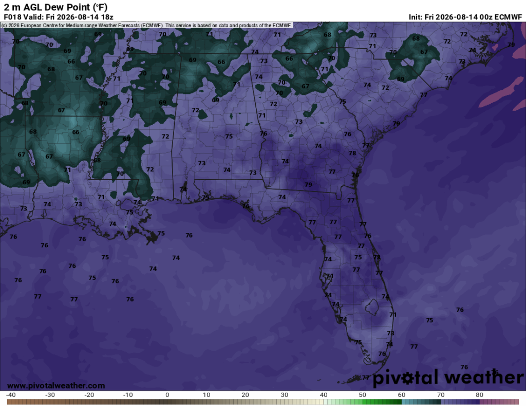
While it’s still the deep south in August, the humidity won’t be as unbearable as it can be today, with dew points in the upper 60s in parts of northern Louisiana and Mississippi. Alabama and the Florida panhandle aren’t so lucky, with dew points closer to what we’re used to, in the mid 70s.
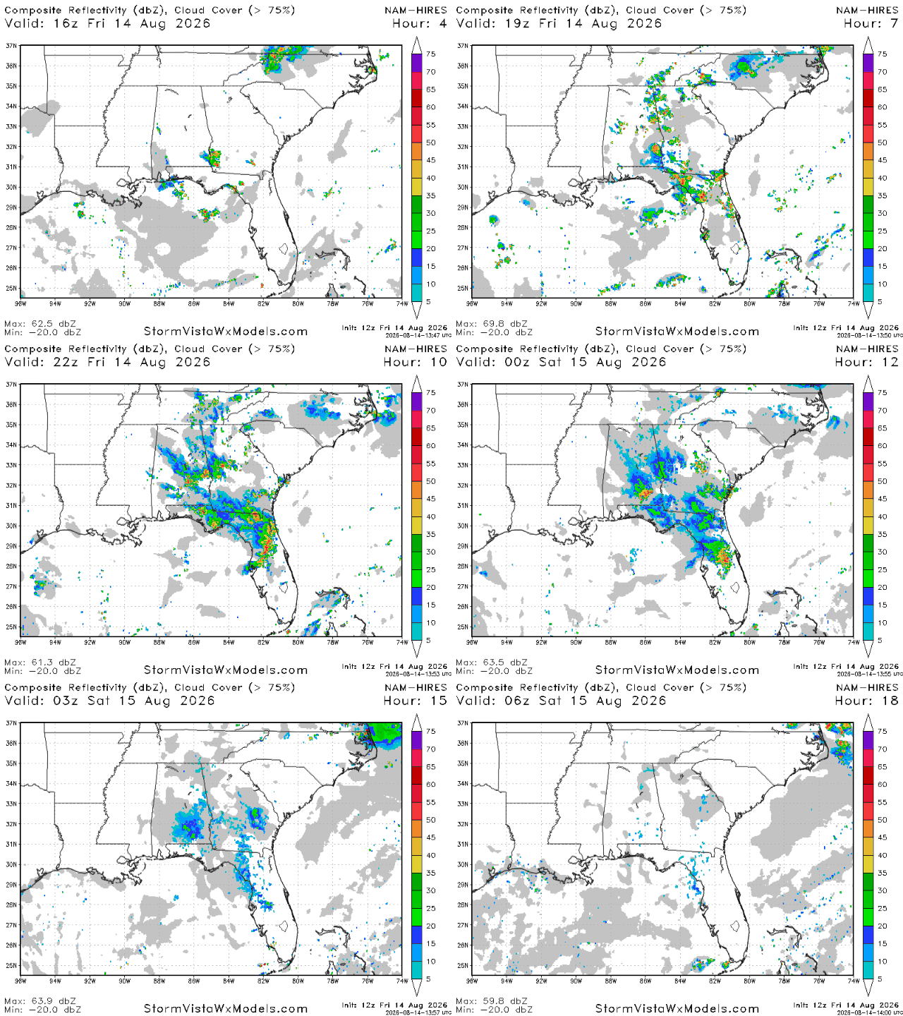
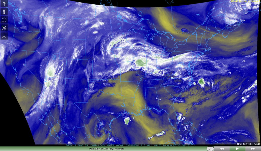
The storm situation today can be best described as a tale of two halves. If you’re to the east/northeast of Mobile, there’s a good chance that you’ll see some storms fire up today beginning in the early afternoon and lasting until 9 tonight. The big hot spot for storms tonight is the Florida panhandle, with Tallahassee being the most likely major city to see some significant storms. If you’re in Montgomery, you should also expect a few storms tonight.
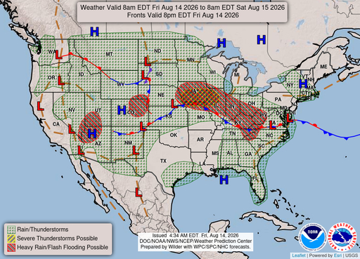
On the other hand, if you’re in Mississippi or Louisiana, an area of mid-level dry air is going to suppress storm development tonight, and skies will remain clear. It’s not going to be cool, but it could be a decent night to get outdoors (with bug spray, of course) and enjoy the not too humid air.

Tomorrow
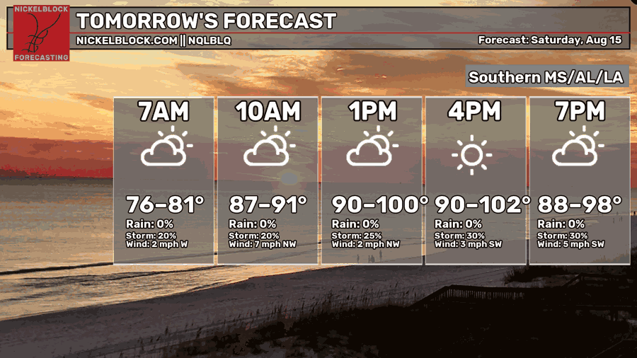
We’re expecting another day with highs that could be in the triple digits tomorrow. Morning lows will only drop down into the upper 70s and even lower 80s for some. Until the ridge abates, relief from this heat is unlikely.
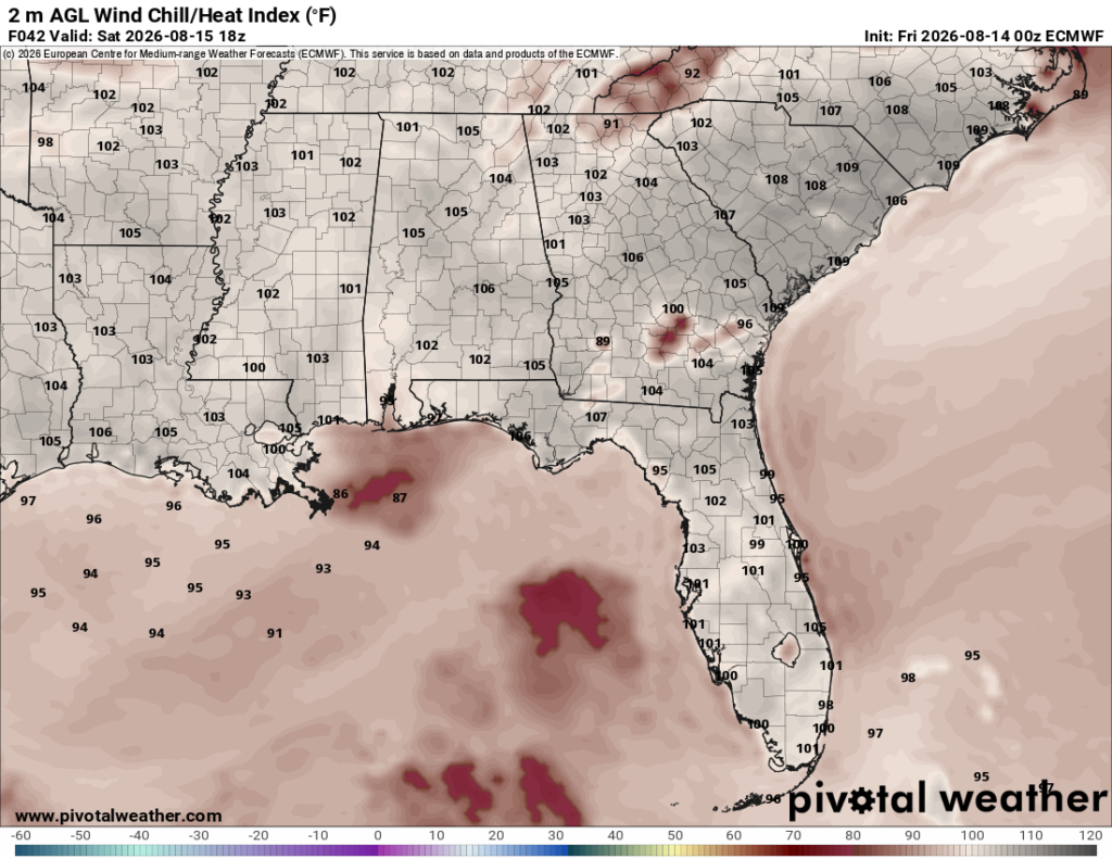
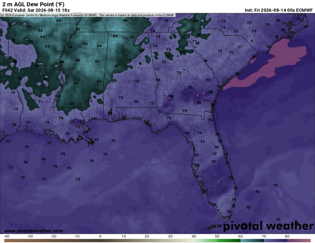
Similar to today, dew points won’t be as oppressive as they have been previously, despite the temperatures. Heat index values will still be over 100ºF, but considering that the actual temperature will be pretty close to 100ºF, we can infer that the air won’t feel too much like a sauna tomorrow. Similar to today, dew points are lowest throughout Mississippi, northern Louisiana, and northern Alabama.
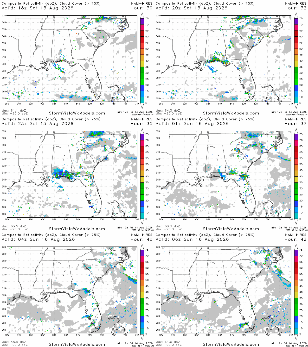
A few sea breeze storms are on tap for tomorrow in the Florida panhandle, particularly in the Pensacola/Mobile area. Storms are likely to fire up in the early afternoon and will last until around 7-8 pm tomorrow. Storms are expected to be pretty sparse in most other places, so weekend outdoor activities like going to the pool or beach aren’t likely to be disrupted.
Sunday
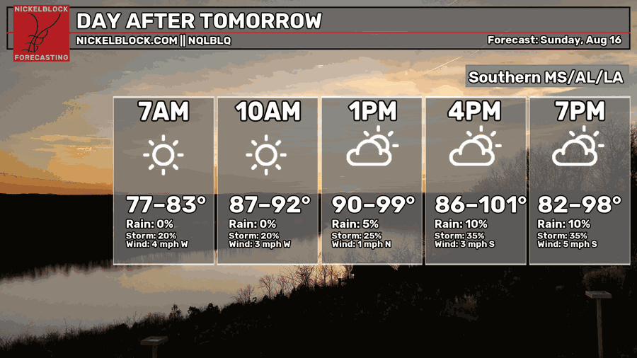
Both weekend days will be hot, with many spots having a very good chance of seeing triple digits afternoon highs again on Sunday. In the morning, temperatures will only drop into the upper 70s and lower 80s.
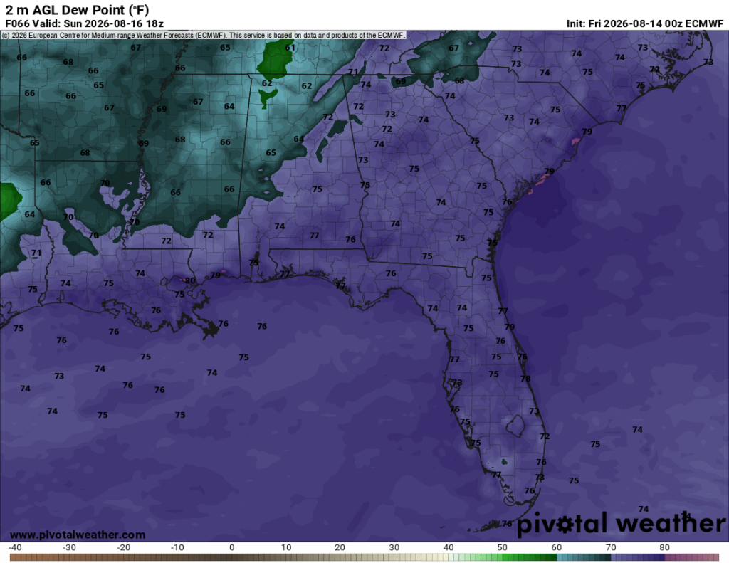
The moisture gradient will look a bit more horizontal tomorrow, with dew points in the mid-upper 60s in the northern portions of Louisiana, Mississippi, and Alabama. The southern half of those states will be subject to oppressive dew points well into the 70s on Sunday.
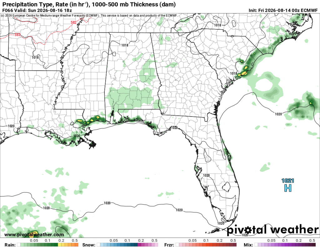
On Sunday afternoon, the ECMWF model is showing a slight to moderate chance of scattered thunderstorms in the southern half of Alabama. It’s also showing a moderate chance of sea breeze storms all along the coastal parts of our forecast region.

Extended Outlook
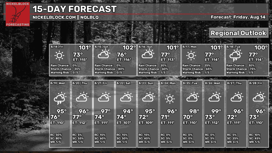
Over the next 2 weeks, the heat will continue to be the big weather story. High temperatures in the triple digits can be expected from today until early next week, but after that the highs don’t cool down too much. Beginning in the middle of next week until the end of the forecast period, high temperatures drop slightly into the mid-upper 90s for most days.
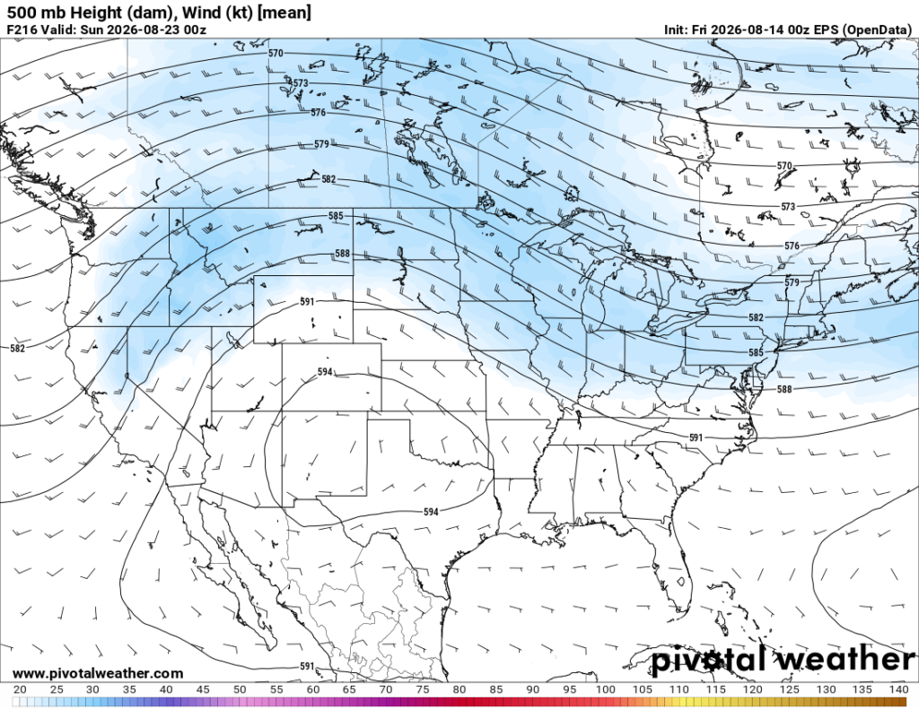
Subtropical ridging, which usually leads to very hot temperatures in our area, will continue for a few more days. After that, ridging is likely to shift to the west, centering itself over Texas and the southwest. While this pattern will still deliver above normal temperatures for us, they will cool down compared to what we’ve experienced over the past few days as ridging tends to deliver hotter temperatures when it’s directly above a certain place.
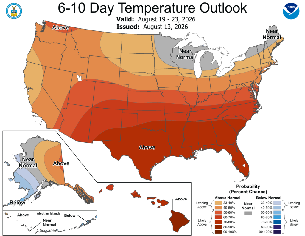
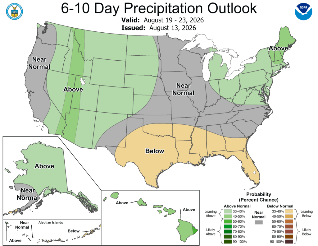
The NOAA climate prediction center is giving us very good odds at seeing above normal temperatures during the August 19-23 time period. They’re also giving us a chance at seeing below normal precipitation, as a stubborn ridge will steer away low pressure systems that deliver rain.
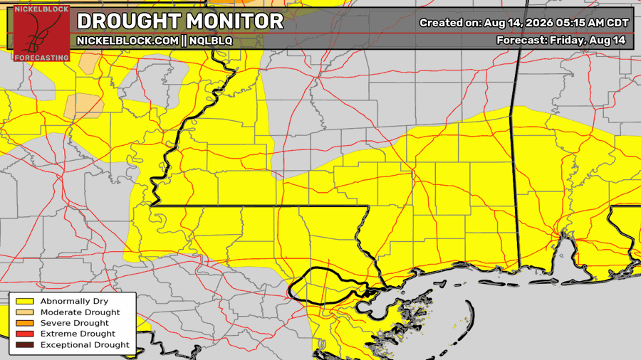
This is not an ideal situation. The drought monitor that was released yesterday shows a return of abnormal dry conditions to southeastern Louisiana, the gulf coast of Mississippi and further north, as well as the Mobile area. While we are not in a full blown drought by any means, if this heat and lack of precipitation continues, we could be looking at a minor drought status in our area by September.


