I’ve heard from a few folks asking about why I’m the only one talking about the chance for severe weather. It is a good question. And I’m glad folks are curious. It is good to always follow-up on things when you need extra info. And I’m happy to help when I can!
I may be the only person you’ve seen that is talking about the potential for severe weather, but I’m not alone.
The Storm Prediction Center is also calling for a chance for severe weather. They have outlined the areas with a Marginal Risk for severe weather. That is a “1” on the 1-to-5 scale where “5” is the highest risk for the most significant severe weather.

So, it certainly isn’t looking like Easter of 2020. But it also isn’t zero.
New Data
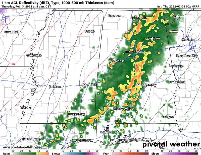
The afternoon models came back a bit more active with embedded supercells within the line of storms that is expected to develop tomorrow mid-morning across Louisiana. The latest HRRR model is currently finsihing up, but here is the data that is available so far, showing basically the same thing that the afternoon guidance was suggesting – a line of storms with a few embedded supercells, perhaps one storms ahead of the line.


The afternoon models also increased the coverage of the Updraft Helicity streaks. Below is an animation of the available data from earlier today. Try not to worry about which individual model says what. Instead simply notice that there are actually streak on the maps. And all of them. That was not the case when I wrote my morning forecast.
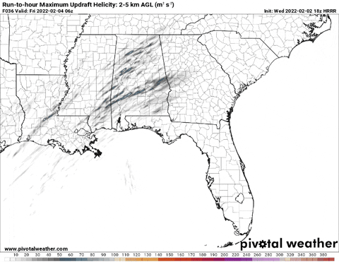
This is also mirrored by the SPC’s HREF Ensemble, which has a lot of the same models shown above, repeated. But notice a 10- to 30-percent chance that there is a storm with 75m/s of Updraft Helicity. Those aren’t bad odds.
And 75m/s of UH is enough to produce a severe storm. And is also enough, given the right other ingredients, to produce a tornado.
CIPS Analogs
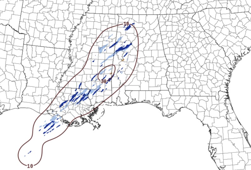
Looking at the CIPS Analogs, the Top 15 times the atmosphere has looked most similar to this setup it produced severe weather across the region about 20- to 40-percent of the time. So, again, not incredibly high, but certainly not zero.

The toughest part is, that most of the analogous events are from previous decades. Analogs include five (5) from the 90s, two (2) from the 80s, and (3) from the 70s. Decades when receiving severe weather reports wasn’t as easy. Since The Year 2000, there have been five (5) analogous events and three of the five produced at least one severe weather report.
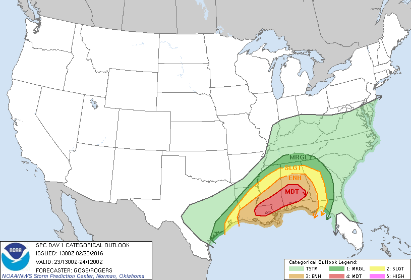
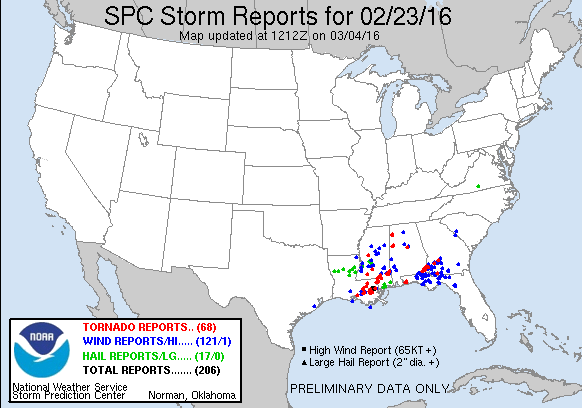
The most recent analogous day, in 2016, was quite the day. I wrote about it here. It was a Moderate Risk day with multiple tornadoes.
Thankfully, while similar in some ways, it won’t be in others. That should save us from having to deal with anything too crazy.
Gulf of Mexico Temps
In a word: Warm.
Sea surface temperature anomalies show plenty of 1C to 3C above normal with a blob of 5C above normal seat surface temperatures right off the coast of Louisiana and Mississippi.

This helps the very warm, moist air from the Gulf and northern Caribbean feed into the region with very little modification.
The HYSPLIT model, something NOAA uses to track the movement of air, shows that the air that we will be importing ahead of the cold front will be fresh from the Bahamas

And it will get here by traveling across Cuba and up the Gulf Loop Current. And the air will only be about 1500ft off the ground when it gets here.


Notice that in the lower levels, there isn’t much of a change. Surface temperature near Cuba is 75F. It is 70F parked along the coast of Mississippi.
And we are parking that warmer air underneath air aloft that is 4C (7F) cooler. Instant instability.
Timeline & Threats
So far, it looks like despite the new information increasing the potential intensity of storms, not much has changed to the overall forecast from this morning. There has been a slight shift in the timeline, though, as it looks like storms may pick up about an hour or so faster than I was thinking this morning.
8a-10a — Showers and storms developing, very few may be strong to severe. Main threats with any storm will be heavy rain, frequent lightning, gusty wind, small hail, and a tornado can not be ruled out.
10a-2p — Showers and storms likely, some strong and a few may be severe. Main threats with stronger storms will be very heavy rain, frequent lightning, wind gusts up to 60mph, hail up to the size of quarters, and the potential for a tornado (up to EF2 in strength)
2p-6p — Showers and storms likely, some strong and very few severe. Main threats with stronger storms will be very heavy rain, frequent lightning, wind gusts up to 60mph, hail up to the size of quarters, and the potential for a tornado (up to EF2 in strength)
6p-10p — Showers and storms ending. Few remaining storms will be strong, very few, if any, will be severe. Main threats with any storm will be heavy rain, frequent lightning, gusty wind, small hail, and a tornado can not be ruled out.
The peak timeline for the potential for the strongest storms is still looking like around the lunch hour and into the early afternoon, depending on your location.
I ran the Karrie Meter and the data hasn’t changed much. It is up 0.49 since this morning.

KARRIE METER: 4.29

Bottom Line
Here’s the deal, not everyone is going to see severe weather. As of this writing, the SPC only has a Marginal Risk out. Based on the numbers coming back from the data today, I’m surprised they didn’t increase it to a Slight Risk, but they may be waiting until tonight to do that.
Either way, the potential for severe storms isn’t particularly high.
But it does look like a few severe storms will be possible tomorrow. The main concern being heavy rain, brief flash flooding, frequent lightning wind gusts up to 65mph, hail up to the size of quarters, and the potential for a tornado or two (up to EF2 in strength)
Most folks will see just heavy rain, gusty wind and lightning. But keep an eye to the sky, just in case you are one of the few people who gets stuck underneath one of the stronger storms.
On top of all of this, there is also the chance for 2″ to 4″ of rainfall. That may lead to some localized flash flooding. So if there is water across the road while you’re driving around tomorrow, please don’t try to drive through the water, and find another way around. You never know what is – or is not – underneath floodwaters.


Thank you for the late evening update!