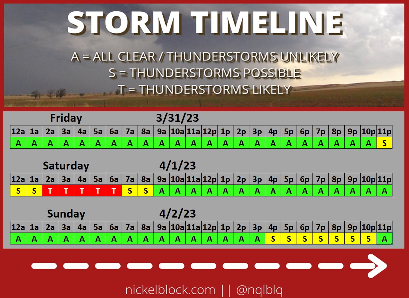
Tonight is not a night you need to ‘stay up’ waiting for storms. If you do, you’ll be up all night, in some cases, simply waiting.
Storms will be possible as we head through the overnight hours and into tomorrow morning. But the potency of the storms will be quite a bit lower than places to the north. And, in fact, many spots may not see storms arrive until a few hours before dawn tomorrow morning. And in some cases after sunrise!
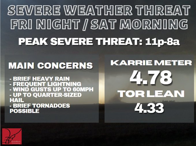
The main concerns with storms that develop and move through will be brief heavy rain, lightning, gusty wind, small hail and the potential to produce a tornado. But it will be more difficult for tornadoes to develop down here than they were to develop north of the area on Friday afternoon.
The timeline shows the best time to see storms will be between 2a and 6a tomorrow morning.
And currently, the Karrie Meter is in the high 4s but the TOR LEAN (which needs a new scale, honestly) is slightly lower, meaning the tornado threat is lower-than-normal for this type of situation. There is still the potential, but the threat isn’t as high as it usually would be.
To keep up with the weather, be sure to download the NickelBlock Forecasting weather app! Loved by thousands already!


