As we move through the day on Friday it looks like there will be a decent swatch of the country dealing with the potential for severe weather. That includes us down here, but our risk will be quite a bit lower.
Currently the Storm Prediction Center is highlighting Memphis and surrounding areas as well as eastern Iowa with the highest risk for severe weather. Those areas are under a Moderate Risk, a “4” on teh 1-to-5 scale where “5” is the highest risk for the most significant severe weather.
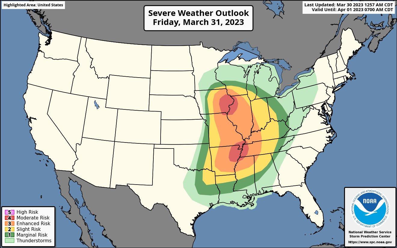
Down here, we are looking at a Marginal Risk. That is a “1” on the same scale. But model guidance isn’t very impressed with the potential. the NAM computer weather model data doesn’t support a threat for widespread severe weather. Instead, a few scattered storms looks more likely.
Once this moves through, we will wait a few days before the next round of storms drift through early next week.
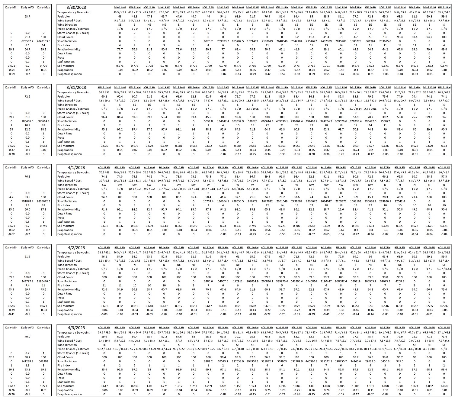
AG FORECAST
Here is a look at the five-day Ag forecast with extra forecast details specifically for the Ag community.
REGIONAL DAY TO DAY FORECAST
Today
Sunny. Not as cool with highs in the upper 70s. East winds 5 to 10 mph.
Tonight
Mostly clear in the evening, then becoming mostly cloudy. Not as cool with lows around 60. Southeast winds 5 to 10 mph.
Friday
Partly sunny in the morning, then becoming mostly cloudy. Highs in the lower 80s. South winds 15 to 20 mph with gusts up to 30 mph.
Friday Night
Mostly cloudy. A slight chance of showers in the evening, then showers likely with a chance of thunderstorms after midnight. Lows in the upper 60s. South winds 10 to 15 mph with gusts up to 25 mph. Chance of rain 70 percent.
Saturday
Mostly sunny. A slight chance of showers and thunderstorms in the morning. Highs in the mid 80s. Southwest winds around 10 mph, becoming northwest in the afternoon. Chance of rain 20 percent.
Saturday Night
Partly cloudy in the evening, then becoming mostly cloudy. Cooler with lows in the mid 50s.
Sunday
Mostly cloudy. A slight chance of showers in the afternoon. Highs in the mid 70s. Chance of rain 20 percent.
Sunday Night
Mostly cloudy with a chance of showers with a slight chance of thunderstorms. Lows around 60. Chance of rain 40 percent.
Monday
Mostly cloudy with a chance of showers and thunderstorms. Highs around 80. Chance of rain 40 percent.
Monday Night
Mostly cloudy. Lows in the upper 60s.
Tuesday
Mostly cloudy. Highs in the mid 80s.
Tuesday Night
Mostly cloudy. Lows in the lower 70s.
Wednesday
Mostly cloudy. A slight chance of showers and thunderstorms in the afternoon. Highs in the mid 80s. Chance of rain 20 percent.


