There is another chance for severe weather this week, but this time it should remain – mainly – to the north of the area. It is another situation where the analogs are pretty set on the potential for severe weather weather and the Storm Prediction Center is ID’ing a large area
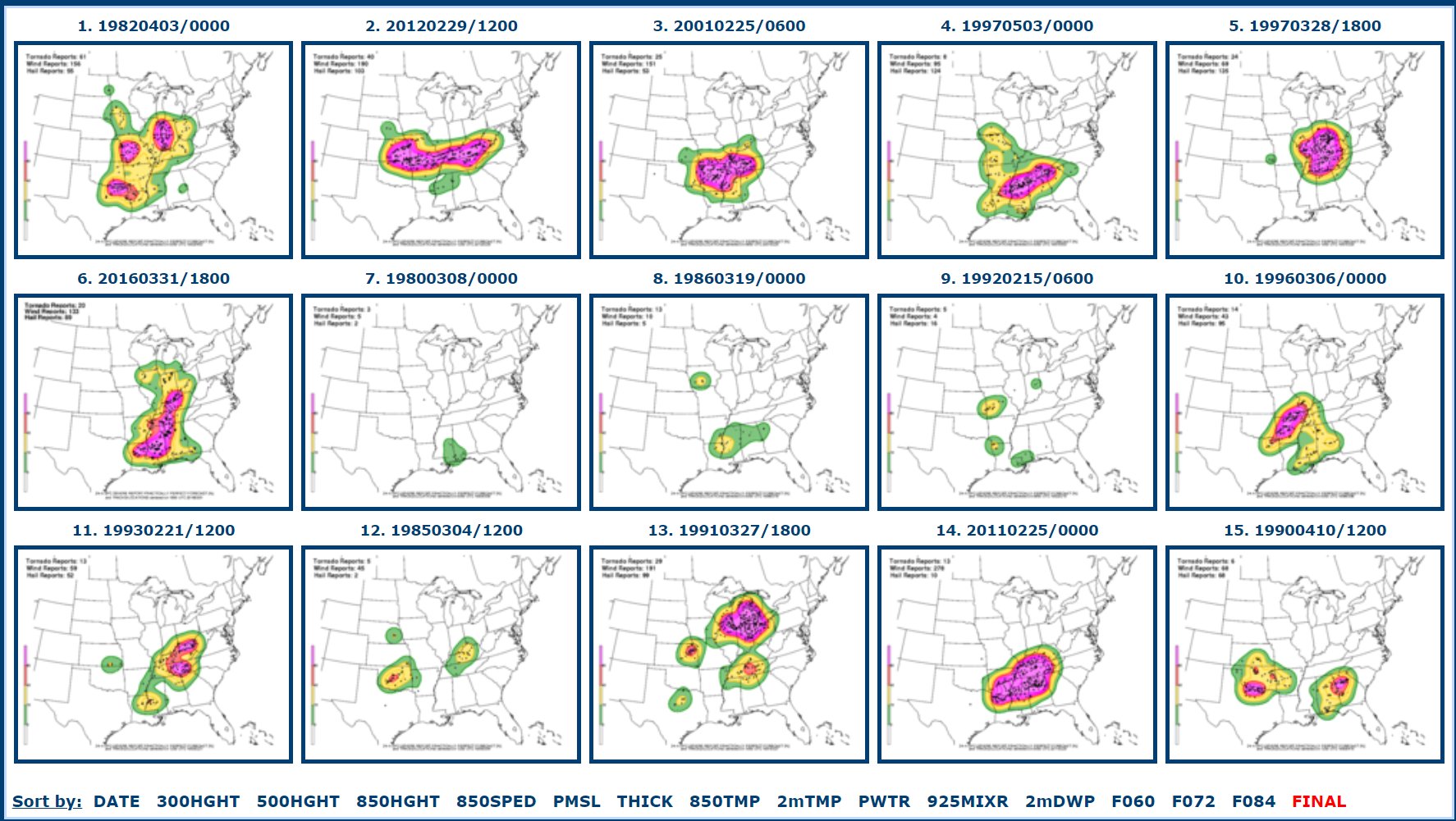

While parts of the area are looking at a Marginal Risk for severe weather, the line of storms that will be approaching, given the latest model data, should be falling apart as they enter the region.
Part of the reason for this is the cold air behind this system isn’t terribly cold, so the front is going to lack a fair bit of punch to begin with. It is also going to be moving a ways away from the forcing and energy associated with the storm system it self.
And, on top of that, the Gulf is pretty balmy. And there is a reasonable ridge over the southeast meaning that any front that tries to casually stroll to the Gulf is going to get shredded.
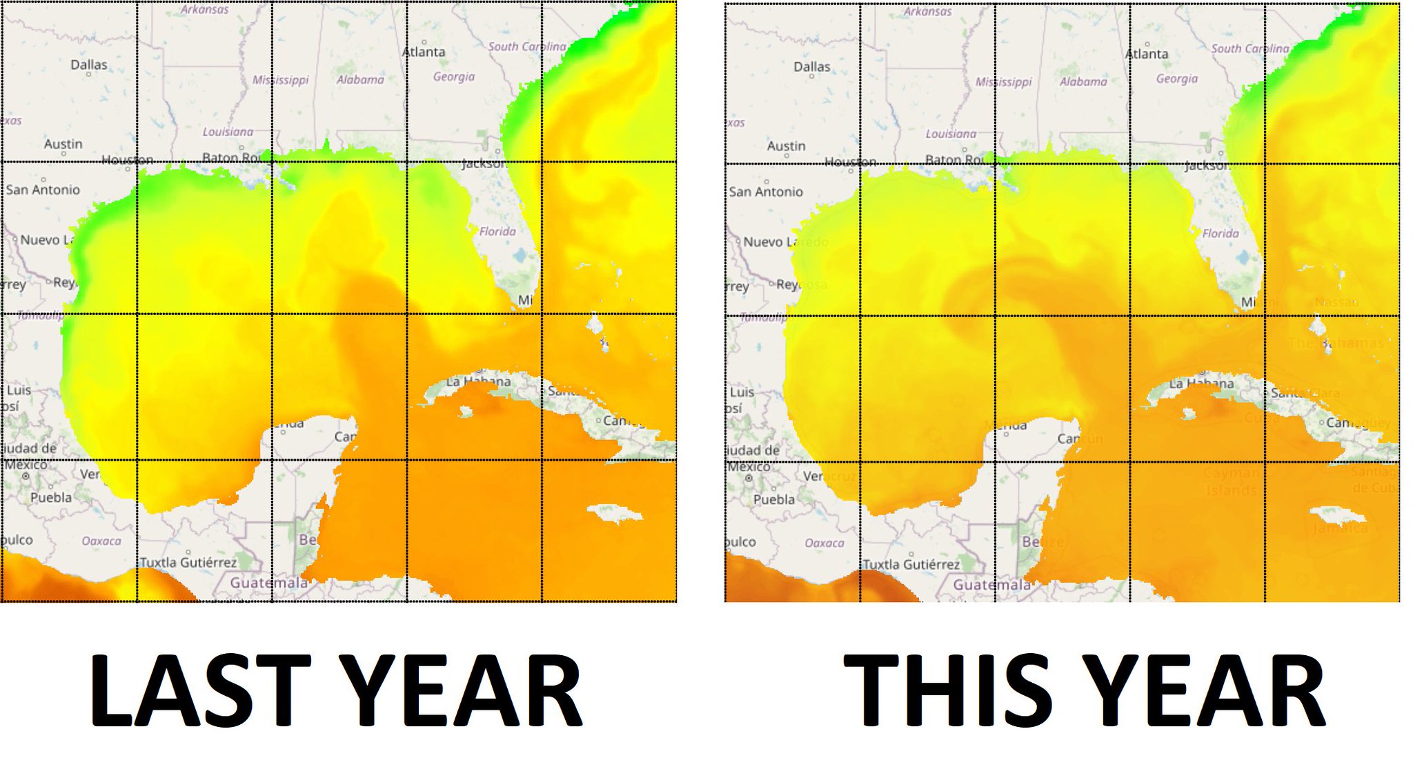
A quick aside, seeing the loop current already showing up on Sea Surface Temp maps is a bit troubling. The Ocean Heat Content is also already higher than last year at this time, too. Sea Haight Anomalies are also, generally, higher.
This all points to a very warm Gulf of Mexico. Not just at the surface, but also ‘to depth’ as we say. That means a lot of energy for tropical systems. So despite the flipping to an El Nino and all of the “slower than normal Hurricane season” talk you are going to hear, I need everyone to know that even if there is just one storm in the Gulf this year, it will have access to a lot of ‘food’ for it to grow up and be big and strong. So it may not matter if it is a slow season, it the one storm there is happens to be int he Gulf and happens to end up near you.
As we move through the weekend, things should calm down and then we get another shot for more storms as we move into next week.
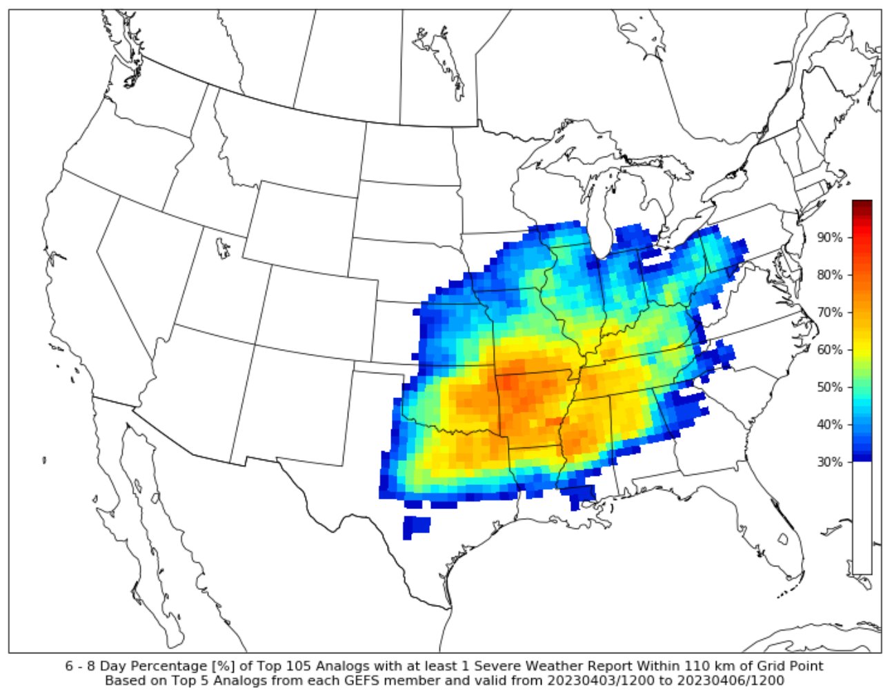
Again, it looks like the threat will be a bit to the north of the area, but it bears monitoring during the next few days.
On top of that, next week is looking rather toasty again. So get the shorts out and put those coast away.
REGIONAL DAY TO DAY FORECAST
Today
Partly sunny. Highs in the upper 60s. Northeast winds 5 to 10 mph.
Tonight
Clear. Lows in the mid 40s. Northeast winds around 5 mph.
Thursday
Sunny. Highs in the upper 70s. East winds 5 to 10 mph.
Thursday Night
Partly cloudy. Lows in the upper 50s. Southeast winds 5 to 10 mph.
Friday
Mostly cloudy with showers and storms possible. Highs in the lower 80s. South winds 15 to 20 mph with gusts up to 30 mph. Chance of rain 40 percent.
Friday Night
Mostly cloudy with storms possible. Lows in the upper 60s. Chance of rain 40 percent.
Saturday
Mostly cloudy. Highs in the lower 80s.
Saturday Night
Mostly cloudy. Lows in the mid 50s.
Sunday
Mostly cloudy. Highs in the upper 70s.
Sunday Night
Mostly cloudy. Lows around 60.
Monday
Mostly cloudy with a chance of showers and thunderstorms. Highs in the lower 80s. Chance of rain 40 percent.
Monday Night
Mostly cloudy. Lows in the upper 60s.
Tuesday
Mostly cloudy with a few storms possible. Highs in the mid 80s. Chance for rain 30 percent.


