Happy 4th of July! I hope you all have something fun planned for today! Whether it be a firework show, a barbecue, or a small get together, go out there and celebrate our country’s 250th birthday!
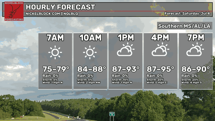
High temperatures this afternoon will range from the mid 80s to the mid 90s. Skies will be fairly sunny, so make sure to wear sun protection this afternoon if you’re going to be outdoors.
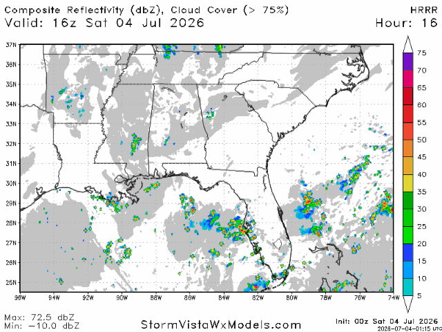
Some potentially strong storms may develop tonight in two areas. The area with the strongest storms looks to be near the Arkansas/Mississippi border as well as near the Louisiana/Mississippi border. A secondary area of storms caused by the sea breeze are also likely to form between Baton Rouge, Hattiesburg, and Mobile. Most storms should fizzle out by 9-10 tonight.
Rainfall totals will generally be between a quarter and half an inch with some localized areas potentially seeing over an inch. Storms will bring gusty winds, heavy rain, and lightning.
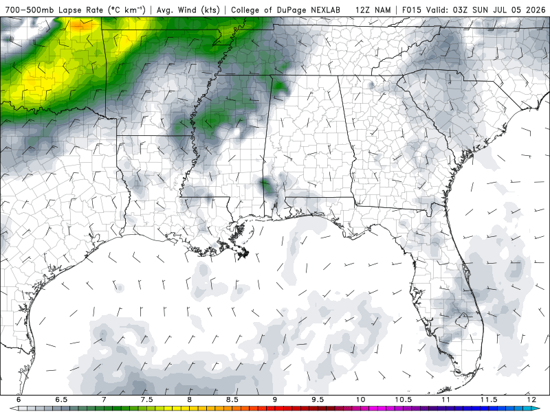
Since yesterday, the temperature forecast hasn’t changed much, but the mid-level atmosphere is now likely to be more unstable than it was previously thought to be. Therefore, more and stronger storms have become more likely.
Tomorrow
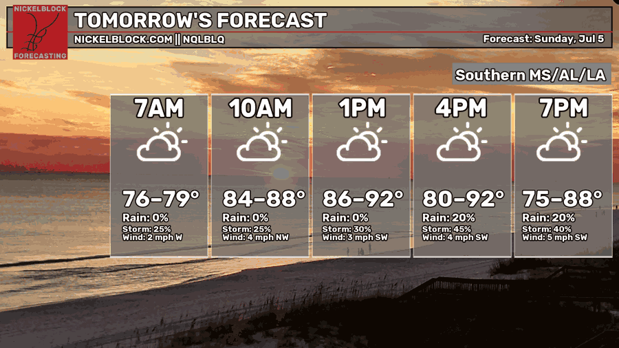
Moving into tomorrow, not much has changed in the forecast. High temperatures will still be in the mid 80s to the low 90s, with hotter temperature the further east you go.
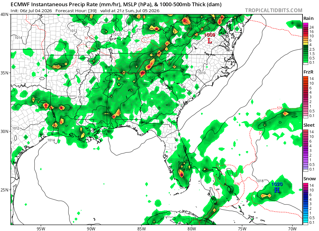
Tomorrow, we are going to be at the boundary between high pressure to the east and low pressure to the west. Therefore, a line of storms may set up from New Orleans to Hattiesburg to Birmingham moving east/southeast. This line will act as a boundary between hotter and drier air to the east and slightly cooler air to the west.
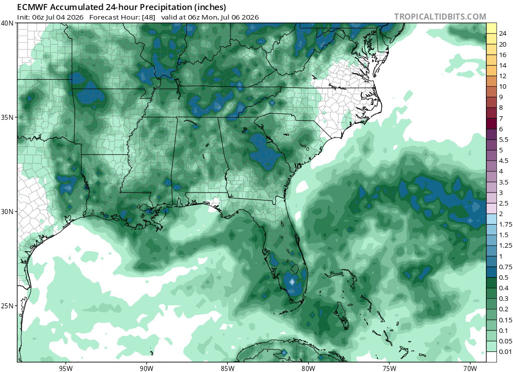
Rainfall totals will generally be between a tenth of an inch to a half inch, but some localized areas directly hit by a thunderstorm may see totals closer to an inch or more. Overall, the forecast remains unchanged from yesterday.