Howdy! Happy Fourth of July!
The heat and humidity are here, making it feel a lot hotter than it actually is. Isolated showers and thunderstorms are possible today, chances increasing for the rest of the weekend and into next week.

TODAY/TONIGHT
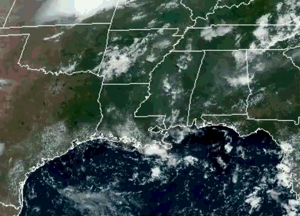
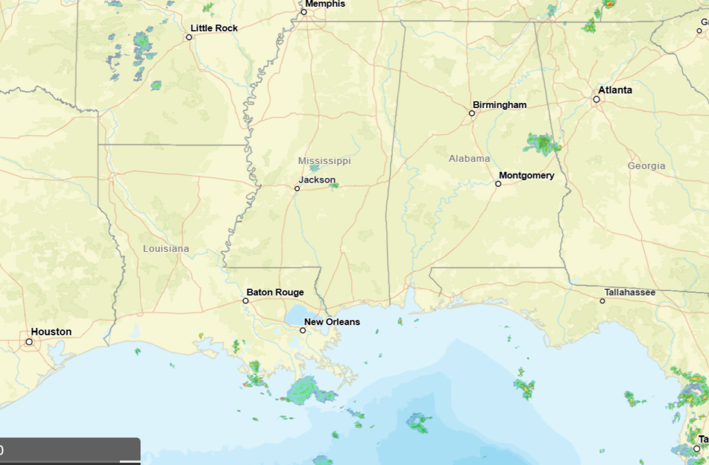
Looking out the window, there are currently a couple of showers in the area out in near Auburn, AL and near Brandon, MS and off the coast of southern Louisiana. A few clouds in the region, more along the coast of Louisiana.
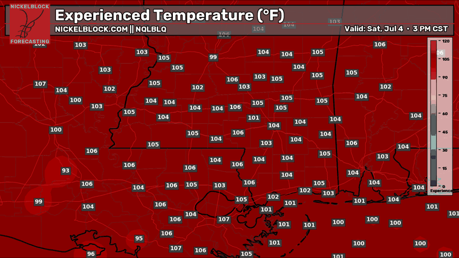
Temperatures are currently in the mid to upper 70s, dewpoints ranging from the low to upper 70s keeping humidity levels high. Heat index values are currently in the upper 70s for much of the region.
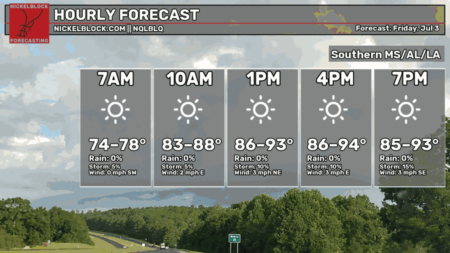
The highs for today will range in the mid 80s to mid 90s, humid conditions persist and heat index values increase above 100, ranging from 100-105 for a lot of areas. Isolated to scattered showers and thunderstorms are possible today due to a sea breeze (when cooler air from the ocean flows over warmer air inland).
Southern portions of the states have the greatest potential for these storms, especially in southern Louisiana extending into the northern part of the state. These storms have the potential to produce some strong winds and lightning, so as you are planning your parties and celebrations, keep this in mind and always prioritize your safety!
Another bit about safety… it will be hot today so please stay hydrated and pay attention to how you are feeling! You can have fun but also celebrate in a safe and healthy way. Live it up!

TOMORROW
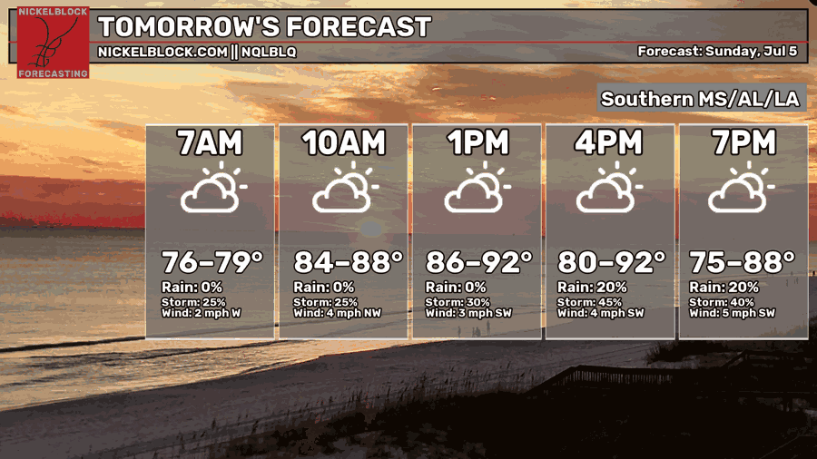
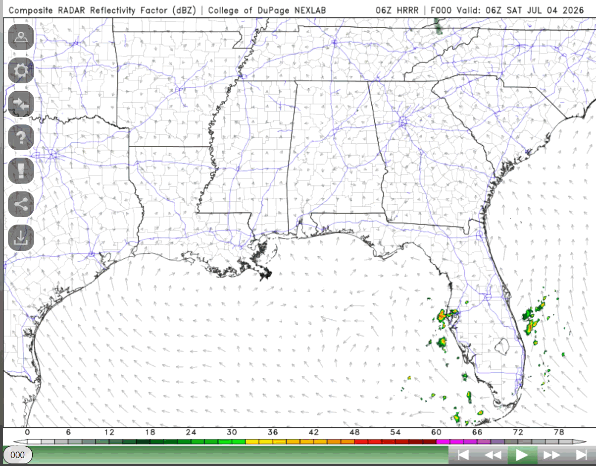
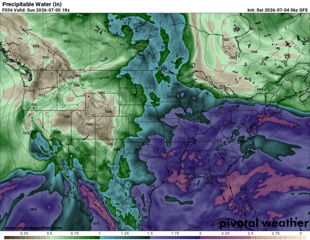
“Cooler” highs for tomorrow, ranging in the low 80s to low 90s. This can be attributed to the amplification of the trough just northeast of us, the ridge shifting more east and this will bring with it an increased chance for some showers and thunderstorms. Moisture levels will increase as precipitable water values reach 2.0-2.5 inches, aiding and fueling precipitation potentials (see below).
Scattered to numerous showers and thunderstorms will impact the region producing heavy rain, lightning, and strong winds. This will last into the evening and tomorrow night, most showers moving out of the southern areas around 10-11pm.

MONDAY
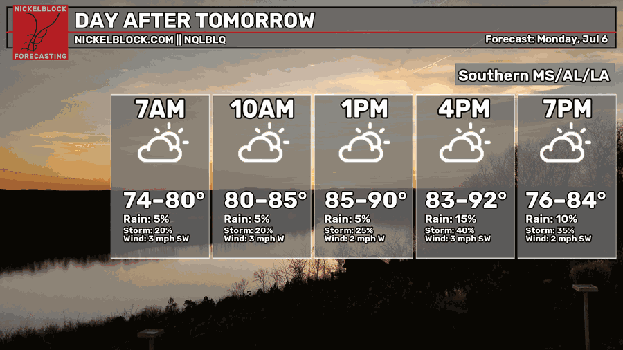
The same pattern continues into Monday, chance of precipitation increased for much of the region and slightly cooler temperatures with that rain as a weak surface trough is anticipated to impact the area. Temperatures will still remain hot along with humid conditions, increasing heat index values over 100 for most of the region. A more summer-like pattern will occur next week.
Temperatures for a lot of the region will be slightly above normal (by a couple degrees), areas around Shreveport and out near Woodville, MS seeing slightly cooler than average temperatures for this time of year, but humidity is doing nothing to provide any relief.

EXTENDED DAY OUTLOOK
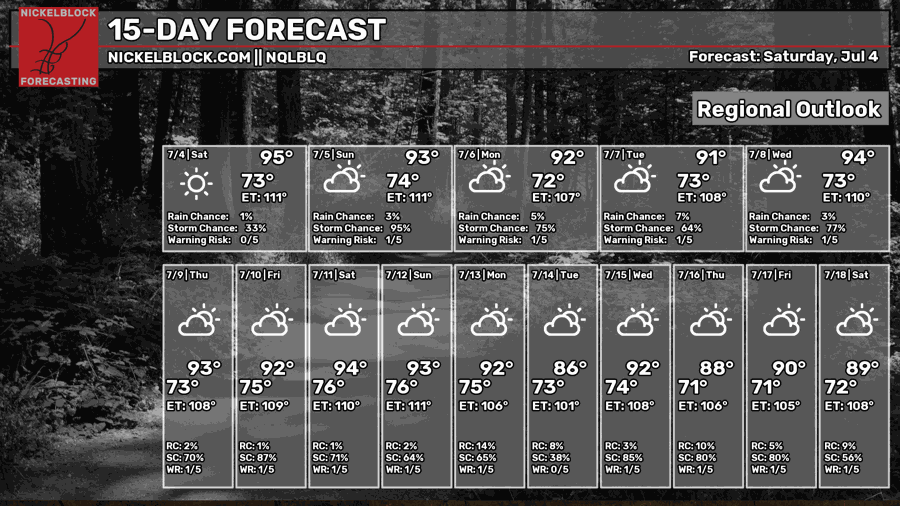
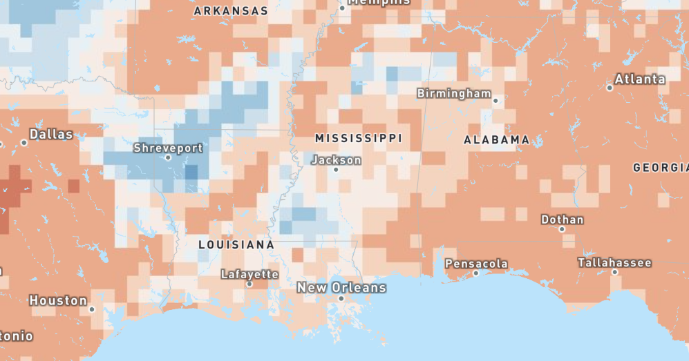
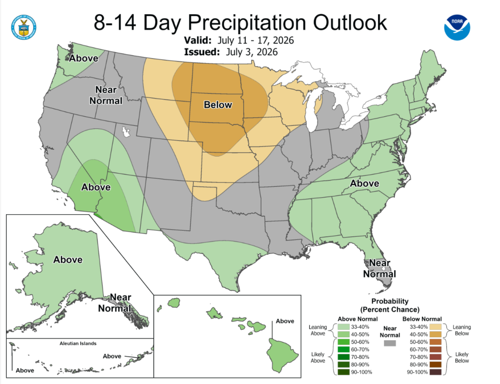
Looking ahead, the hot and humid conditions will persist, with an increase chance in showers and thunderstorms. Temperatures will remain slightly above average for the time of year, Alabama and portions of Mississippi seeing slightly above precipitation levels.
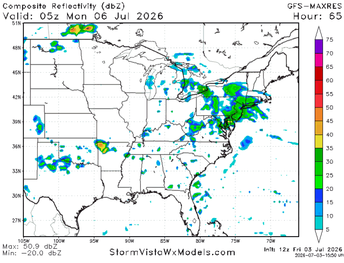
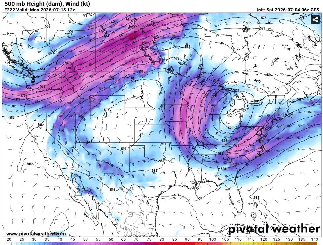
In terms of upper-level patterns, the 500mb map below is showing the chance of having a trough extend into our region by July 13, which would bring with it some interesting weather (definitely more chance for strong thunderstorms). It will be interesting to see how this will play out and how that will impact the region. It is still too far out to be sure of anything, though.
For now, make sure to stay weather aware today and have fun with family and friends for this Fourth of July (and happy 250th anniversary of the United States!!). Enjoy the rest of your day!
Also, make sure to watch my video forecast for today!


