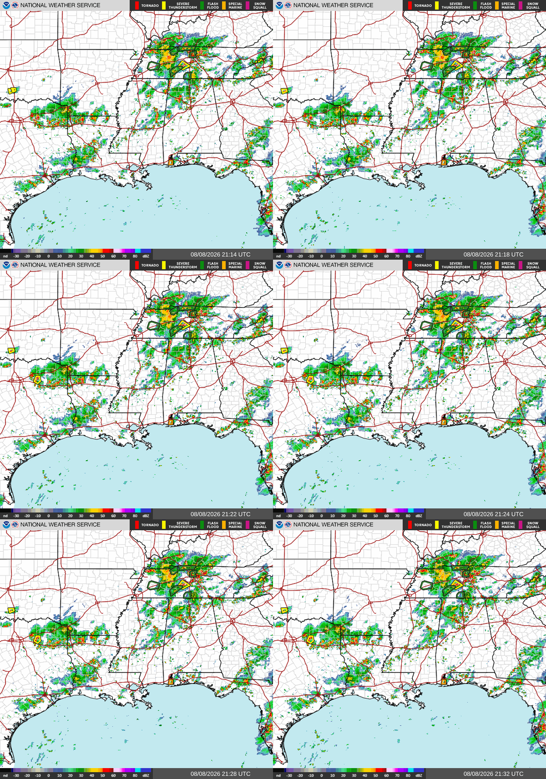
Currently, we have quite the setup across Southern MS/AL/LA. An area of high pressure over southern MS/AL has allowed warm and moist Gulf air to move in across the region, creating stronger thunderstorms across our area this afternoon.
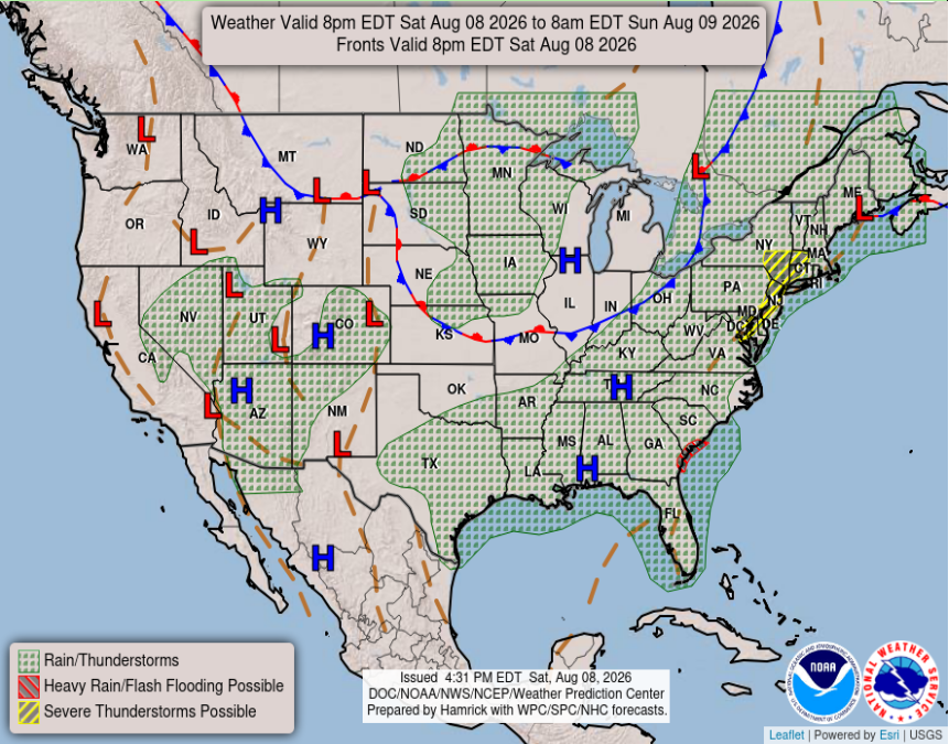
We had an elongated area of relatively low atmospheric pressure along the GA/SC coast that intruded into Florida this morning, which is also impacted our weather pattern. The low-pressure area has since broken up and is hanging around the Florida Peninsula, but is also working to keep these storms up for the region. We can see below that most, if not all of the South is expecting rain or thunderstorms this evening.
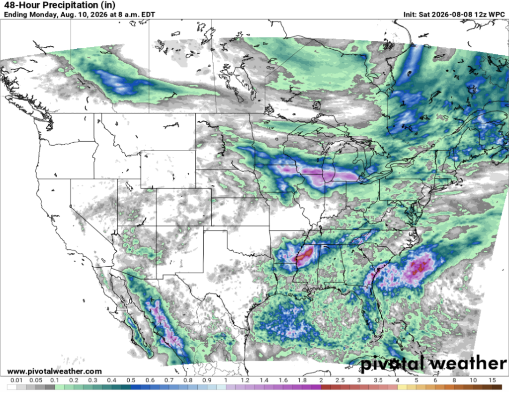
Looking at our 48-hr QPF, we see values that are much higher than those predicted in yesterday’s forecast. This shows how quickly conditions can change, especially in summer, when warm, moist air moves off the Gulf into the southern states. The bulk of the precipitation seen today in northern MS is associated with a former area of low pressure over the Midwest that has since dissipated, but still brought in up to 4 inches of rain to northern Mississippi.