Here is a long list of gauges from the Lower Mississippi River Forecast Center. These images will refresh as data is avialable. The page will need to be refreshed in order to pull the latest available data.
Here is a map with the top 8 chosen gauges (though more will be added):

River Gauges
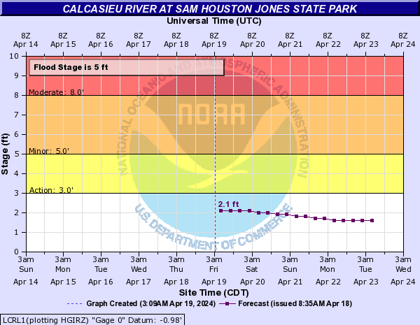
North side of Lake Charles, LA

North of Lake Charles, LA
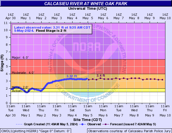
North of Lake Charles, LA
Bundick Lake near Dry Creek, LA

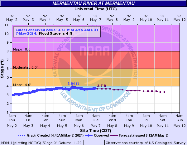
Mermentau river near Jennings, LA
Mermentau river on Grand Lake

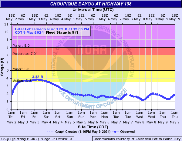
Choupique Bayou on HWY 108 near Choupique Oil and Gas field
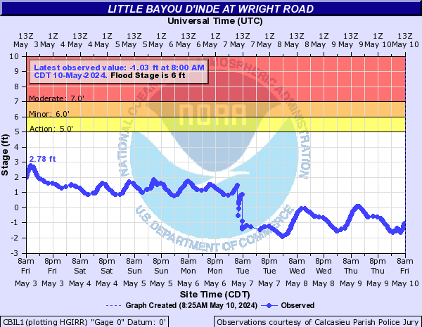
Little Bayou D’inde at Wright Road near Sulphur, LA
Tidal Stations
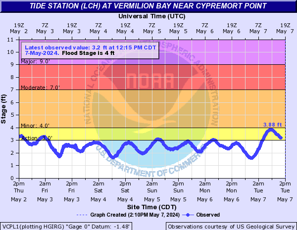
Tide station at Vermillion Bay
Tide station at Freshwater Canal Locks

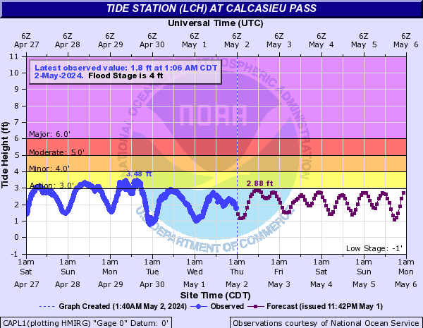
Tide station at Calcasieu Pass near Cameron, LA
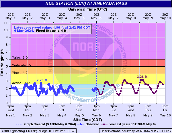
Tide station at Amereda Pass