Greetings from Across the Pond!
Looking at the forecast ‘back home’ and things look rather odd during the enxt few days. Not severe. Not catastrophic. Just odd.
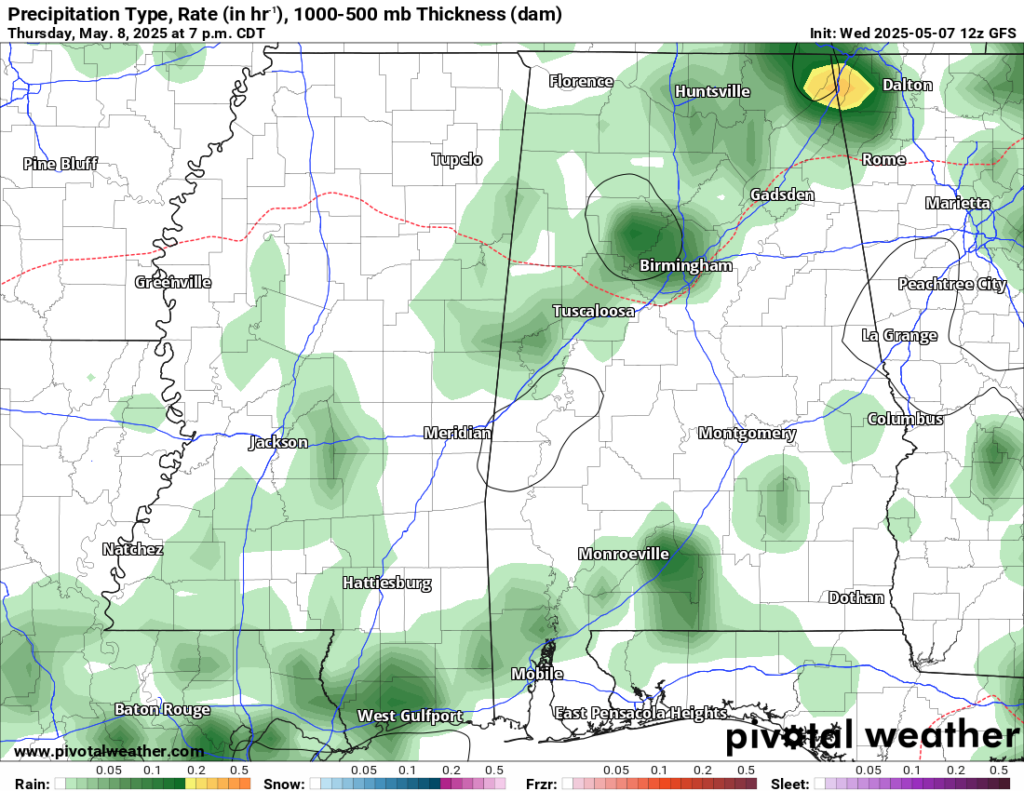
The showers and storms from today will give way to isolated rain and storms tomorrow across the region. Nothing terribly organized as a very weak front tries to slide through. It won’t quite make it. So expect the rain to linger into Friday, too.
During the day on Friday, the odd stuff starts. Model guidance is trying to spin up a weak are of surface low pressure along the tail end of the front. This isn’t weird, necessarily. But it is weird for it to be happening this time of year and so close to shore.
When these things happen, typically they happen a few hundred miles offshore after a front kicks all the way through. This time, it is shown as happening much closer to home.
When this happens, it will curly-cue around area area for Saturday and into Sunday before exiting to the north on Monday.

In fact, for a short period of time this weekend (likely late Saturday night through Sunday midday) this feature may even exhibit subtropical properties. Low-end chance, but not zero.
What does all of htis mean for you?
Rain. And thunder.
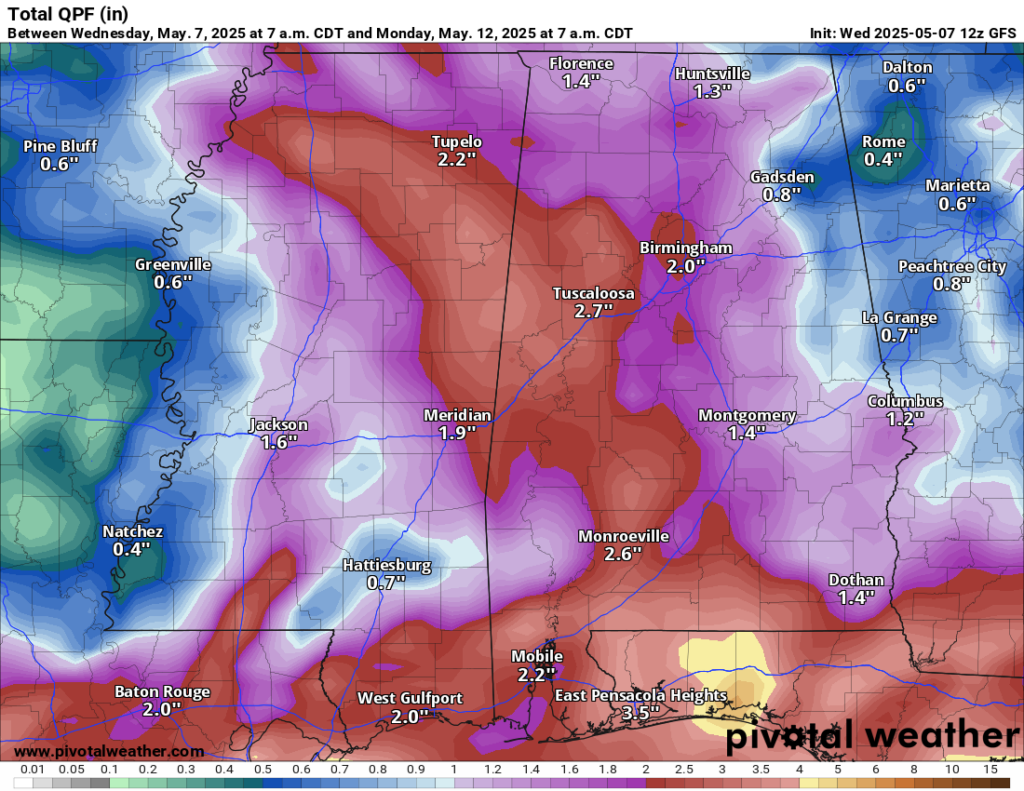
So far, model guidance puts the heaviest rain over into the Florida panhandle, but given the oddity of this system, I would argue that there is an increased chance for the bullseye of rain to move around a bit int he coming days. That means things may get a bit wetter for us.
The good news is that once we get past Monday, things should start to improve. This area of low pressure kicks out and we start to dry back out and warm up. Some indications suggest highs near 90 by next weekend.
REGIONAL DAY TO DAY FORECAST
Today: Mostly sunny. Highs in the upper 80s. Southeast winds 5 to 10 mph.
Tonight: Partly cloudy in the evening, then mostly cloudy with a slight chance of showers and thunderstorms after midnight. Lows in the upper 60s. Southeast winds 5 to 10 mph. Chance of rain 20 percent.
Thursday: Partly sunny. A slight chance of showers and thunderstorms in the morning, then a chance of showers and thunderstorms in the afternoon. Highs in the mid 80s. South winds 5 to 10 mph with gusts up to 25 mph. Chance of rain 40 percent.
Thursday Night: Partly cloudy with a slight chance of showers and thunderstorms. Lows in the mid 60s. South winds 5 to 10 mph. Chance of rain 30 percent.
Friday: Partly sunny with a chance of thunderstorms. A chance of showers in the morning, then showers likely in the afternoon. Highs in the mid 80s. South winds 5 to 10 mph. Chance of rain 60 percent.
Friday Night: A chance of thunderstorms. Showers likely, mainly in the evening. Lows in the mid 60s. Chance of rain 60 percent.
Saturday: Showers likely with a chance of thunderstorms. Highs in the lower 80s. Chance of rain 70 percent.
Saturday Night: Mostly cloudy with a chance of showers and thunderstorms in the evening, then partly cloudy after midnight. Lows around 60. Chance of rain 40 percent.
Sunday: Mostly sunny. A slight chance of showers and thunderstorms in the afternoon. Highs in the lower 80s. Chance of rain 40 percent.
Sunday Night: Clouds with rain possible. Lows in the upper 50s. Chance of rain 40 percent.
Monday: Mostly cloudy. Highs in the mid 80s. Chance of rain 30 percent.
Monday Night: Clearing skies. Lows in the upper 50s.
Tuesday: Partly sunny. Highs in the mid 80s.


Thank You, Nick ~ Your careful explanations of weather in my home of Hattiesburg is greatly appreciated.