With as cool of a day we had today and a few small cells of rain, the rest of the week will be absolutely nothing like today. We’re going to dive headfirst into summer by midweek and I’m sure we’ll stay there for quite a while.
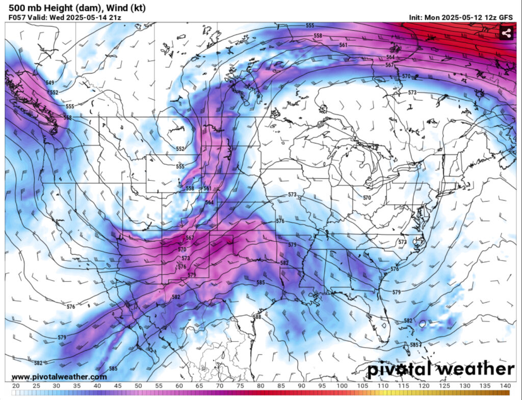
By tonight, the rain chances will die down and give way to patchy dense fog overnight and into the early morning. Tuesday will see sunnier skies and much warmer weather in the mid 80s. After the cold front moves out, we’ll have a gradient wind bringing in gusty conditions on Wednesday. Highs in the upper 80s and lows in the upper 60s.

By Friday, we’ll reach a much more linear pattern in the upper levels and a high pressure system in the Atlantic to form. Unfortunately (or fortunately for those who love the heat), this means that we’re officially reaching the summer temperatures. Highs will be in the low to mid 90s across the area with lows in the low 70s. The good news is that the heat index isn’t much higher than the high temperature, but the UV index will still be very high, so wear your sunscreen when you go out. Later on in the weekend, we’ll have a few shortwave systems move from the northwest despite the slight blocking that the high pressure is doing. Rain chances are fairly slim south of Highway 84, but still possible.
Regional Day-to-Day Forecast
This Afternoon – A 30 percent chance of showers and thunderstorms. Mostly sunny, with a high in the mid 70s. West wind around 5 mph.
Tonight – A 10 percent chance of showers and thunderstorms before sunset. Patchy fog after 3am. Otherwise, mostly clear, with a low in the upper 50s. Calm wind.
Tuesday – Patchy fog before 10am. Otherwise, sunny, with a high in the mid 80s. West southwest wind 5 to 10 mph, with gusts as high as 20 mph.
Tuesday Night – Mostly clear, with a low in the mid 60s. South wind around 5 mph.
Wednesday – Sunny, with a high in the upper 80s. South southwest wind 5 to 15 mph, with gusts as high as 25 mph.
Wednesday Night – Mostly clear, with a low in the upper 60s. South wind 5 to 10 mph, with gusts as high as 20 mph.
Thursday – Mostly sunny, with a high in the low to mid 90s. South southwest wind 5 to 10 mph, with gusts as high as 20 mph.
Thursday Night – Partly cloudy, with a low around 70. South wind around 5 mph.
Friday – Partly sunny, with a high in the low to mid 90s. South southwest wind 5 to 10 mph, with gusts as high as 20 mph.
Friday Night – Mostly cloudy, with a low in the low 70s.
Saturday – A 30 percent chance of showers and thunderstorms. Mostly sunny, with a high in the low 90s.
Saturday Night – Partly cloudy, with a low in the low 70s.
Sunday – A 20 percent chance of showers and thunderstorms. Mostly sunny, with a high in the low 90s.
Sunday Night – Partly cloudy, with a low in the low 70s.
Monday – Mostly sunny, with a high in the low to mid 90s.


