We’re finally looking at a nicer weekend with the exception of a small chance of showers and thunderstorms Sunday afternoon. As for next week, Monday and Tuesday are looking great as well – sunny with high temperatures in the upper 80s. Although, there is some more stormy weather to end next week, so be prepared for potential rain and thunderstorms starting Wednesday, with temperatures reaching 90 degrees.
This Weekend’s Weather:
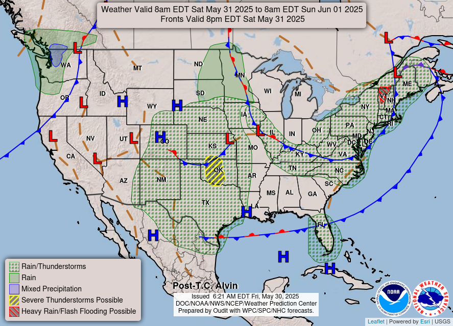

As you can see in the image on the left, we are looking nice and dry for today, and the nearby high pressure system and dry air mass is bringing us some much-needed nice weather.
As for Sunday, the image on the right is showing a low pressure system coming in, putting the area at risk for a possible afternoon pop-up shower and/or thunderstorm. The chance of rain is low though, around a 20% chance, so not too much to worry about.
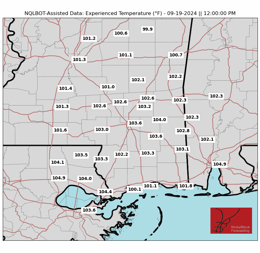

As far as temperature goes, high temperatures this weekend will be in the mid to high 80s, but due to some high humidity, the “feels like” temperatures will be a good amount higher than the actual temperature. Take a look at the images for this weekend’s experienced temperature at noon, New Orleans is pushing 98 degrees both days, Hattiesburg at 94 on Saturday, Mobile even reaches 100 on Sunday. If you’re taking advantage of the dry weekend weather, make sure to stay hydrated and cool in the heat!
Looking Into Next Week
Due to stable conditions in the atmosphere for Monday and Tuesday, next week will have a beautiful sunny start, and on Wednesday afternoon the wet weather will start up again for the rest of the week. Later on Tuesday a low pressure system will make its way across Middle America, and towards our area, unfortunately this will bring wet weather by Wednesday. There will also be high CAPE in the area later next week, indicating a high level of instability in the atmosphere. These conditions are very favorable to some stormy weather, so be prepared and keep an eye out for storms later next week.
Temperatures are also forecasted to rise next week, with high temperatures reaching the 90s during the daytime and low temperature only dipping down to the 70s at night, so definitely prepare yourself for the start of summery temperatures!
[wpcode id=”41149″]
Regional Day-to-Day Forecast
Today: Sunny skies and highs in the mid 80s. Winds will be calm.
Tonight: Mostly clear skies and lows in the mid 60s. Winds will be calm.
Sunday: Sunny during the day with a slight chance of showers and thunderstorms in the afternoon. Highs will be in the mid 80s during the day and lows in the mid 60s at night. Chance of precipitation 20%.
Monday: Mostly sunny with highs in the high 80s during the day and lows in the high 60s at night. Winds will be calm.
Tuesday: Mostly sunny with highs in the high 80s during the day and lows in the low 70s at night. Winds will be light, about 5-10mph.
Wednesday: Sunny during the day with chance of showers and thunderstorms in the afternoon. Highs around 90 during the day and lows in the low 70s at night. Chance of precipitation 20%.
Thursday: Showers and thunderstorms likely. Highs around 90 during the day and lows in the mid 70s at night. Chance of precipitation 60%.
Friday: A chance of showers and thunderstorms. Highs around 90 during the day and lows in the mid 70s at night. Chance of precipitation 50%.


