This weekend we’ll be seeing our typical pattern of sunny skies in the morning with possible showers and thunderstorms scattered in the afternoon and evening, along with some steamy temperatures. Some of these pop up storms may be severe, especially in the Jackson, Mississippi area. As for next week, unfortunately more rain and possible thunderstorms are forecasted for throughout the week. Let’s get into some more details below:
Current Setup
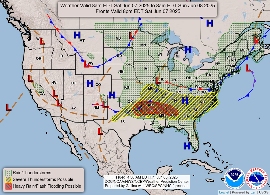
As you can see, both heavy rain and severe thunderstorms are possible for the northern halves of Mississippi and Alabama. Severe thunderstorms are also possible in northern Louisiana, with rain and thunderstorms forecasted for the New Orleans area. There is also a cold front moving into our area, bringing the wet weather that is forecasted our way.
[wpcode id=”41149″]
This weekend’s weather
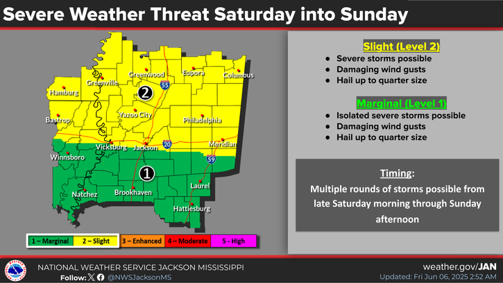
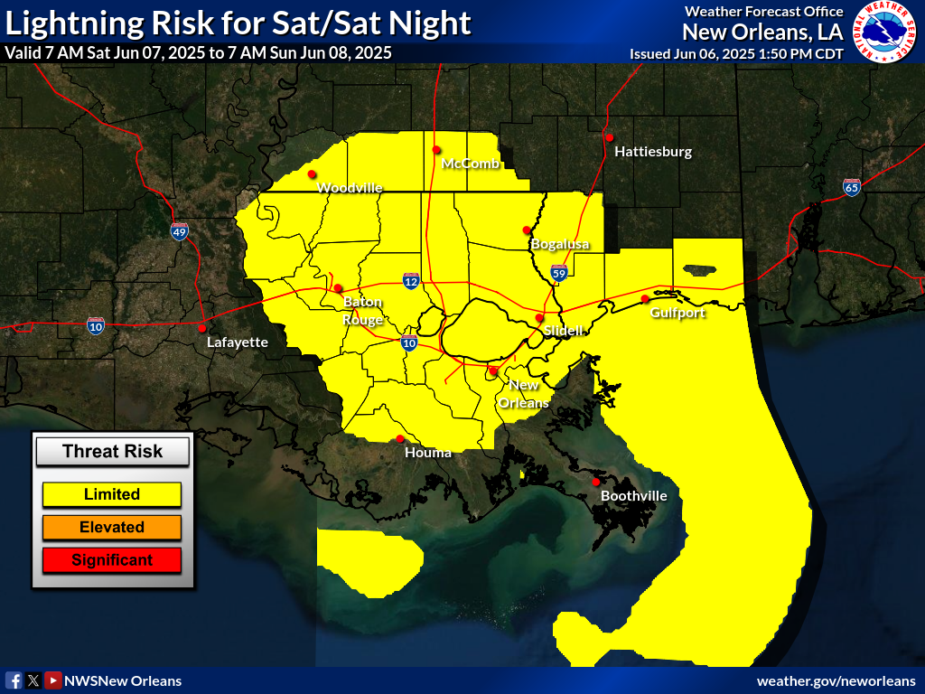
As you can see, there is a marginal to slight chance of severe weather in the Jackson area, so if you are in that area, make sure to check for any thunderstorm warnings before heading outside. There is also a risk for lightning in the New Orleans area. Although this risk is “limited” it is still something to keep an eye on. Remember: if thunder roars, go indoors!
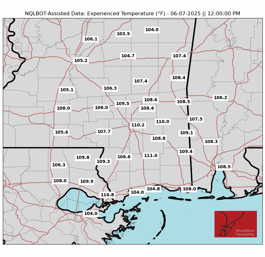

Temperatures this weekend are also looking quite hot, with experienced temperatures reaching over 100 degrees for both Saturday and Sunday. Check out Hattiesburg on Saturday, reaching over 110 degrees, along with many other cities across the region. So if you find some sunshine between storms this weekend, be sure to stay hydrated while outside!
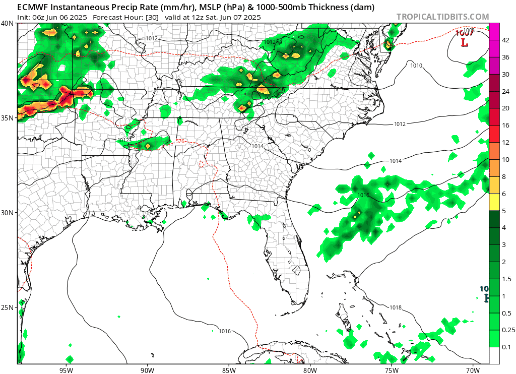
This model shows the precipitation for this weekend, and we can see some larger storms sweeping over the northern parts of Mississippi and Alabama, and some smaller, scattered storms popping up over the southern parts of Louisiana, Mississippi, and Alabama as well. It’s definitely a good idea to check the radar if you plan on going outside this weekend!
[wpcode id=”41149″]
Looking into next week:
Next week we will unfortunately be looking at more rain but slightly cooler temperatures, due to a front coming in and sitting over our region.

The image above shows the the 15 day forecast: there is a high chance for showers and thunderstorms from Sunday to Wednesday, a lower chance for stormy weather from Thursday to next Wednesday, and storms picking back up by the end of next week. High temperatures are sitting around the mid 80s to lower 90s and lows in the 70s. Note that for many of the upcoming days, the experienced temperature is much higher than the actual temperature. So, stay cool and dry next week and stay tuned for daily updates!
Regional Day-to-Day Forecast
Today: Sunny during the morning with a slight chance of showers and thunderstorms in the afternoon. Highs in the low 90s. Chance of precipitation 20%.
Tonight: Mostly clear, then a chance of thunderstorms later at night. Lows in the mid 70s. Chance of precipitation 20%.
Sunday: Mostly sunny with a chance of showers and thunderstorms in the afternoon. Highs in the low 90s during the day and lows in the mid 70s at night. Chance of precipitation 50%.
Monday: Chance of showers and thunderstorms throughout the day. Highs in the high 80s during the day and lows in the mid 70s at night. Chance of precipitation 70%.
Tuesday: Chance of showers and thunderstorms throughout the day. Highs in the high 80s during the day and lows in the low 70s at night. Chance of precipitation 70%.
Wednesday: Chance of showers and thunderstorms throughout the day. Highs in the high 80s during the day and lows in the mid 70s at night. Chance of precipitation 30%.
Thursday: Chance of showers and thunderstorms throughout the day. Highs in the high 80s during the day and lows in the mid 70s at night. Chance of precipitation 70%.
Friday: Chance of showers and thunderstorms throughout the day. Highs in the low 90s during the day and lows in the low 70s at night. Chance of precipitation 40%.
Saturday: Mostly sunny with a chance of showers and thunderstorms in the afternoon. Highs in the low 90s during the day and lows in the mid 70s at night. Chance of precipitation 40%.


