Another wet week is expected with a stalling front allowing plenty of moisture inflow to move in over the next several days. This doesn’t look to stop for a while as that inflow is hardly interrupted and a high pressure system develops pushing the front north but keeping the rain in the southeast.
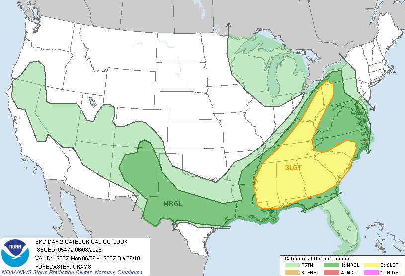
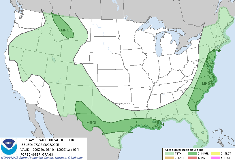
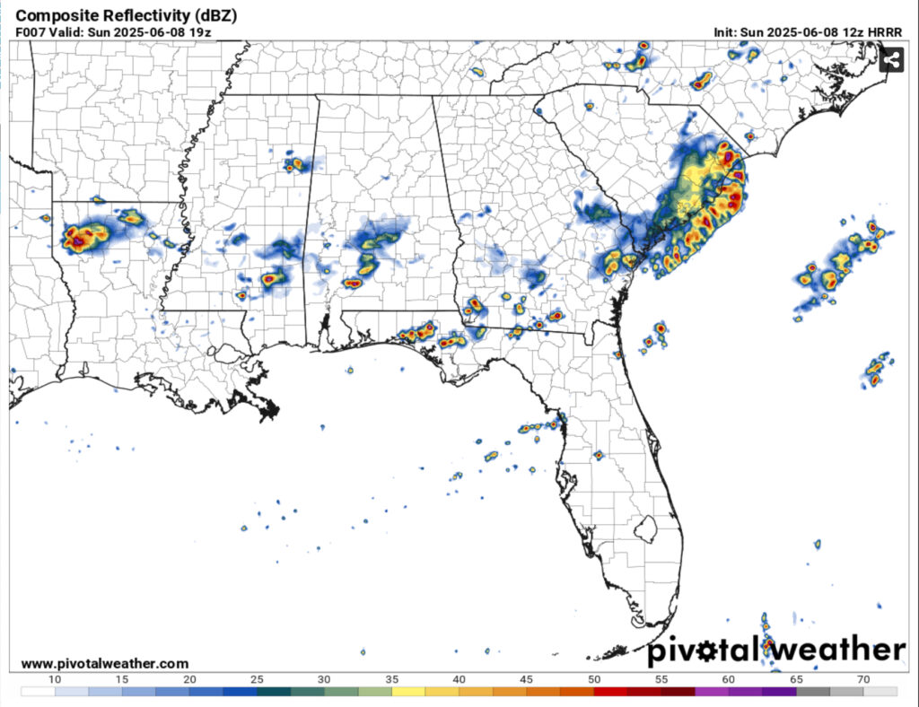
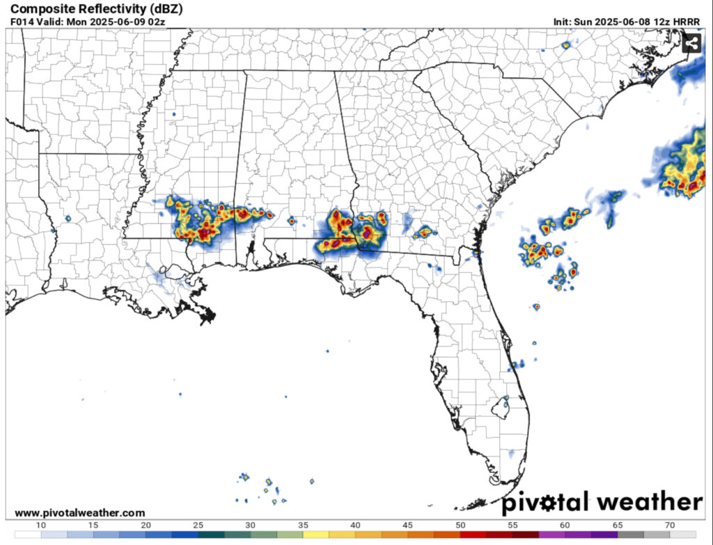
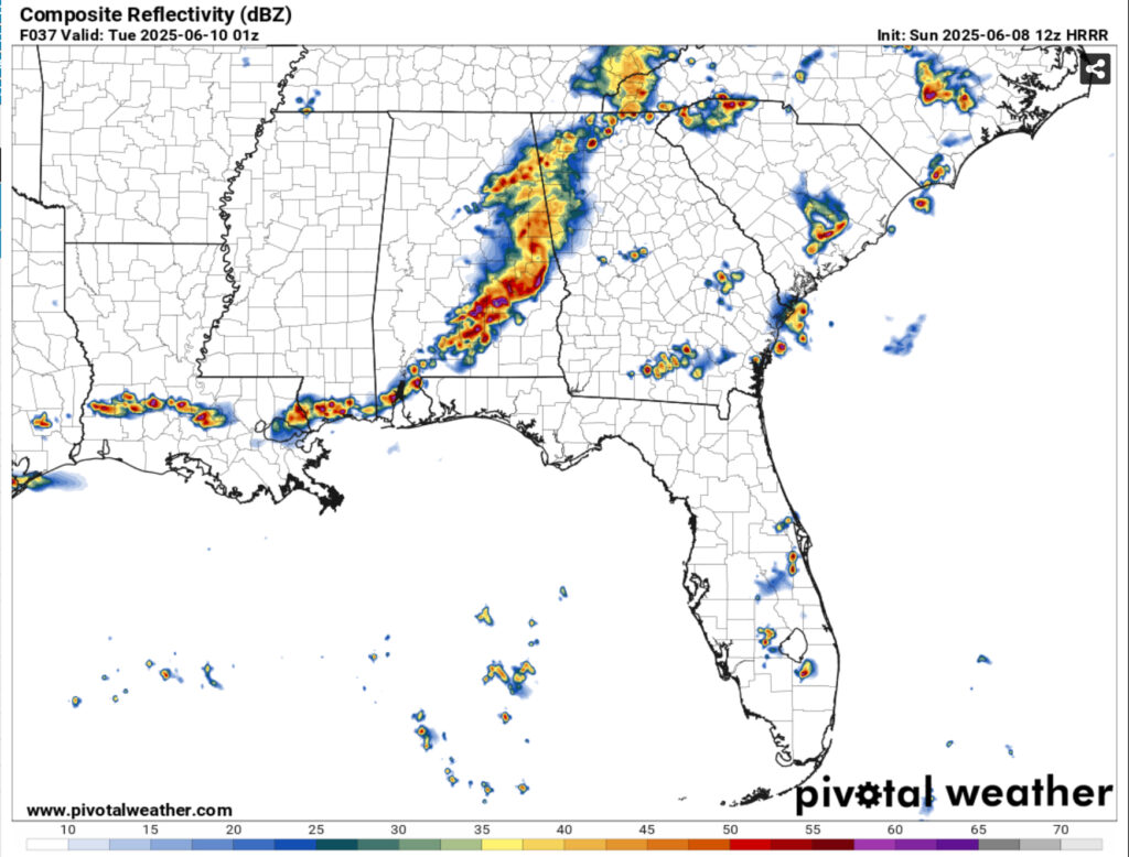
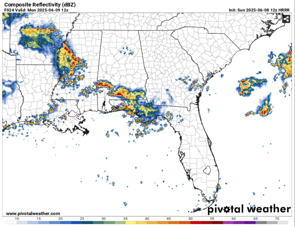
The Storm Prediction Center has the southeast placed under 2 different severe weather outlooks for Monday and Tuesday. Tonight will be important to how strong the storms will be tomorrow. With a small MCS moving southward in the early afternoon and another one moving in this evening into the overnight hours, this could allow for a cold pool to develop over the Pine Belt and surrounding areas. What this means is that the severe threat could be diminished a bit before it arrives in the afternoon. Our main concerns will be straight line wind damage, flash flooding and lightning. Tuesday is less of a threat since the system will move further south, however thunderstorms are still possible during the day.
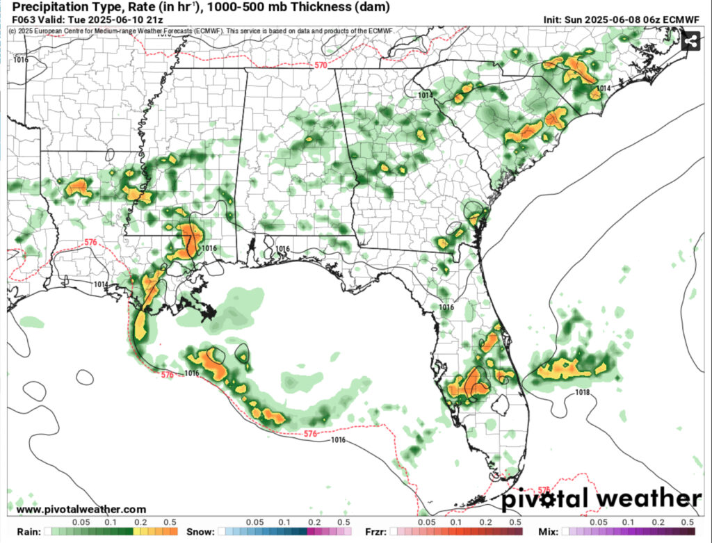
Due to the constant rain, the temperatures will also fall into the mid 80s during the day and stay around the low 70s at night. Dewpoints will also reach the upper 60s to low 70s for the next several days indicating a chance for rain in the morning as well. Mixed rain chances are possible during the week with them slowly being confined to the afternoon by the weekend. As a surface high moves by mid-week, the severe chances will reduce.
By the end of the week, temperatures will climb back into the low 90s due to the surface high and cloud cover will reduce as well. Rain chances will stay the same as the Gulf moisture inflow will still be present. By the beginning of the next week, the front will move in to move the low pressure system out of the way.
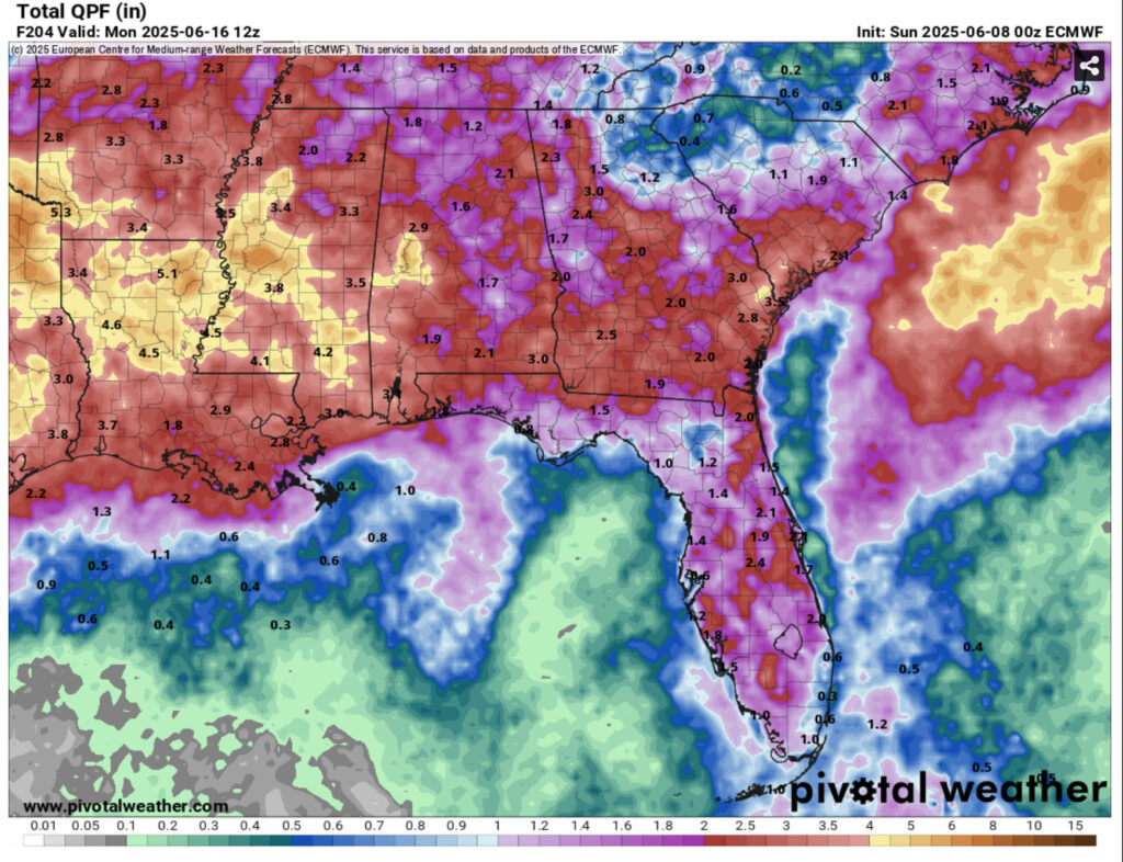
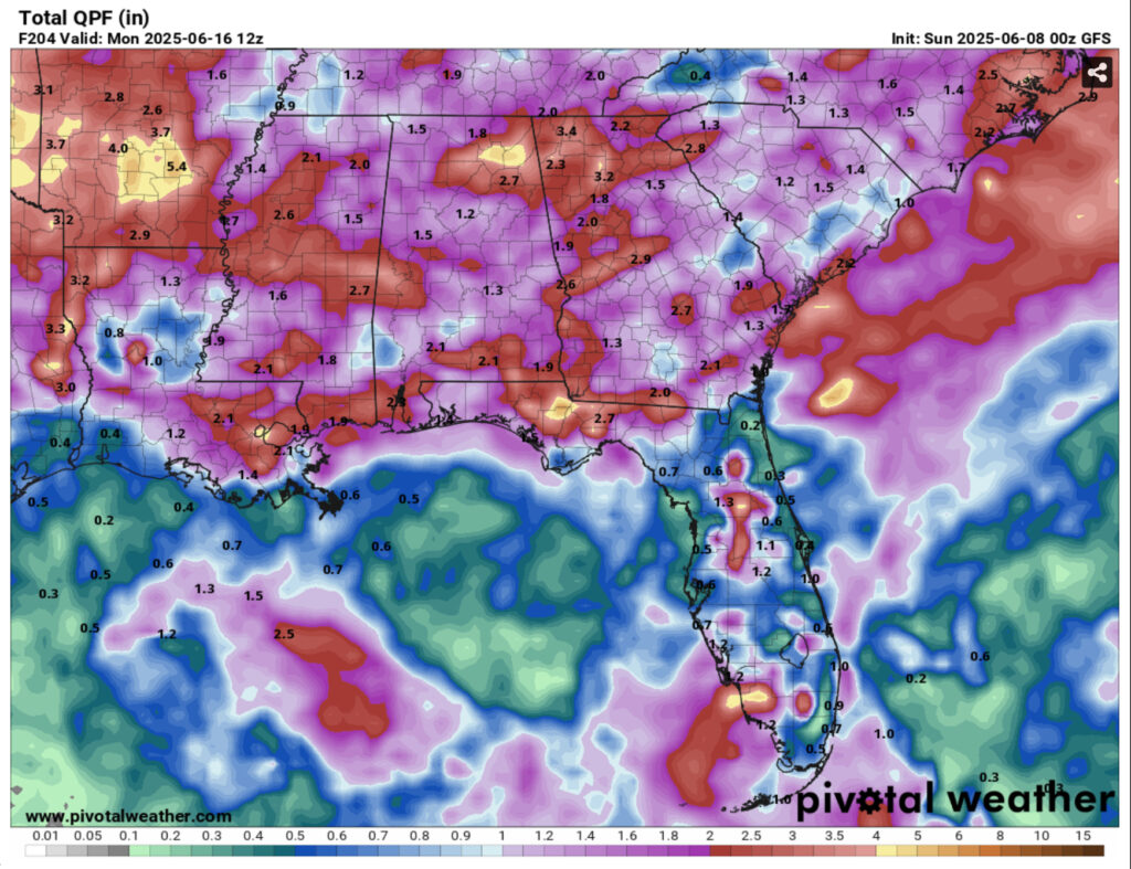
Rainfall totals range from around 1.5-4.5”. I think our highest totals will be in the beginning of the week with some short bursts adding to the total by the end of the weekend.
Regional Day-to-Day Forecast
This Afternoon – A slight chance of showers, then a chance of showers and thunderstorms in the afternoon. Partly sunny, with a high in the low 90s. Heat index values as high as 100. West wind 5 to 10 mph. Chance of precipitation is 40%.
Tonight – Showers and thunderstorms likely, mainly before sunset. Mostly cloudy, with a low in the low 70s. West wind around 5 mph becoming calm. Chance of precipitation is 60%. New rainfall amounts between a tenth and quarter of an inch, except higher amounts possible in thunderstorms.
Monday – Showers and thunderstorms possible, some severe. High in the low 90s. West southwest wind 5 to 10 mph, with gusts as high as 20 mph. Chance of precipitation is 80%. New rainfall amounts between a tenth and quarter of an inch, except higher amounts possible in thunderstorms.
Monday Night – Showers and thunderstorms likely. Some of the storms could be severe. Low in the low 70s. West southwest wind around 5 mph becoming calm in the evening. Chance of precipitation is 80%. New rainfall amounts between a tenth and quarter of an inch, except higher amounts possible in thunderstorms.
Tuesday – Showers and thunderstorms likely. Some of the storms could be severe. High in the mid 80s. Calm wind becoming west around 5 mph. Chance of precipitation is 90%. New rainfall amounts between a quarter and half of an inch possible.
Tuesday Night – Showers and thunderstorms likely into the overnight hours. Mostly cloudy, with a low around 70. Calm wind. Chance of precipitation is 30%.
Wednesday – showers likely and possibly a thunderstorm. Mostly cloudy, with a high near 90. Calm wind becoming south southwest around 5 mph. Chance of precipitation is 70%.
Wednesday Night – A 20 percent chance of showers and thunderstorms before midnight. Mostly cloudy, with a low in the low 70s. Calm wind.
Thursday – Showers and thunderstorms likely, mainly in the afternoon. Mostly cloudy, with a high in the low 90s. Calm wind becoming south southeast around 5 mph in the afternoon. Chance of precipitation is 70%.
Thursday Night – A 20 percent chance of showers and thunderstorms before midnight. Mostly cloudy, with a low in the low 70s.
Friday – Showers and thunderstorms likely. Partly sunny, with a high in the low 90s. Chance of precipitation is 70%.
Friday Night – A 20 percent chance of showers and thunderstorms. Partly cloudy, with a low in the low 70s.
Saturday – Showers and thunderstorms likely. Partly sunny, with a high in the low 90s. Chance of precipitation is 70%.


