Our regular pattern of scattered showers and storms is here to stay, with rising air in the upper atmosphere and a cold front near the surface coming into our area causing the continued wet weather. Our risk for severe weather is generally low, but high heat indices will continue to be a concern to watch out for. Let’s get into some more details!
[wpcode id=”41149″]
The Current Setup for Today
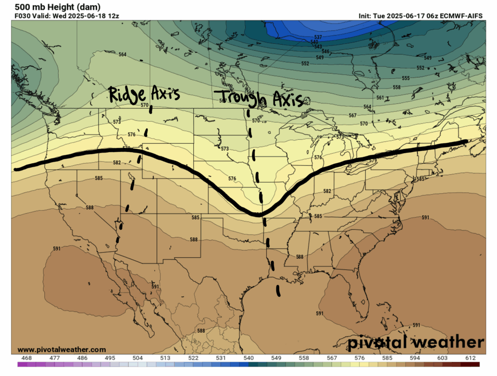
Looking at our 500mb upper-air map, we can see a trough, or dip in our general flow, which is sandwiched between a ridge to our west and another to the east (which was just a bit too far to the right to show in this map). To the right of this trough, i.e. our region, there is divergence aloft. This “divergence aloft” basically just indicates rising air, which often creates low pressure systems, leading to cloud formation and subsequent precipitation in our area.
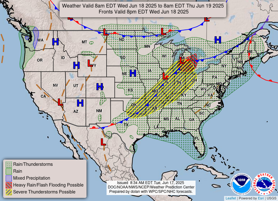
Looking closer to the ground, we can see that there is a cold front moving toward our region. As you may know, cold fronts typically bring soggy, and at times severe, weather (you can see the severe risk in yellow along the cold front). Fortunately, the risk for severe weather as of now for our area is quite low.
[wpcode id=”41149″]
Today’s Weather:

Because of our current setup in the atmosphere, we will have our typical summer day consisting of mostly sunny skies in the morning, with some scattered showers and thunderstorms in the afternoon. Temperatures will reach 90 degrees, but per usual, high humidity will make it feel warmer outside than it actually is. Check out the experienced temperatures for tomorrow:
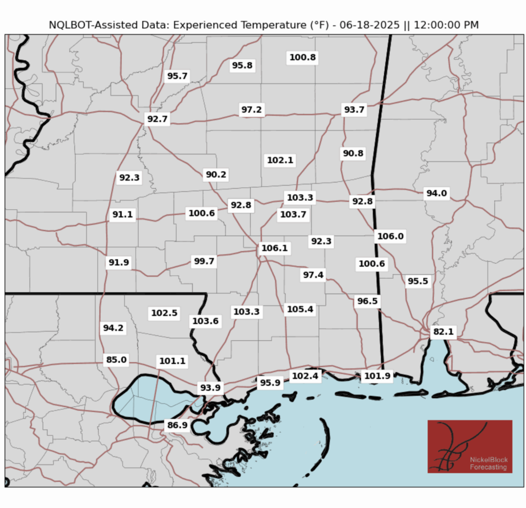
As you can see, in many places the “feels like” temperatures are a good 10-15 degrees higher than the actual temperature, so if you are planning on being outside today make sure to stay hydrated and take breaks!
The Rest of the Week/Weekend:
Once again, we have scattered showers and thunderstorms popping up for the rest of the week. The risk for severe storms remains low, though. Take a look at the radar for the rest of the week and through the weekend:
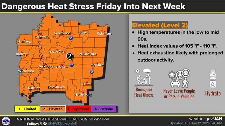
We will also see high temperatures in the low 90s with high heat indices which is definitely something to look out for if you have any outdoor weekend plans!
[wpcode id=”41149″]
An Extended Outlook:

As you can see, there is a chance for showers and storms almost everyday, but the risk that they will be severe is low. Temperatures will generally remain in the low 90s, with a high heat index.
[wpcode id=”41149″]
Regional Day-to-Day Forecast:
Today: Mostly sunny in the morning, with a chance of showers and thunderstorms in the afternoon. Highs reaching 90 degrees. Chance of precipitation 50%.
Tonight: Slight chance of showers and thunderstorms early on in the evening. Lows in the mid 70s. Chance of precipitation 20%.
Thursday (Juneteenth): Chance of showers and thunderstorms throughout the day. Highs in the low 90s during the day and lows in the mid 70s at night. Chance of precipitation 60%.
Friday: Mostly sunny in the morning, with a chance of showers and thunderstorms in the afternoon. Highs in the low 90s during the day and lows in the mid 70s at night. Chance of precipitation 50%.
Saturday: Mostly sunny in the morning, with a chance of showers and thunderstorms in the afternoon. Highs in the low 90s during the day and lows in the mid 70s at night. Chance of precipitation 40%.
Sunday: Mostly sunny in the morning, with a chance of showers and thunderstorms in the afternoon. Highs in the low 90s during the day and lows in the mid 70s at night. Chance of precipitation 50%.
Monday: Slight chance of showers and thunderstorms throughout the day. Highs in the low 90s during the day and lows in the mid 70s at night. Chance of precipitation 60%.
Tuesday: Slight chance of showers and thunderstorms throughout the day. Highs in the low 90s during the day and lows in the mid 70s at night. Chance of precipitation 50%.
Wednesday: Slight chance of showers and thunderstorms throughout the day. Highs reaching 90 degrees during the day and lows in the mid 70s at night. Chance of precipitation 50%.


