This weekend you can expect sunny skies with a mix of clouds for each day. Showers and thunderstorms are possible for the afternoons, but an overall dry pattern with a building ridge of high pressure is expected. Let’s dive into the detailed forecast:
[wpcode id=”41149″]
Today’s Overall Setup


Today’s overall setup for the CONUS is a large ridge building in the desert southwest and a trough moving east northeast with an area of low pressure over the midwest and northeast. Attached to the low pressure system is a cold front that is responsible a severe weather threat in the northeast and mid-Atlantic. A Slight (2/5) risk of severe weather exists from Charolette, NC to northern Maine along the east coast. Out ahead of the cold front is warm and moist air which has descent mid-level flow, as shown in the 500 mb map above. There is a 2 percent tornado risk in the northeast region in the risk zone, but since wind shear is not very high, the SPC is most concerned with severe wind gusts up to 70 mph and possible hail anywhere in the risk zone. We will be keeping an eye on this severe weather threat.
[wpcode id=”41149″]
Today’s Local Forecast
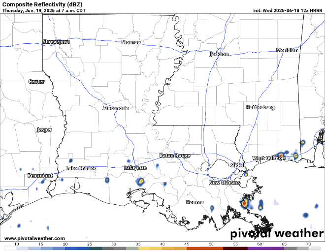
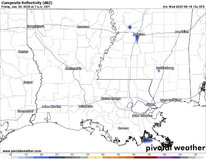
Today, we start the day off cloudy with some showers coming through from the south into coastal Louisiana and coastal Mississippi. As we get to around 12 pm, a line of thunderstorms from the passing cold front will come from the north, hitting Jackson and Meridian. Hattiesburg can expect this line to come through at around 3 pm. After this line comes through, clear conditions are expected for the rest of the night.
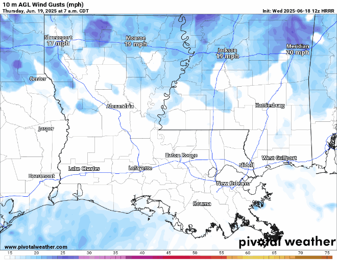
Wind gusts could be high during the segment that comes down into Mississippi. Expect wind gusts up to 30 mph as the cold front comes through, and cooler temperatures!

Here’s an hourly look at the forecast for today for the region.
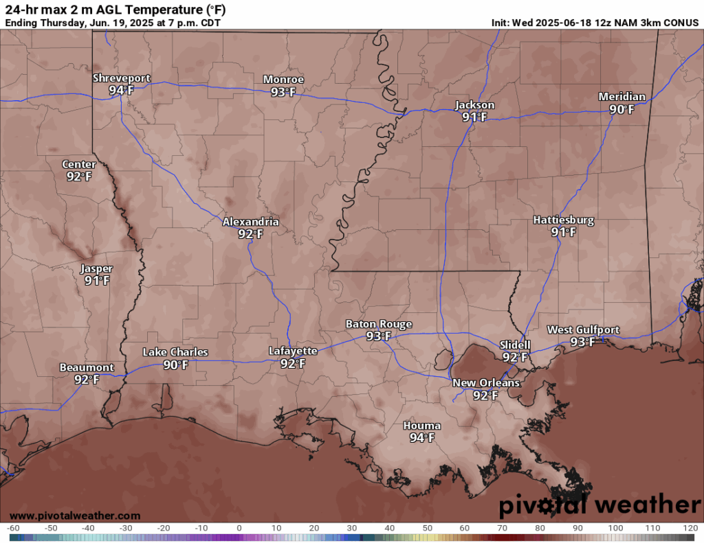
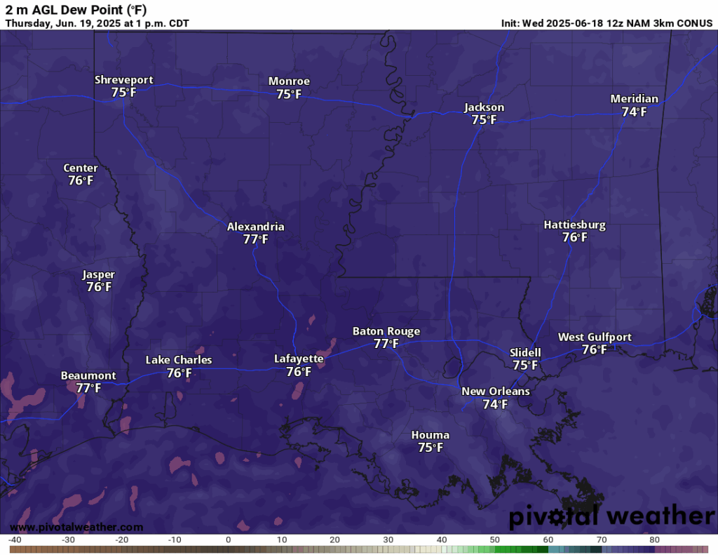
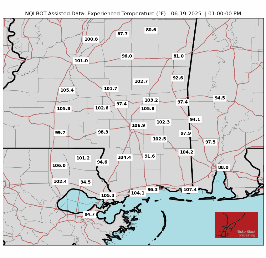
High temperatures today are in the low 90s. Dew points in the mid 70s are making it feel like 107 in Hattiesburg at 1pm. Temperatures will drop as the rain comes through, giving some temporary relief from the heat. Ensure if you are working outside today that you have enough water!
[wpcode id=”41149″]
This Weekend’s Forecast
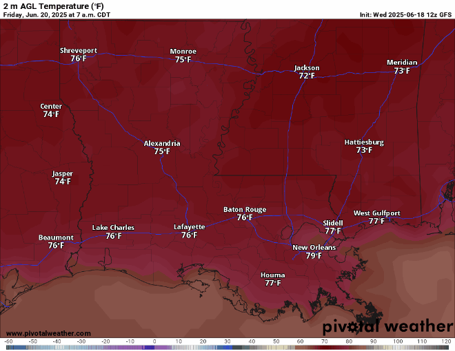
Temperatures this weekend will be in the low to mid 90s during the day and low to mid 70s at night.
This weekend is looking dry for the most part – asides from the usual 4 pm afternoon thunderstorm or two. The ridge of high pressure is keeping the rain to a minimum, so it’s definitely a great weekend for outdoor activities, if you can handle the heat! As always, keep an eye out on the NickelBlock App for real time alerts if you will be outside, and plan around the isolated thunderstorms!
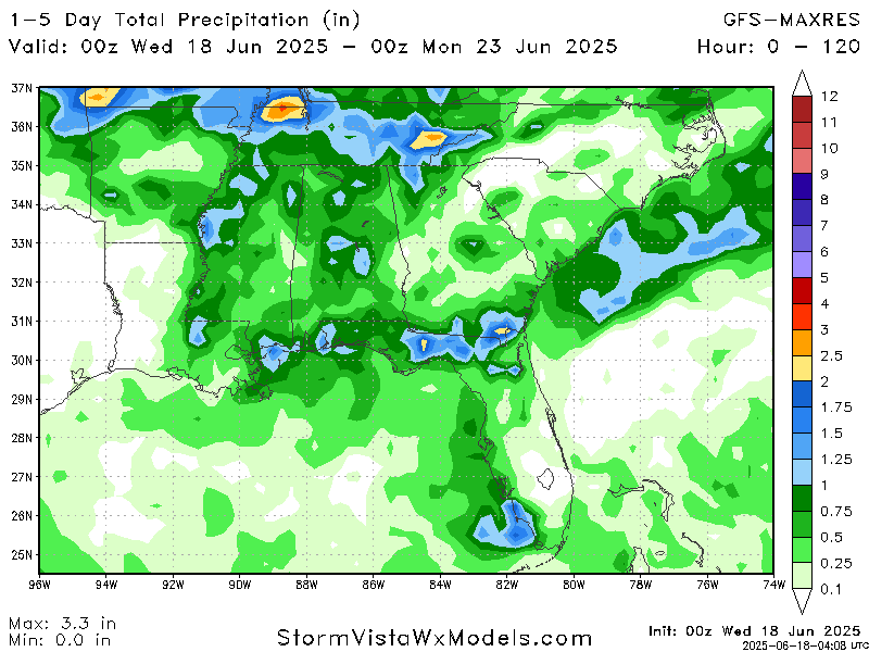
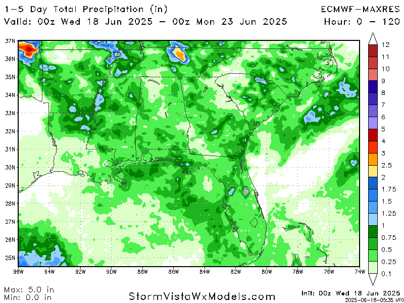
When comparing the two main global models, the GFS (American) and ECMWF (European), the GFS is showing higher rainfall totals through Sunday, especially in coastal and northwestern Mississippi. Meanwhile, the ECMWF is more conservative with precipitation amounts. Given the forecast setup and the expectation of just scattered afternoon storms, I’d lean more toward the ECMWF for the precipitation totals. The ECMWF is also usually more reliable with medium range precipitation forecasts.
[wpcode id=”41149″]
Extended Local Outlook

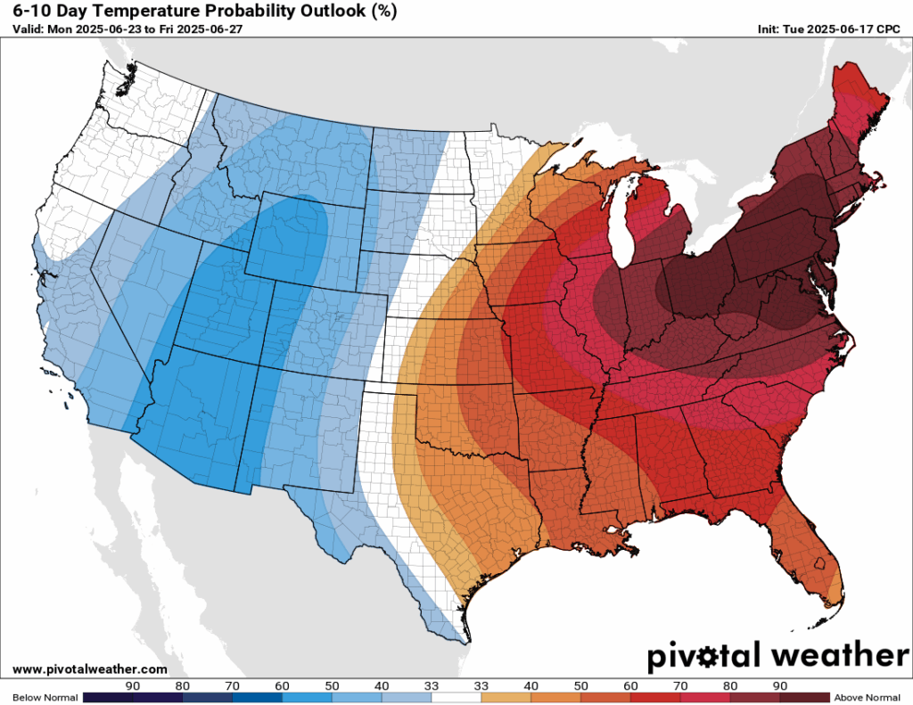
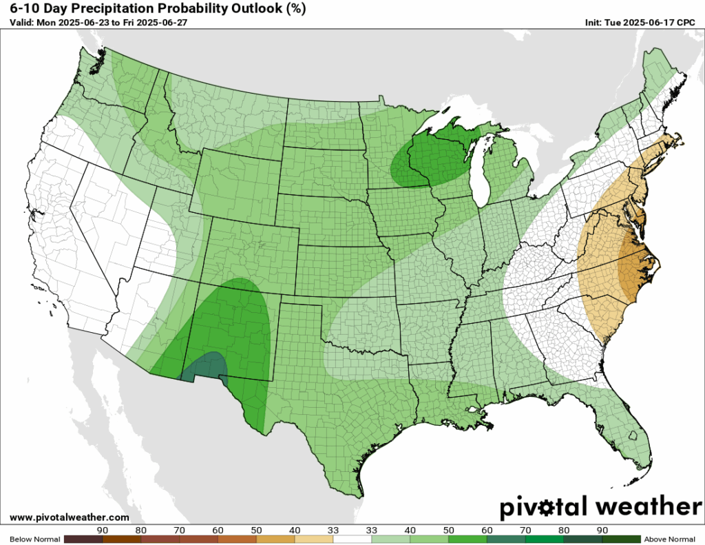
Looking ahead to next week, the ridging is expected to be very intense, with the CPC giving the northeast a 90 percent plus chance of above normal temperatures. The ridging is also in place for our area, so we have a 50-60 percent chance of above normal temperatures. Precipitation is also expected to be slightly above normal, with a 40-50 percent chance for next week.
[wpcode id=”41149″]
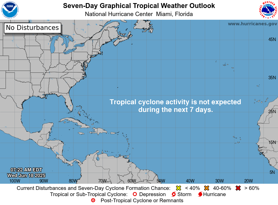
Latest Tropical Update
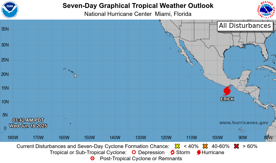
At the time you are reading this, Hurricane Erick could very well be a Major Category 3 Hurricane making landfall in western Oaxaca or eastern Guerrero. Devastating winds, rainfall, and storm sure impacts are expected upon landfall.
The Atlantic Basin is still quiet, and is expected to stay quite for the next 7 days.
Want the latest details on these systems? Check out our daily tropical updates for more in-depth information on the tropics!
REGIONAL DAY TO DAY FORECAST
Today: Mostly sunny, scattered thunderstorms in the afternoon. Highs in the low 90s. Calm winds becoming west around 5 mph in the morning. Chance of rain 60 percent.
Tonight: Partly cloudy. Chance of thunderstorms early in the evening. Lows in the low 70s. West winds around 5 mph becoming calm. Chance of rain 20 percent.
Friday: Mostly sunny. Chance of thunderstorms in the afternoon. Highs in the mid 90s. Calm winds becoming west northwest around 5 mph in the afternoon. Chance of rain 50 percent.
Friday Night: Mostly clear. Lows in the mid 70s. Calm winds.
Saturday: Sunny. Chance of thunderstorms in the afternoon. Highs in the mid 90s. Calm winds becoming east northeast around 5 mph. Chance of rain 40 percent.
Saturday Night: Mostly clear. Lows in the low 70s. Calm winds.
Sunday: Mostly sunny. Chance of showers and thunderstorms in the afternoon Highs in the mid 90s. Calm winds becoming east southeast around 5 mph. Chance of rain 50 percent.
Sunday Night: Mostly clear. Lows in the low 70s.
Monday: Sunny. Chance of showers and thunderstorms in the afternoon. Highs in the mid 90s. Chance of rain 50 percent.
Monday Night: Mostly clear with showers and thunderstorms possible. Lows in the low 70s. Chance of rain 20 percent.
Tuesday: Sunny. Chance of showers and thunderstorms. Highs in the mid 90s. Chance of rain 50 percent.
Tuesday Night: Partly cloudy. Lows in the low 70s. Calm winds.
Wednesday: Mix of sun and clouds. Highs in the low 90s. Calm winds.
Wednesday Night: Partly cloudy. Lows in the low 70s. Calm winds.


