Hurricane Erick is expected to make an intense landfall in western Oaxaca or eastern Guerrero early this morning as a Major Hurricane. Life-threatening impacts are imminent with heavy rain causing mudslides, storm surge, and devastating winds.
[wpcode id=”41149″]
Atlantic Basin Setup

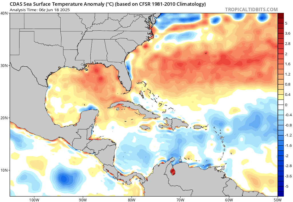
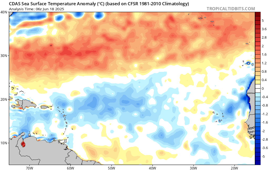
Before we get into Erick in the Pacific, the Atlantic Basin is still as quiet as can be! No tropical waves off of Africa or off of central America are expected in the next 7 days. The Bermuda High is staying strong! The Atlantic is very dry as a result of the high pressure – suppressing any possible tropical development. Sea surface temperatures are also far cooler than average in the eastern Atlantic. Sea surface temperatures are also cooler than average in the southern Caribbean sea, which is where tropical systems tend to form this time of year. The Gulf is contrarily running warmer than average, so any tropical development in July would most likely form close to home. Now is your time to prepare – don’t be too comfortable with the lull in Atlantic development!
[wpcode id=”41149″]
Eastern Pacific Setup
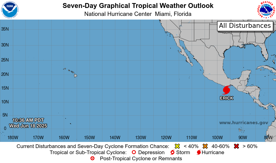
Currently in the Pacific basin, we have Hurricane Erick that is impacting southwestern Mexico and is expected to make landfall early this morning. No other areas of watch are notated by the NHC in the next 7 days. Let’s take a look at the details of Hurricane Erick:
[wpcode id=”41149″]
Eastern Pacific: Hurricane Erick

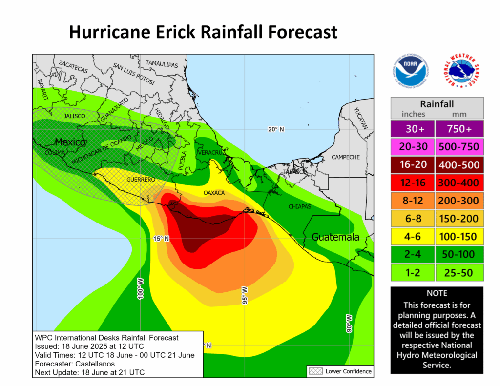
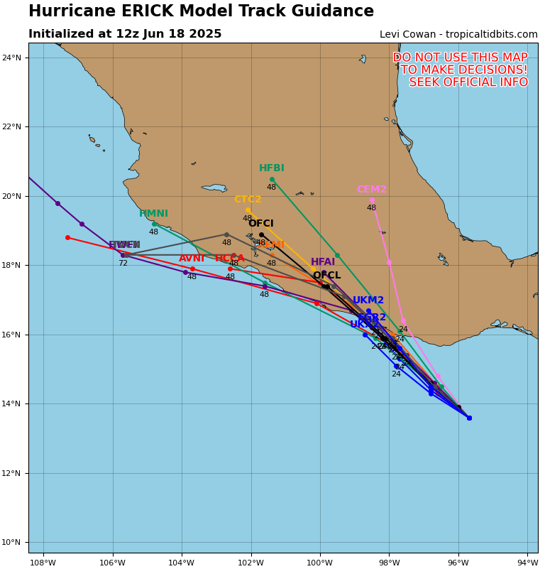
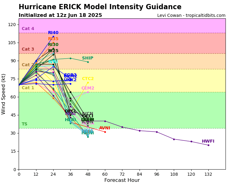
Hurricane Erick will make landfall early this morning in western Oaxaca or eastern Guerrero as a potential major hurricane. The current NHC forecast is a landfalling major hurricane with winds greater than 110 mph. The NHC says that “Life-threatening flooding and mudslides are likely, especially in areas of steep terrain. Dangerous storm surge is expected … devastating wind damage is possible where the core of the storms moves onshore”. This storm has rapidly intensified from a Category 1 Hurricane yesterday, to a Major Hurricane this morning. The storm is expected to weaken quickly upon contact with the land and become a tropical storm later this evening.
[wpcode id=”41149″]
Continue to check back for the latest updates!


