This week, we are looking at very hot temperatures while we are under a ridge of high pressure. Conditions will be generally clear, asides from the typical afternoon thunderstorms. Heat advisories are in place for most of the midwest and northeast for the upcoming heat wave. Let’s dive into the detailed forecast:
[wpcode id=”41149″]
Today’s Overall Setup
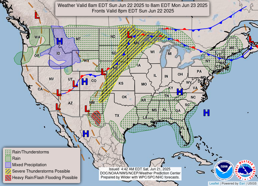
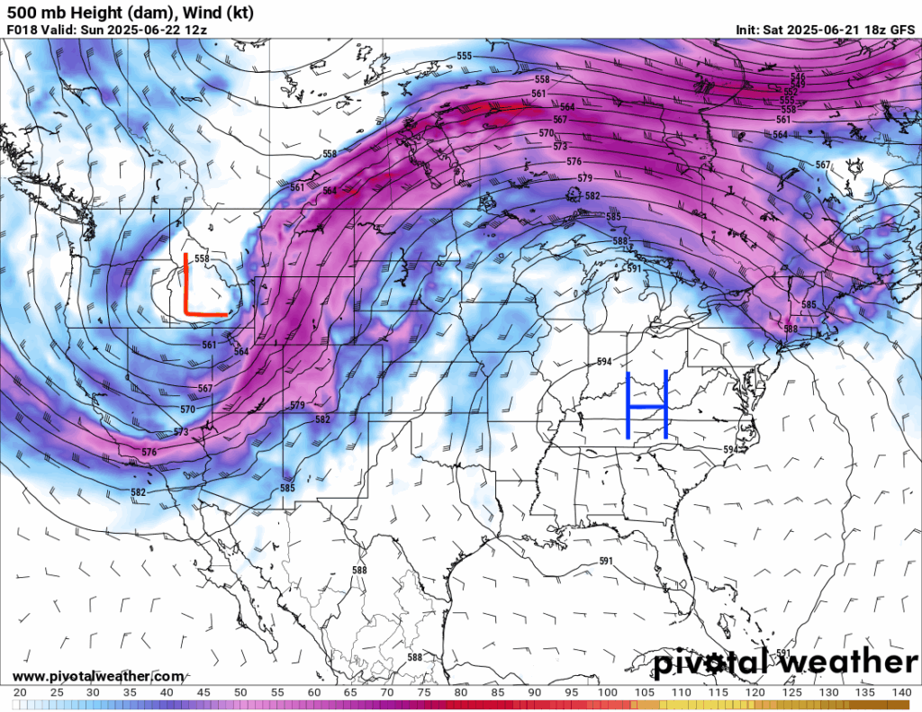
Taking a look at the overall setup, there is a large ridge of high pressure taking shape which will stay in place for a little while until the first or second week of July. This ridge will bring a massive heatwave for most of the eastern half of the country this week. Our local area isn’t seeing as intense ridging and high pressure as parts of the mid-Atlantic and northeast, but we will still see above average temperatures for the beginning of this week – close to 100 degrees!
[wpcode id=”41149″]
Today’s Local Forecast
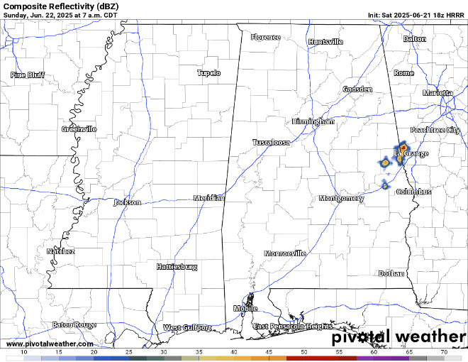
Despite the high pressure, scattered afternoon thunderstorms will still occur today. We will have sunny and clear skies in the morning. The timing for thunderstorms is looking like 1 or 2 pm. These thunderstorms may stick around into the evening hours, but will exit by midnight.

Here’s an hourly look at the forecast for today for the region.
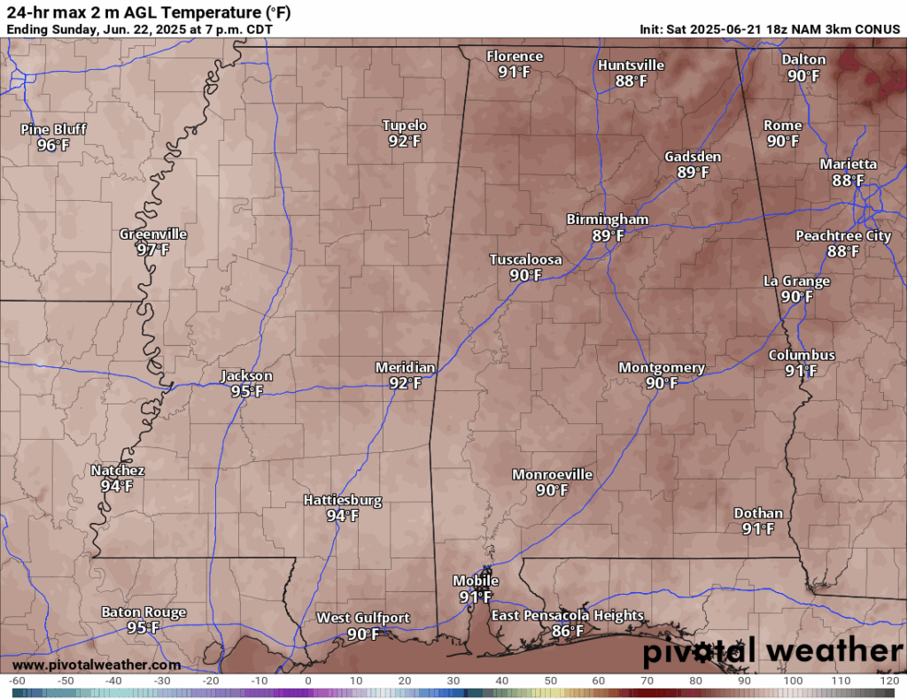
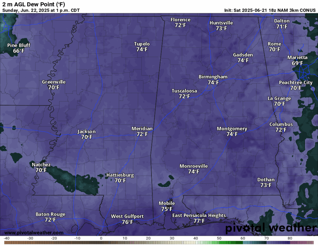
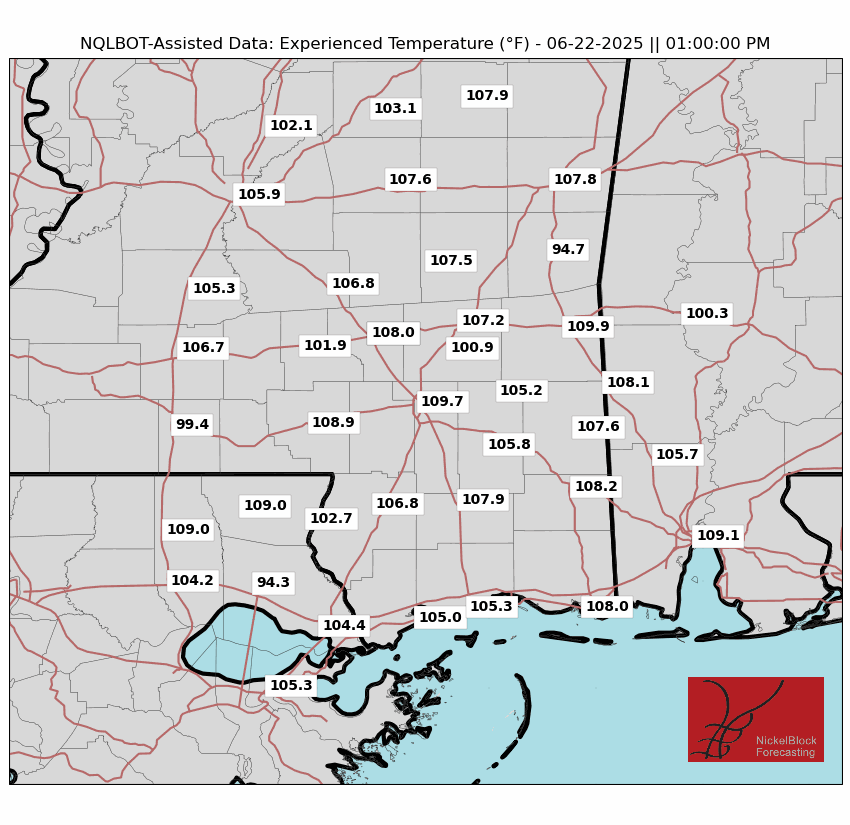
Temperatures will be very hot today in the mid-to-high 90s. Dew points will be in the 70s, so it will be very humid on top of the heat. Experienced Temperatures are almost 110 degrees in Hattiesburg and surrounding areas at 1pm, when sunshine is in full force before the thunderstorms. Ensure you limit outdoor activities today and drink plenty of fluids! Take frequent breaks if you must work outside. Check the NickelBlock app for rain updates!
[wpcode id=”41149″]
Monday-Wednesday Forecast
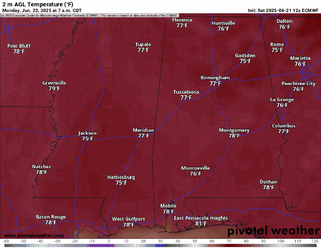
Looking at the beginning of this week (Monday through Wednesday), temperatures are still in the mid-high 90s during the day and 70s at night. Dew points will stay in the 70s during the days, so it will be very humid along with the heat!
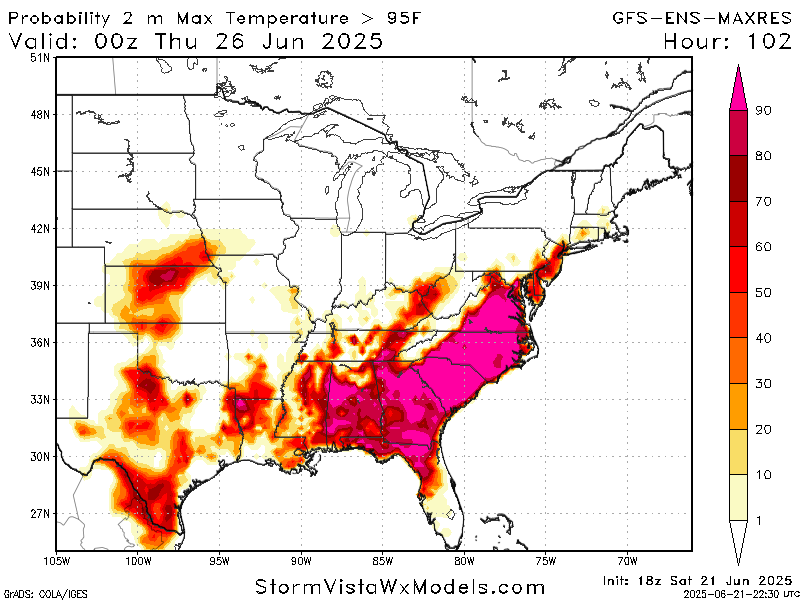
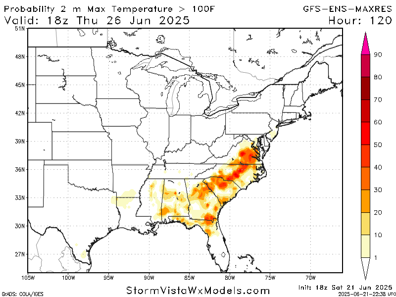
As you can see from the above images, there is a high chance of surface temperatures being greater than 95 degrees Thursday afternoon/evening as a result of the heat wave – according to the GFS ensemble mean. The highest chance of temperatures being above 100 degrees is also Thursday in the early afternoon. This would occur in southern Alabama if it were to happen, but chances are low. For reference, the hottest temperature ever recorded in Hattiesburg was 107 degrees just in 2023! While we will not see that this week, we are certainly close!
In terms of rainfall, the most likely chance of it will be on Monday during the afternoon thunderstorms at around 3 or 4 pm. Tuesday and Wednesday will also see a round of afternoon storms, but they will be very isolated – not everyone will see them. I would caution any afternoon plans on Monday, but wouldn’t necessarily cancel them Tuesday and Wednesday. Ensure you watch the NickelBlock radar, and when thunder roars, go indoors!
[wpcode id=”41149″]
Extended Local Outlook

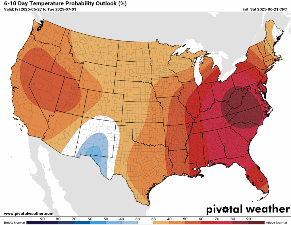
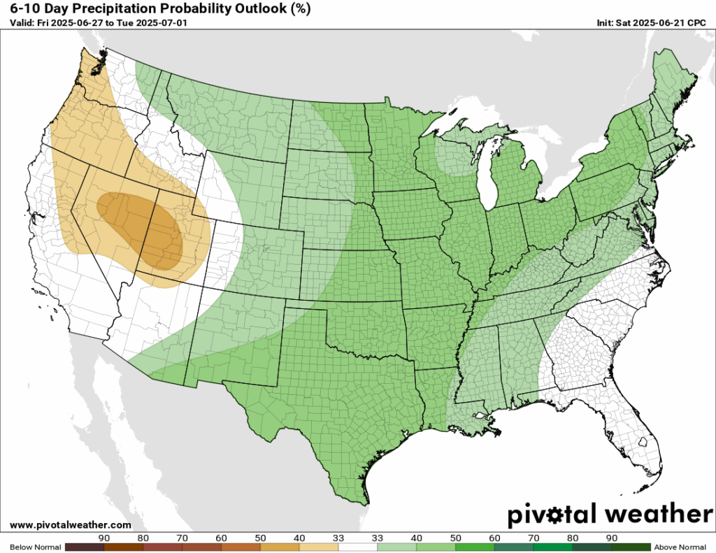
Looking ahead to the weekend and into the following week, the pattern continues with the heat dome over the east. The CPC is giving our area a 60-70 percent chance of above average temperatures during that time, as well as a 33-40 percent chance of above average precipitation. I do not see a big chance for washout rain days within the next two weeks due to our high pressure pattern, but, we could see increased amounts of pop-up afternoon thunderstorms due to the increased temperatures, which bring with it more instability – and of course, we always have enough moisture!
[wpcode id=”41149″]
Latest Tropical Update
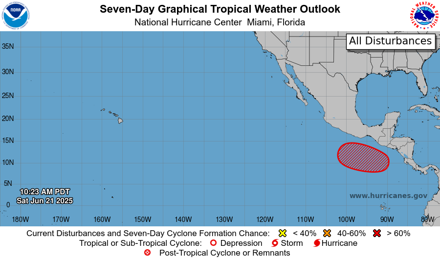
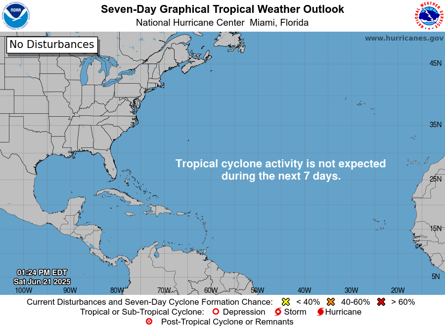
Currently in the tropics, there is an area to watch in the East Pacific, with a zero percent chance of tropical development within the next 48 hours, but a 70 percent chance in the next 7 days. This comes just days after Major Hurricane Erick formed and made landfall in the same development region. It has been a very busy start to the Hurricane Season there. In the Atlantic, however, things are quiet due to large scale high pressure, lots of wind shear, and lots of Saharan dust that all supress development.
Want the latest details on these systems? Check out our daily tropical updates for more in-depth information on the tropics!
REGIONAL DAY TO DAY FORECAST
Today: Mostly sunny, scattered thunderstorms in the afternoon. Highs in the mid 90s. Calm winds becoming southeast around 5 mph in the morning. Chance of rain 60 percent.
Tonight: Mostly clear, fog after midnight. Lows in the low 70s. Calm winds.
Monday: Mostly sunny. Chance of thunderstorms in the afternoon. Highs in the mid 90s. Calm winds becoming east around 5 mph in the afternoon. Chance of rain 50 percent.
Monday Night: Mostly clear, fog after midnight. Lows in the low 70s. Calm winds.
Tuesday: Sunny. Chance of thunderstorms in the afternoon. Highs in the low 90s. Calm winds becoming east southeast around 5 mph. Chance of rain 40 percent.
Tuesday Night: Partly cloudy. Lows in the low 70s. Calm winds.
Wednesday: Mostly sunny. Chance of showers and thunderstorms in the afternoon. Highs in the mid 90s. Calm winds becoming east southeast around 5 mph in the afternoon. Chance of rain 20 percent.
Wednesday Night: Mostly clear. Lows in the low 70s. Calm winds.
Thursday: Mostly sunny. Very hot. Chance of showers and thunderstorms in the afternoon. Highs in the high 90s. Chance of rain 20 percent.
Thursday Night: Mostly clear. Lows in the low 70s.
Friday: Mostly sunny. Very hot. Chance of showers and thunderstorms. Highs in the high 90s. Chance of rain 30 percent.
Friday Night: Mostly clear. Chance of showers and thunderstorms. Lows in the mid 70s.
Saturday: Sunny. Chance of showers and thunderstorms. Highs in the mid 90s. Chance of rain 30 percent.


