General Central/Eastern Kansas Forecast
Short-Term (Tuesday-Wednesday)
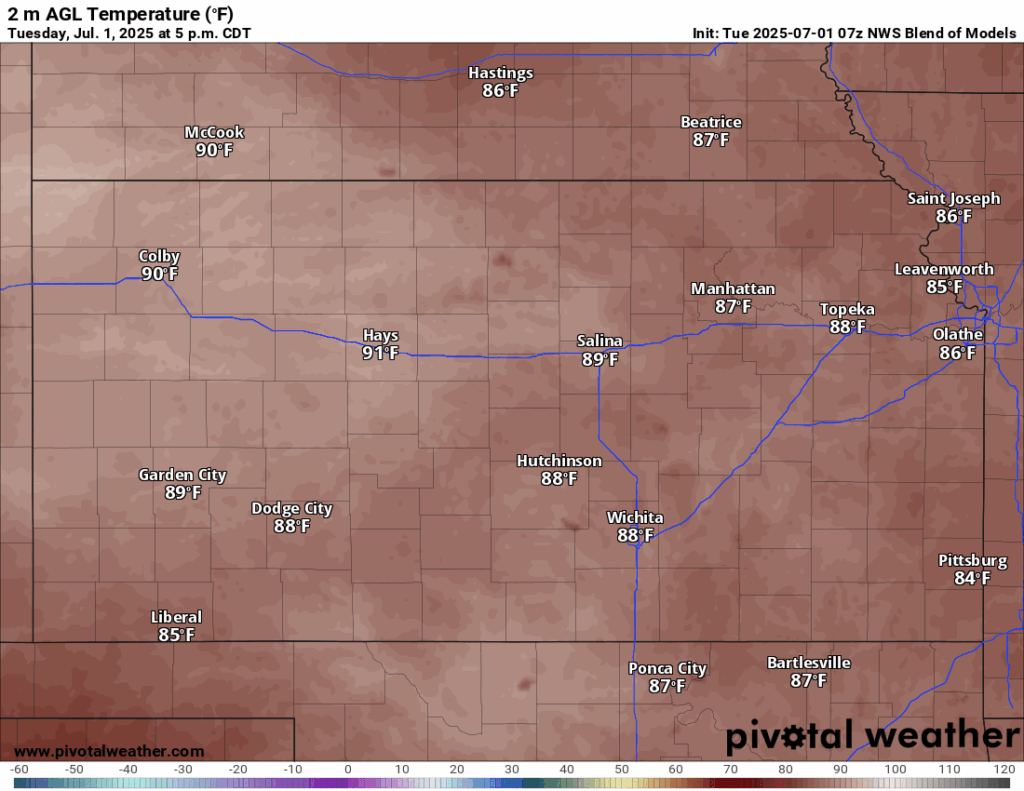
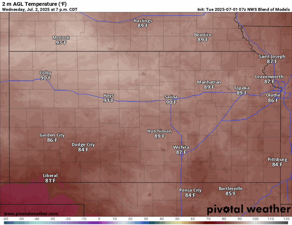
For the next couple of days, conditions will be on the quieter side of things as high pressure moves in over the area behind a departing cold front from yesterday. Much drier air will permeate the region, which will help increase the comfort level somewhat for those outside, even with the high temperatures today reaching the upper 80s. Winds will generally be light and variable with the high pressure spinning over us. Relative humidity values will range between 35-50%; a stark contrast to the deep, humid air we have been under for much of the late spring and early portions of summer. Overnight low temperatures will be very comfortable, down into the mid to upper 60s.
Tomorrow will maintain the calm and dry conditions, even with the high pressure moving off to the north and a return to southerly flow once again. Temperatures again are expected to be in the upper 80s during the day, with southerly winds of 5 to 10 mph. Relative humidity values will be slightly higher than today, but still comfortably between 45-55%. Overnight tomorrow night, low temperatures will be slightly warmer, but still pleasant, in the low 70s.
Long-Term (Thursday-Monday)
Thursday will see the return of southerly to southwesterly flow aloft, which will help pull the warm, humid air from the gulf northward and overspread Kansas once again. This will reintroduce chances for precipitation all the way through the weekend, albeit low chances currently. Temperatures during the long-term period will hover in the upper 80s to low 90s daily. This heat will start to feel like the hot, humid heat of the past couple of days as well with the reintroduction of gulf moisture, with our relative humidity values fluctuating between 55-65%. Current heat indices are projected to be in the low to mid 90s as a result.
Regional Soil Moisture Forecast
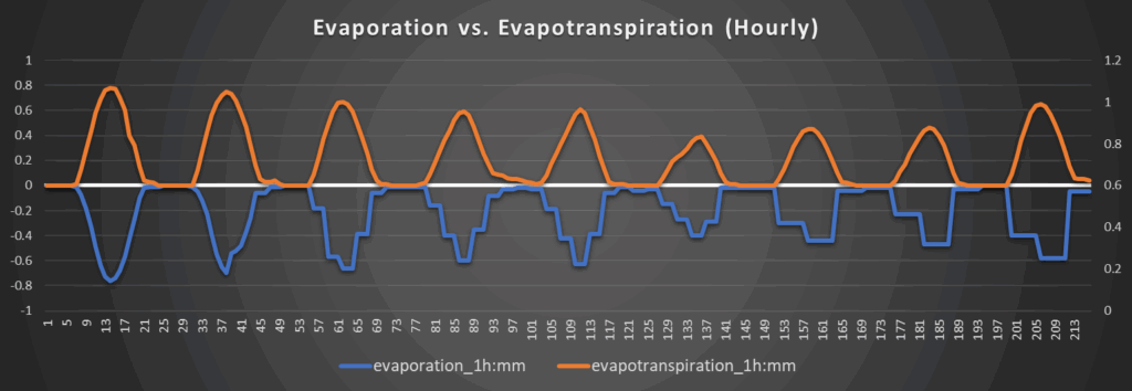
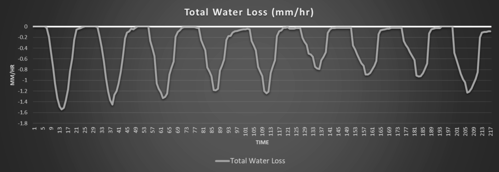
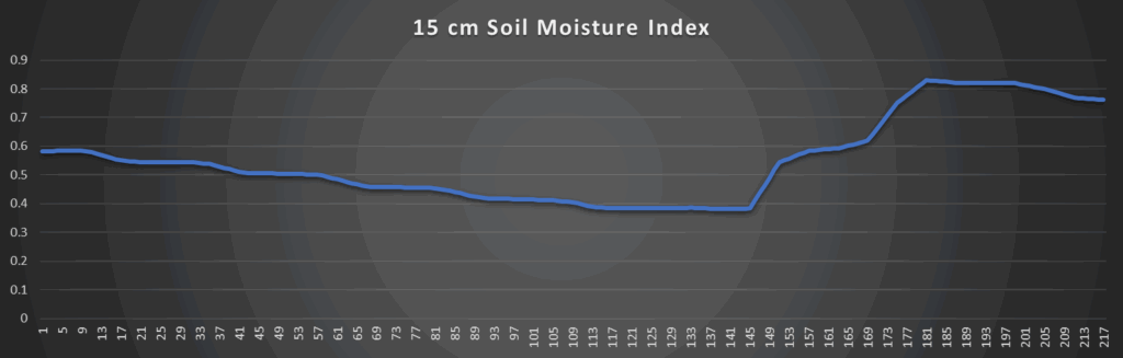
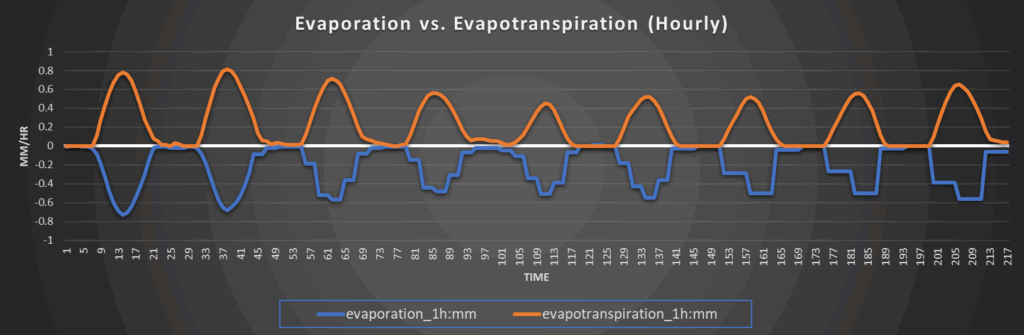
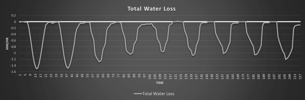
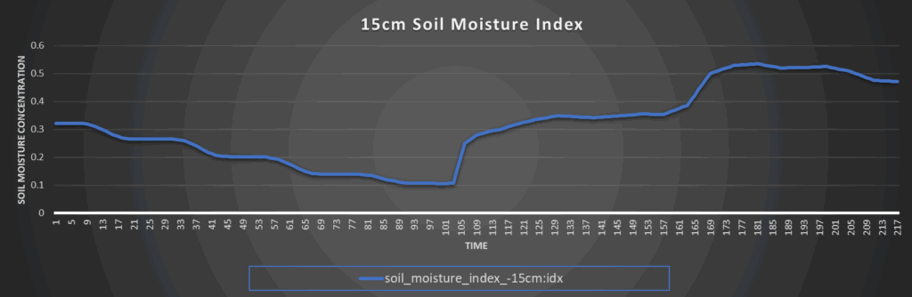
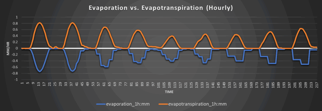
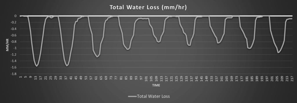
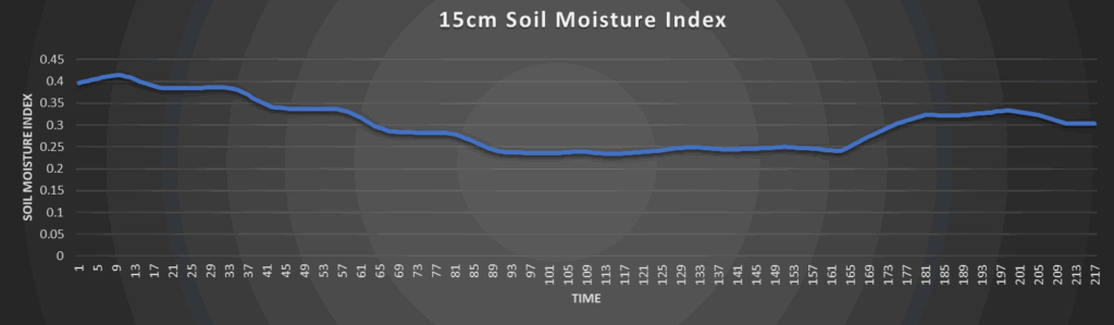
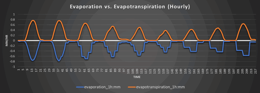
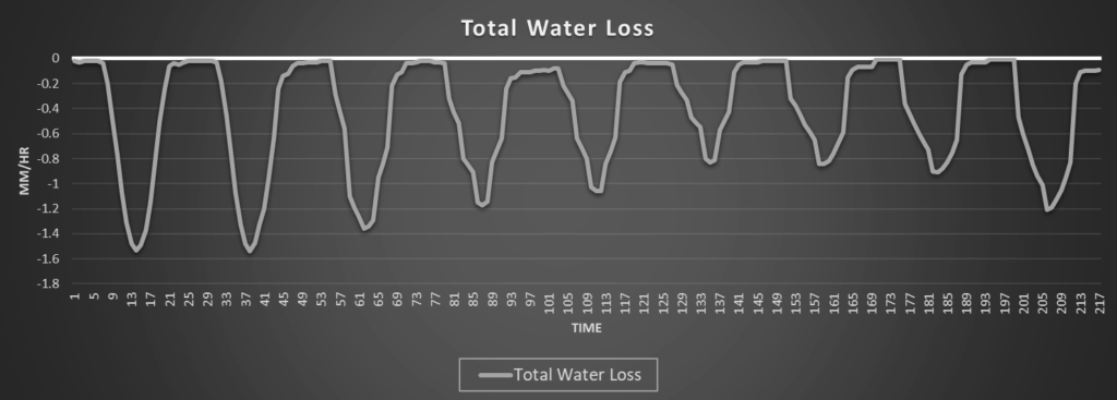
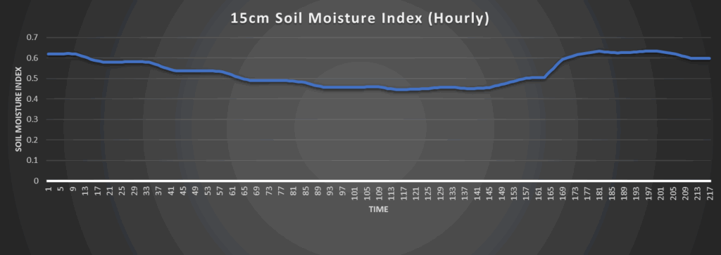
Steady drying of soils will occur over the next few days, as water loss rates increase to between 1 to 1.6 mm/hr during the day. Generally dry conditions will ensue across the region until we get more increased chances for rainfall beyond Thursday. Stresses to crops should not be that big of an issue due to relatively good soil saturation, but some issues may try to present themselves due to overall lack of consistent soaking rainfall over the last week.
Around Westmoreland
Around Scranton
Around Burlington
Around Altoona