After some showers and thunderstorms in the afternoon today, a beautiful Fourth of July and weekend is in the forecast! High pressure and dry air moving into our area will leave skies mostly clear, but it will be very hot and humid. It will be a great weekend to be in the pool and cooking up a BBQ! Let’s dive into the detailed forecast:
[wpcode id=”41149″]
Today’s Overall Setup
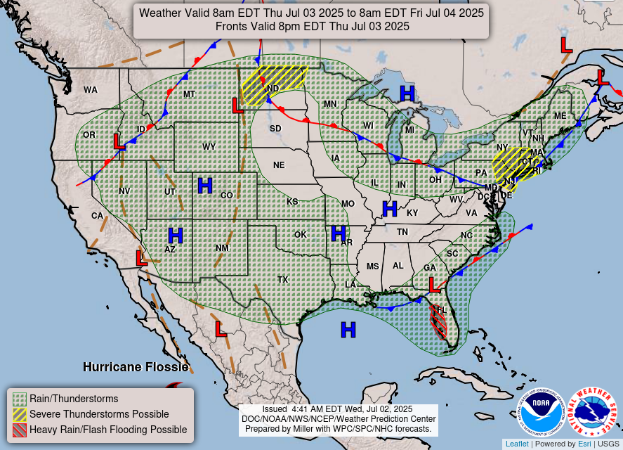
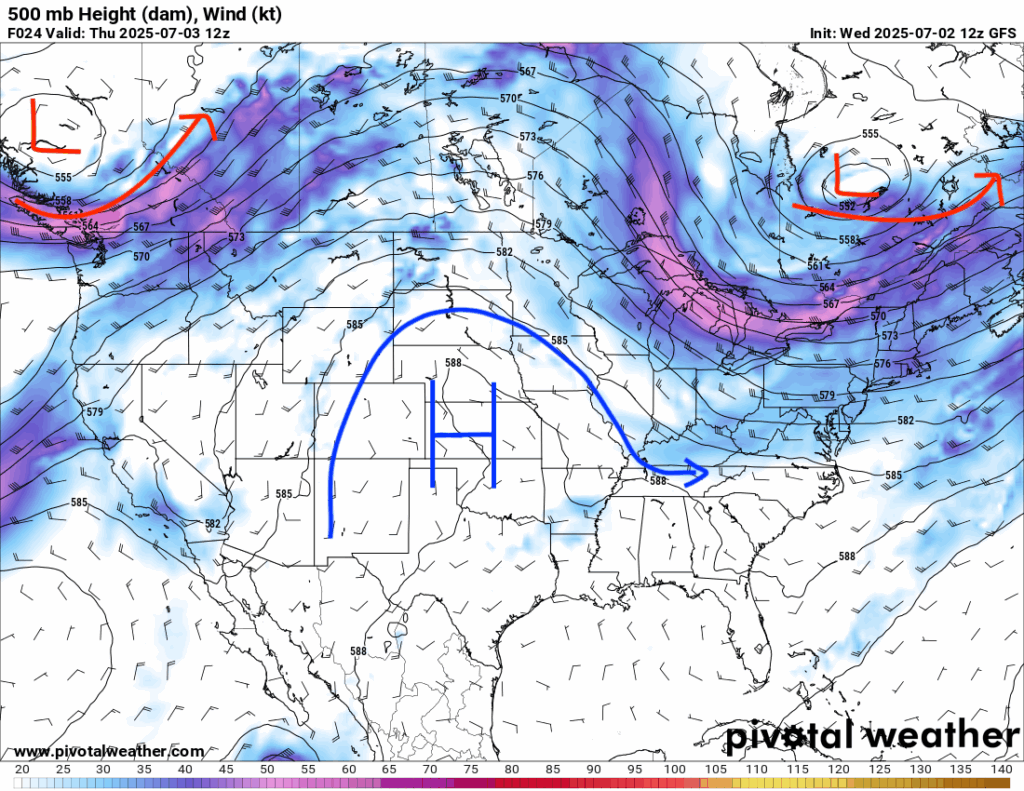
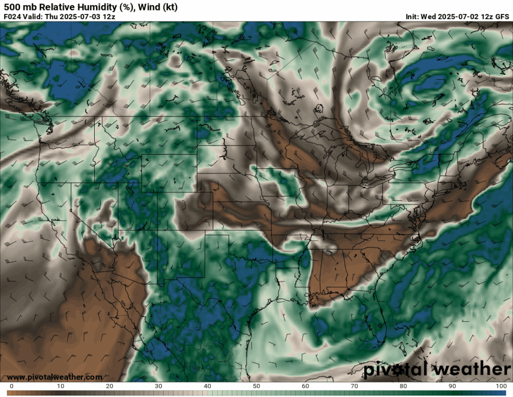
A ridge of high pressure is currently set up in the central CONUS moving east, as well as two low pressure troughs in the northwest and northeast at the mid-levels (500 mb). Severe weather is expected in the northeast under the trough, as well as in North Dakota, where the boundary exists between the trough and the ridge. Our region is seeing chances of afternoon thunderstorms today since we are near the stationary frontal boundary that is bringing flooding rain to the Florida and Alabama Gulf coast. Lots of dry air is currently pushing into our area at the mid-levels, which is keeping us mainly dry for the majority of the day.
[wpcode id=”41149″]
Today’s Local Forecast
Conditions today will be partly cloudy in the morning and early afternoon. Some isolated showers and thunderstorms are expected to come through the area at around 3-4 pm, exiting completely by around 10 pm. These storms will be mainly aim for southwestern Mississippi and southeast Louisiana. Stay weather aware during that time frame!

Here’s an hourly look at the forecast for today for the region.
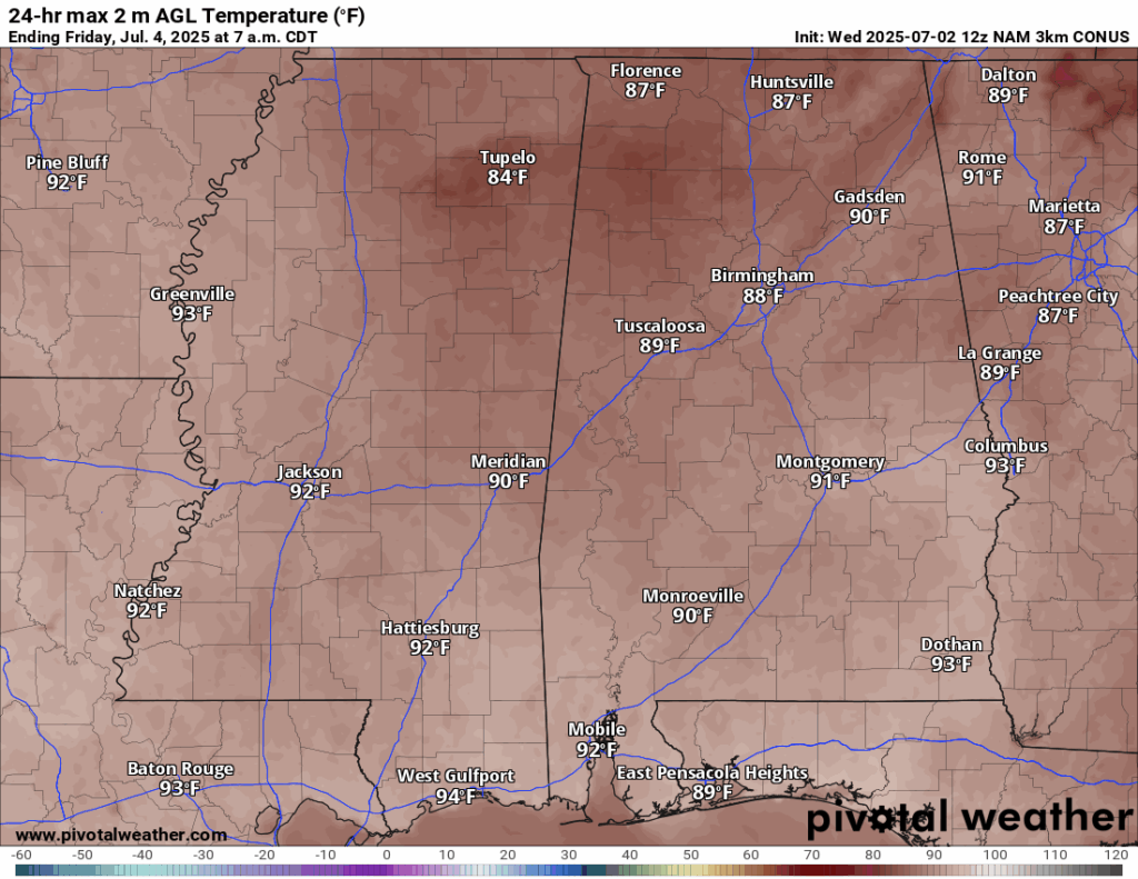
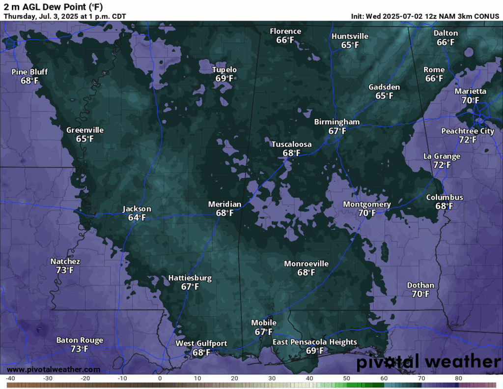
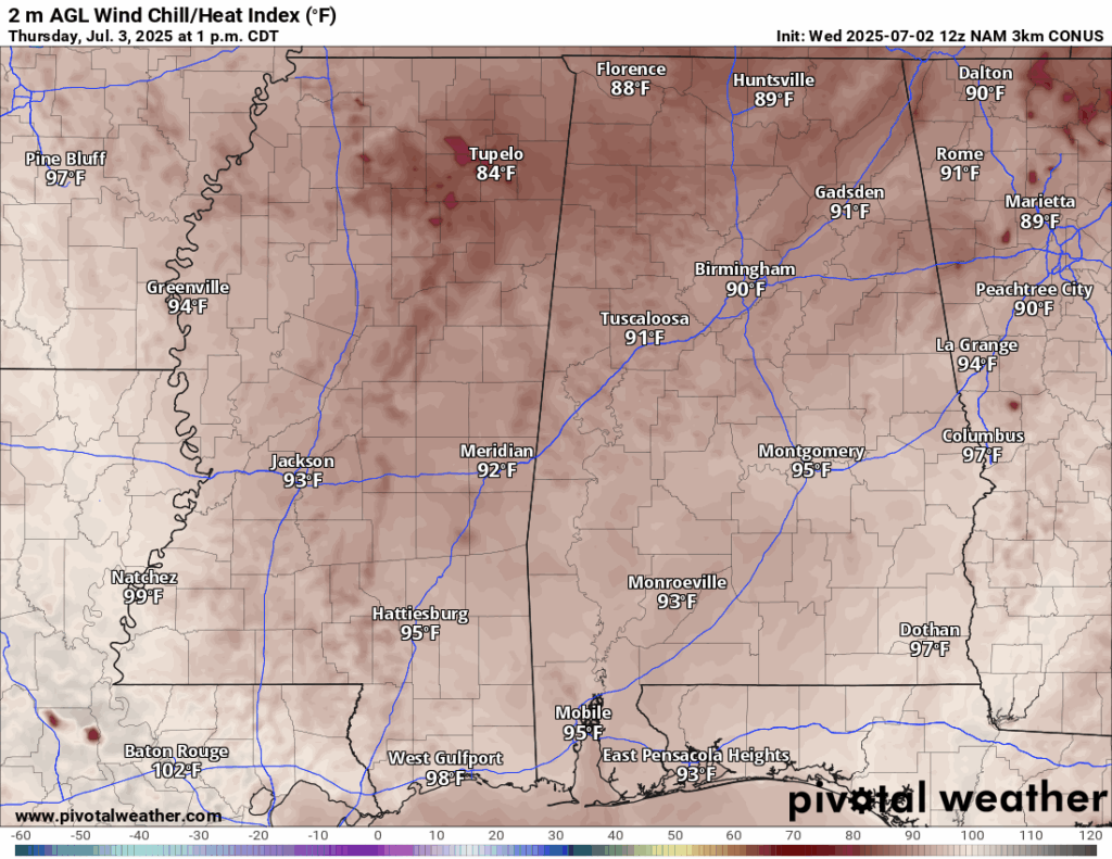
High temperatures today will be in the lower 90s. Dew points will be in the high 60s for most of Mississippi, which will make it feel only a few degrees higher than the actual temperature, in the mid-90s. Those in southwestern Mississippi and Louisiana will see 70 degree dew points, which will make it feel more humid and closer to the 100s. Wherever you may be located, ensure you stay hydrated on this hot humid day.
[wpcode id=”41149″]
Fourth of July Forecast
Looking at your forecast for tomorrow, Independence Day, it will be quite steamy with temperatures in the low-to-mid 90s, with the heat index being a few degrees higher than the temperature – given the 70 degree dew points. A spotty heavy shower or thunderstorm is possible during the afternoon, but it will generally be a very dry day with no rain! Great for the BBQ’s and swimming!
Cloud cover could not be better for the Fourth! Sunny conditions will be in place all day, with only some scattered clouds in the afternoon. By fireworks time, skies are looking to be very clear – so light em’ up! Low’s will be in the 70s, making it a pleasant night to be outside. Have fun, but most importantly, be safe!
[wpcode id=”41149″]
Saturday & Sunday Forecast
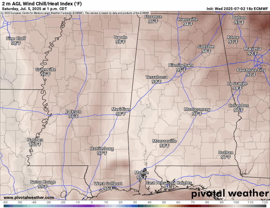
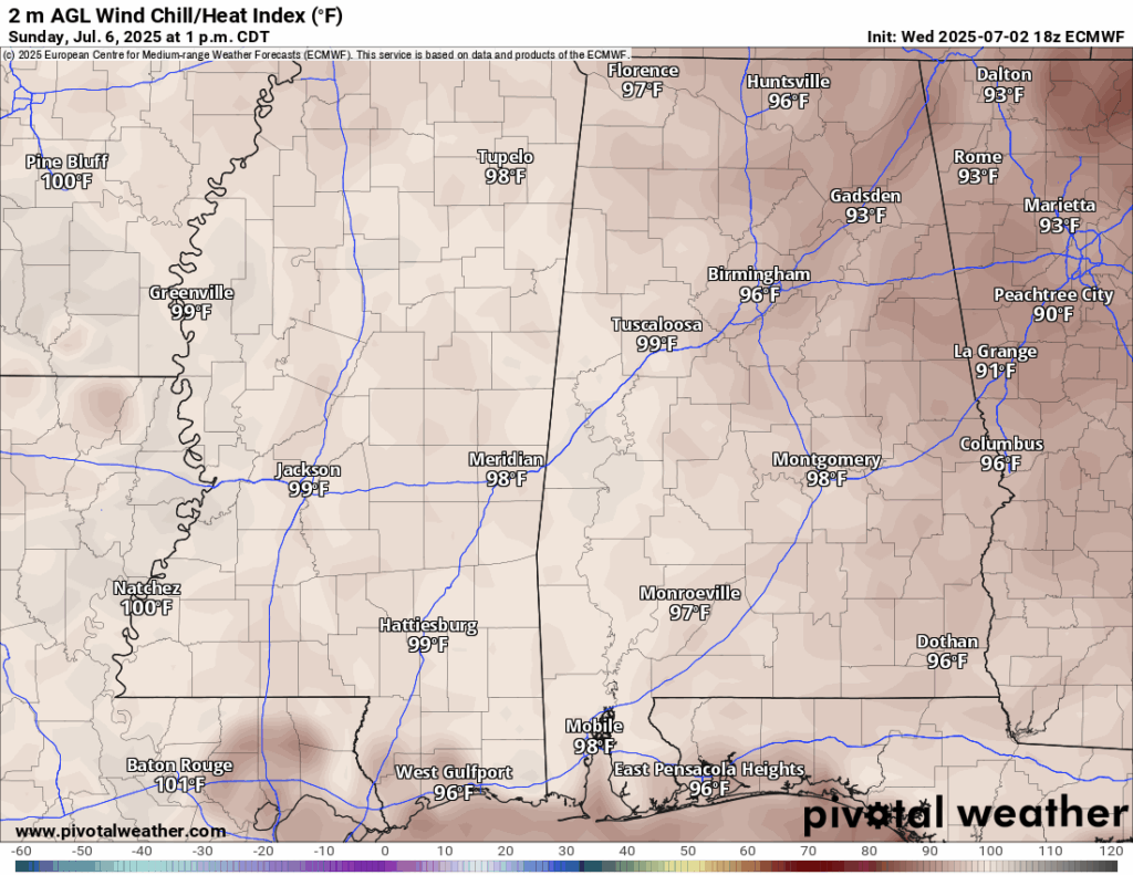
After the party on Friday, you will wake up on Saturday with temperatures already in the 80s. By peak sunshine time, 1pm, temps will be in the high 90s, approaching 100. It will feel a few degrees warmer with the humidity. Sunday’s temperatures will be even hotter, feeling hotter as well.
Conditions this weekend will be mainly clear and sunny along with the hot temperatures. A 20-30 percent chance of a popup thunderstorm or two in the afternoons is in place – but the large-scale dry air at the mid-levels, mentioned earlier, will keep us mainly dry.
[wpcode id=”41149″]
Extended Local Outlook

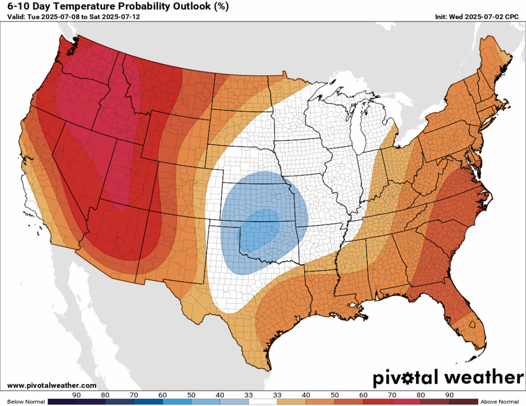
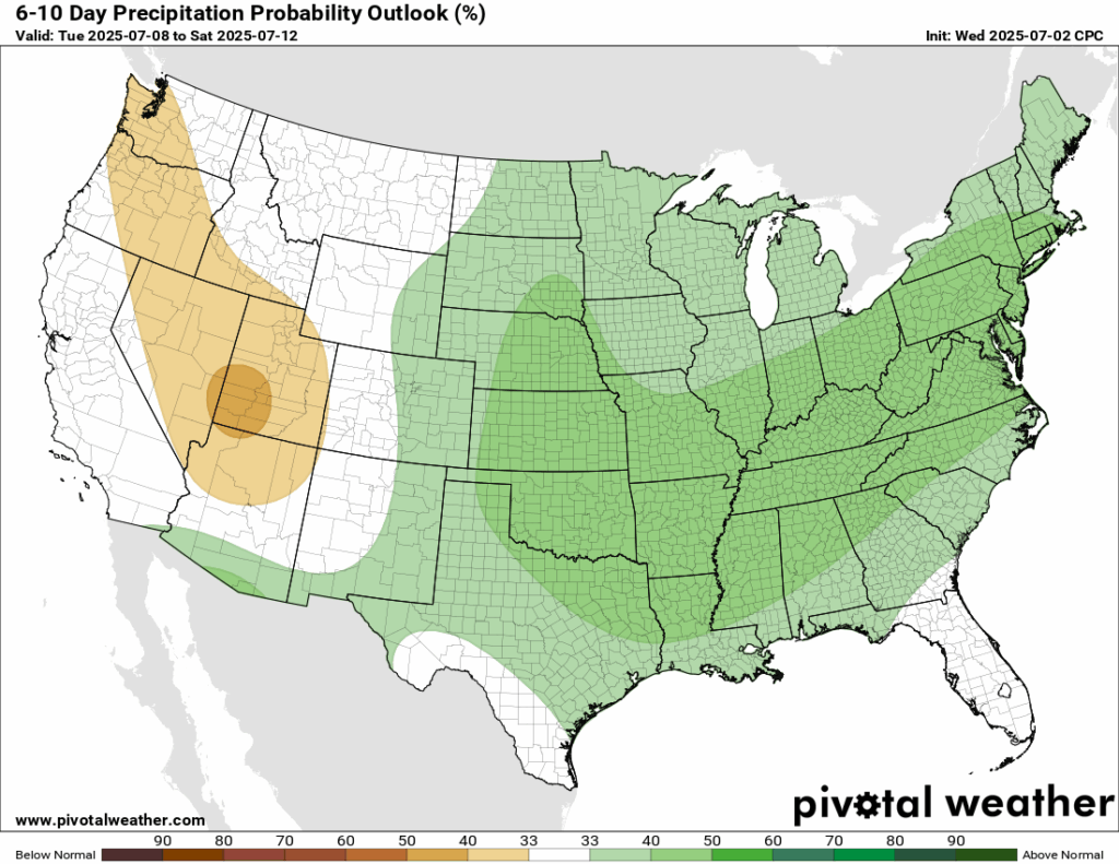
Looking ahead at next week, warmer and wetter conditions are expected by the Climate Prediction Center. A 40-50 percent chance of warmer than average temperatures and a 33-40 percent chance of higher than average precipitation is in the forecast. The reason being is that ridging is expected to amplify in our region which will keep our temperatures up, as well as lots of tropical moisture flowing into our region, which brings up the chances of rain.
[wpcode id=”41149″]
Latest Tropical Update
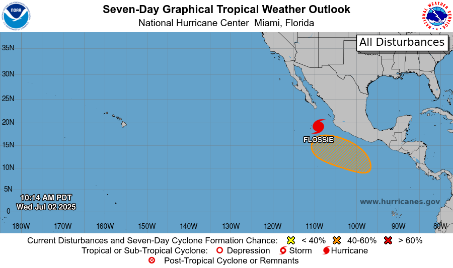
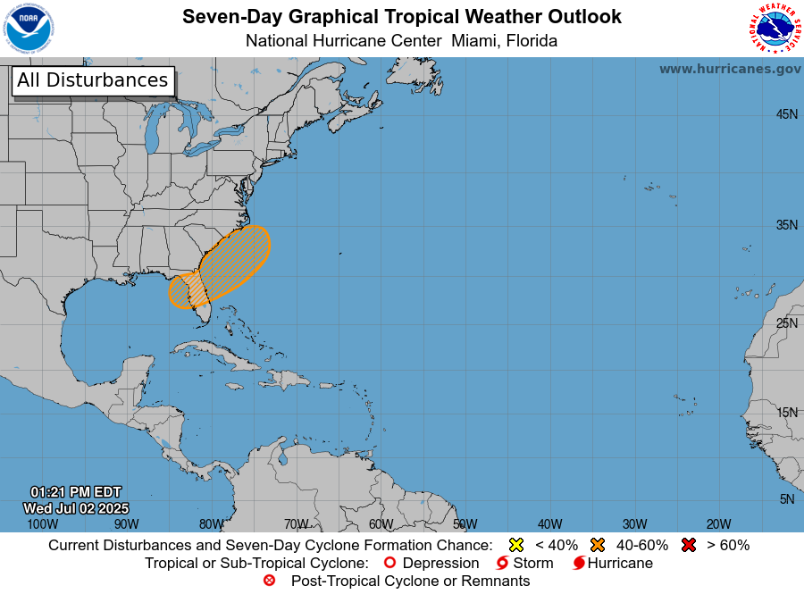
As of the latest update, Hurricane Flossie is a Category 1 with sustained winds at 100 mph. It will weaken into a tropical storm early today and will move to the west northwest out to sea. In the Gulf, there is now a 40 percent of tropical development in the next 7 days. Mainly a very heavy rain threat exists, and lot’s of disagreement with the models make it uncertain on the track of such a system if it does form.
Want the latest details on these systems? Check out our daily tropical updates for more in-depth information on the tropics!
REGIONAL DAY TO DAY FORECAST
Today: Patchy fog before 7am. Otherwise, sunny. Highs in the lower 90s. Calm winds becoming north around 5 mph in the afternoon.
Tonight: Partly cloudy. Lows in the low 70s. North wind around 5 mph becoming calm.
Fourth of July: Sunny. Highs in the mid 90s. Calm winds becoming north around 5 mph in the afternoon.
Fourth of July Firework Time: Mostly clear. Lows in the low 70s. Calm winds.
Saturday: Sunny. Slight chance of showers and thunderstorms in the afternoon. Highs in the mid 90s. Calm winds becoming east around 5 mph in the afternoon. Chance of rain 20 percent.
Saturday Night: Mostly clear. Lows in the low 70s. Calm winds.
Sunday: Sunny. Scattered showers and thunderstorms in the afternoon. Highs in the mid 90s. Calm winds becoming east around 5 mph in the afternoon. Chance of rain 30 percent.
Sunday Night: Patchy fog after 5am. Otherwise, mostly clear. Lows in the low 70s. Calm winds.
Monday: Sunny. Chance of showers and thunderstorms in the afternoon. Highs in the low 90s. Chance of rain 60 percent.
Monday Night: Partly cloudy. Lows in the low 70s.
Tuesday: Mostly sunny. Numerous showers and thunderstorms. Highs in the low 90s. Chance of rain 70 percent.
Tuesday Night: Partly cloudy. Slight chance of showers and thunderstorms. Lows in the mid 70s. Chance of rain 20 percent.
Wednesday: Mostly sunny. Numerous showers and thunderstorms. Highs in the low 90s. Chance of rain 70 percent.


