A moist and unstable air mass will dominate the Gulf Coast region through the next 7 days, with daily convective activity driven by a combination of diurnal heating, Gulf moisture advection, and weak upper-level disturbances.
Thursday–Saturday: Classic Gulf Summer Pattern with Heat and Isolated Storms
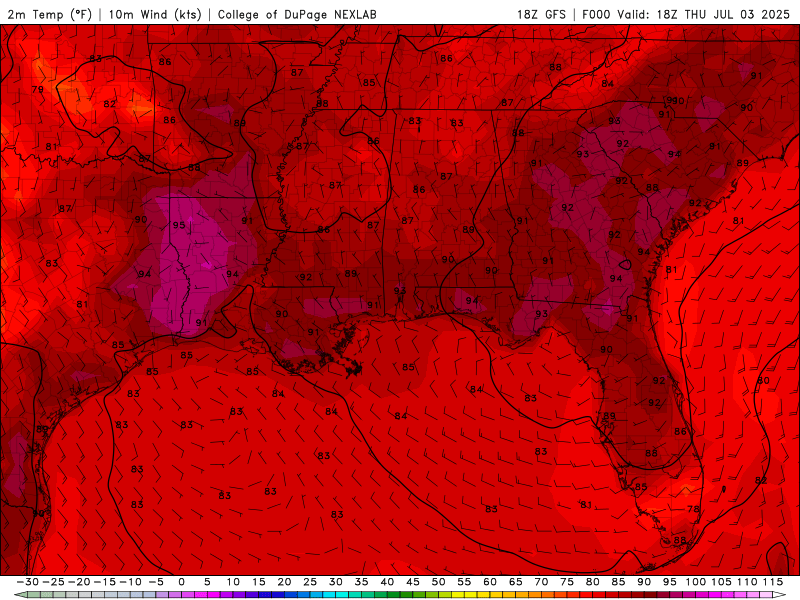
Surface temperatures for Thursday to Wednesday of next week from the GFS model. //Courtesy: College of DuPage
From Thursday through Saturday, the region will experience a classic summertime pattern. On Thursday, a subtle upper-level trough over the northern Gulf will enhance instability, allowing for scattered afternoon thunderstorms, particularly inland where surface convergence is strongest. Temperatures will climb into the low 90s, with dew points in the mid-70s pushing heat indices near or above 100°F. By Friday, the pattern remains largely unchanged, though a slightly more organized sea breeze front may lead to more widespread convection during the afternoon and early evening hours. The Fourth of July will be warm and humid, with a 40–50% chance of thunderstorms that could briefly disrupt outdoor celebrations. Saturday sees a modest increase in mid-level ridging, which may suppress some storm development, but isolated to scattered storms are still expected, especially where mesoscale boundaries interact. Highs will reach the mid-90s, and the heat index could exceed 105°F in areas with limited cloud cover.
Sunday–Tuesday: Deep Moisture Surge Brings Widespread Storms and Flooding Risk
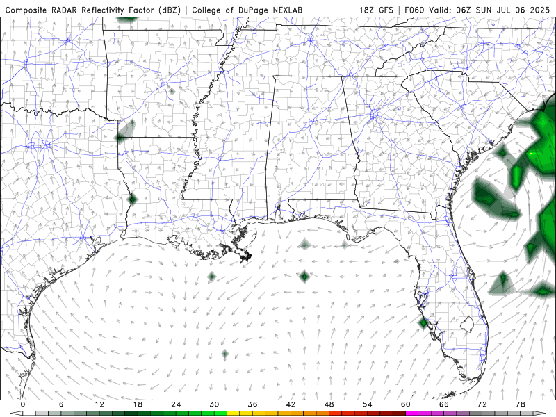
Composite Reflectivity for Sunday to Tuesday of next week from the GFS model. //Courtesy: College of DuPage
From Sunday through Tuesday, the atmosphere becomes increasingly saturated, with precipitable water values exceeding 2 inches, signaling a period of enhanced convective potential. On Sunday, the combination of deep moisture and weak steering flow will support slow-moving thunderstorms capable of producing localized flash flooding, especially in urban and low-lying areas. Monday brings the potential for a weak frontal boundary to sag into the region from the north, providing additional lift and increasing the coverage and intensity of thunderstorms. These storms may be more organized and could feature gusty winds, frequent lightning, and torrential rainfall. Tuesday continues the unsettled trend, with the front lingering and the airmass remaining highly unstable. Expect numerous showers and storms, particularly during the afternoon hours, with some areas potentially receiving multiple rounds of rainfall.
Wednesday: Slight Drying Trend, But Storm Chances Persist
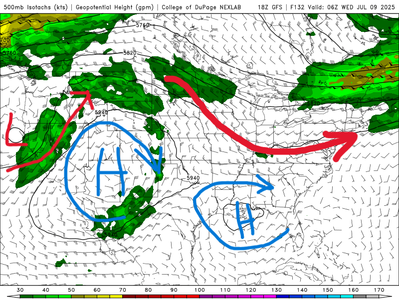
500 mb map for Wednesday of next week from the GFS model. //Courtesy: College of DuPage
By Wednesday, a subtle drying trend aloft may begin to take shape, slightly reducing storm coverage. However, the abundant low-level moisture and persistent Gulf flow will still support isolated to scattered thunderstorms, especially along sea breeze boundaries. Temperatures will remain seasonably hot, with highs in the low to mid-90s and continued high humidity. While the overall pattern shows signs of slight moderation, the risk of daily convection and heat-related stress will persist through midweek.
Regional Day-to-Day Forecast
Thursday – Mostly sunny with a 20% chance of isolated afternoon thunderstorms. High near 92°F. Winds NW at 5–10 mph.
Thursday Night – Partly cloudy with a 10% chance of rain. Low around 76°F. Winds light and variable.
Friday (Independence Day) – Mostly sunny and hot with a 20% chance of afternoon thunderstorms. High near 91°F. Winds NNW at 5–10 mph.
Friday Night – Partly cloudy. Low around 76°F. Winds light and variable.
Saturday – Mostly sunny in the morning, then increasing clouds with a 30% chance of scattered thunderstorms in the afternoon. High near 93°F. Winds ESE at 5–10 mph.
Saturday Night – Partly cloudy with a 20% chance of rain. Low around 76°F. Winds light and variable.
Sunday – Partly to mostly cloudy with a 50% chance of showers and thunderstorms, mainly in the afternoon. High near 89°F. Winds SSE at 5–10 mph.
Sunday Night – Partly cloudy with a 20% chance of showers. Low around 76°F. Winds light and variable.
Monday – Partly sunny with a 60% chance of scattered thunderstorms, especially in the afternoon. High near 89°F. Winds SW at 5–10 mph.
Monday Night – Partly cloudy with a 30% chance of showers. Low around 77°F. Winds WSW at 5–10 mph.
Tuesday – Showers and thunderstorms likely with a 70% chance of rain. High near 89°F. Winds WSW at 5–10 mph.
Tuesday Night – Partly cloudy with a 40% chance of showers and thunderstorms. Low around 77°F. Winds light and variable.
Wednesday – Partly sunny with a 60% chance of showers and thunderstorms, especially in the afternoon. High near 90°F. Winds NW at 5–10 mph.
Wednesday Night – Partly cloudy with a 30% chance of rain. Low around 76°F. Winds light and variable.


