We are looking at scattered showers and thunderstorms in the forecast for today, followed by a hot early half of the week with the typical afternoon thunderstorms, but sunny skies when it is not raining. Plus, a quick update on Tropical Storm Chantal. Let’s dive into the detailed forecast:
[wpcode id=”41149″]
Today’s Overall Setup
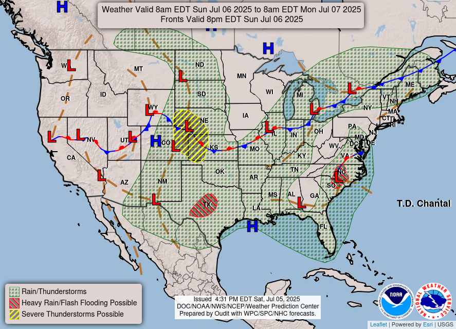
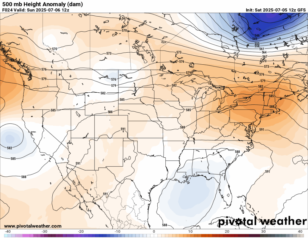
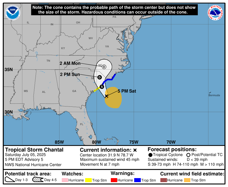
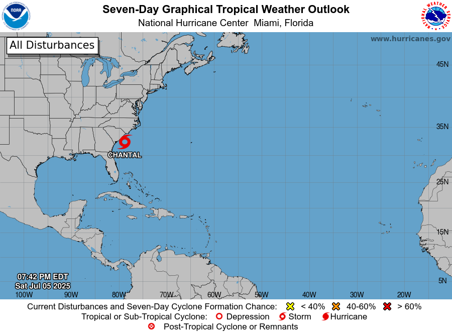
The surface map for today is quite busy to look at. There is a long stationary front draped from California through the center of the country into the upper northeast bringing rain and severe storms along its path. In our area, we can see from the 500 mb anomalies map that there is an increased amount of troughing, meaning the atmosphere is supporting instability and unsettled weather. We can also see Tropical Storm Chantal, which will weaken into Tropical Depression Chantal today after making a landfall in South Carolina. Tropical storm warnings are in effect for the northern South Carolina coast and southern North Carolina coast (that’s a tongue twister isn’t it!).
[wpcode id=”41149″]
Today’s Local Forecast
The instability along with plenty of lower-level tropical moisture will lead to some rain in the forecast for today. While it is not looking like a washout, isolated rain showers and thunderstorms will move in after 12pm and soak whoever winds up being under them! The most probable timing for the most intense round will be from 5pm-8pm. Ensure you have your umbrella handy and keep an eye on the NickelBlock radar. When you recieve the instant lightning alerts, that’s your sign to head indoors!

Here’s an hourly look at the forecast for today for the region.
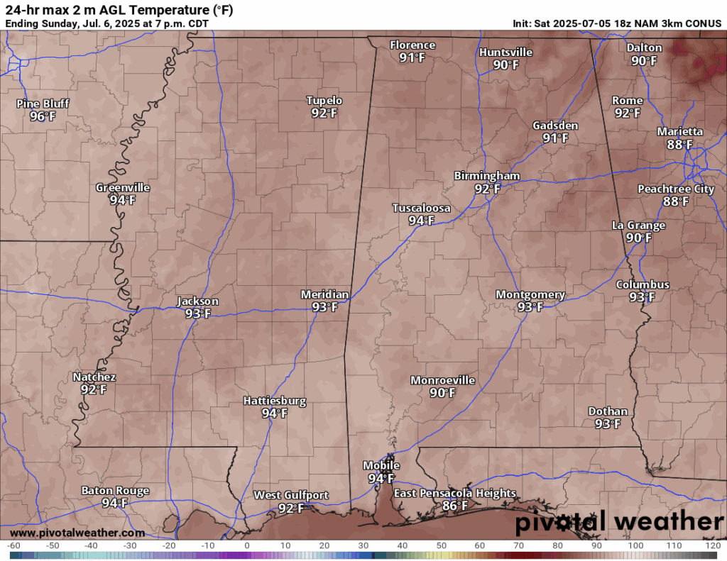
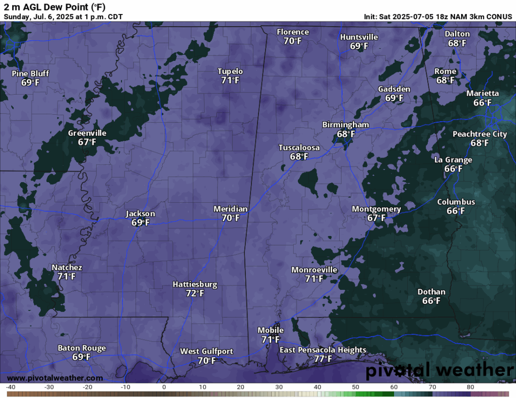
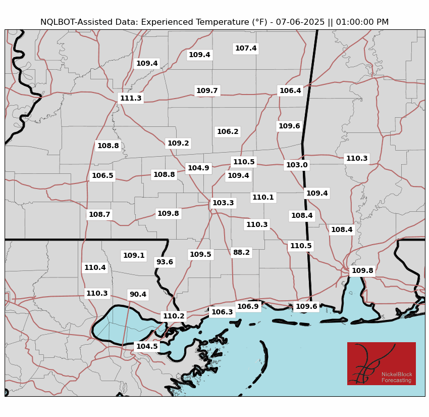
High temperatures today will be in the low-to-mid 90s with feels like temperatures reaching 100-110+ in most areas. It will feel slightly cooler if you are under some rain, but it should warm right back up right after. Overall, it will be a muggy, partly sunny day with isolated showers and thunderstorms after 12pm. Expect a low in the low 70s.
[wpcode id=”41149″]
Monday-Wednesday Forecast
Temperatures Monday, Tuesday, and Wednesday are looking to be similar today – in the low-to-mid 90s, with high humidity making it feel up to 110 degrees. Staying hydrated is essential to keeping up with the sweltering heat.
Sun and clouds will dominate the forecast for Monday, Tuesday, and Wednesday. While there is a 60 percent chance of scattered showers and thunderstorms in the afternoon on Monday and Tuesday, we are mostly expected to stay clear when there is no rain. Wednesday will see only a 20-30 percent chance of isolated showers and thunderstorms, with mostly sunny skies. As always, keep an eye out on the radar, because a quick popup thunderstorm is always possible in our area.
[wpcode id=”41149″]
Extended Local Outlook

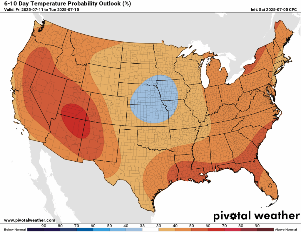
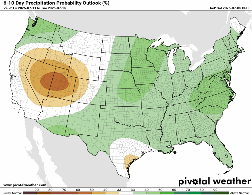
Looking ahead into next weekend and early next week, the Climate Prediction Center has a 50-60 percent chance of above normal temperatures – that means more heat! With that, there is a 33-40 percent chance that we will see above normal rainfall as well, though there is low confidence in that.
[wpcode id=”41149″]
Latest Tropical Update
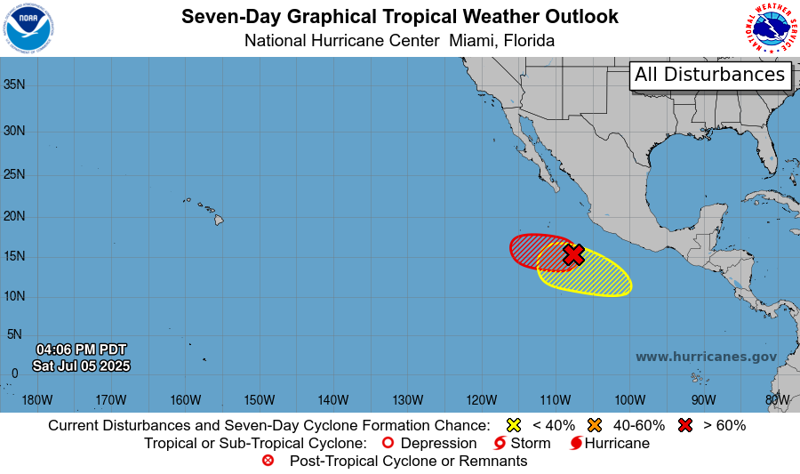
Currently in the tropics, we have two areas to watch in the eastern Pacific Basin right on top of eachother, one having a 60-70 percent chance of development in the next 48 hours to 7 days and the other having a 0-20 percent chance of development in the next 48 hours to 7 days. The eastern Pacific is flying though named storms this season!
In the Atlantic Basin, we have Tropical Storm Chantal, which is making landfall this morning in the northern South Carolina coast as a weak tropical storm. It will weaken into a Tropical Depression today, and bring a plume of moisture into the mid-Atlantic and northeast this week.
Want the latest details on these systems? Check out our daily tropical updates for more in-depth information on the tropics!
REGIONAL DAY TO DAY FORECAST
Today: Sunny. Slight chance of showers and thunderstorms in the late afternoon. Highs in the mid 90s. Calm winds becoming southeast around 5 mph. Chance of rain 30 percent.
Tonight: Mostly clear. Patchy fog after 5am. Lows in the low 70s. South southwest winds around 5 mph becoming calm. Chance of rain 30 percent before 7pm.
Monday: Sunny. Scattered showers and thunderstorms after 1pm. Highs in the mid 90s. Calm winds becoming southwest around 5 mph in the afternoon. Chance of rain 40 percent.
Monday Night: Mostly clear. Lows in the low 70s. South wind around 5 mph becoming calm.
Tuesday: Sunny. Scattered showers and thunderstorms in the afternoon. Highs in the mid 90s. Calm winds becoming west southwest around 5 mph in the afternoon. Chance of rain 40 percent.
Tuesday Night: Mostly clear. Lows in the mid 70s. Calm winds.
Wednesday: Mostly sunny. Isolated showers and thunderstorms in the afternoon. Highs in the mid 90s. Calm winds becoming west around 5 mph in the afternoon. Chance of rain 30 percent.
Wednesday Night: Partly cloudy. Lows in the mid 70s.
Thursday: Sunny. Numerous showers and thunderstorms in the afternoon. Highs in the mid 90s. Chance of rain 70 percent.
Thursday Night: Mostly clear. Slight chance of showers and thunderstorms. Lows in the mid 70s. Chance of rain 30 percent.
Friday: Partly sunny. Numerous showers and thunderstorms. Highs in the low 90s. Chance of rain 70 percent.
Friday Night: Partly cloudy. Slight chance of showers and thunderstorms. Lows in the mid 70s. Chance of rain 30 percent.
Saturday: Partly sunny. Numerous showers and thunderstorms. Highs in the mid 90s. Chance of rain 70 percent.


