Today, we are looking at the typical afternoon showers and thunderstorms with temperatures in the low-to-mid 90s. Friday, we will see more numerous showers and thunderstorms, mainly in the morning and afternoon hours, and slightly cooler. This weekend is looking beautiful, with sunny skies – but of course it wouldn’t be a sunny day without the popup thunderstorms as well. Let’s dive into the detailed forecast:
[wpcode id=”41149″]
Today’s Overall Setup
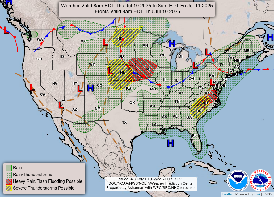
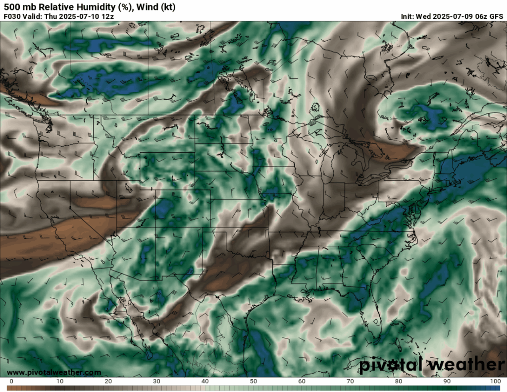
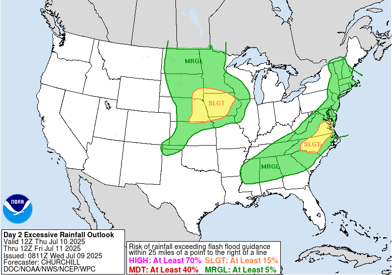
There is lot’s of moisture in the atmosphere and instability on this summer day, bringing the threat of severe weather and flash flooding to the central/northern plains and from northern Mississippi through the northeast. The bullseye for the greatest threat is over Iowa and surrounding states, where there is a stationary front sitting overhead, as well as Virginia and North Carolina – an area that has seen enough flooding recently. For our area, we have a lot of humidity and hot temperatures trying to make the atmosphere unstable, but large-scale high pressure over the gulf if preventing any sort of washout for our day today.
[wpcode id=”41149″]
Today’s Local Forecast
We will start of today dry with a mix of sun and clouds. By the time the afternoon comes, the typical shower and thunderstorm will come through the area. This is most likely to fill in more by 4-5 pm, but some early popup storms are certiantly possible. These scattered showers and thunderstorms will stick around until around 10-11pm. I would ensure any outdoor plans are taken care of before mid-afternoon! Ensure your NickelBlock notifications are turned on to receive instant lightning alerts and check the radar if you are outside!

Here’s an hourly look at the forecast for today for the region.
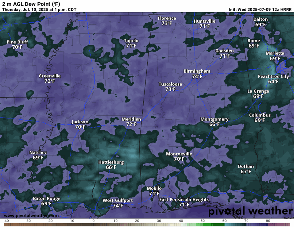

High temperatures today are sitting slightly above our average, in the low-to-mid 90s. Looking at our dew points for today, they are sitting in the high 60s and low 70s, which is still very humid but not as oppressive as we have seen the past few weeks. When there are no clouds, temperatures will feel in the 100s, even up to 110! Ensure you are well hydrated through the day.
[wpcode id=”41149″]
Friday-Sunday Forecast
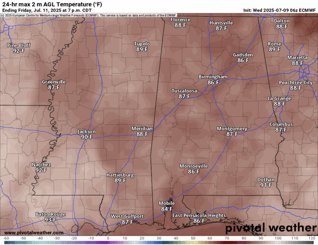
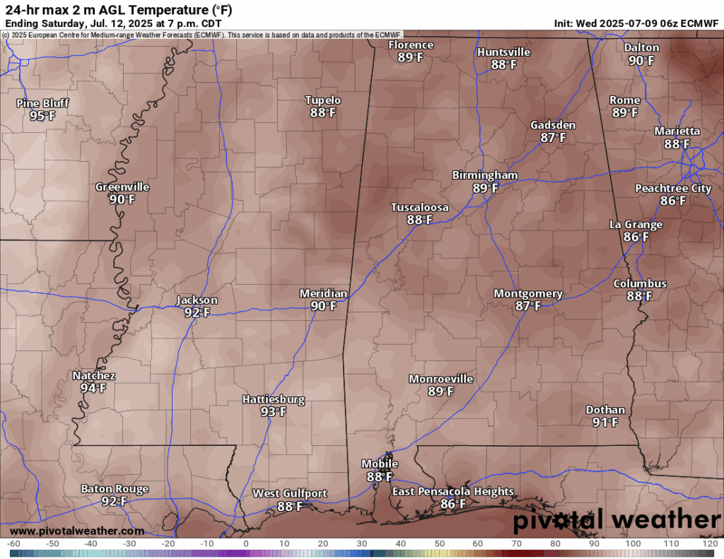
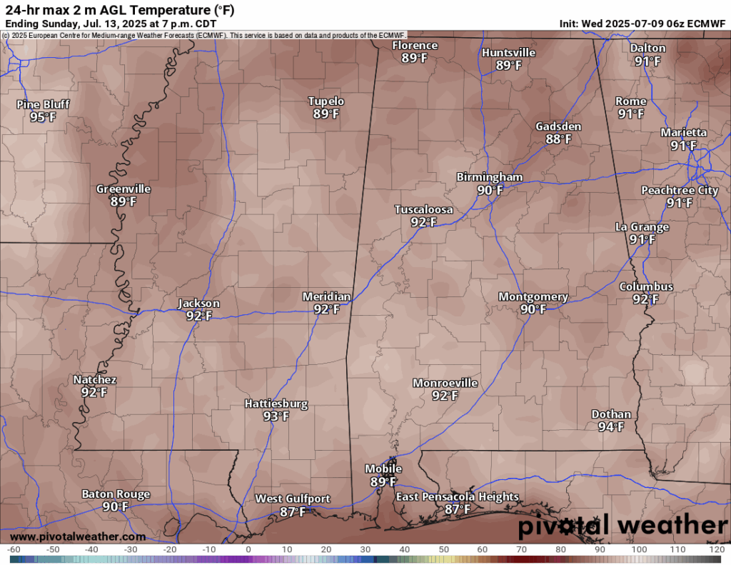
Looking into the weekend, Friday will be slightly cooler with temperatures in the high 80s and very low 90s in spots. This is mainly due to the increased rain chance which I will mention below. Saturday and Sunday will be right back into the low 90s, though!
On Friday, a passing shortwave trough will bring an increased chance of more numerous showers and thunderstorms. Rain will be most likely in the morning and afternoon, but should clear out by the evening and night time. The sun will be back for Saturday and Sunday, but afternoon showers and thunderstorms will popup at the usual 2-7pm timeframe. These will be more isolated than Friday’s, so we’re not looking at a washout for everyone this weekend.
[wpcode id=”41149″]
Extended Local Outlook

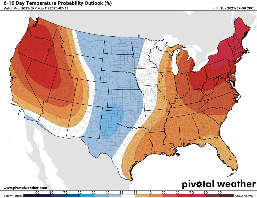
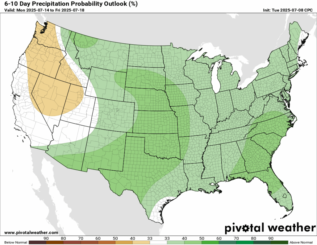
Looking ahead into next weekend and early next week, the Climate Prediction Center still has a 50-60 percent chance of above normal temperatures – that means more heat! With that, there is also still a 33-40 percent chance that we will see above normal rainfall as well, though there is low confidence in that.
[wpcode id=”41149″]
Latest Tropical Update
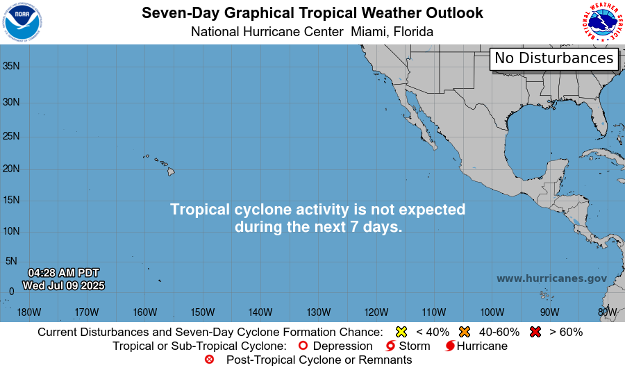
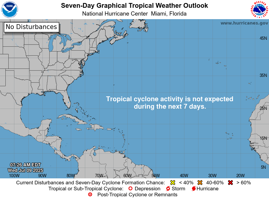
For the first time this summer, it seems like the eastern Pacific basin is quiet?! Yes, there is a lull in tropical activity for the next 7 days, and the same goes for the Atlantic.
Want the latest details on these systems? Check out our daily tropical updates for more in-depth information on the tropics!
REGIONAL DAY TO DAY FORECAST
Today: Mostly sunny. Showers and thunderstorms likely in the afternoon. Highs in the low 90s. Calm winds becoming west around 5 mph. Chance of rain 60 percent.
Tonight: Partly cloudy. Slight chance of showers and thunderstorms early. Lows in the low 70s. West wind around 5 mph becoming calm. Chance of rain 20 percent.
Friday: Mostly sunny. Showers and thunderstorms likely in the afternoon. Highs in the mid 90s. Calm winds becoming west southwest around 5 mph in the afternoon. Chance of rain 70 percent.
Friday Night: Partly cloudy. Lows in the mid 70s. South southwest wind around 5 mph becoming calm.
Saturday: Sunny. Scattered showers and thunderstorms in the afternoon. Highs in the mid 90s. Calm winds becoming south southwest around 5 mph in the afternoon. Chance of rain 50 percent.
Saturday Night: Mostly clear. Lows in the mid 70s. South wind around 5 mph becoming calm.
Sunday: Sunny and hot. Scattered showers and thunderstorms in the afternoon. Highs in the upper 90s. Calm winds becoming west around 5 mph. Chance of rain 50 percent.
Sunday Night: Mostly clear. Lows in the mid 70s.
Monday: Sunny and hot. Scattered showers and thunderstorms in the afternoon. Highs in the upper 90s. Chance of rain 50 percent.
Monday Night: Mostly clear. Lows in the mid 70s.
Tuesday: Mostly sunny. Showers and thunderstorms likely. Highs in the mid 90s. Chance of rain 60 percent.
Tuesday Night: Partly cloudy. Lows in the mid 70s. Light and variable winds.
Wednesday: Partly cloudy in the morning. Scattered showers and thunderstorms in the afternoon. Highs in the mid 90s. Light and variable winds. Chance of rain 40 percent.


