General Central/Eastern Kansas Forecast
Short-Term (Tuesday-Wednesday)
Today looks to be another generally dry day across the region, with perhaps an isolated shower in far southeast Kansas. Temperatures across the board look to again reach the low to mid 90s, with southerly winds of 5 to 15 mph. Northern and northeast Kansas will feel relatively dry outside, with relative humidity between 30-45%, making for at least a somewhat more comfortable heat. Southern and southeast Kansas will continue to feel just a touch more humid, with relative humidity values ranging between 45-60%. Heat indices today look to be on the higher side, with generally upper 90s expected and isolated pockets of low 100s possible. Overnight temperatures tonight will be warmer than in the last couple of days, with low temperatures in the mid 70s across the region.
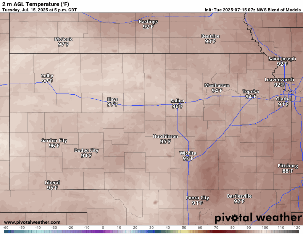

An ejecting shortwave across Nebraska may see some scattered showers return to northern and northeast Kansas early tomorrow morning, especially north of I-70. Most likely timing for these showers will be from 12-4am, but some lingering activity could hang around through sunrise. Further redevelopment of showers and thunderstorms in association with an incoming cold front is likely during the overnight hours in central and northern Kansas. Some of these storms may be marginally severe, with gusty winds being the most likely hazard. High temperatures will stay around where they will be today, with highs in the mid to upper 90s in the afternoon, but with slightly stronger southerly winds of around 10 to 15 mph. Relative humidity values look to increase as moisture from the gulf surges northward in front of this cold front, bringing our RH values to 45-60% across the board. Heat indices tomorrow will again reach the upper 90s to potentially low 100s across the region. Overnight low temperatures will range from the upper 60s (in northern Kansas behind the front) to mid 70s further south.
Long-Term (Thursday-Monday)
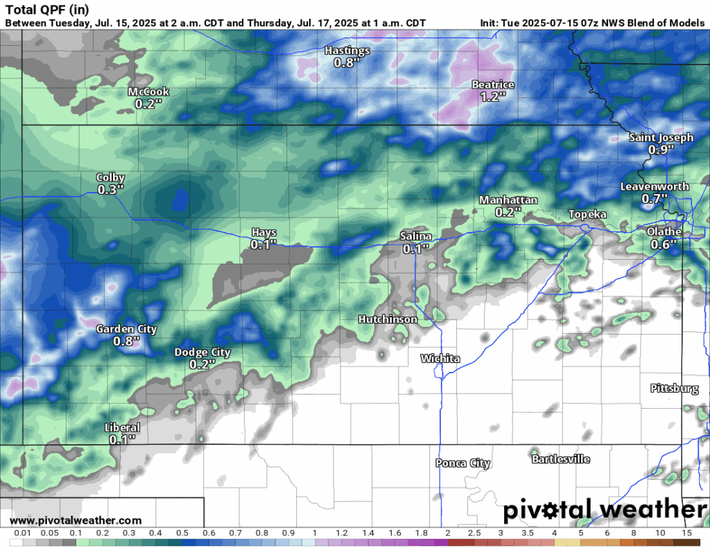
A cold front will traverse through the state on Thursday morning and help to knock down our temperatures noticeably (into the low to mid 80s) and increase rain chances considerably. Scattered showers and thunderstorms will be possible for much of the region throughout the day, with 0.5 to 1 inch of rainfall being possible. This cold front should stall out across southern Kansas somewhere near the Kansas-Oklahoma border Thursday night before mixing out and allowing southerly flow to return. Continued isolated to scattered rain chances look to last through the weekend and early week before high pressure looks to build and bring the classic summertime heat and dryness back to the region.
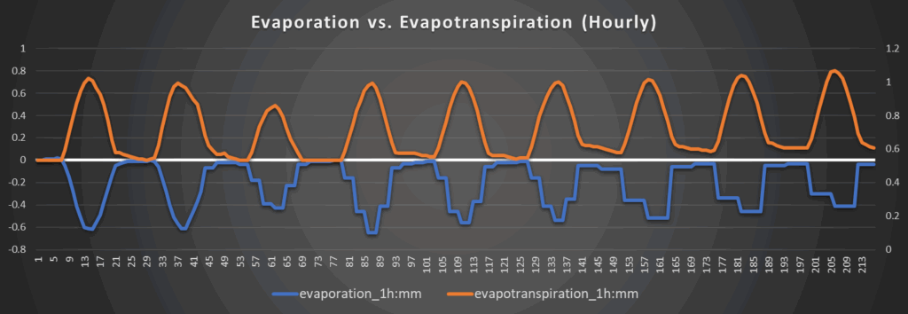
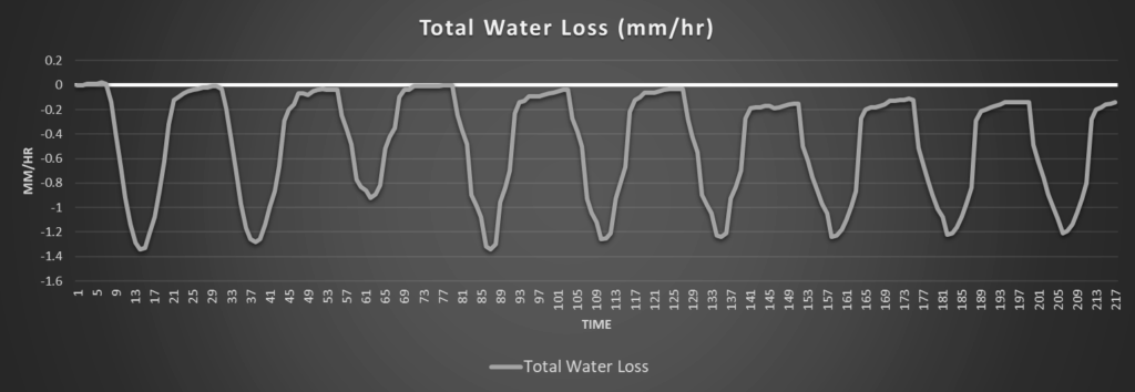
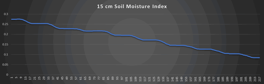
Regional Soil Moisture Outlook
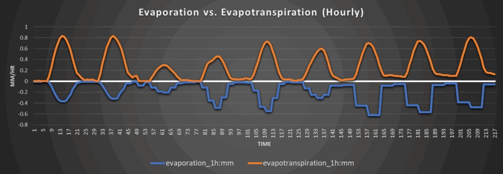
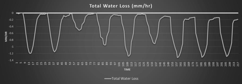
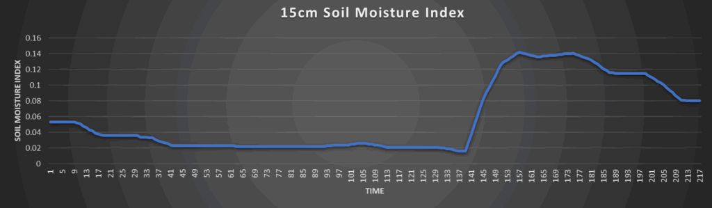
Around Westmoreland
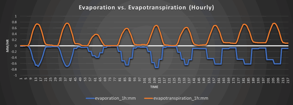
Around Scranton
Around Burlington
Around Altoona