Hello everyone! Today, we are expecting the first round of rain to come from the system that has been in the talks the past few days. Heavy rain Friday and Saturday will be the main impact, with southern Louisiana taking the hit at most of the rain totals. Let’s dive into the detailed forecast:
[wpcode id=”41149″]
Today’s Overall Setup
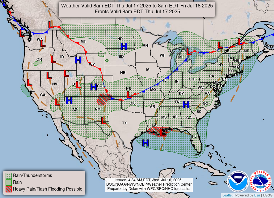
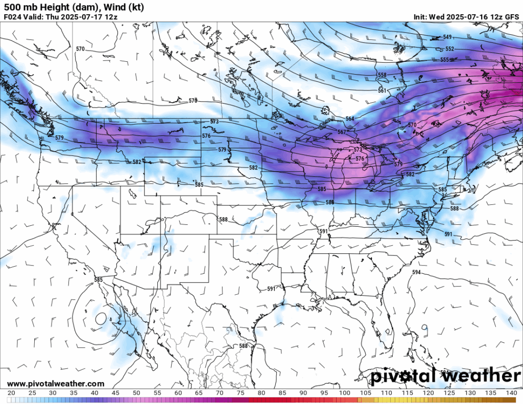
Today’s setup in the mid-levels (500 mb) is mainly zonal, or generally west-to-east flow. There is a high pressure in the Gulf and a cold front in the central plains, with both act as the steering flow for Invest 93L. Invest 93L is creeping into southern Louisiana today, bringing rounds of rain there. Heavy rain and flash flooding are possible today as the outer bands start to push onshore.
[wpcode id=”41149″]
Today’s Local Forecast
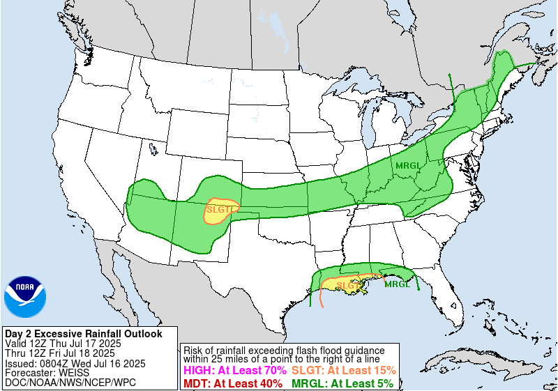
Mostly cloudy skies are in the forecast today, but we are staying mainly dry in the morning and early afternoon. Some showers and thunderstorms will creep in from the Gulf in the later afternoon and will stick around through the evening. These showers are the outer rain bands from the invest low pressure system. There is a chance that some of this rain could produce some flash flooding, primarily in extreme southern Mississippi and southeastern Louisiana. There is a Slight (at least 15 percent) chance of flash flooding from the WPC. The most probable days for flooding will be Friday and Saturday.

Here’s an hourly look at the forecast for today for the region.
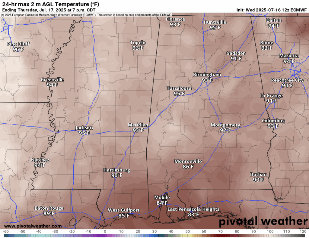
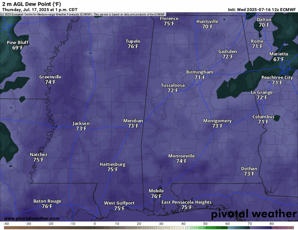
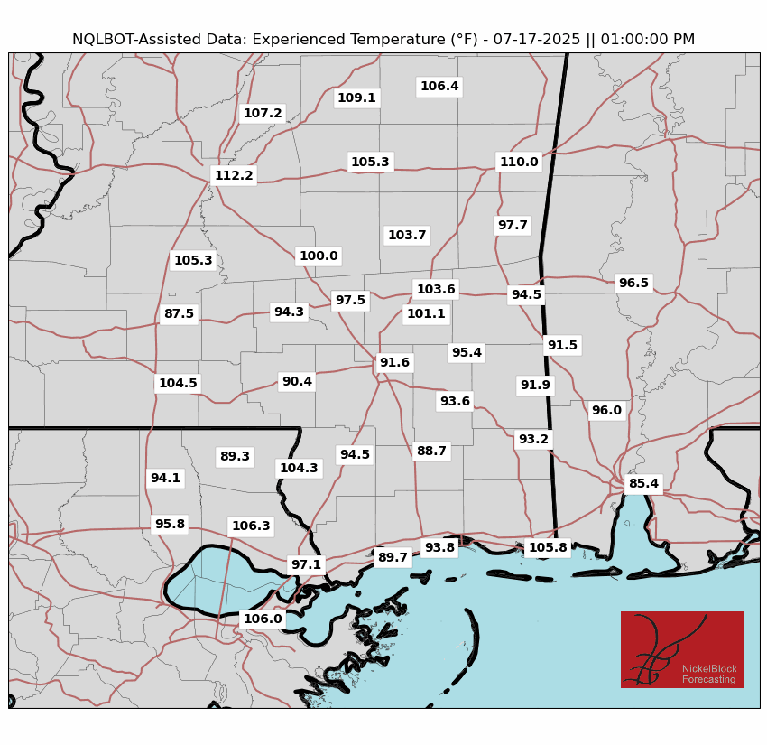
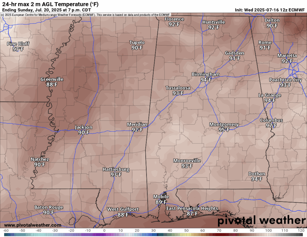
High temps today will be in the high 80s for those in southern Louisiana and low-to-mid 90s for those in southern Mississippi. Dew points are up there in the mid-to-high 70s, which is brutal humidity. The tropical moisture is certainly there and is making it feel like over 100 degrees when it is not raining. Of course, when it does rain you should feel some relief from the heat.
[wpcode id=”41149″]
Friday-Sunday Forecast
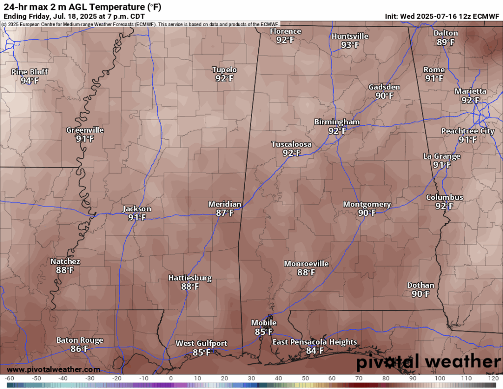
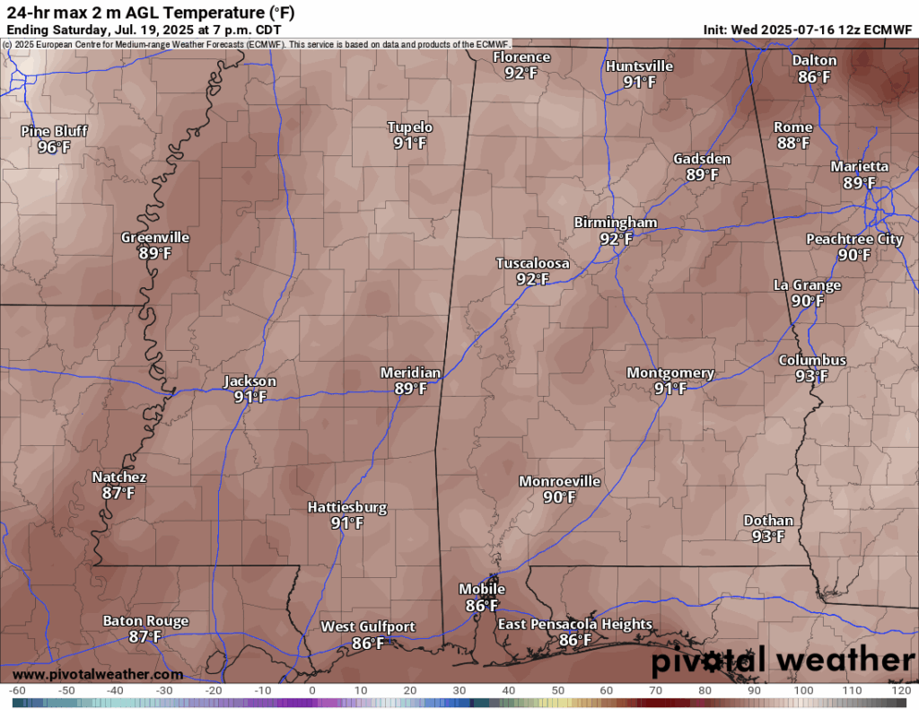
Temperatures will be slightly cooler than average on Friday, with most of us not breaking 90 degrees. Things start to warm up slowly for Saturday and Sunday as the system slides to our north, and we are back to more sun to warm things up.
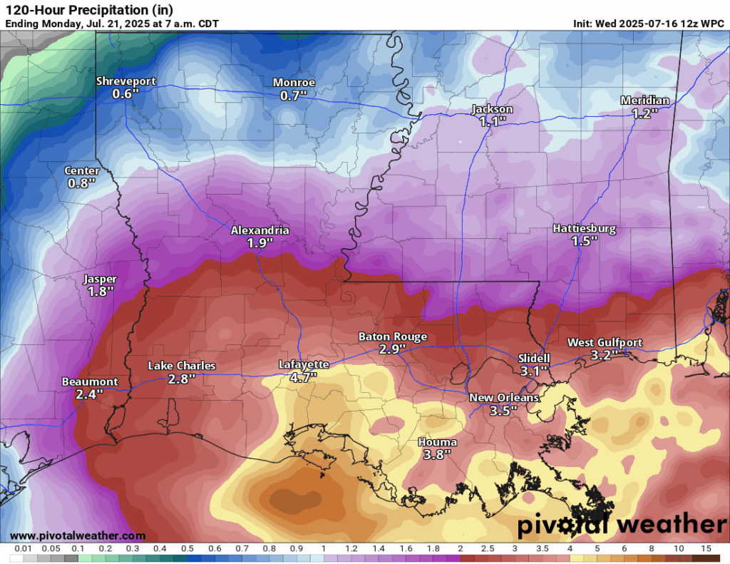
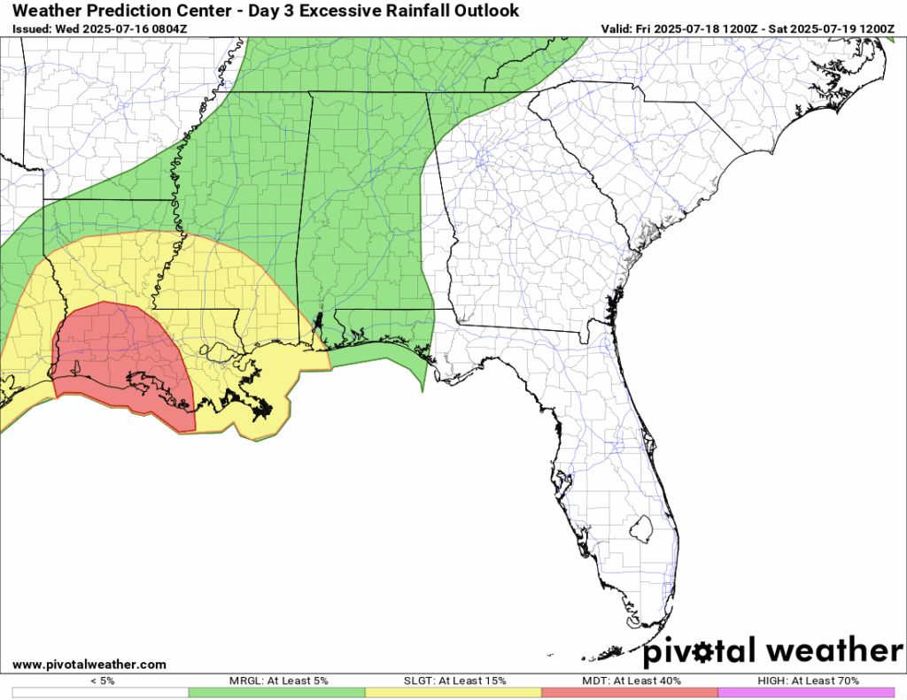
Rainfall starts to move in today as the low creeps into southeastern Louisiana, but more consitent rain will occur Friday, Saturday, and Sunday. Rain totals are expected to be 5-8 inches in southern Louisiana, with some areas locally seeing a foot of rain from this system. For those near Hattiesburg you can expect 1-3 inches, but some areas will see locally higher amounts, of course. The WPC has a Moderate (at least 40 percent) chance of flash flooding for southern Louisiana on Friday and a Slight (at least 15 percent) chance for the New Orleans area and into southern Mississippi. A flood watch is also currently in effect for southern Louisiana and southern Mississippi.
[wpcode id=”41149″]
Extended Local Outlook

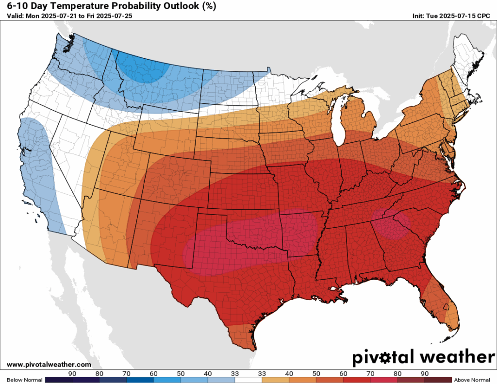
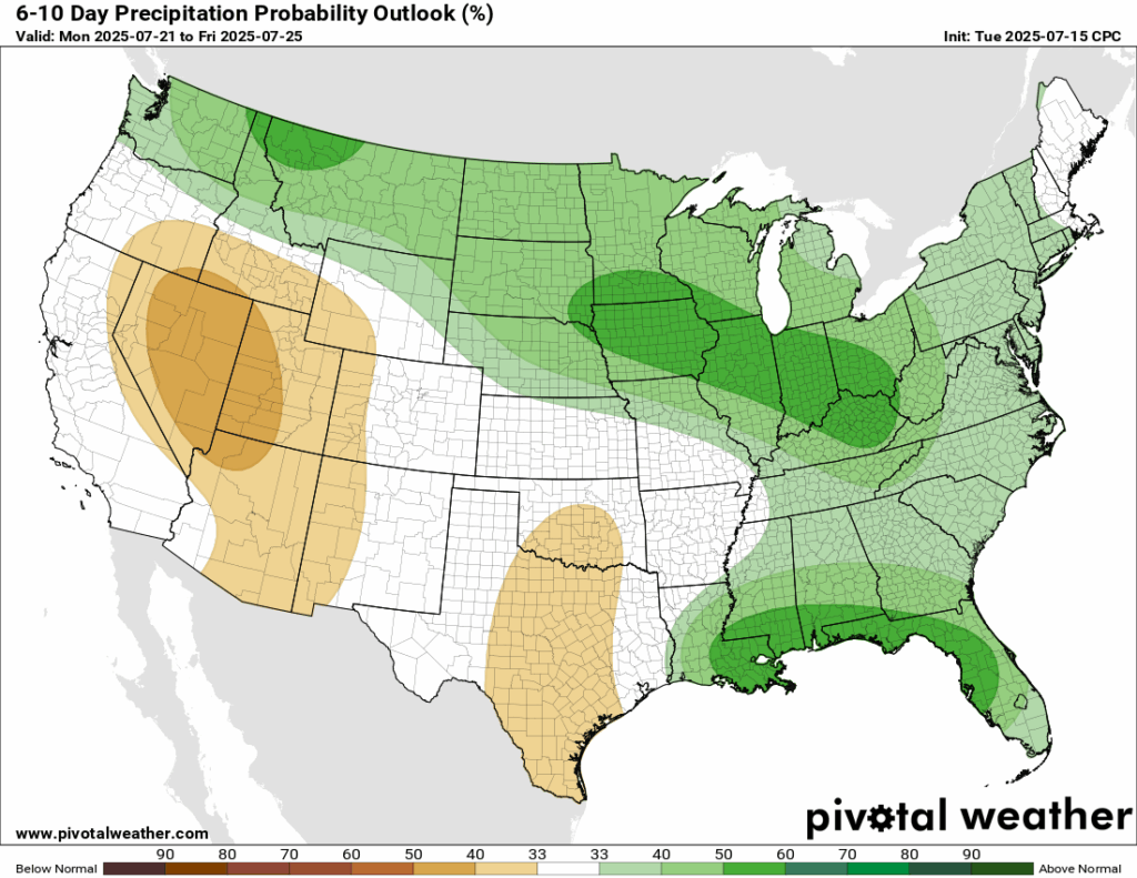
Looking ahead at the next 6-10 days, temperatures are very likely to be above normal, given that we will be situated near a high pressure system and we are in the negative phase of the Pacific North American pattern (PNA). Rainfall will also likely be above average, with lots of tropical moisture to work with.
[wpcode id=”41149″]
Latest Tropical Update
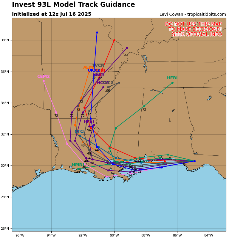
Invest 93L is tracking to the west into our area and will bring heavy rain to southern Louisiana. Almost a foot of rain is possible in some locations. Mississippi will see generally 1-3 inches, but locally higher amounts are certainly possible.
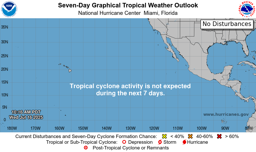
Want the latest details on these systems? Check out our daily tropical updates for more in-depth information on the tropics!
REGIONAL DAY TO DAY FORECAST
Today: Mostly cloudy. Showers and thunderstorms likely in the later afternoon. Highs in the low 90s. East northeast wind 5 to 10 mph becoming southeast in the afternoon. Chance of rain 70 percent.
Tonight: Mostly cloudy. Chance of showers and thunderstorms. Lows in the mid 70s. East southeast wind around 5 mph. Chance of rain 30 percent.
Friday: Mostly cloudy. Showers and thunderstorms likely throughout the day. Highs in the low 90s. South wind 5 to 10 mph, with gusts up to 20 mph. Chance of rain 90 percent.
Friday Night: Mostly cloudy. Thunderstorms early, ending before 7pm. Lows in the mid 70s. South wind around 5 mph becoming calm in the evening. Chance of rain 80 percent.
Saturday: Mostly cloudy. Showers and thunderstorms likely in the late morning through afternoon. Highs in the low 90s. Light south wind becoming southwest 5 to 10 mph in the morning. Chance of rain 70 percent.
Saturday Night: Partly cloudy. Lows in the mid 70s. South southwest wind around 5 mph becoming calm.
Sunday: Partly sunny. Scattered showers and thunderstorms in the afternoon. Highs in the mid 90s. Calm winds becoming west southwest around 5 mph in the afternoon. Chance of rain 40 percent.
Sunday Night: Mostly clear. Lows in the mid 70s.
Monday: Sunny and hot. Scattered showers and thunderstorms in the afternoon. Highs in the upper 90s. Chance of rain 40 percent.
Monday Night: Mostly clear. Lows in the mid 70s.
Tuesday: Mostly sunny and hot. Scattered showers and thunderstorms in the afternoon. Highs in the upper 90s. Chance of rain 40 percent.


