Tropical Invest 93L is being steered to the north, with the center of circulation over Louisiana. This will continue to make things pretty wet here in southern Mississippi. Once the storm moves out, a high pressure in the Gulf and a ridge will combine to give us drier and warmer than average conditions the next couple of days, before more rainfall potentially returns later next week.
DETAILS ON TROPICAL INVEST 93L
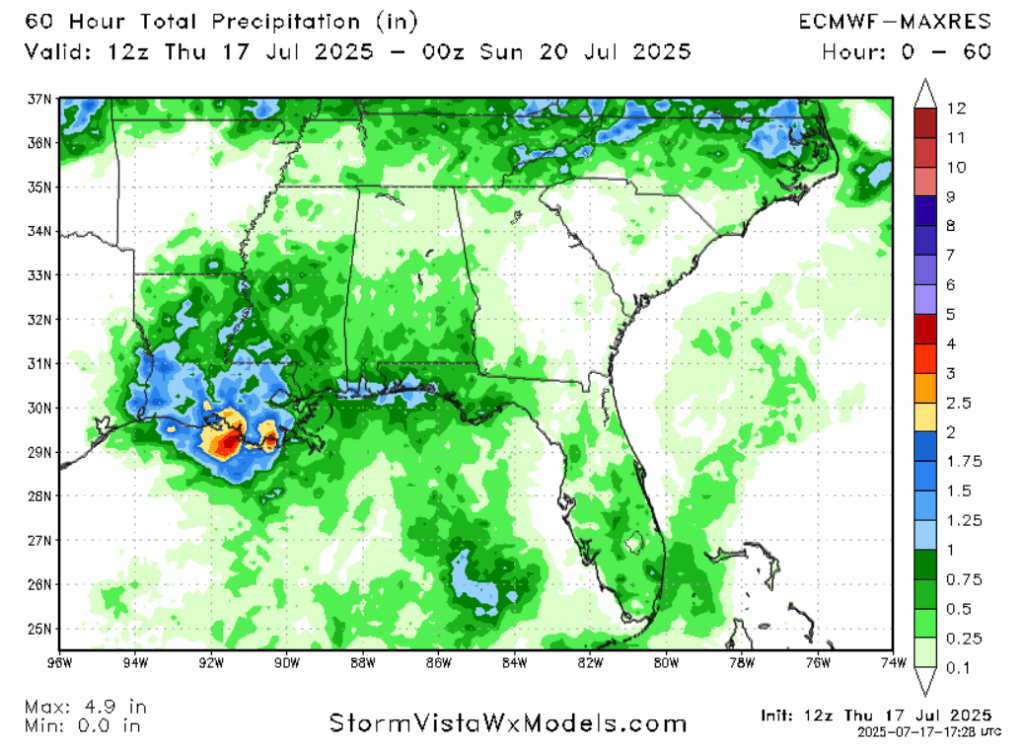
The closer to the Gulf Coast you go, the more rainfall you have already gotten, and the more you will continue to get. The Climate Prediction Center has implemented a marginal risk (5% chance within 25 miles) of flash flooding for our forecast area, except for parts of the counties that touch the Gulf, which have been given a slight risk (15% chance within 25 miles). Models are calling for between 0.5″ and 1.25″ of rain in the coastal areas from now until the end of the day. Locally higher amounts, potentially on the order of 2″ to 3″, are possible in localized areas.

While there seems to be more rain on the western side of this system, the eastern side of storms are known to be more convective in nature. Low-level wind shear doesn’t look too impressive on the CAMs, but an uncapped moist environment means that thunderstorms with severe potential are not completely out of the question.
Damaging winds outside of thunderstorms do not appear to be a threat due to this storm’s weaker nature and the center of circulation being inland. Winds will be from the southeast, shifting to the southwest on Saturday. Sustained winds are not expected to exceed even 20 miles per hour.
Similarly, storm surge shouldn’t be a big issue.
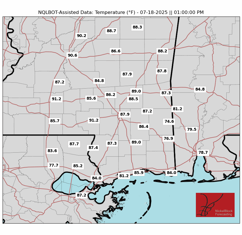
One silver lining, the persistent cloud cover will likely keep high temperatures from reaching 90 degrees or higher in many places. It will be muggy; humidity will make the air feel like around 100 in the early afternoon. But it will still be an improvement compared to both before and after this event.
SUMMERTIME WEATHER RETURNS SUNDAY
Once our tropical invest propagates out of the area, a ridge will begin to build. This will usher in warmer temperatures and a smaller but still noticeable precipitation chance of 30 to 40%. High temperatures will reach into the mid 90s, with apparent temperatures approaching the 110 degree mark. Wind will be light during fair weather. This weather pattern will last most of next week, at least until Wednesday.
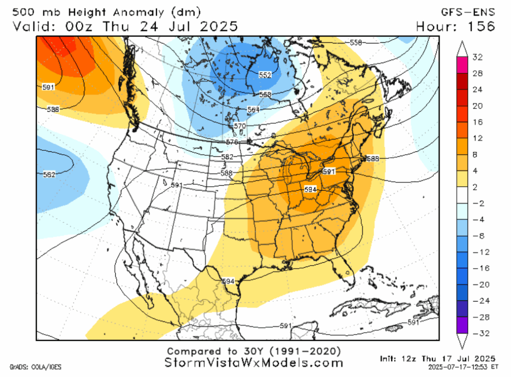
LONG RANGE
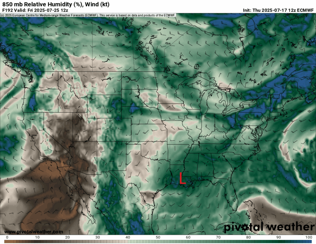
The ridge is expected to stick around for a while, contributing to a signal for above average temperatures. Model composites are in agreement about warmer than average conditions. Both mainline medium range models show a combination of elevated 700mb humidity and 850mb vorticity in the Gulf in the 6-9 day time frame, which is a signal for a tropical wave to form. If that occurs, it would cause a period of wetter than average conditions.
DAY-TO-DAY REGIONAL FORECAST
Today: Rain. Thunder possible. Highs in the high 80s. Rainfall amounts around a half an inch, with higher amounts along the Gulf coast and in embedded thunderstorms. Winds south at 10 mph, with gusts up to 20 mph.
Tonight: Mostly cloudy. Lows in the mid 70s.
Saturday: Rain. Thunder possible. Highs around 90. Rainfall amounts around a quarter of an inch, with higher amounts in embedded thunderstorms. Chance of rain 80%. Winds southwest at 5-10 mph, with gusts from 15-20 mph. Lows in the mid 70s.
Sunday: Mostly sunny. Highs in the mid 90s. Afternoon thunderstorms possible. Humid. Chance of rain 40%. Lows in the mid 70s.
Monday: Mostly sunny. Highs in the mid 90s. Afternoon thunderstorms possible. Chance of rain 30%. Lows in the mid 70s.
Tuesday: Mostly sunny. Highs in the mid 90s. Afternoon thunderstorms possible. Chance of rain 30%. Lows in the upper 70s.
Wednesday: Mostly sunny. Highs in the upper 90s. Afternoon thunderstorms possible. Chance of rain 30%. Lows in the upper 70s.
Thursday: Partly cloudy. Highs in the mid 90s. Afternoon thunderstorms possible. Chance of rain 40%. Lows in the upper 70s.
Friday: Mostly cloudy, rain possible. Highs in the lower 90s. Chance of rain 50%. Lows in the upper 70s.
Saturday: Mostly cloudy, rain possible. Highs in the lower 90s. Chance of rain 50%. Lows in the upper 70s.
Sunday: Partly cloudy. Highs in the lower 90s. Afternoon thunderstorms possible. Chance of rain 40%. Lows in the mid 70s.


