With tropical system Invest 93L beginning to leave our area today, there are chances for showers and thunderstorms throughout the day today, but extreme rainfall amounts are not expected. Tomorrow we will be back to afternoon popup showers and thunderstorms. The combination of above 90 temperatures and high humidity with make for some high indices next week.
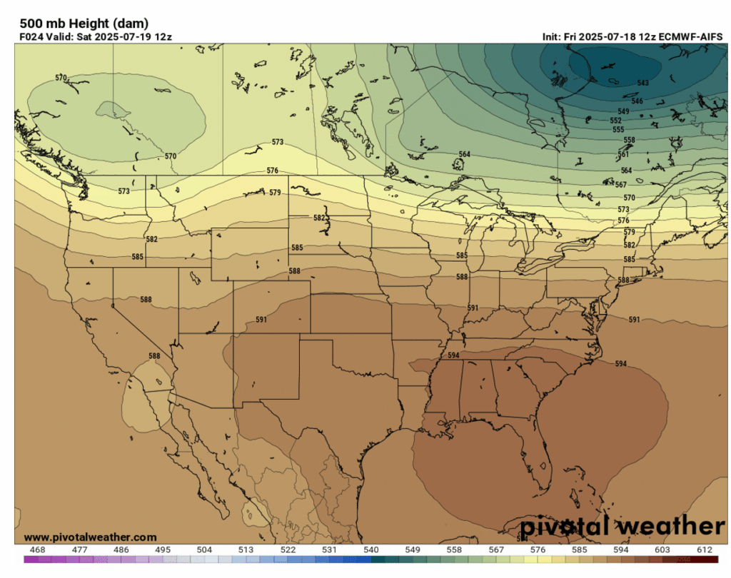
In the upper-air, we will have some zonal flow for the weekend, with a cut off low over Southern California and Baja California, Mexico and a high pressure area over the Southeast. A large ridge will start to build in over the week, playing a part in cranking the heat up next week.
Looking at our surface chart, the risk for heavy rainfall and flash flooding from the recent tropical development 93L has now moved north of our region, but the chance of rain and thunderstorms still remains for today.

This Weekend’s Weather:

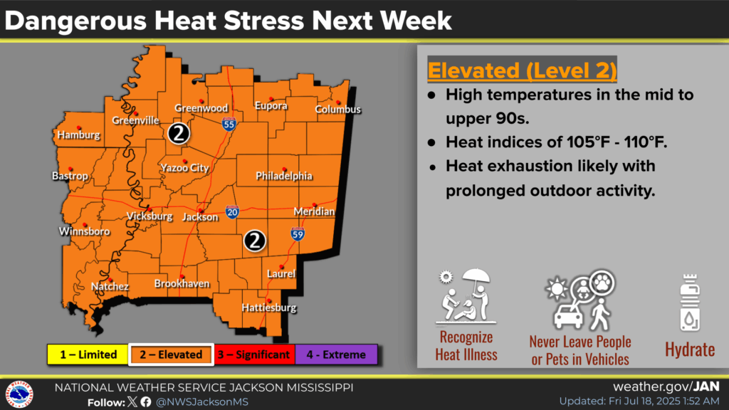
Unfortunately, the high humidity is not going to budge for the weekend and into next week, increasing heat indices. Check out the experienced temperatures for today and tomorrow at 2 pm:
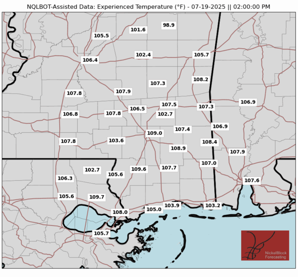
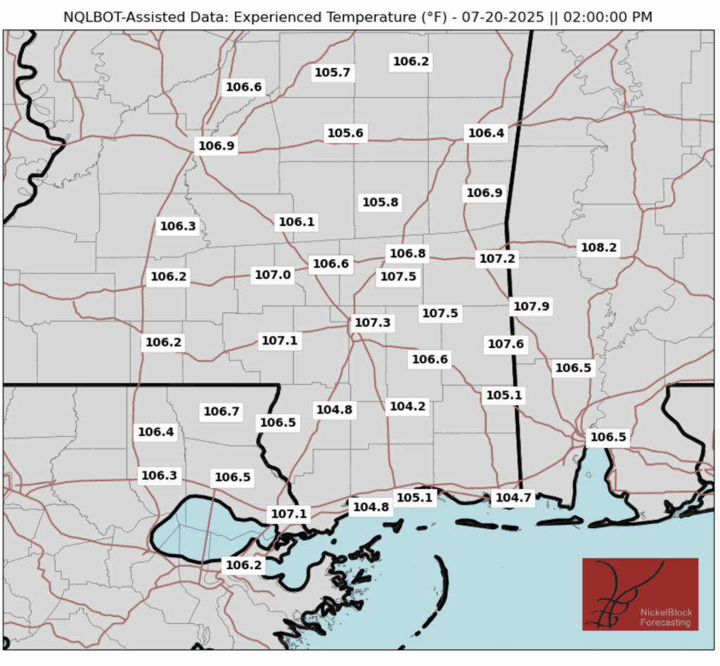
During the afternoons of both days this weekend, experienced temperatures will be above 100 degrees across the board, and above 105 degrees in most places.
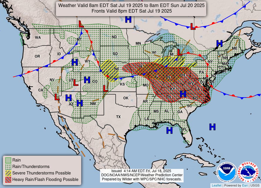
As for precipitation, here’s the radar for this weekend:
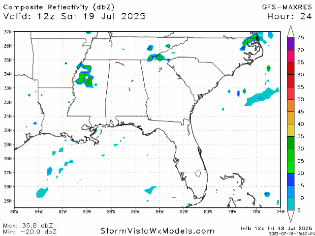
As the tropical system makes its way out of our region, we can expect some showers and thunderstorms throughout the day. Rainfall won’t be very heavy, with 24-hour precipitation accumulating to maybe a half of an inch. By tomorrow, we should begin to return to our typical summer afternoon scattered storm pattern.
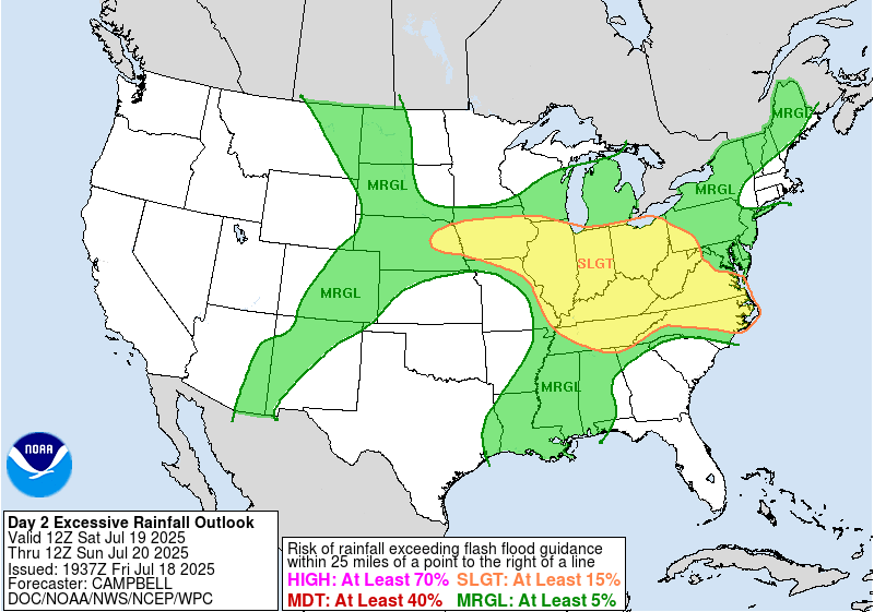
It is difficult to know exactly how much rain will fall from tropical systems like 93L, so the WPC has marked our area as a marginal risk (at least a 5% risk) for excessive rainfall today, but this risk will subside completely by tomorrow.
Next Week’s Weather:

With the incoming ridge bumping temperatures up to the mid to high 90s and forecasted high humidity, heat advisories or excessive heat warnings can be expected for this week.
Our regular pattern of afternoon scattered showers and thunderstorms will be back in schedule for this week, but conditions in the morning will be mostly sunny and then hot throughout the day.
Regional Day-to-Day Forecast:
Today: Chance of showers and thunderstorms throughout the day. Highs in the low 90s. Chance of precipitation 60%.
Tonight: Chance of showers and thunderstorms early in the evening, then partly cloudy. Lows in the mid 70s. Chance of precipitation 30%.
Tomorrow: Sunny in the morning with a chance of showers and thunderstorms in the afternoon. Highs in the low to mid 90s during the day and lows in the mid 70s at night. Chance of precipitation 40%.
Monday: Sunny in the morning with a chance of showers and thunderstorms in the afternoon. Highs in the mid 90s during the day and lows in the mid 70s at night. Chance of precipitation 30%.
Tuesday: Sunny in the morning with a slight chance of showers and thunderstorms in the afternoon. Highs in the high 90s during the day and lows in the mid 70s at night. Chance of precipitation 20%.
Wednesday: Mostly sunny in the morning with a chance of showers and thunderstorms in the afternoon. Highs in the high 90s during the day and lows in the mid 70s at night. Chance of precipitation 50%.
Thursday: Mostly sunny in the morning with a chance of showers and thunderstorms in the afternoon. Highs in the high 90s during the day and lows in the mid 70s at night. Chance of precipitation 60%.
Friday: Mostly sunny in the morning with a slight chance of showers and thunderstorms in the afternoon. Highs in the low 90s during the day and lows in the mid 70s at night. Chance of precipitation 20%.
Saturday: Mostly sunny in the morning with a chance of showers and thunderstorms in the afternoon. Highs in the low 90s during the day and lows in the mid 70s at night. Chance of precipitation 30%.


