The current tropical system Invest 93L is making its way out of our area, leaving some more rain in its path. It is forecasted to move northeast. As for future Atlantic disturbances, The National Hurricane Center (NHC) has marked one new disturbance with a 20% chance of development. There is one disturbance in the East Pacific, but its likelihood of landfall is next to none at this point.
Current Atlantic Setup
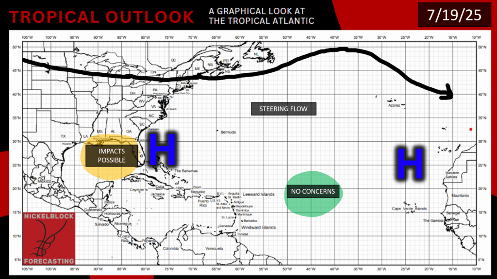
Today, we have some zonal flow over the eastern half of the continental US, with a ridge over the middle of the Atlantic. We also have our typical high pressure spots on each side of the Atlantic Basin. Tropical system 93L is almost out of the way, but our forecast area can still expect some rain throughout the day today:
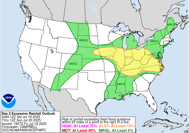
Our area has a marginal risk for excessive rainfall, with rain and thunderstorms forecasted throughout the day today. The total rainfall for today is forecasted to be around a half of an inch or less.
Future Activity in the Atlantic?
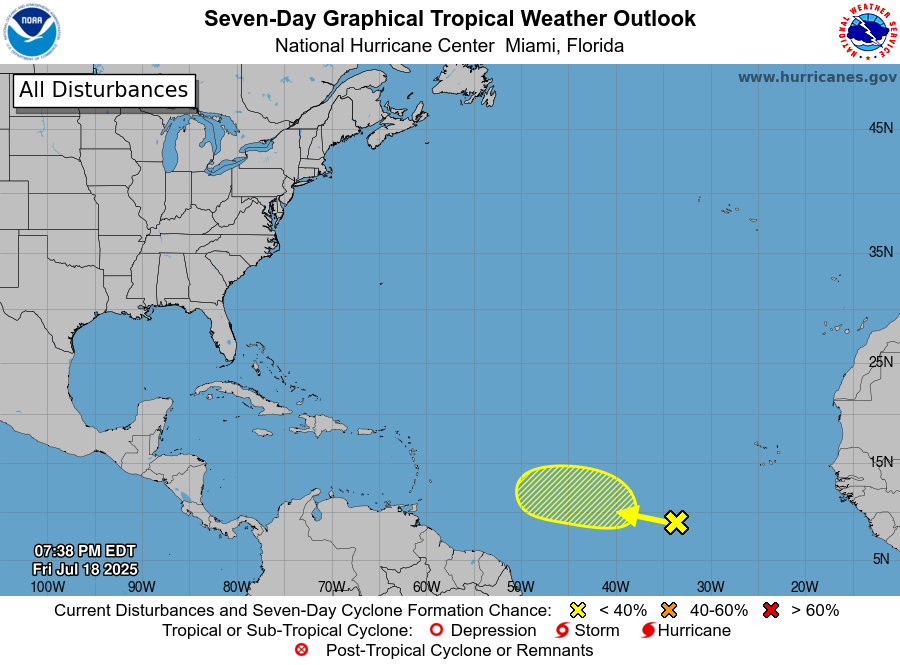
Last night, the NHC noted another disturbance in the Atlantic, very slowly making its way west-northwestward toward the Caribbean at about 10 mph. This disturbance has a low chance of development in the next 7 days at 20%. This broad area of low pressure was caused by a tropical wave, and the showers and thunderstorms within this low pressure area are still quite disorganized.
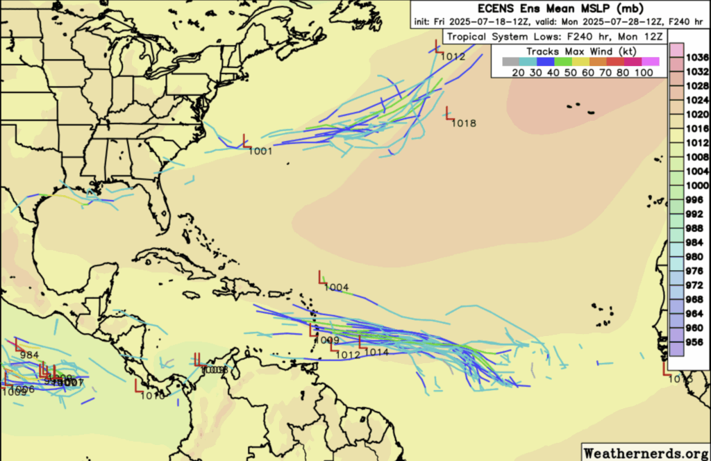
Many of the ensemble models have picked up on this disturbance as well:
This disturbance has found some moisture to hold on to moving westward, and there will be a path of low wind shear for this disturbance, but only for the next couple of days. This disturbance is currently moving and developing very slowly, so there is a chance that conductive environmental conditions won’t stay strong for long enough for this area to really develop, although it is a little to early to tell today. We will keep an eye on how this area develops in the incoming days.
Pacific Disturbance
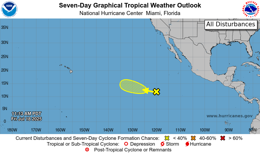
There is one disturbance in the East Pacific, and it has a 20% chance of development in the next week. The disturbance contains an area of showers and thunderstorms, but these storms are still pretty disorganized. The disturbance is moving toward slightly colder waters and wind shear will remain high, although there is some high humidity in the area. With these conditions, this system may develop a little, but major development is unlikely at this point. Regardless of whether this disturbance develops or not, it is very unlikely that it makes landfall or has any effects on land as of right now.
Stay tuned for more NickelBlock tropical updates!


