I’m currently writing this at Mercury Pizza so shoutout to them.
Summer heat is back with a vengeance after a slight interruption by the subtropical system. It’s hot, y’all. And I mean really hot, and it’s only going to get worse through the next few days. Since the subtropical system is dissolved, a strong high pressure system is moving right back in over the Gulf to bring in the heat stress. Heat indices will rise into the upper 100s to 110s in some areas, so please be careful if you’re outdoors.
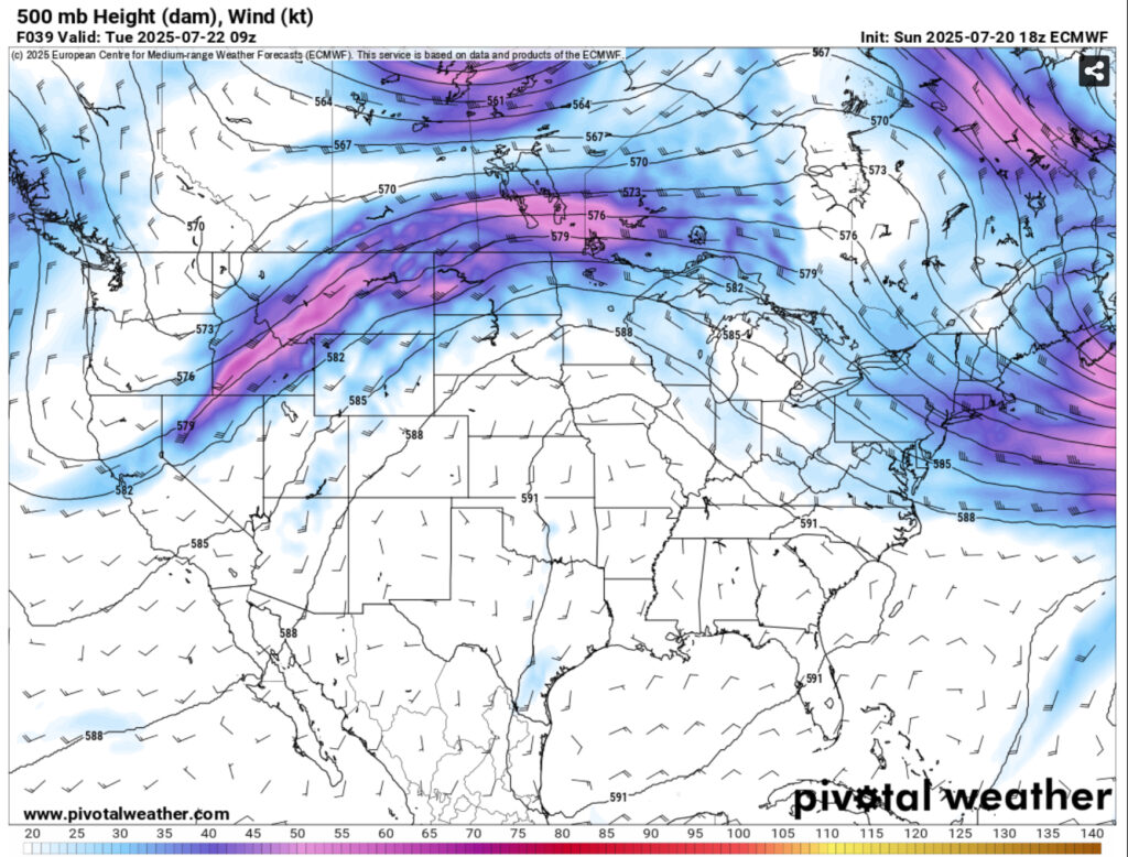
The main reason for this heat dome is the location of the surface ridge which is located in the Gulf. This will feed much of the moisture and drive up the dewpoints into the mid 70s. Some isolated thunderstorms are possible through the next couple of days, but the high will inhibit some of the thunderstorm development in the afternoon.
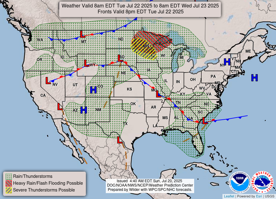
Similar to last week’s subtropical system, a dissolving low pressure system will move south towards Florida and cross into the Gulf bringing more thunderstorms and rain across the coastal South. This system looks to be a little more tame compared to the last one. It still has the characteristics of a tropical system, however it’s too soon to say how much of an effect it will have on the region. Despite that, we’ll still likely see some rain for the next several days.

The heat will still have an effect on us, though. Most of these storms look to be diurnal and develop in the afternoon which means that we’ll feel the heat before the storms roll in during the afternoon. As it moves closer, we may get some slightly cooler days, but it’ll still be very humid outside.
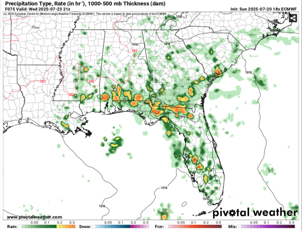
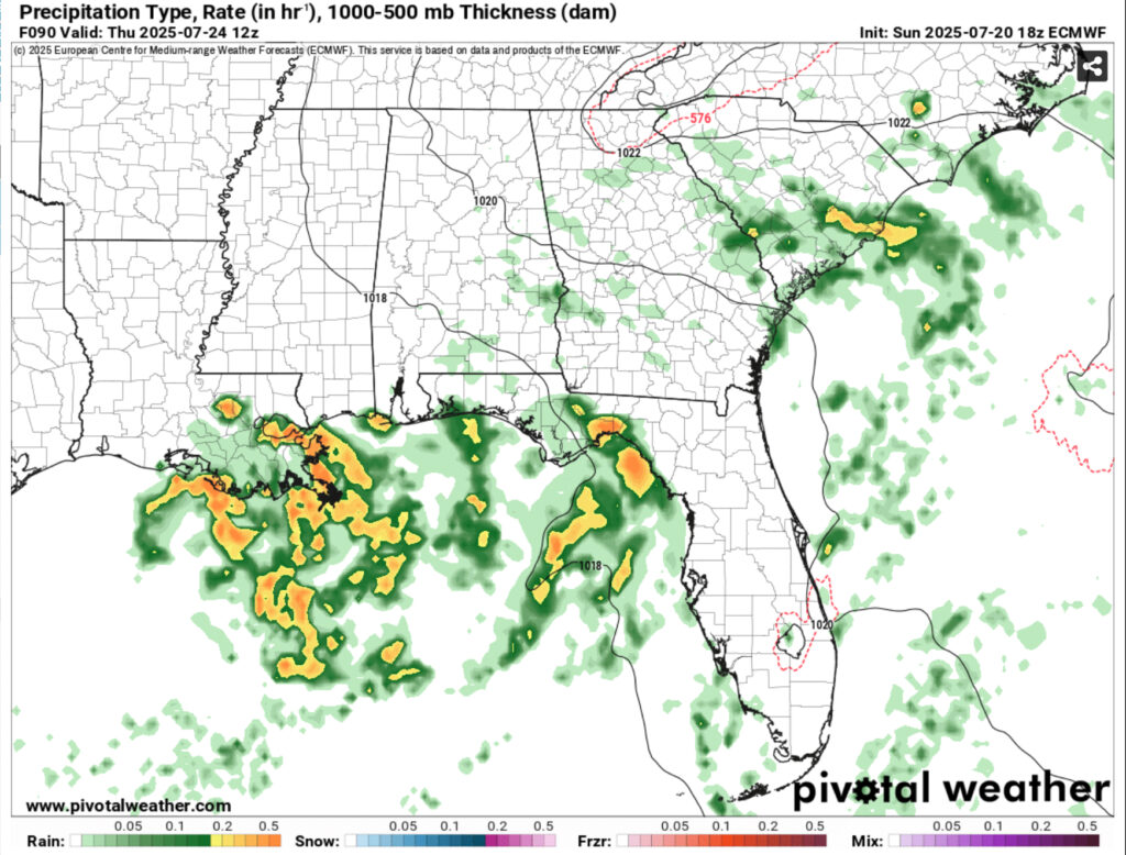
Rainfall totals are a bit less than last time, but they have a similar track. Most of the heavy rain is concentrated to the AL/LA/MS coast with some moving inland. Rainfall totals look to be above 2-3 inches with inland totals around 1 inch and above. For now, we’ll have to wait for more model guidance to see where the system may move. Landfall looks to be around the weekend again, however it may linger a bit towards the beginning of next week.
For now, stay cool during the week by any means possible! If you have weekend plans, make sure you have a backup just in case the rain comes.
Regional Day-to-Day Forecast
Tonight – Mostly clear, with a low in the mid 70s. South southwest wind around 5 mph becoming calm.
Monday – Sunny and hot, with a high in the upper 90s. Heat index values as high as 105. Calm wind becoming west around 5 mph in the morning.
Monday Night – Mostly clear, with a low in the mid 70s. Calm wind.
Tuesday – A 20 percent chance of showers and thunderstorms in the afternoon. Mostly sunny and hot, with a high in the upper 90s. Heat index values as high as 106. Calm wind becoming northwest around 5 mph.
Tuesday Night – A 20 percent chance of showers after midnight. Partly cloudy, with a low in the mid 70s. Calm wind.
Wednesday – Showers and thunderstorms likely in the afternoon. Mostly sunny and hot, with a high in the upper 90s. Calm wind becoming north around 5 mph in the morning. Chance of precipitation is 60%. New rainfall amounts of less than a tenth of an inch, except higher amounts possible in thunderstorms.
Wednesday Night – A 40 percent chance of showers and thunderstorms before midnight. Mostly cloudy, with a low in the mid 70s. East wind around 5 mph becoming calm.
Thursday – Showers and thunderstorms, mainly in the afternoon. High in the low 90s. Calm wind becoming east around 5 mph in the morning. Chance of precipitation is 80%.
Thursday Night – A 20 percent chance of showers and thunderstorms before midnight. Mostly cloudy, with a low in the mid 70s. East southeast wind around 5 mph becoming calm in the evening.
Friday – A chance of showers and thunderstorms, then showers and possibly a thunderstorm in the afternoon. High in the low 90s. Chance of precipitation is 80%.
Friday Night – A 20 percent chance of showers and thunderstorms. Partly cloudy, with a low in the mid 70s.
Saturday – Showers and thunderstorms likely. Mostly sunny, with a high in the low 90s. Chance of precipitation is 70%.
Saturday Night – Partly cloudy, with a low in the mid 70s.
Sunday – Showers and thunderstorms likely. Mostly sunny, with a high in the mid 90s. Chance of precipitation is 60%.


