General Central/Eastern Kansas Forecast
Short-Term (Monday-Tuesday)
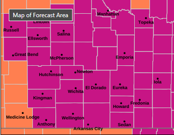
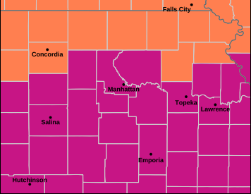
The heat is officially here for the summer, as high pressure continues to build over us in the short-term and long-term. High temperatures today will again be very hot, soaring into the low 90s to low 100s with southerly winds of 5 to 10 mph gusting to 25. The humidity will continue to stick around, especially in eastern Kansas, where relative humidity values will range between 55-70%. Central Kansas will be somewhat less humid, with average relative humidity values fluctuating between 35-45%. As a result, afternoon heat indices will largely be in the low to mid 100s, potentially reaching as high as 110. Consequentially, an Extreme Heat Warning is in effect for areas along and south of I-70 until 7pm Wednesday. Furthermore, a Heat Advisory is in effect for areas north of I-70 until 9pm tonight. It is important to note that expansion of the Extreme Heat Warning north of I-70 could be possible if projected heat indices do overperform forecasted highs. By tonight, temperatures will be on the warmer side for our lows, falling into the mid to upper 70s.

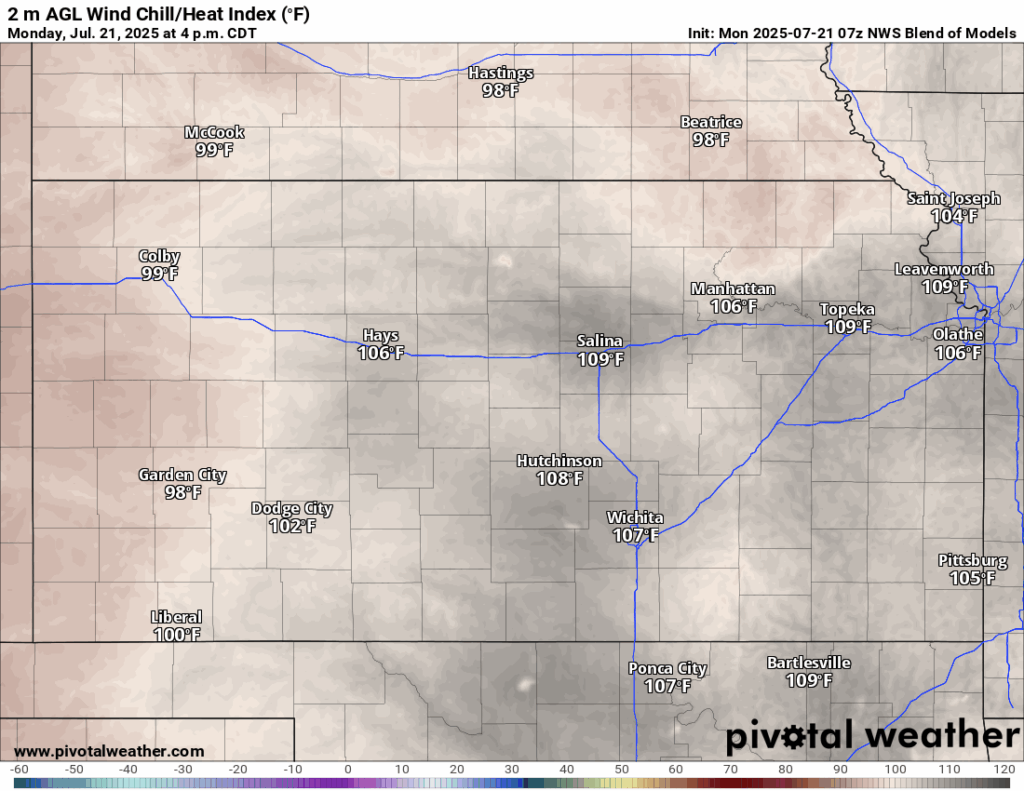
For tomorrow, another scorcher of a day, with high temperatures again in the low 90s to low 100s, with continued southerly winds of 5 to 15 mph gusting to 30. Relative humidity will be slightly lower throughout the day tomorrow, with central Kansas ranging between 25-40% and eastern Kansas ranging between 40-55%. Heat indices will again be in the low to mid 100s by the afternoon. Overnight lows tomorrow night will stay on the warm side in the mid to upper 70s.
This morning will be our last chance at rain through the short-term period with thunderstorms possible from small disturbances in the upper-level flow. This activity looks to be fairly isolated in nature, so widespread rainfall should not be anticipated tomorrow morning. Areas with the best chance at seeing precipitation will be north of I-70 and east of US-75, but overall, anyone north of I-35 has an outside shot at rain in the morning. New rain totals look to stay below an inch. This will fully shut down by noon today and will mark the beginning of an extended period of hot and dry weather across central and eastern Kansas.
Long-Term (Wednesday-Sunday)
Overall. the weather will be fairly persistent through the week and into the weekend, with daily highs in the upper 90s to low 100s and heat indices potentially reaching the mid to upper 100s. Of note, the Extreme Heat Warning currently in effect until Wednesday may get extended further into the weekend should these conditions hold. Outside of the heat, a shortwave and associated “cold” front may sweep through the state on Friday, which may increase rain chances briefly and somewhat bring down our high temperatures, but overall precipitation chances are low at this time.
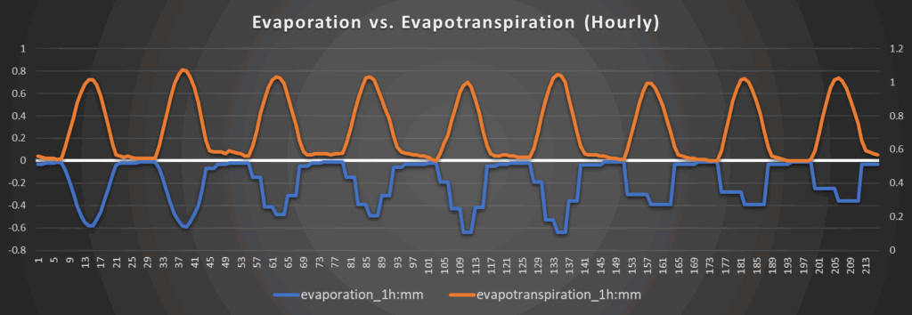
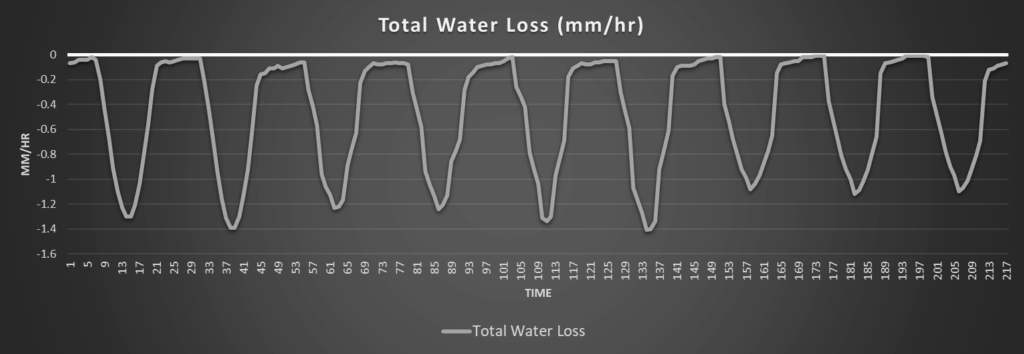
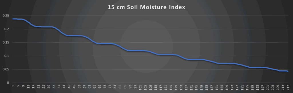
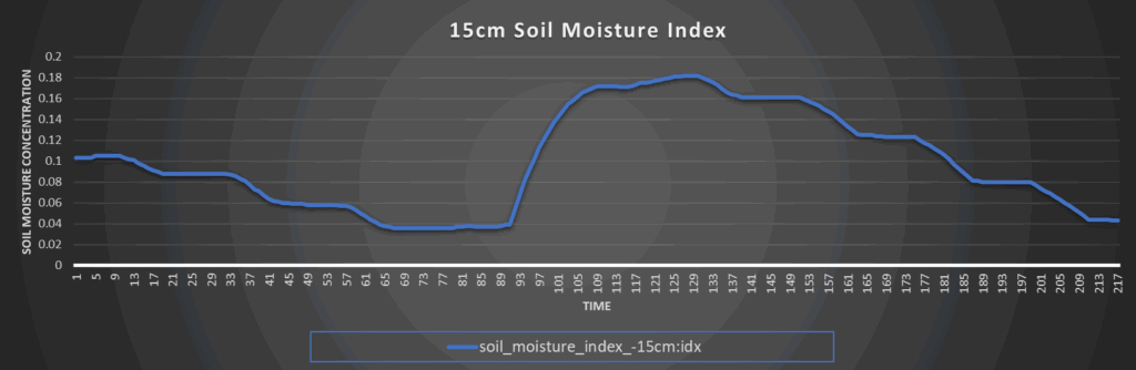
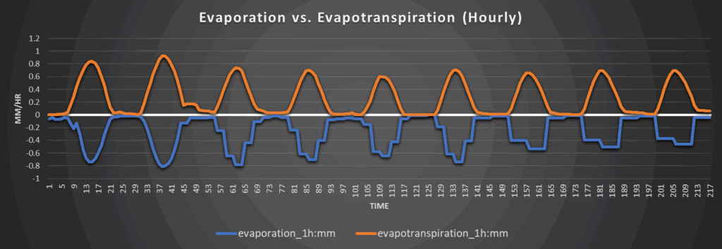
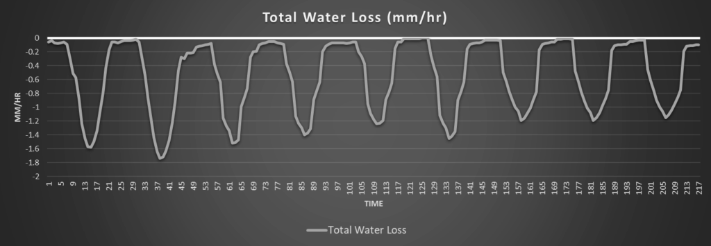
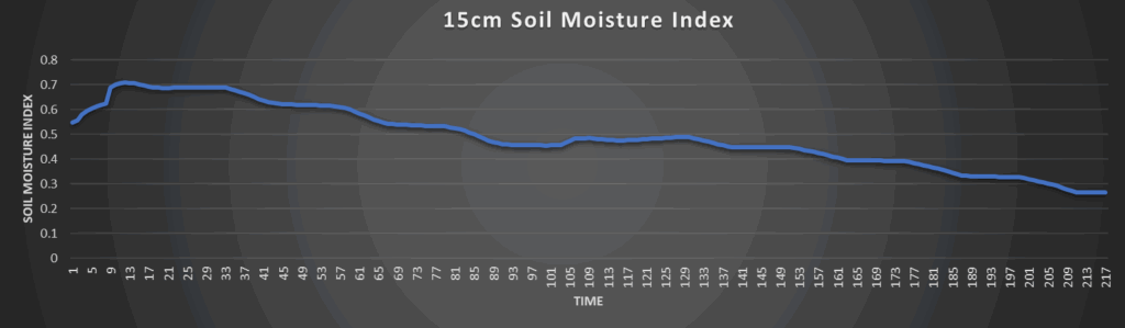
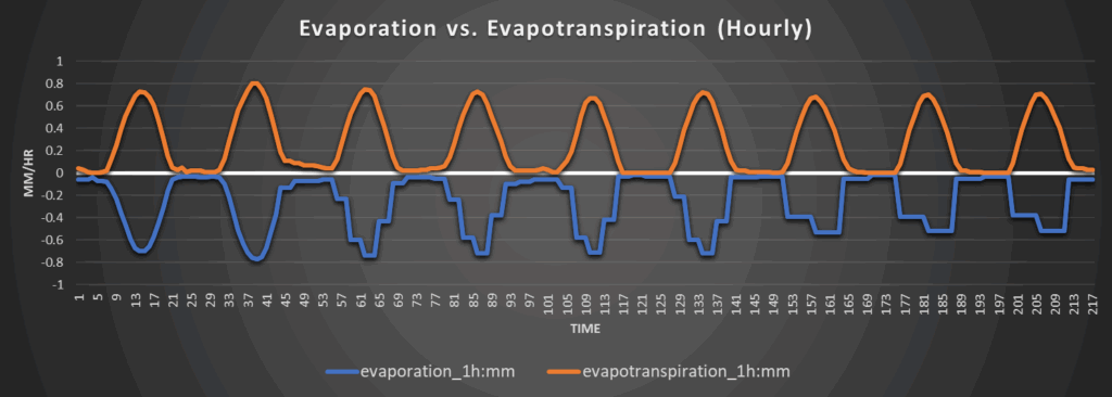
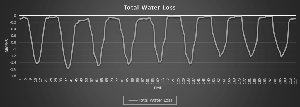
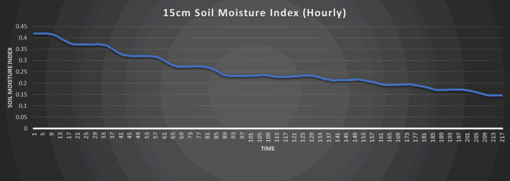
Regional Soil Moisture Outlook
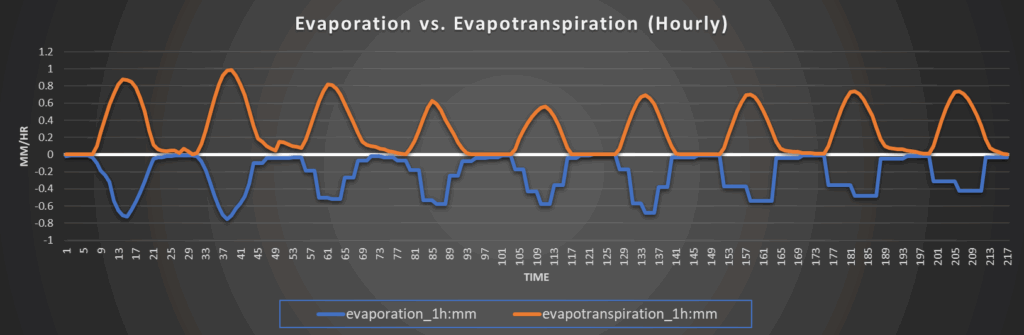
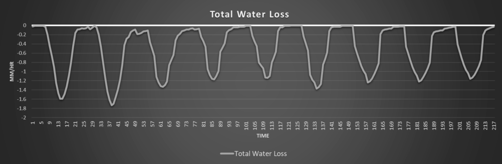
Soils will continue to dry over the coming days from the sweltering heat and lack of rainfall. Peak water loss rates will top out at around 1.3 to 1.7 mm/hr over the next couple of days, ensuring persistent rapid drying. Overall widespread soil moisture recovery is not expected at this time, with abnormally dry soil conditions becoming more common, especially in the southern half of Kansas this week.
Around Westmoreland
Around Scranton
Around Burlington
Around Altoona