Some rogue thunderstorms from the east have pushed through western Alabama into eastern Mississippi before they tuckered out a bit. There’s still some rain on the way and much of the Gulf out towards the mouth of the Mississippi will see some rougher weather this evening. Afterwards, a few showers may linger before we close out the night. Temperatures are expected to reach the mid 70s tonight with partly cloudy skies and very humid conditions.
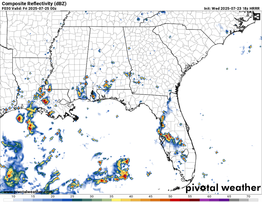
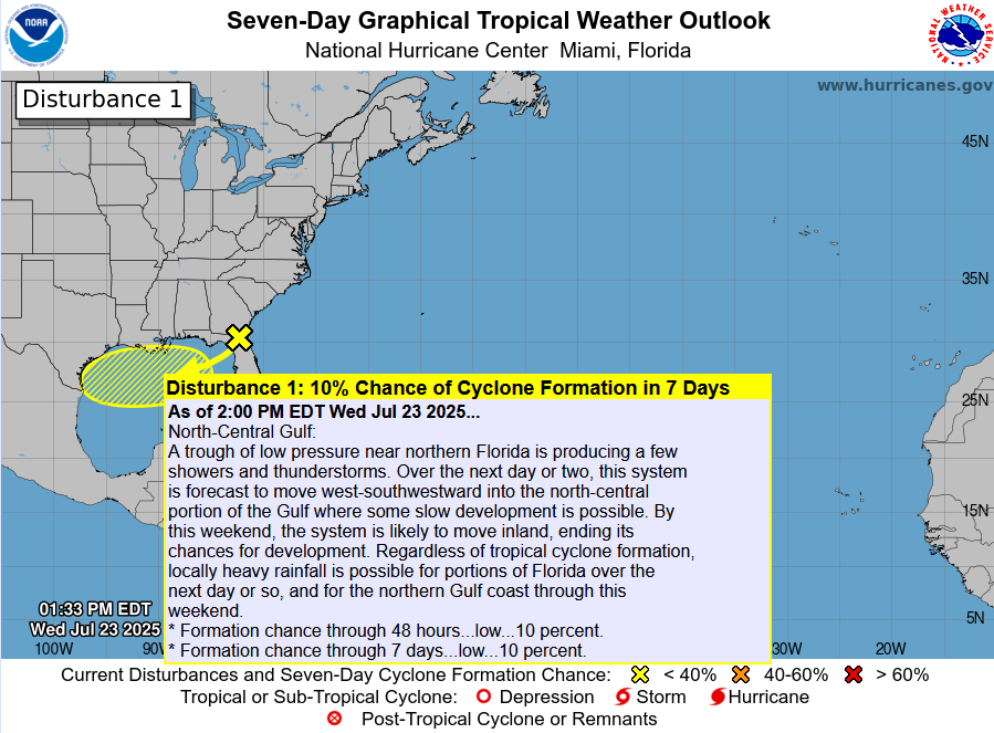
If you wondered where those storms came from, we repeat the process of last week with another tropical invest! This time it’s 95L, another system that branched off a front off the coast of the Carolinas. It’s moving further southwest and will continue it’s southwesterly track until it’s pulled north thanks to a large ridge to our west. Right now it’s a pretty broad area of rotation near the eastern panhandle of Florida, but it’ll slowly move our way in the next few days. The chances of this becoming more than a tropical invest are very low. A high pressure system is already located over the western part of the Gulf near Texas and will likely aid in keeping this system in the status that it is.
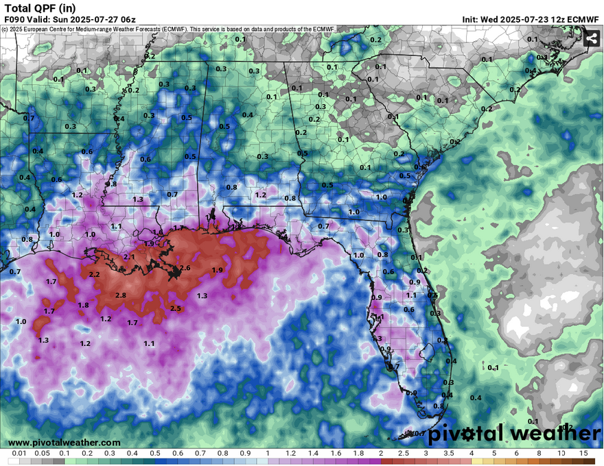
While there won’t be much for tropical weather, it’s still going to keep things soggy for us during the next few days. Rain chances are likely for Thursday-Saturday as it moves along. Chances will be higher as it moves inland Friday and Saturday as more moisture flow brings in more storms. Rainfall totals are still varied with some suggesting around 0.75″ and others over 1″ around the Pinebelt. Most of the rain will be concentrated around the Louisiana coast like last time, however. Expect some possible flash flooding in some areas.
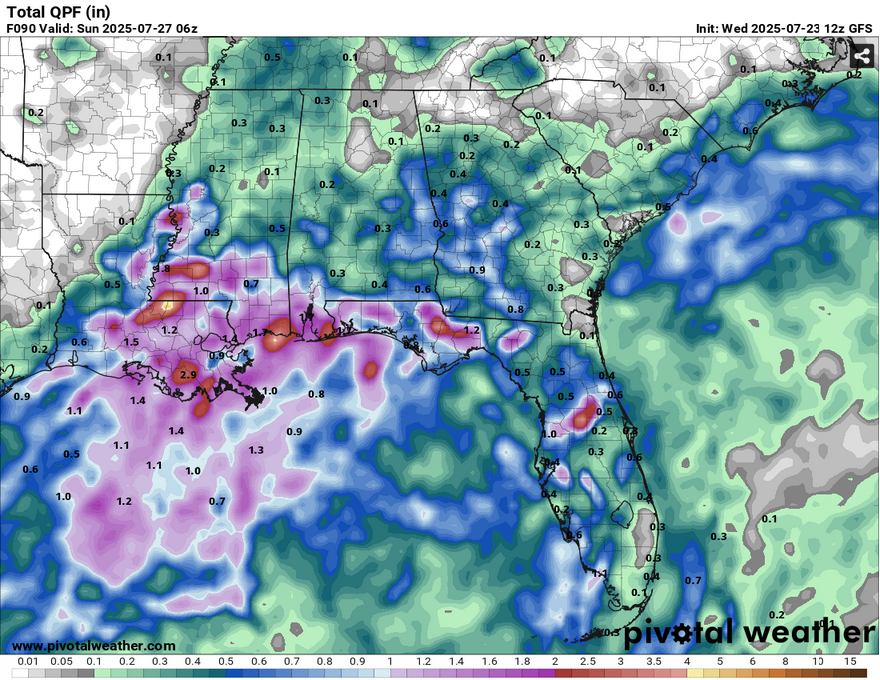
Another thing to watch out for, is of course, the heat. Despite the incoming storms, Thursday and Friday will be hot, and the NWS in Jackson has already placed a heat advisory out for tomorrow. The experienced temperature will reach the mid 100s tomorrow and near 100 Friday. Saturday will likely be hot as well before the storms roll in, so watch yourself and take care of anyone else that is sensitive to the heat in the next few days. The low temperature won’t cool us off much either as we’ll only reach the mid 70s for the next several days. Sunday will continue the heat trend after the storm dissipates and we’ll likely see temperatures in the mid to upper 90s again.
[wpcode id=”41179″]


