Hey everyone! We have a soggy start to the weekend, but a drier end of the weekend and start of next week. With the rain comes slightly cooler temperatures, but the humidity will not let down. Let’s dive into the detailed forecast:
Today’s Overall Setup
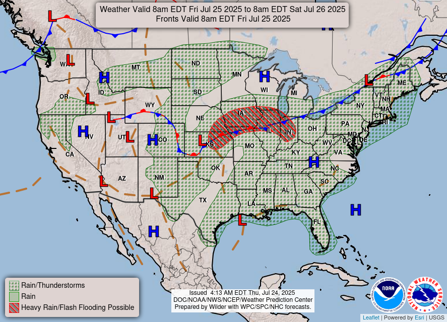

Before we look at our local forecast, it’s always important to look at the overall pattern and what’s going on throughout the entire CONUS. The forecast chart for today is looking quite messy, with a stationary front and cold front bringing rain and possible severe weather to the midwest and northeast. It is also impressively hot overall in the eastern CONUS, with our 500 mb pattern showing some intense ridging expanding today. We have a bunch of extreme heat warnings and heat advisories for those under the ridging.
Looking into our area, while there is ridging at the mid-levels, there is the tropical disturbance that is currently just a low pressure system in the northern Gulf, which is bringing us some rain for the start of the weekend. The low will slide west and away by Sunday, and some high pressure will move in. Let’s look at all of the details:

Today’s Local Forecast
Today, we are expecting more rain than sun for most of us. I wanted to zoom out from the typical zoomed in local precipitation model run, to show where this rain is coming from. Remember that tropical disturbance that we’ve been talking about? Well the moisture from that is hanging around the northern Gulf and will move into our area early this morning through the afternoon and into the evening. These showers and storms will be fairly isolated, and some models are going for less rain than the HRRR, but overall a soggy start to the weekend is likely.
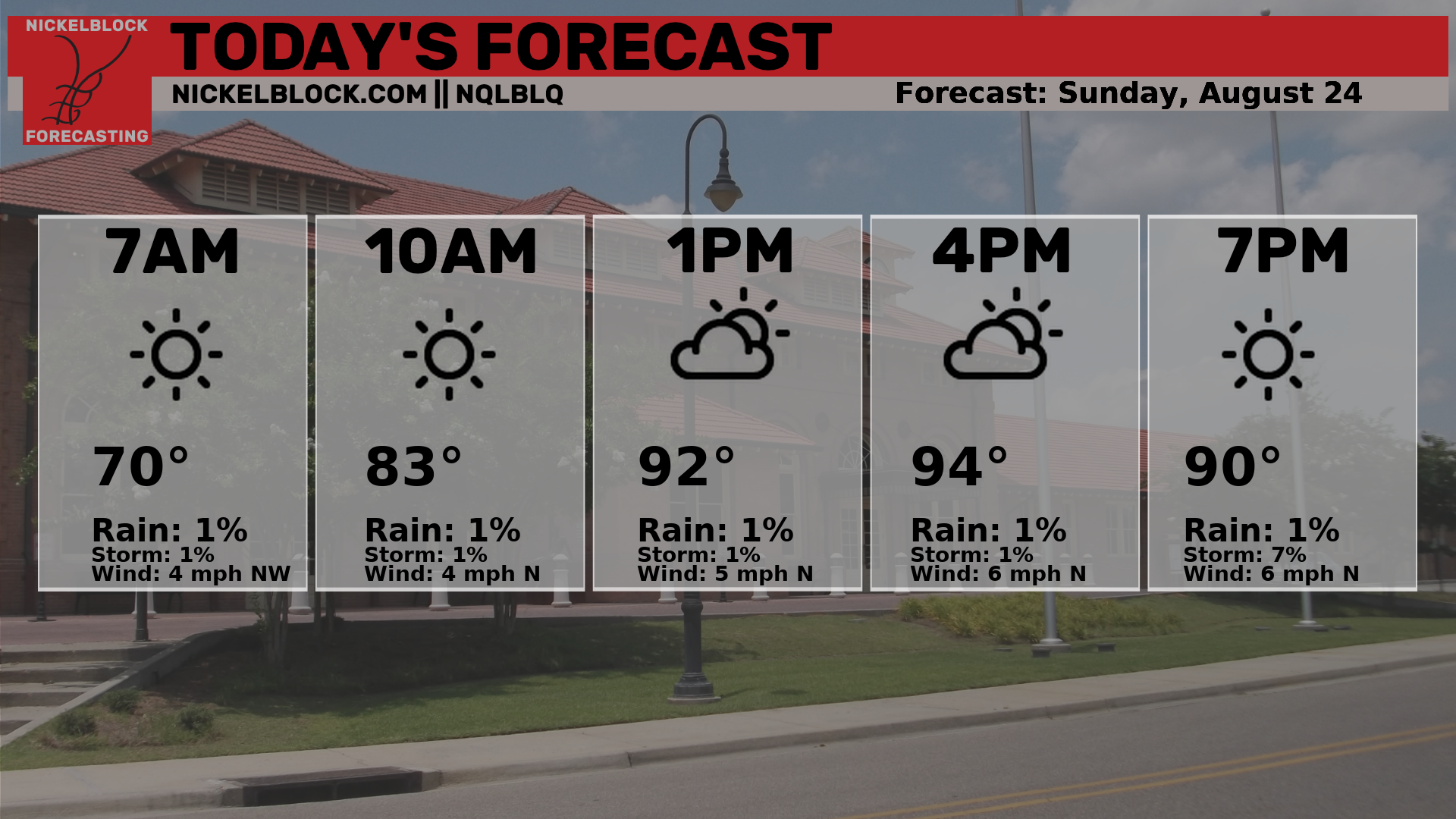
Here’s an hourly look at the forecast for today for the region.
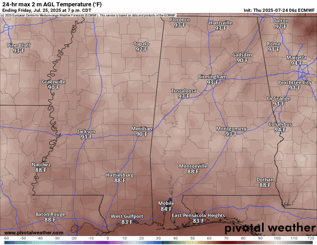
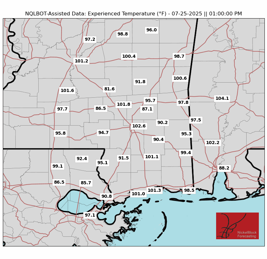
High temperatures today will be in the high 80s and low 90s. The high humidity will make it feel much warmer when it is not raining. Of course, the rain showers will temporarily cool things off, which is what the experieced temperature map is showing at 1pm.
Saturday & Sunday Forecast
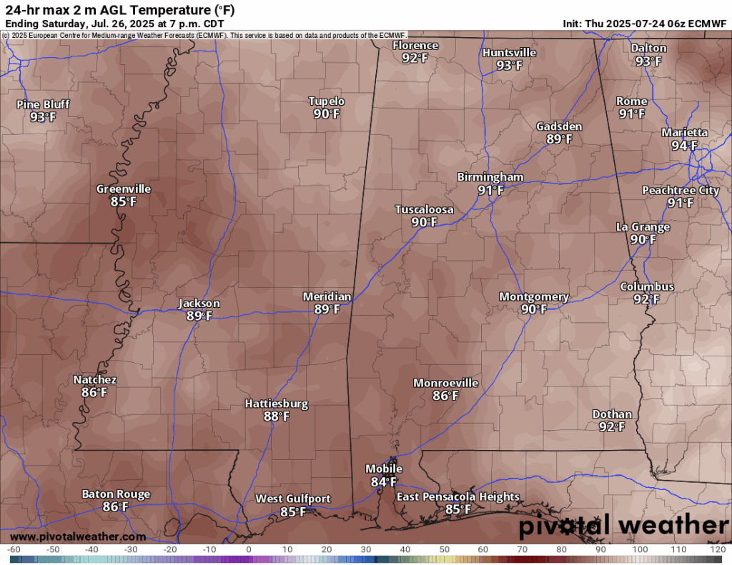
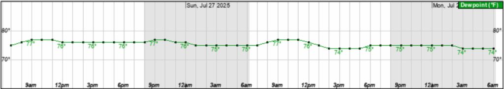
Looking into the weekend, we are expecting the rain to stick around through Saturday, which will prohibit the high temperatures from being too high. Most areas will see a high in the high 80s or very low 90s due to the increased cloud cover and periodic rain showers. Though temperatures are slightly cooler than average, it is certianly very humid out there. Dew points will stick in the mid 70s for Saturday and Sunday, making it feel very sticky.
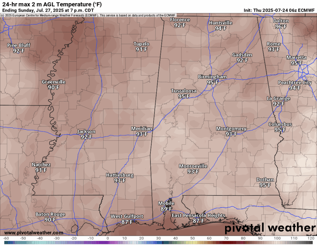
The rain continues for Saturday, which will be more of a soaker than Friday. By Sunday, high pressure moves in and keeps us mostly dry. There could be some isolated showers, but a much nicer day overall.
Extended Local Outlook

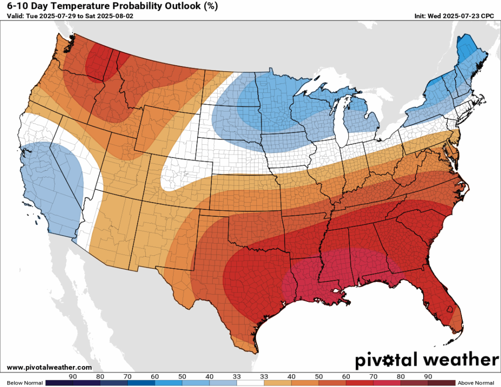
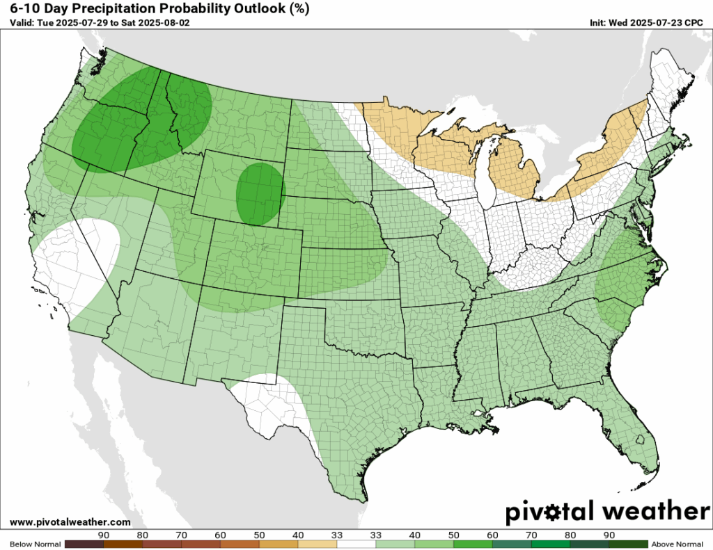
As we look ahead into late next week into next weekend, which is the first weekend in August, temperatures are looking to be very likely above average for our region. We could also see some more of the same in regards to rainfall, which is above average – but there is a low probability of that at this time.
Latest Tropical Update
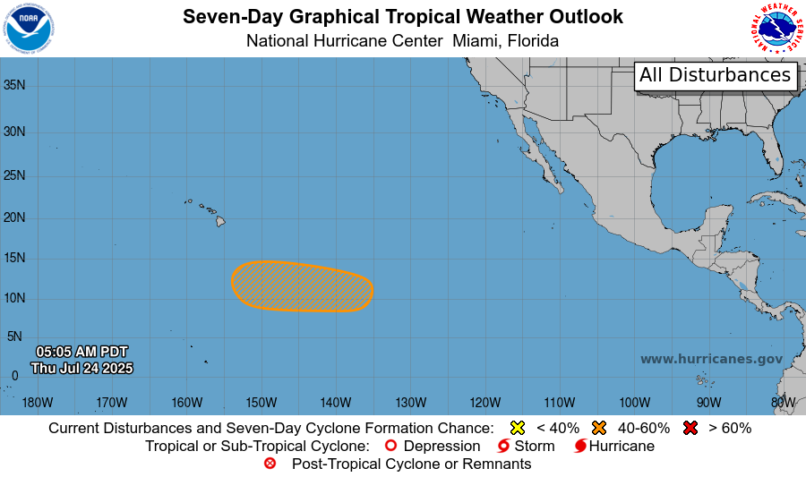
What’s going on in the tropics? There are two tropical disturbances that we are tracking, one in the Gulf and one in the eastern Pacific. In the Pacific, there is a medium chance of development in the next 7 days (40 percent). This is the closest tropical disturbance to Hawaii so far this season, but is expected to track just to the south of the Hawaiian islands.
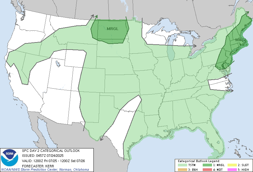
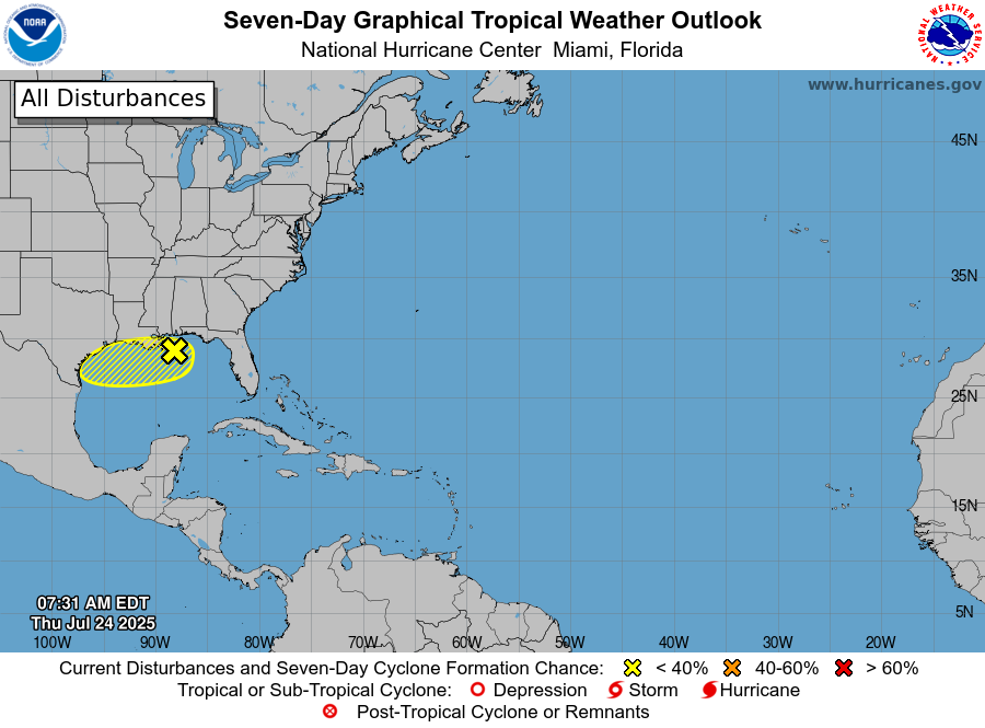
In the Atlantic, the disturbance in the Gulf has a low chance at developing (only 10 percent in the next 48 hours or 7 days). This will most likely just bring some moisture and rain to the western coastal Gulf.
Want the latest details on these systems? Check out our daily tropical updates for more in-depth information on the tropics!
REGIONAL DAY TO DAY FORECAST
Today: Mostly cloudy. Showers and thunderstorms spotty in the afternoon. Highs around 90. South southeast wind 5 to 10 mph, with gusts up to 20 mph. Chance of rain 60 percent.
Tonight: Mostly cloudy. Lows in the mid 70s. South southeast wind around 5 mph becoming calm.
Saturday: Mostly sunny. Showers and thunderstorms likely in the afternoon. Highs in the low 90s. Calm winds becoming south around 5 mph in the morning. Chance of rain 70 percent.
Saturday Night: Partly cloudy. Lows in the mid 70s. South wind around 5 mph becoming calm in the evening.
Sunday: Sunny and hot. Slight chance of showers and thunderstorms in the afternoon. Highs in the upper 90s. Calm winds becoming south southwest around 5 mph. Chance of rain 20 percent.
Sunday Night: Mostly clear. Lows in the upper 70s. Calm winds.
Monday: Sunny and hot. Highs in the upper 90s. Calm winds becoming north around 5 mph in the afternoon.
Monday Night: Mostly clear. Lows in the upper 70s.
Tuesday: Sunny and hot. Slight chance of showers and thunderstorms in the afternoon. Highs near 100. Chance of rain 20 percent.
Tuesday Night: Partly cloudy. Slight chance of showers and thunderstorms. Lows in the mid 70s. Chance of rain 20 percent.
Wednesday: Mostly sunny and hot. Scattered showers and thunderstorms in the afternoon. Highs near 100. Chance of rain 30 percent.


