Hi everyone! We are entering yet again another heatwave for the beginning of the week. Dry weather with plenty of sun will take over the skies today and tomorrow, but rain comes back in the forecast with less on Tuesday and more on Wednesday. Let’s take a look at what’s going on:
Today’s Overall Setup
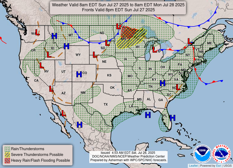
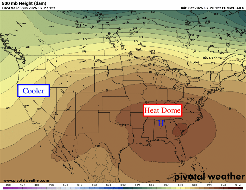
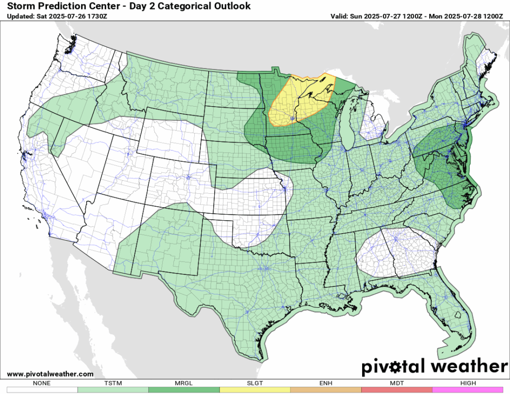
Overall, the forecast for today is mostly clear but very hot due to the intense ridge that is centered on our area currently. There is a surface high pressure that is keeping things dry for us today. The upper Midwest and mid-Atlantic regions are seeing a severe weather threat today, which you can see are areas on the edge of the ridge, known as the “ring of fire”.

Today’s Local Forecast
After the past few rainy days we’ve experienced, today is still expected to stay mostly dry! There will be a mix of sun and clouds for the whole day, with some very isolated showers or thunderstorms possibly passing through our area in the afternoon. The HRRR model shows some more than the high resolution NAM, so there could very well be no rain at all! Definitely a great day for a summer BBQ or to hang by the pool.
Here’s an hourly look at the forecast for today for the region.
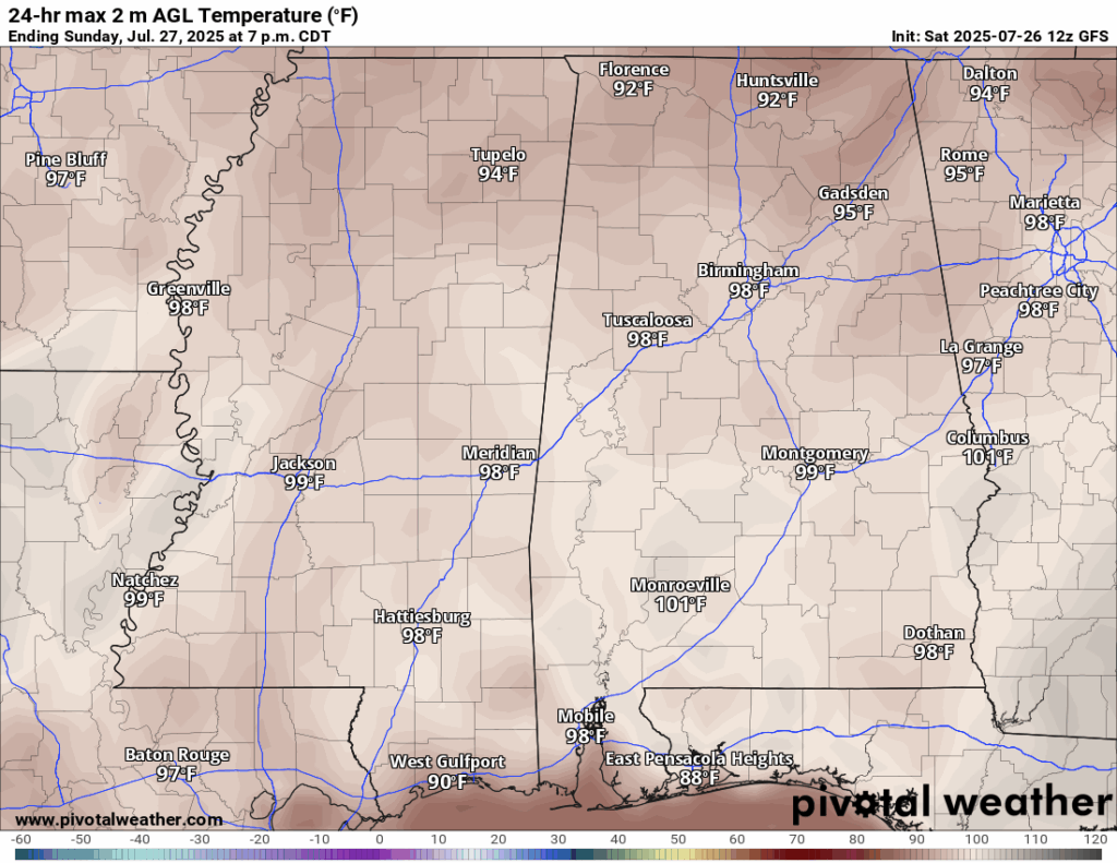
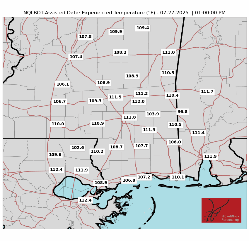
It will be quite hot outside today as temperatures are able to heat up much more than they have the past few days from the clouds and rain. High temperatures will be mainly in the mid 90s but that persistent sun and high humidity will make it feel around 110 degrees during the peak afternoon hours. Swimming will be necessary as well as plenty of bottles of water! As always on a summer day, a popup storm is always possible, so when thunder roars, go indoors and out of the pool! Enjoy the day today!
Monday-Wednesday Forecast
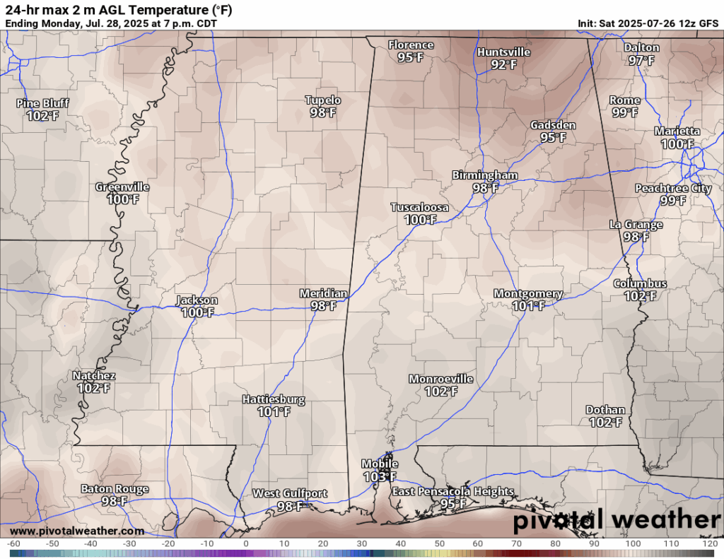
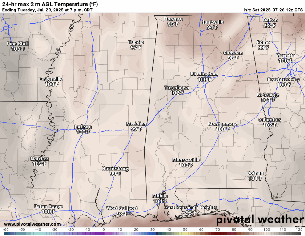
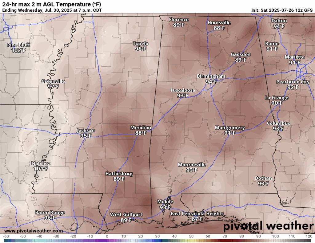
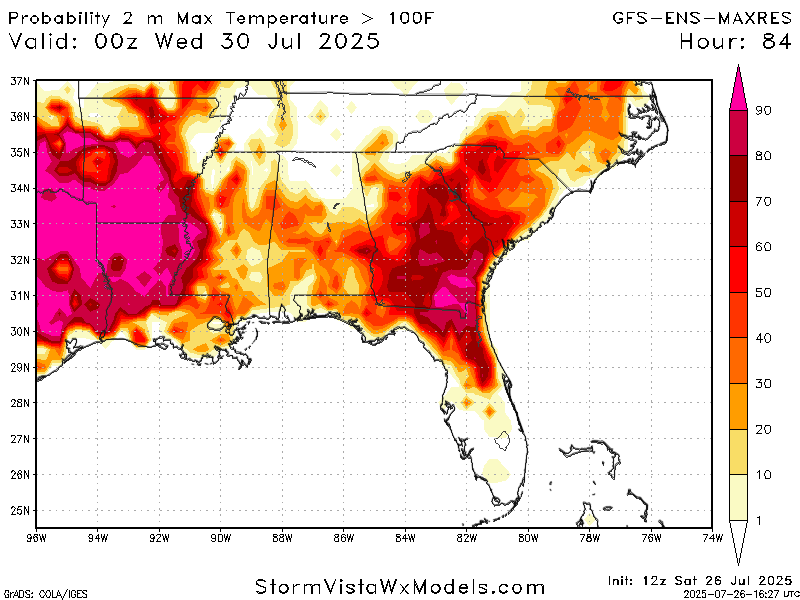
The heat does not let down for Monday, with high’s sitting around 100 degrees plus! Tuesday is a very similar story, but the chance of breaking 100 degrees is slightly less. By Wednesday, rain is back in the forecast which brings our high temperature back to a reasonable 90 degrees.
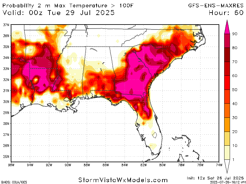
As you can see, the heat is very brutal for all of the southeast, with many areas seeing a high chance at temperatures breaking 100 degrees.
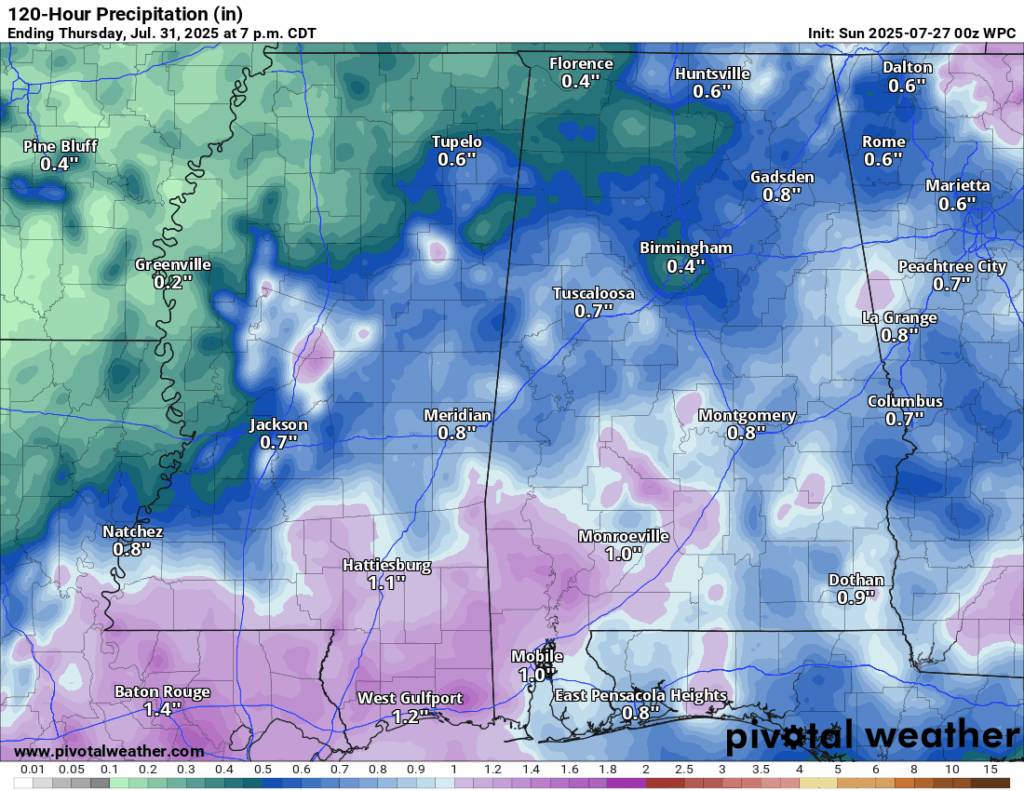
Conditions will stay clear for Monday but rain becomes more likely for Tuesday and even more for Wednesday due to an area of low pressure moving in. Around an inch or an inch and a half is expected from Tuesday to Wednesday, which is nothing we can’t handle, plus it will cool down those temperatures even slightly!
Extended Local Outlook

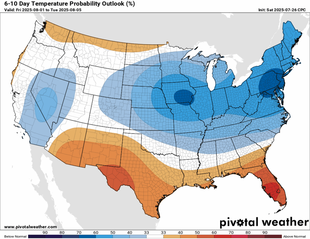
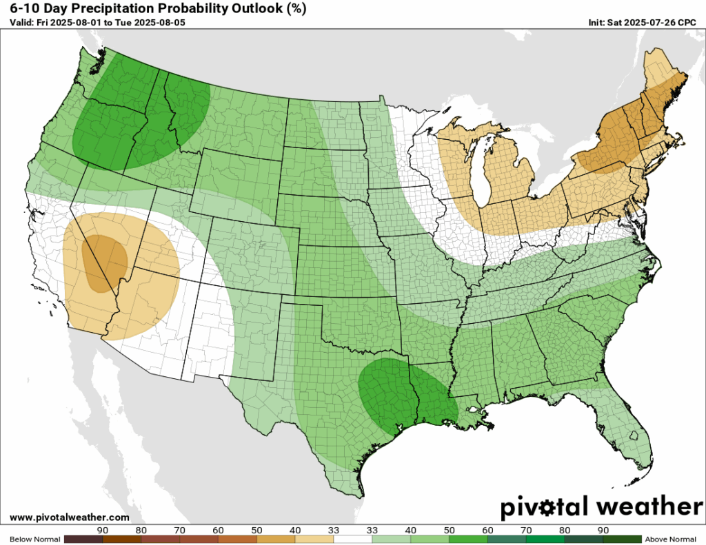
The heat dome is expected to finally weaken by next week and bring a high chance of cooler than average temperatures for most of the eastern CONUS. The southeast coast is the exception, unfortunately, so we are still looking at some above normal temperatures for next week, BUT, it is not expected to be nearing the 100s, so that is good news. We also could see some increased chance of above normal rainfall, but this is nothing we haven’t seen for a week in the summer!
Latest Tropical Update
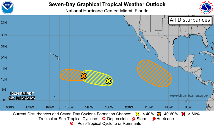
The Pacific basin has ramped back up after a little bit of a lull, with 3 areas to watch from the NHC. The two in orange do have a medium chance at developing, but the one in yellow has a low chance. I am keeping a closer eye on the right-most orange area to watch because it is not too far from the Mexican coast and both the GFS and the Euro do spin up an organized area of low pressure over the next week in that development region.
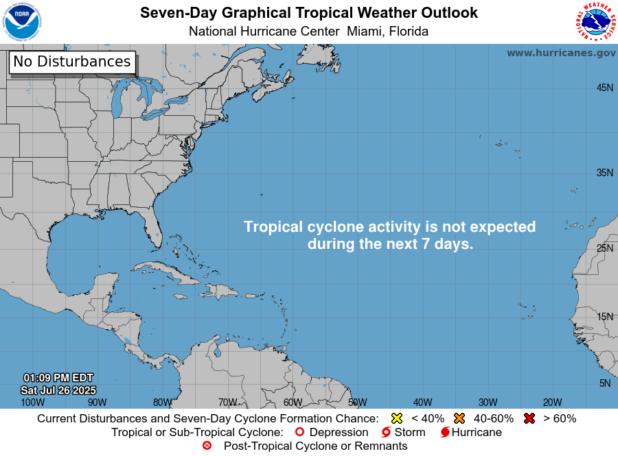
While the Atlantic does not have any official areas to watch from the NHC, we are watching the northern Caribbean for potential development. Models have been pretty consistent with an area of low pressure forming and tracking to the northwest, but we are still far out and lot’s could change.
Want the latest details on these systems? Check out our daily tropical updates for more in-depth information on the tropics!
REGIONAL DAY TO DAY FORECAST
Today: Patchy fog before 8am. Otherwise, sunny and hot. Isolated thunderstorms possible in the afternoon. Highs in the upper 90s. Calm winds. Chance of rain 20 percent.
Tonight: Mostly clear. Lows in the mid 70s. Calm winds.
Monday: Sunny and hot. Highs near 100. Calm winds becoming north northwest around 5 mph in the morning.
Monday Night: Mostly clear. Lows in the upper 70s. Calm winds.
Tuesday: Mostly sunny and hot. Scattered showers and thunderstorms in the afternoon. Highs in the upper 90s. Calm winds becoming north around 5 mph. Chance of rain 40 percent.
Tuesday Night: Partly cloudy. Chance of showers and thunderstorms. Lows in the mid 70s. Calm winds. Chance of rain 40 percent.
Wednesday: Mostly sunny and hot. Showers and thunderstorms likely in the afternoon. Highs in the low 90s. Calm winds becoming southeast around 5 mph. Chance of rain 70 percent.
Wednesday Night: Partly cloudy. Chance of showers and thunderstorms before 1am, then a slight chance of showers. Lows in the mid 70s. Chance of rain 40 percent.
Thursday: Mostly sunny. Showers and thunderstorms likely in the afternoon. Highs in the low 90s. Chance of rain 70 percent.
Thursday Night: Partly cloudy. Chance of showers and thunderstorms. Lows in the mid 70s. Chance of rain 30 percent.
Friday: Mostly sunny. Showers and thunderstorms likely. Highs in the low 90s. Chance of rain 70 percent.


