Hi everyone! Today is looking to be one of those typical summer days with clear conditions in the morning hours, followed by scattered showers and thunderstorms in the afternoon and evening. This weekend could see an increased chance of rain each day, but the pattern is expected to flip to become more dry by mid week next week, as a stalled-out boundary moves out of the region by then. Let’s take a look at what’s going on:
Today’s Overall Setup
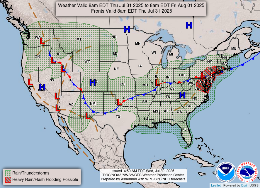
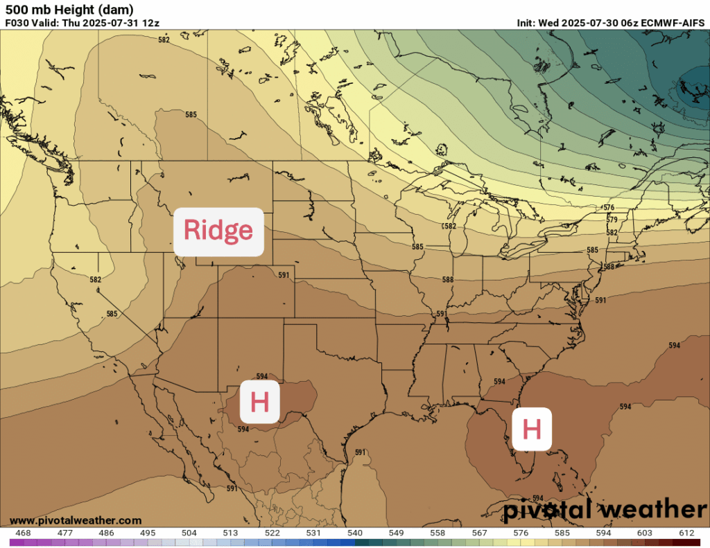
A broad upper-level ridge is in place over the western U.S., keeping things hot and mostly dry across the southwest and into parts of the northern Rockies and southwestern Canada. Meanwhile, a stalled frontal boundary draped from the Mid-Atlantic into the southern Plains is helping to trigger rounds of showers and thunderstorms, especially across parts of the southeast and Tennessee Valley.
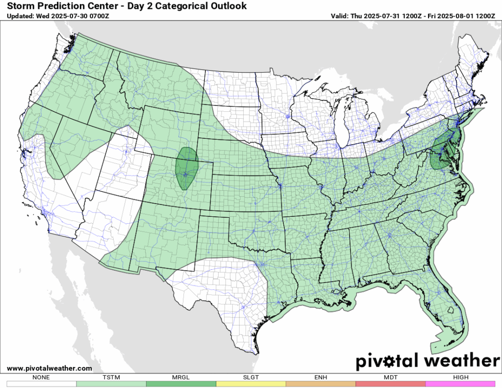
In our region, while the boundary has not yet moved over our area, the presence of it to our north combined with deep moisture and daytime heating is keeping scattered storms in the forecast today. The SPC has our region in a general thunderstorm risk today, but it’s still a good idea to stay weather aware if you’re out and about.

Today’s Local Forecast
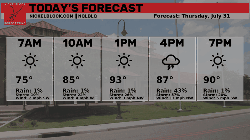
Here’s an hourly look at the forecast for today for the region.
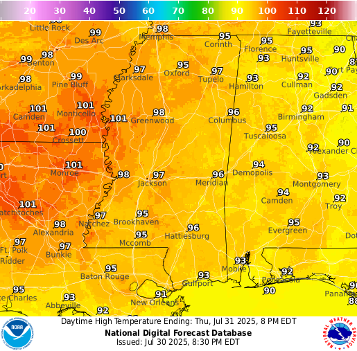
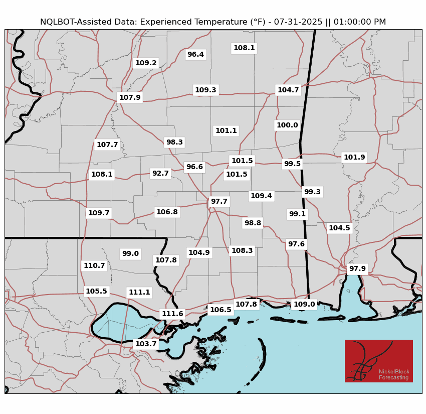
High temperatures today will be in the low-to-mid 90s with brutally high humidity, making it feel like the 100s for most of the region. When the rain comes through, you will notice temperatures cooling down for a bit, but it will only return back to the high heat! Ensure you are staying hydrated during the day!
Today, we can expect a clear morning followed by scattered showers and thunderstorms in the afternoon. Storms could fire up in the early afternoon and continue to stick around until the evening – a typical summer day pattern for the area. Today will not be a washout, so plan your day around the radar and ensure you have those NickelBlock lightning updates enabled!
Friday-Sunday Forecast
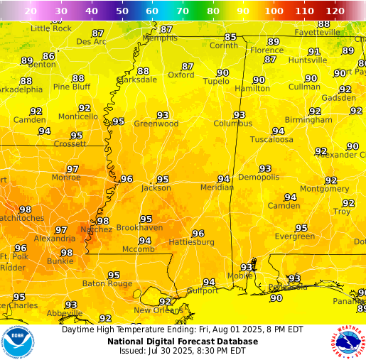
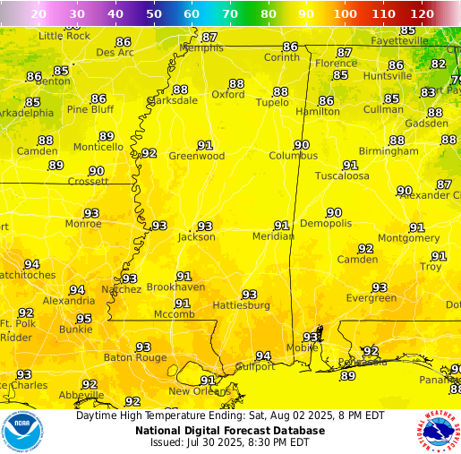
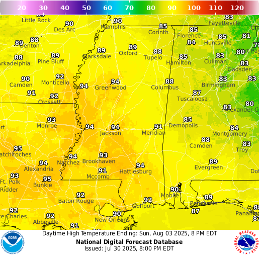
Temperatures will be in the low-to-mid 90s for Friday, low 90s on Saturday, and low-to-mid 90s on Sunday. It will be extremely humid this weekend with dew points sitting in the 70s and around 80 in some areas. That is oppresive humidity that makes it unbearable to stay outside. While the forecast is for morning sun and afternoon rain this weekend, I would reccomend staying inside whenever possible.
This weekend is looking to be more wet than dry for our region. A stalled out cold front will move southward into our area and bring with it some unsettled weather. The greatest chance of rain will be on Saturday and Sunday, but Friday will also see some as well. The pattern each day will be sunny during the morning hours and then scattered showers and thunderstorms popping up during the afternoon into the evening. As we get closer to those days, we can see from our higher resolution models where and when the most rain will fall, but this far out we could say that it will likely be a more soggy weekend than not.
Extended Local Outlook

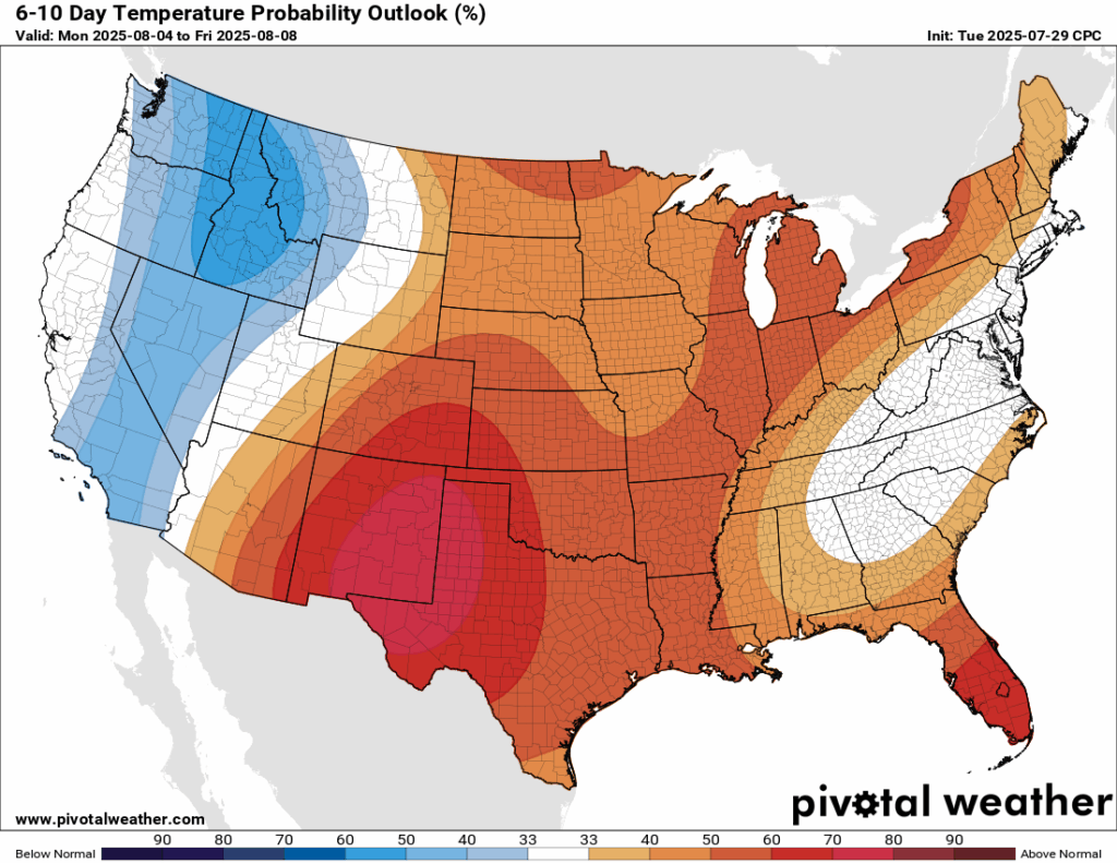
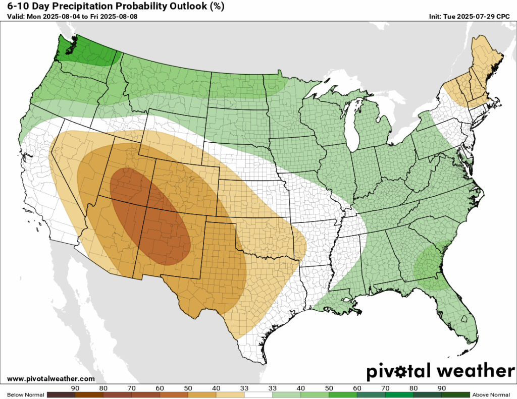
After all of the hype of the summer “cold front”, which will bring down temperatures to “only” the mid-to-high 80s in our area, above normal temperatures are back in the forecast in the next 6-10 days. Currently, the CPC has our region under a small chance of above normal rainfall for that timeframe, but it’s a low probability and under all of the ridging that will take shape, we aren’t expecting a rainy pattern for next week. Just check out the 15 day forecast above: mid-week next week into next weekend is looking to be more dry than wet!
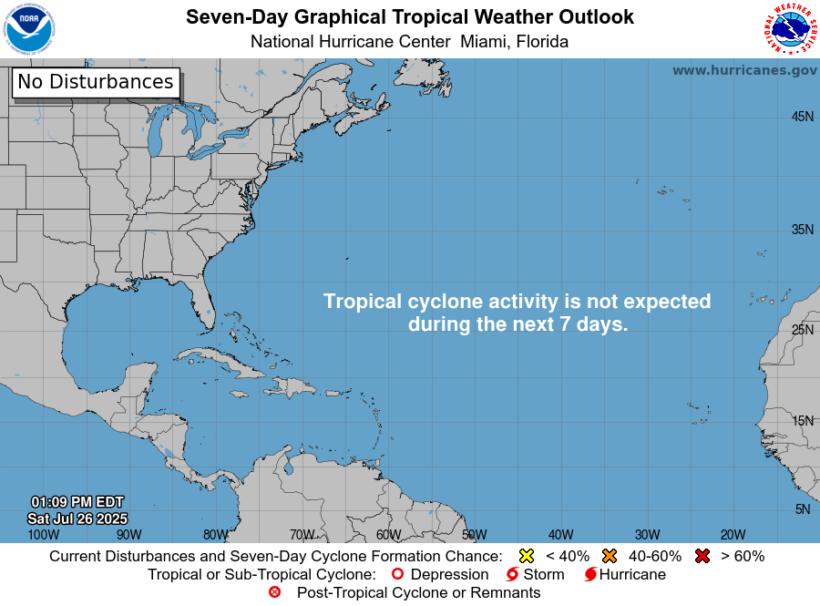
Latest Tropical Update
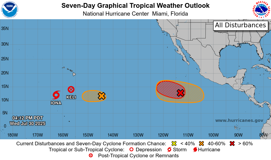
Tropical activity is heating up across the Eastern and Central Pacific. We currently have Tropical Storm Iona and the remnants of Keli south and west of Hawaii. Just behind Keli is an area to watch with a medium chance of development. Closer to Mexico, an area of low pressure has a high chance of development over the next 7 days and could become our next named storm. In the same slightly larger area, another disturbance has a medium chance of forming as it moves westward. We’ll be watching these areas closely over the coming days.
The Atlantic is quiet for now, but we are still watching closely for potential development in the Main Development Region off of Africa. Dry air and hostile winds are making it hard to develop right now, but it might move into a more conducive environment for development in the next week.
Want the latest details on these systems? Check out our daily tropical updates for more in-depth information on the tropics!
REGIONAL DAY TO DAY FORECAST
Today: Increasing clouds. Showers and thunderstorms scattered in the early afternoon. Highs in the mid 90s. Calm wind becoming west southwest around 5 mph in the afternoon. Chance of rain 60 percent.
Tonight: Mostly clear with a slight chance of showers and thunderstorms before 1am. Lows in the mid 70s. Calm wind. Chance of rain 20 percent.
Friday: Sunny and hot. Showers and thunderstorms likely after 1pm. Highs in the low-to-mid 90s. Calm wind becoming west around 5 mph. Chance of rain 60 percent.
Friday Night: Partly cloudy. Chance of showers and thunderstorms before 1am. Lows in the mid 70s. Calm wind. Chance of rain 30 percent.
Saturday: Mostly sunny. Showers and thunderstorms likely after 1pm. Highs in the mid 90s. Calm wind becoming north around 5 mph. Chance of rain 70 percent.
Saturday Night: Partly cloudy. Slight chance of showers and thunderstorms before 1am. Lows in the mid 70s. Calm wind. Chance of rain 30 percent.
Sunday: Mostly sunny. Chance of showers and thunderstorms after 1pm. Highs in the mid 90s. Calm wind becoming north around 5 mph. Chance of rain 70 percent.
Sunday Night: Partly cloudy. Slight chance of showers and thunderstorms before 1am. Lows in the low 70s. Calm wind. Chance of rain 20 percent.
Monday: Mostly sunny. Chance of showers and thunderstorms in the afternoon. Highs in the low 90s. Calm wind becoming south around 5 mph. Chance of rain 50 percent.
Monday Night: Partly cloudy. Slight chance of showers and thunderstorms. Lows in the low 70s. Calm wind. Chance of rain 20 percent.
Tuesday: Mostly sunny. Showers and thunderstorms likely. Highs in the low 90s. Chance of rain 60 percent.


