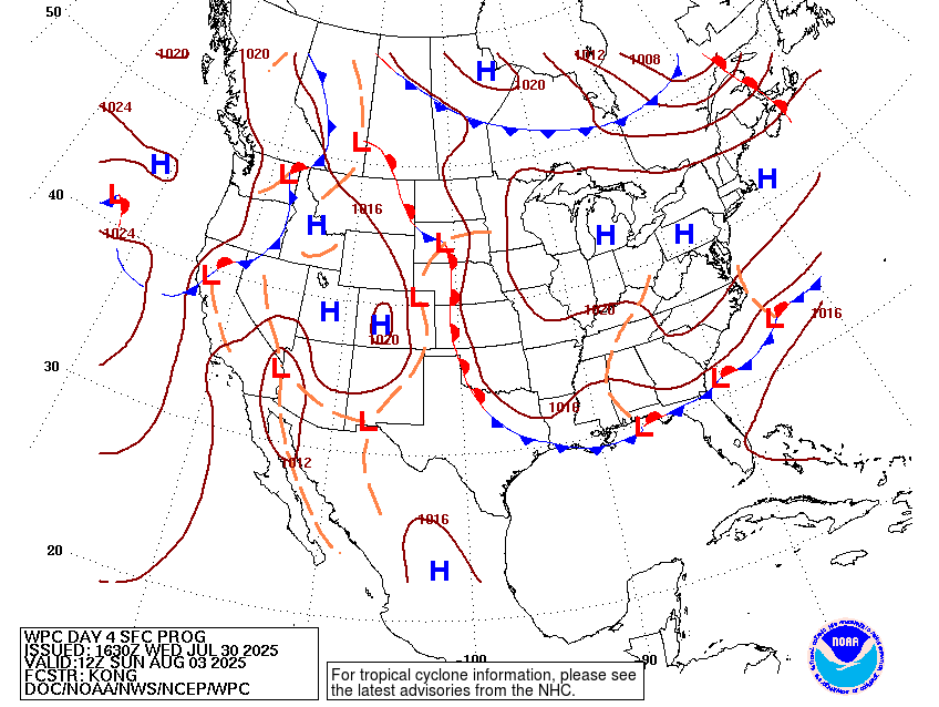
The rain definitely hung around yesterday and into the morning time. The front I mentioned back on Sunday is slowly making its way down. A large area of high pressure is taking over near the Midwest and forcing the front towards the Southeast. And of course, that means, a bunch of rainy days ahead. And also heat, the heat for south Mississippi summers never goes away.
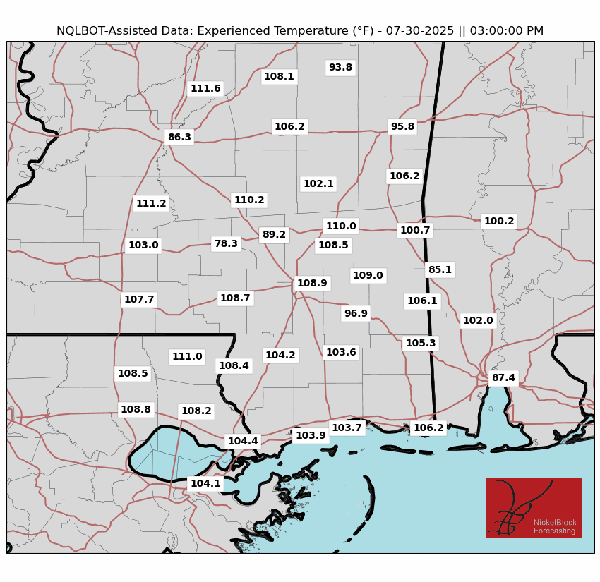
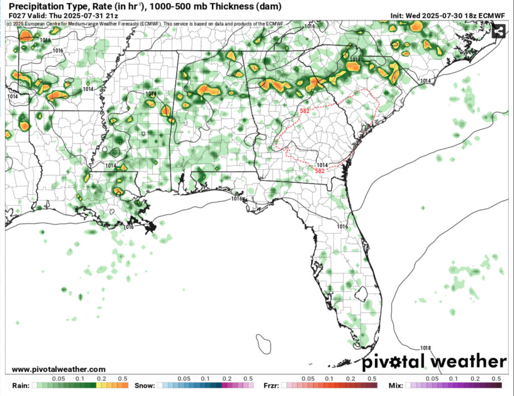
Thursday and Friday look to be our hottest days as temperatures reach the mid 90s and the feels-like temperature is going to be much hotter. How hot? Try around 105, or even hotter! Needless to say it’s going to be miserable outside until the rain comes later. We’ll be waiting on the rounds of storms to move in from the north. The first two will be a bit more hit or miss since the front is much further north, however we’ll likely see some pop-up thunderstorms along with more dynamic ones in the mix. Patchy fog is also possible due to the calm wind tonight. Some storms may linger into the overnight hours.
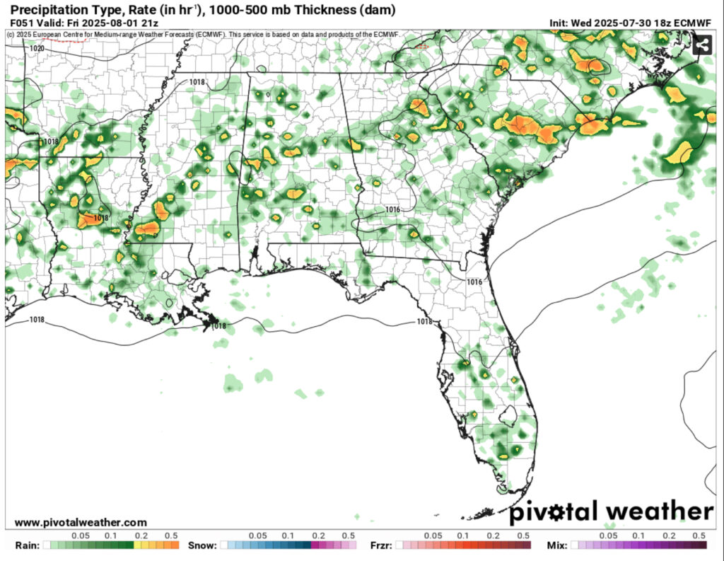
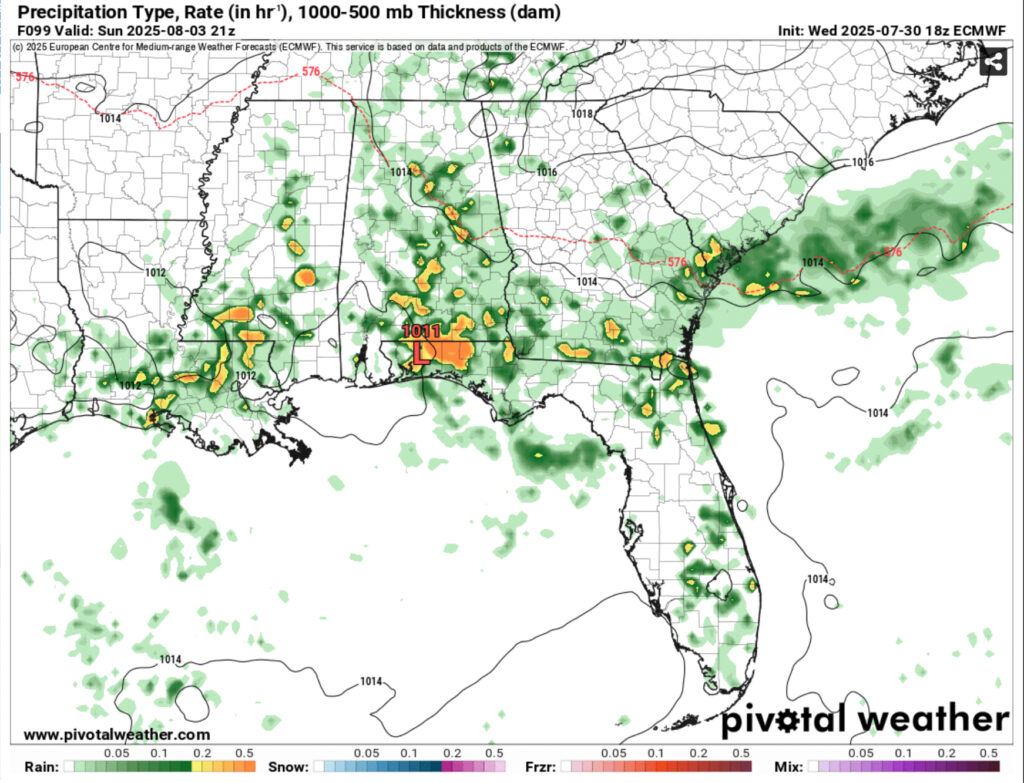
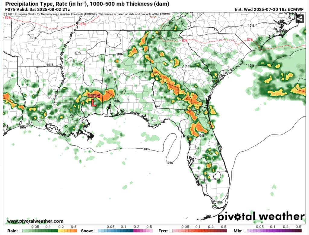
Saturday is when the front makes its way past the Arkansas/Louisiana border and the rain chances become more potent. More cloud cover is expected during the day reducing some of the heat, but we’ll still see indices reaching around 100. Expect some heavier rain during the day mixed with thunderstorms. Sunday will be a similar story as the front hits the coastline, however it will stall and keep the rain chances on us next week. Highs will be in the low 90s and winds from the north and north northwest.
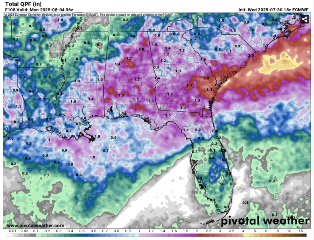
I would keep your umbrella handy and have sunscreen at the same time for the rest of the week. It’s a frustrating one, I know, considering the past couple of weekends have been plagued with thunderstorms, but this has held off some of the overbearing heat that we usually feel this time of year. Hope you all have a good weekend!


