Hi everyone! Dangerous heat is expected today with temperatures in the mid-to-upper 90s. Also, there will be some scattered thunderstorms in the afternoon today, and a cold front will slide down into our area this weekend, bringing with it more frequent rain. Let’s take a look at what’s going on:
Today’s Overall Setup
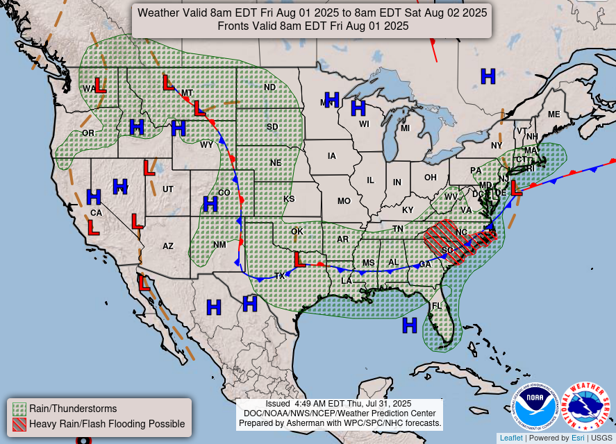
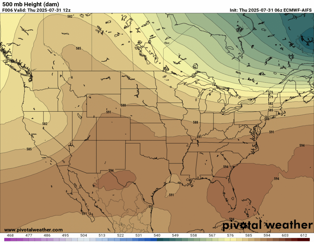
A cold front is making it’s way south into our region today, but we will feel the effects of it on Saturday and Sunday. As the front stalls out by Sunday, it will stick around for Monday and Tuesday next week, bringing the chance of rain each day. The ridge that we can see from the 500 mb heights chart will move to the east into our region by the middle of next week, which will bring drier and warmer weather with it.
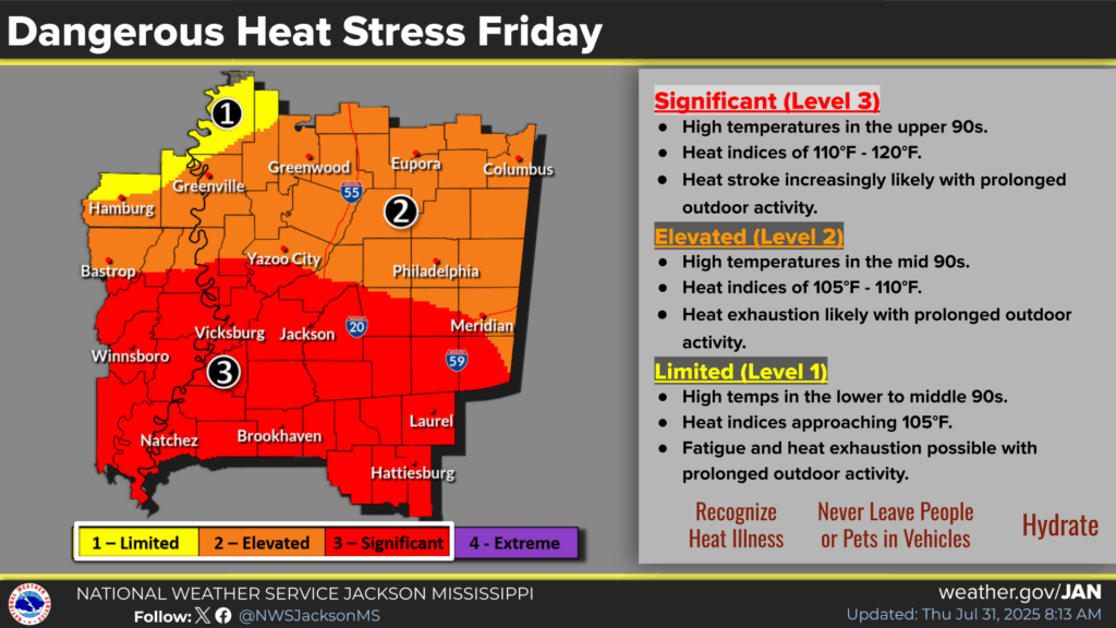
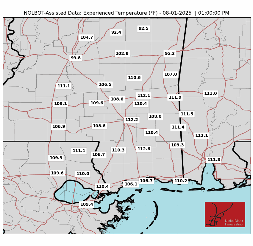
Dangerous heat is expected today, with most of our area under a Significant (Level 3/5) threat of dangerous heat. This means that temperatures will be in the mid-to-upper 90s and heat indices will be in the 110s. Heat-related illness could be an issue today, so ensure you do not spend too much time outside.

Current Conditions

Here’s a look at the current temperatures and heat indices.
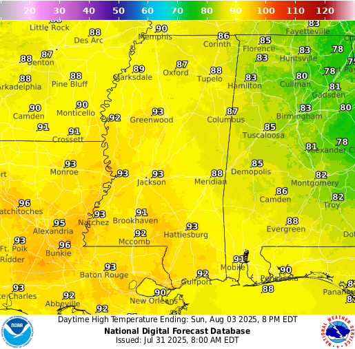
Today’s Local Forecast
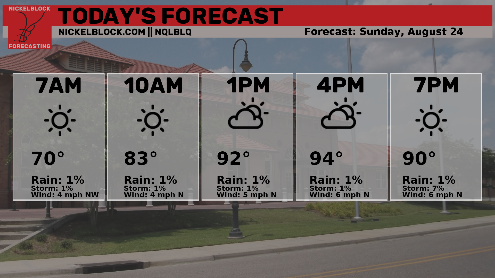
Here’s an hourly look at the forecast for today for the region.
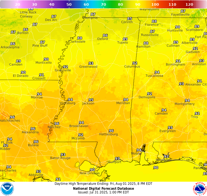
Temperatures today will be in the mid 90s, which will feel like the 110s with the high humidity. Staying hydrated is extremely important during this extreme heat, as well as limiting outdoor activity as much as possible during the peak afternoon hours.
The morning starts off fairly clear today, but clouds will fill in as isolated showers and thunderstorms pop up in the afternoon. It will be a good morning to get some outdoor plans completed, but ensure you stay cautious with the heat and stay aware of the storms by the afternoon hours. These will continue into the evening and we could see some frequent lighning with them. Ensure you are checking the NickelBlock radar and stay indoors when you hear thunder!
Saturday & Sunday Forecast
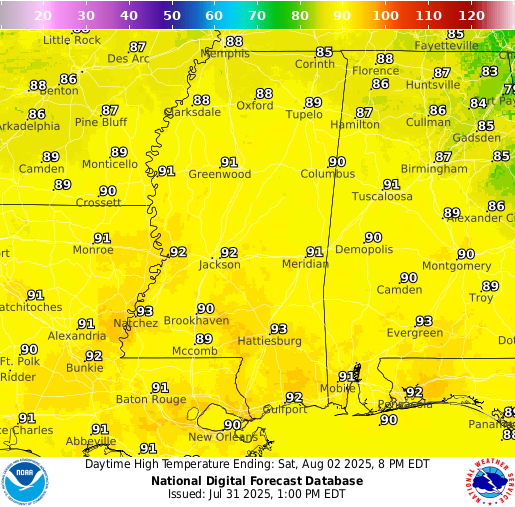
High temperatures on Saturday will be in the low 90s, given that forecasted rain will cap temperatures from becoming too high. Sunday, high temperatures will be similar to Saturday’s, but could be a little higher given the decrease in cloud cover.
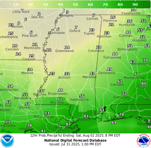
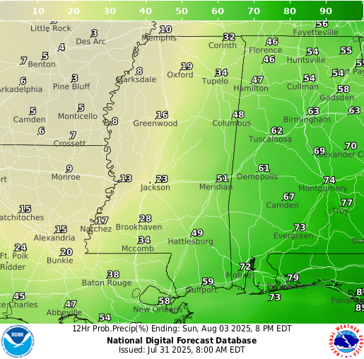
This weekend is looking to be a soggy one. While only around an inch of rain will fall generally in our area, each day will see increased cloud cover and rounds of showers and thunderstorms. Saturday is looking to be the day with the most rain for most of us, with a higher chance of rain the further south you are. On Sunday, the chance of rain goes down, and a lot of the cloud cover will clear up, but the presence of the stationary front will make a few showers certainly possible in the afternoon.
Extended Local Outlook

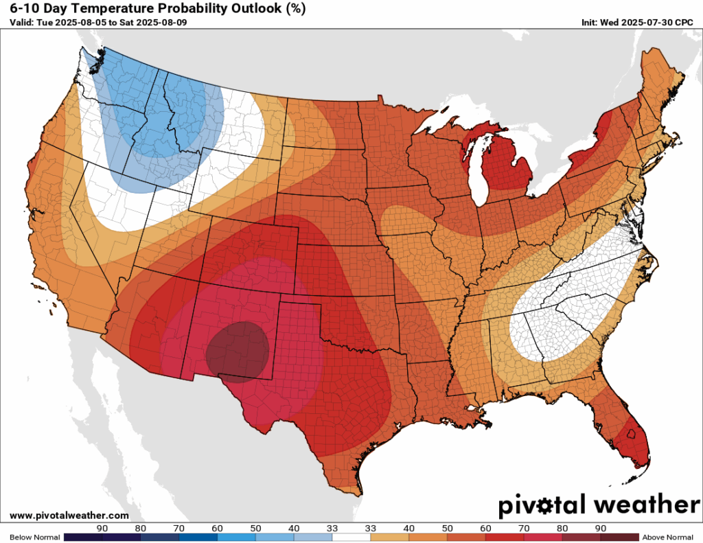
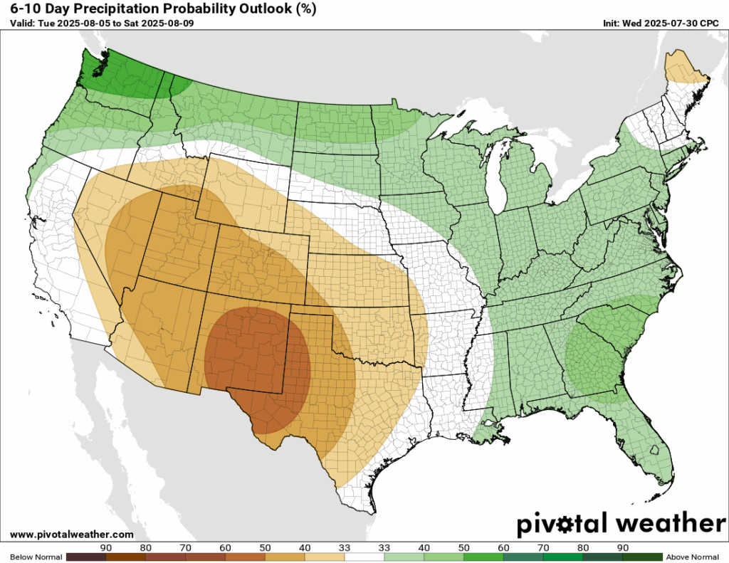
After our temporary “cooldown”, temperatures are expected to become back to above normal in the 6-10 day timeframe. We could also see a small chance at above normal rainfall, but the large-scale pattern will be more conducive to dry weather! Notice how the areas on the map in the dark red (high probability for above normal temperatures) and the areas in the dark orange (high probability of below normal rainfall) line up, indicating that there will be a large ridge that takes shape. The overall downward forcing will prohbit any rain and make it very hot there!
Latest Tropical Update
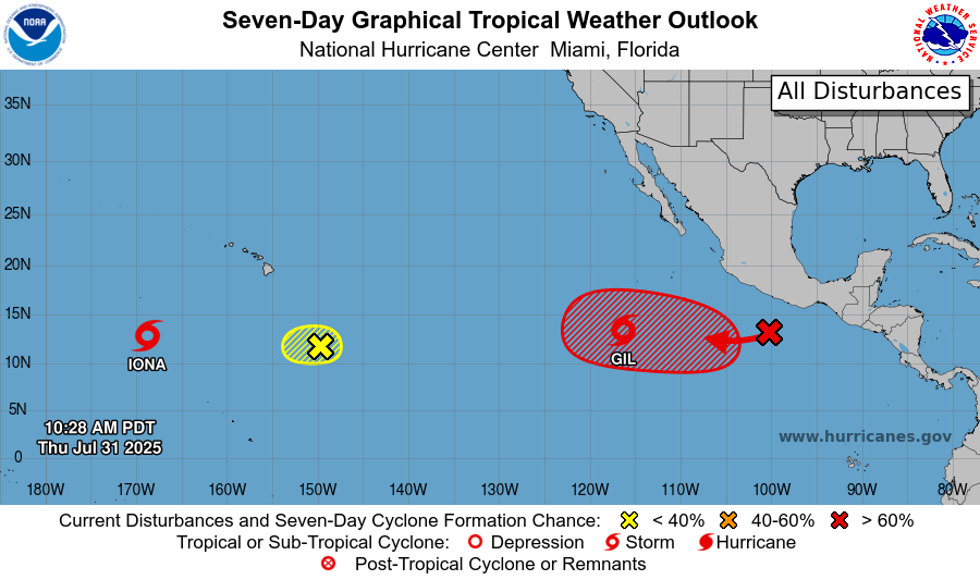
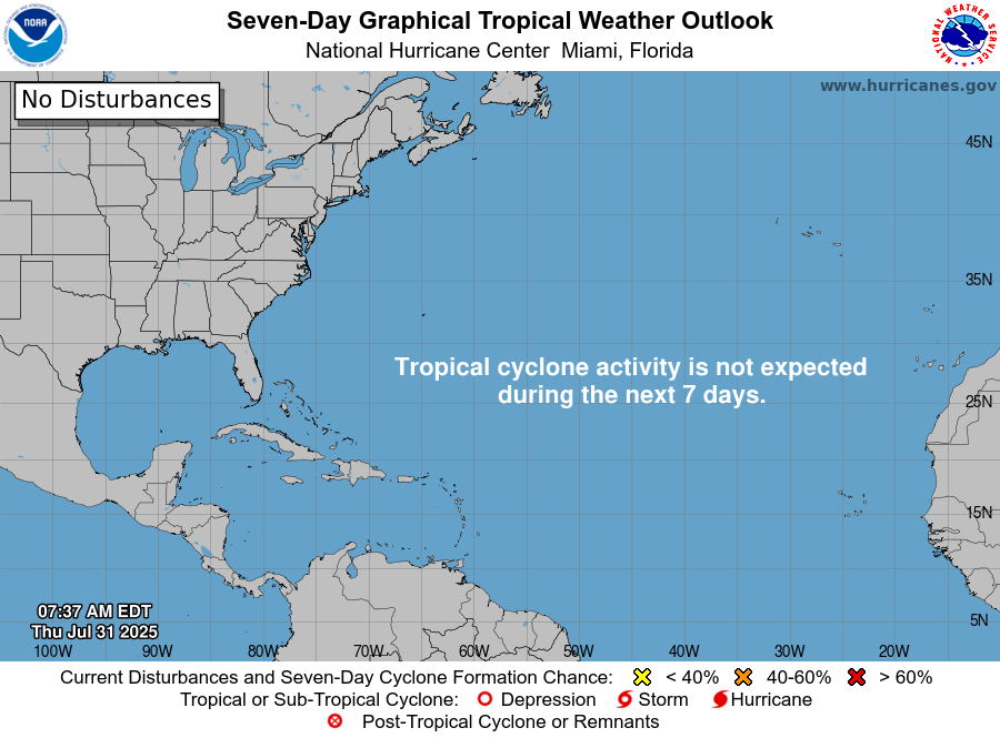
The Eastern/Central Pacific Basin is quite active at the moment. We have Tropical Storm Iona winding down as it travels to the open waters of the Central Pacific, Invest 92C becoming less favorable for development, newly named Tropical Storm Gil, and another area to watch in the same area as Gil. The Atlantic is quite for the next 7 days, but a potential development is possible off of Africa in the next week. Yes, there’s a lot going on. But we have details on each system in our tropical update!
Want the latest details on these systems? Check out our daily tropical updates for more in-depth information on the tropics!
REGIONAL DAY TO DAY FORECAST
Today: Sunny in the morning, becoming mostly cloudy. Showers and thunderstorms possible after 1pm. Highs in the mid-to-upper 90s. Calm wind becoming north northwest around 5 mph. Chance of rain 60 percent.
Tonight: Partly cloudy. Chance of showers and thunderstorms before 1am. Lows in the mid 70s. Calm wind. Chance of rain 30 percent.
Saturday: Mostly sunny. Showers and thunderstorms likely after 1pm. Highs in the low 90s. Calm wind becoming north around 5 mph. Chance of rain 70 percent.
Saturday Night: Partly cloudy. Slight chance of showers and thunderstorms before 1am. Lows in the low 70s. North wind around 5 mph becoming calm. Chance of rain 20 percent.
Sunday: Decreasing clouds. Sunny with a chance of showers and thunderstorms after 1pm. Highs in the low 90s. Calm wind becoming north around 5 mph. Chance of rain 50 percent.
Sunday Night: Mostly clear. Lows in the low 70s. Calm wind.
Monday: Mostly sunny. Chance of showers and thunderstorms in the afternoon. Highs in the low 90s. Calm wind becoming east around 5 mph. Chance of rain 50 percent.
Monday Night: Partly cloudy. Slight chance of showers and thunderstorms before 1am. Lows in the low 70s. Chance of rain 20 percent.
Tuesday: Mostly sunny. Showers and thunderstorms likely. Highs in the low 90s. Chance of rain 60 percent.
Tuesday Night: Mostly clear. Slight chance of showers and thunderstorms. Lows in the low 70s. Chance of rain 20 percent.
Wednesday: Mostly sunny. Chance of showers and thunderstorms. Highs in the low 90s. Chance of rain 30 percent.


Thank you for providing controls on the videos. Makes it easy to see what is going on at a certain time.
Of course, Charles. Thank you for the feedback!