General Central/Eastern Kansas Forecast
Short-Term (Friday-Saturday)
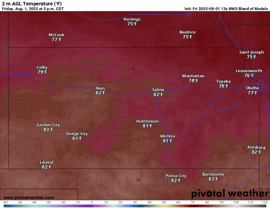
Temperatures today and tomorrow will be largely the same across the region, with high temperatures in the upper 70s to low 80s and low temperatures falling to the upper 50s to mid 60s. Winds will be easterly today at around 5 to 10 mph before becoming southeasterly tomorrow at 5 to 10 mph. Overall, conditions will remain dry across the region today and tomorrow, save for the possibility of scattered showers moving into north-central Kansas tomorrow morning (north of I-70 and west of K-99) at around 7am, ending by 1pm. Other than that, today and tomorrow will be another cool, pleasant day across central and eastern Kansas.

Long-Term (Sunday-Thursday)
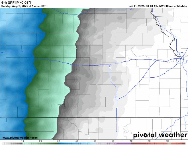
Chances for scattered showers and thunderstorms look to return Sunday-Monday across the region, as we get some small-scale mid-level disturbances traverse across the state. No severe activity is currently anticipated with these storms, with only isolated locally heavy rainfall being a nuisance. Storms look to develop near I-135 Sunday morning and slowly move eastward throughout the day before shutting down Sunday night into early Monday morning.
Dry conditions will follow this beginning on Monday, as well as temperatures slowly creeping higher again, as high pressure begins to set in over the state. Temperatures will eventually make it back into the upper 80s to mid 90s by next Thursday, returning us back to seasonal conditions.
Drought Update
Drought conditions saw widespread improvement across north-central to northeast Kansas over the past week from the periods of heavy rainfall. With the cooler temperatures and sporadic chances for rain over the next few days, expect no new drought concerns or areas of abnormally dry conditions to set in across our region.


Regional Soil Moisture Outlook
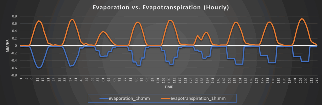
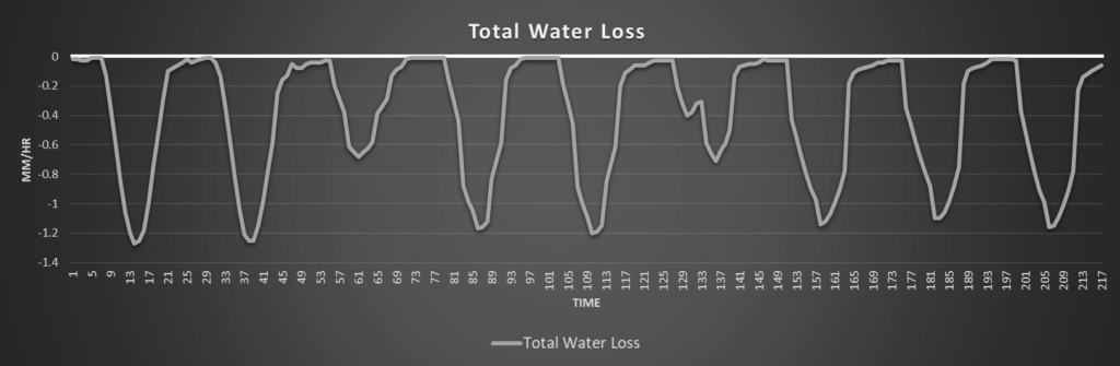
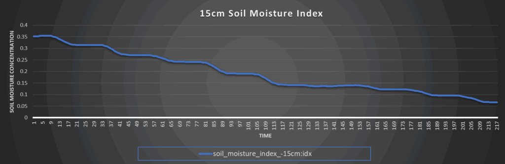
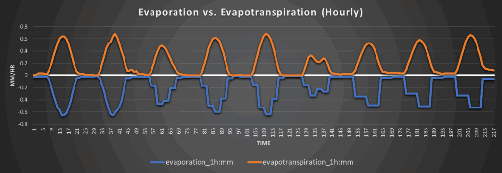
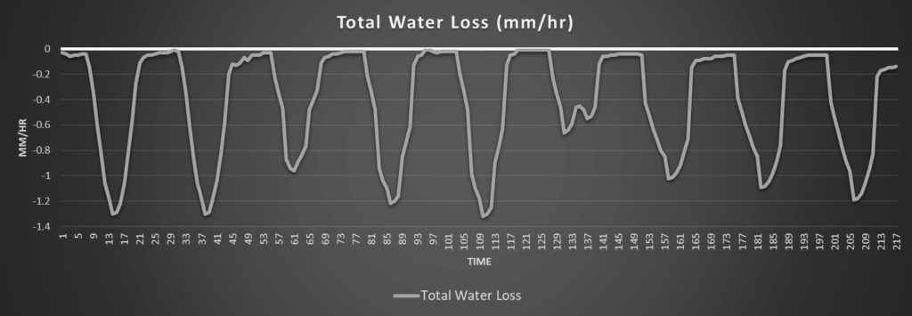
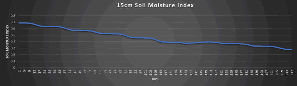
Around Westmoreland
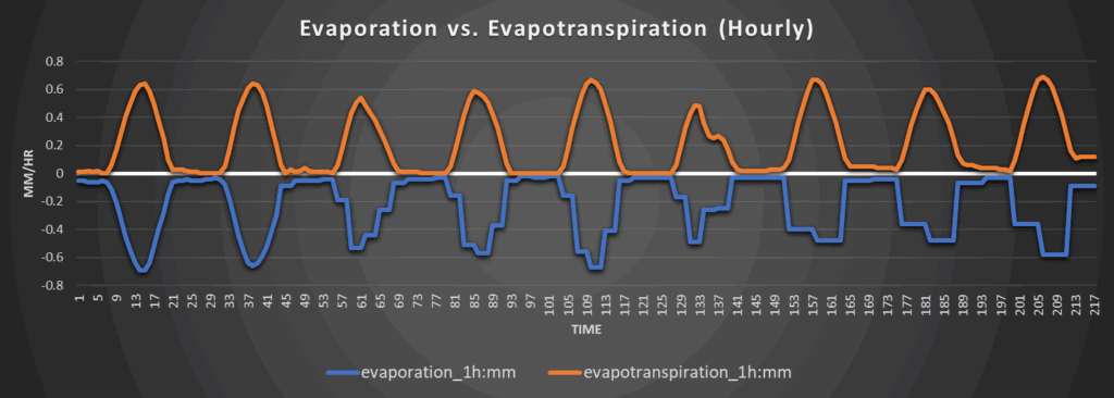
Around Scranton
Around Burlington
Around Altoona