Hi everyone! The typical summer pattern will play out today for our region, morning sun followed by isolated afternoon thunderstorms and sun in between them. The start of the weekend is looking to be quite the same. Let’s take a look at what’s going on:
Today’s Overall Setup
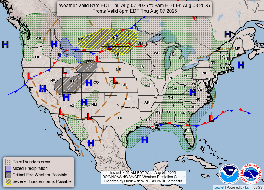
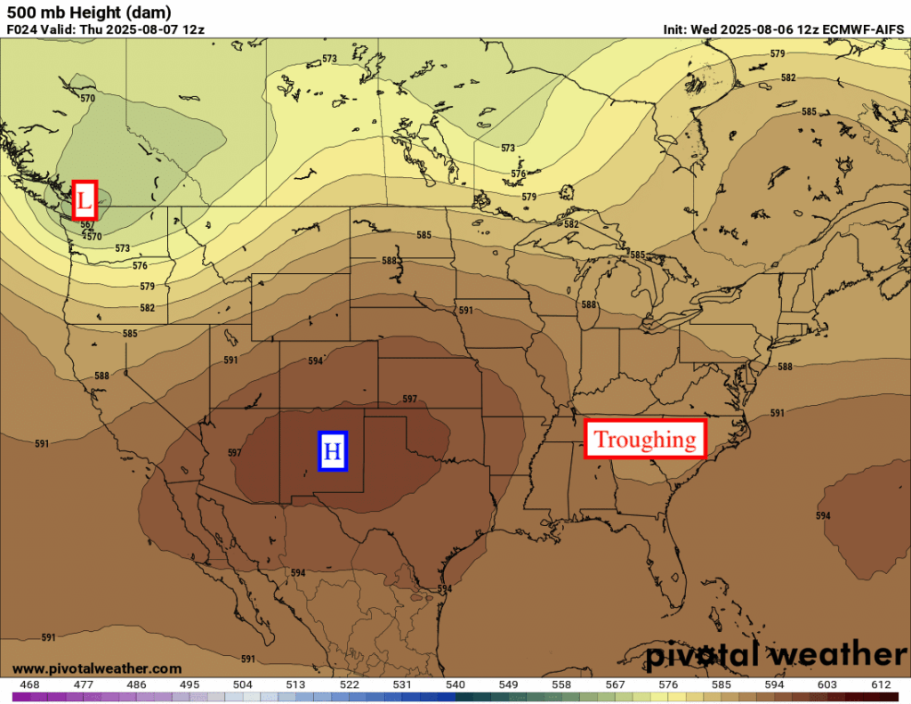
Looking at the National Forecast Chart, there is some severe weather potential in the northern Plains and in eastern Montana, fire weather possible in NV, UT, and WY, as well as a chance of some snow/rain in the mountains in the northern Rockies. All of this unsettled weather is occuring at the edge of the high pressure ridge that is stationed over the southwest, in between the ridge and the low pressure trough in the northwest.
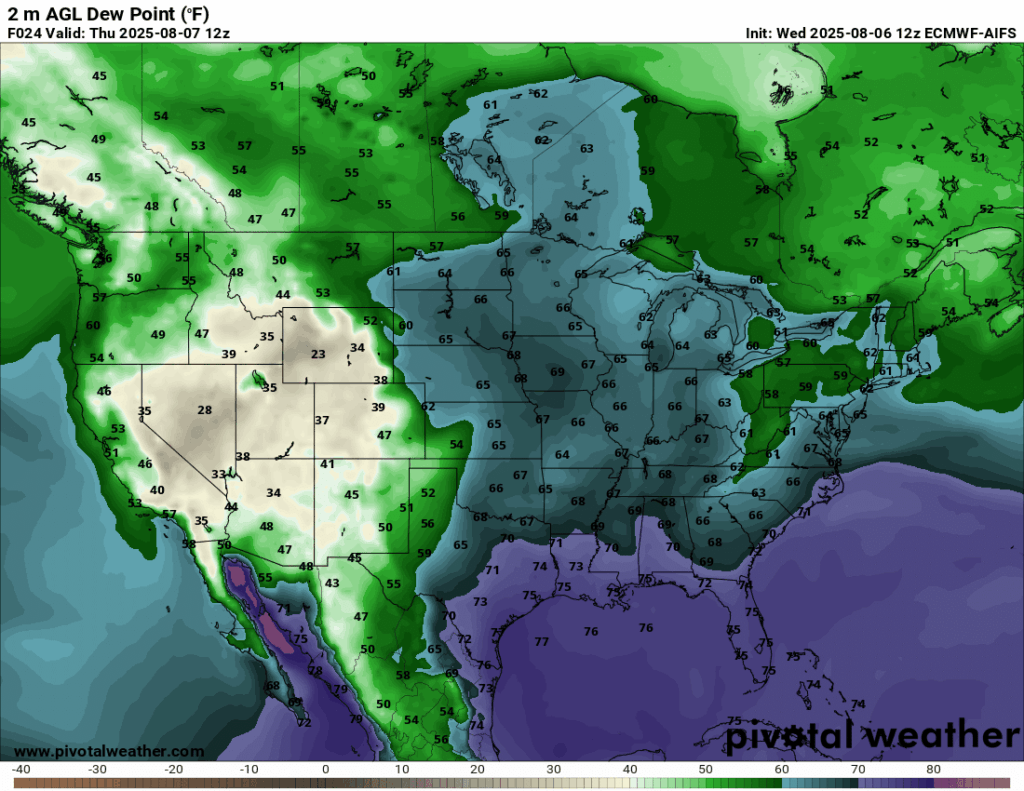
In the NickelBlock region, we are seeing a chance of showers and thunderstorms popping up in the afternoon – part due to a stalled out front that is near the area, but also the typical summer pattern playing out for us. There is plenty of moisture in our area, with moisture flow from the Gulf stretching all the way north through Canada.

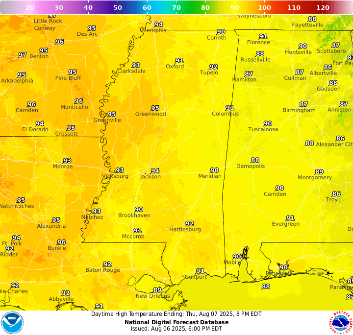
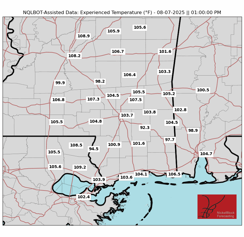
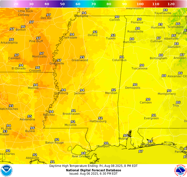
Current Conditions

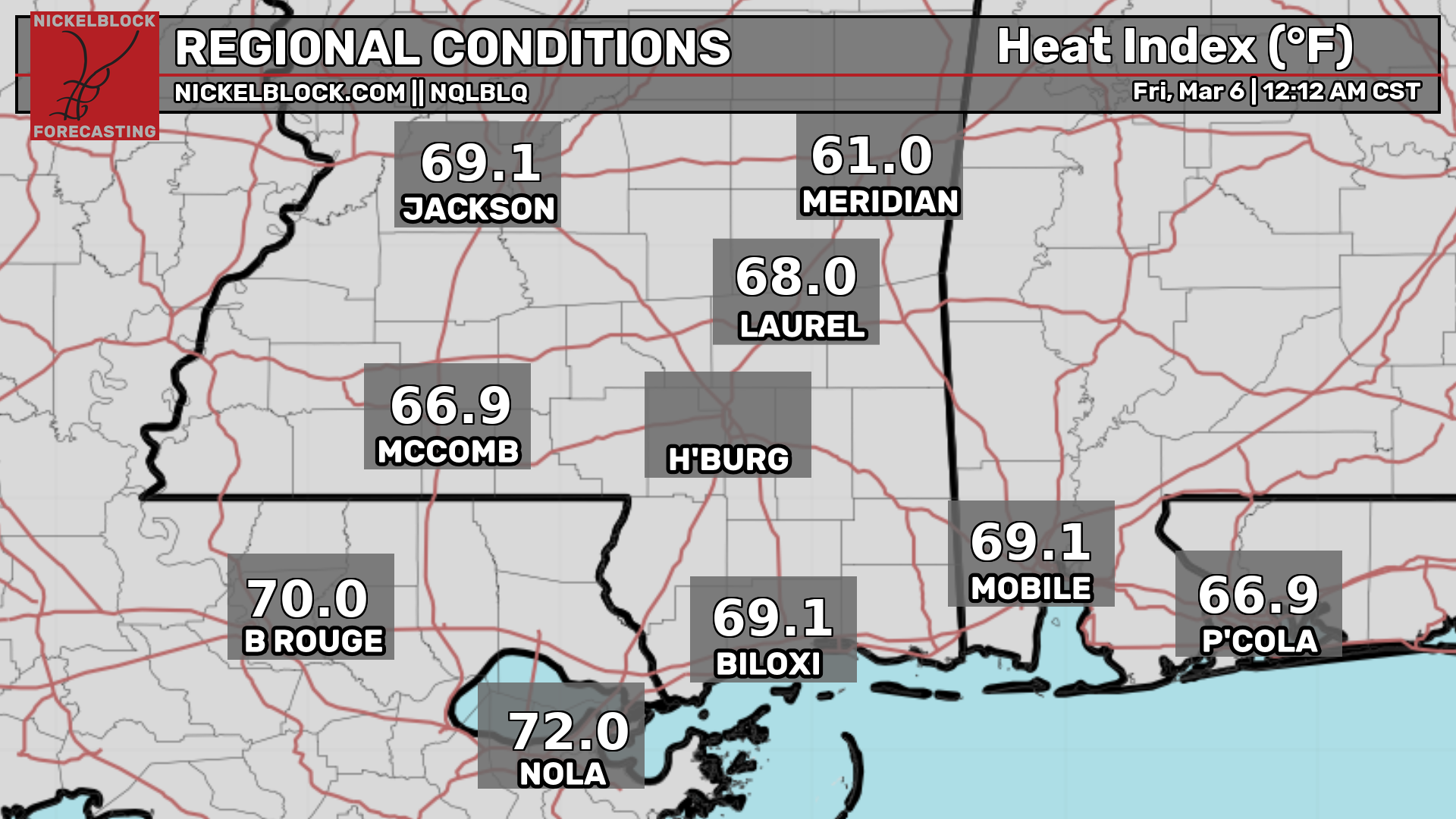
Here’s a look at the current temperatures and heat indices.
Today’s Local Forecast
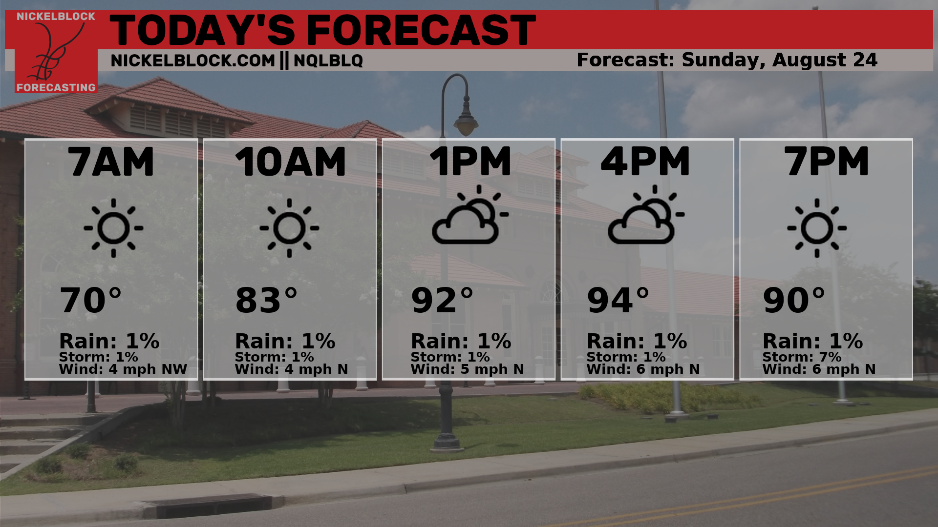
Here’s an hourly look at the forecast for today for the region.
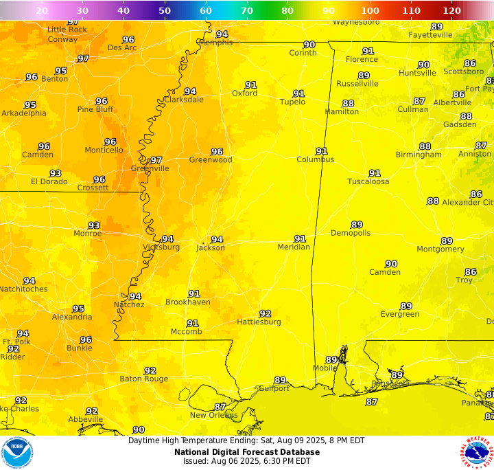
High temperatures will sit in the low 90s today, with 70 degree dew points making it feel over 100 during the afternoon hours.
Today, we will see a mix of sun and clouds with some isolated showers and thunderstorms in the afternoon. It’s looking like a good day for some morning outdoor work, if needed.
Friday & Saturday Forecast
High temperatures for the beginning of the weekend, Friday & Saturday, will be in the low 90s. High humidity will certainly make it feel much warmer than that, so ensure you stay hyrdated and out of the sun whenever possible to prevent heat illness.
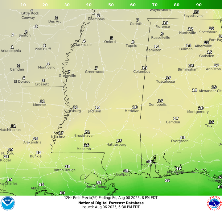
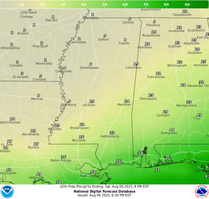
Rainfall for Friday and Saturday will be minimal, with only a 20-30 percent chance of rain in the afternoon or evening hours. We do still have that stalled out front in the area, but it is just south of us – so most of the rain should stay off coast.
Extended Local Outlook

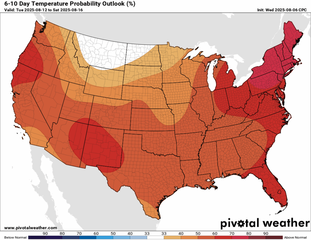
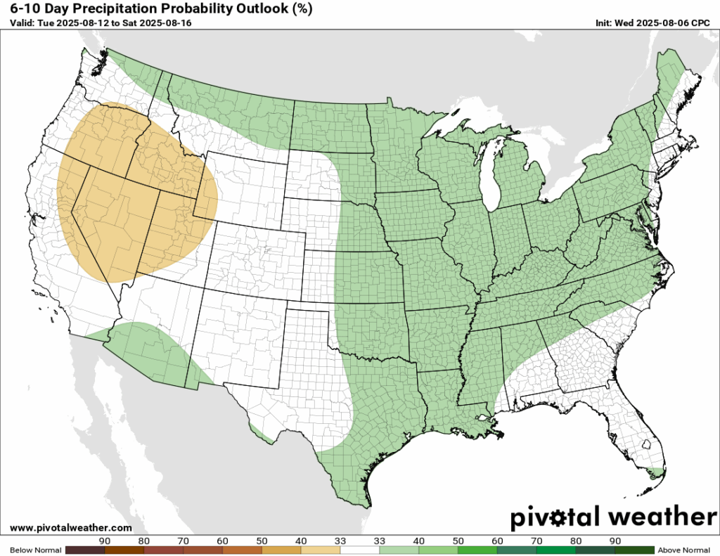
Heat, heat, and then more heat! It seems like each week, our region is under a warmer than average temperature trend. Unfortunately, the heat is again sticking around in the 6-10 day timeframe. In terms of rain, a slight chance of a wetter 6-10 days is possible, but near normal rainfall is the likely outcome.
Latest Tropical Update
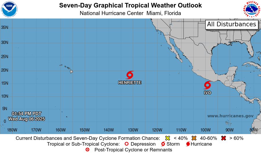
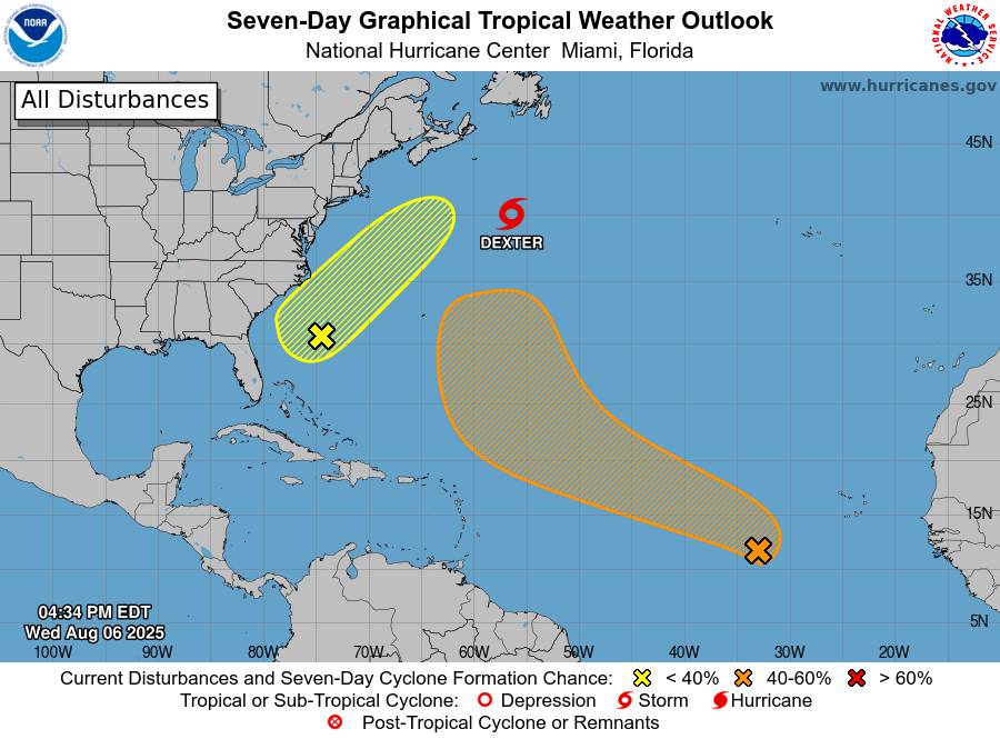
We’re tracking three areas in the Atlantic. One is off the coast of Africa and could slowly develop as it moves west. The other is off the Southeast U.S. coast with low chances of forming as it drifts north. Tropical Storm Dexter is slowly strengthening and could briefly become a hurricane before weakening and transitioning into a non-tropical system later this week in the open north Atlantic. The Gulf and Caribbean are quiet for now. In the Pacific, Tropical Storms Ivo and Henriette are expected to stay over open water. Let’s look into the details:
Want the latest details on these systems? Check out our daily tropical updates for more in-depth information on the tropics!
REGIONAL DAY TO DAY FORECAST
Today: Mostly sunny. A slight chance of showers and thunderstorms in the afternoon. Highs in the low 90s. Calm wind becoming northeast around 5 mph. Chance of rain 30 percent.
Tonight: Mostly cloudy early, then gradually clearing. A slight chance of showers and thunderstorms before 7pm. Lows in the low 70s. Calm wind. Chance of rain 30 percent.
Friday: Sunny in the morning, becoming partly cloudy. A slight chance of showers and thunderstorms after 1pm. Highs in the low 90s. Calm wind becoming east around 5 mph. Chance of rain 30 percent.
Friday Night: Mostly clear. Lows in the low 70s. Calm wind.
Saturday: Mostly sunny. A slight chance of showers and thunderstorms after 1pm. Highs in the low 90s. Calm wind becoming east around 5 mph. Chance of rain 30 percent.
Saturday Night: Mostly clear. Lows in the low 70s. East southeast wind around 5 mph becoming calm.
Sunday: Mostly sunny. A chance of showers and thunderstorms after 1pm. Highs in the low 90s. Calm wind becoming east around 5 mph. Chance of rain 50 percent.
Sunday Night: Partly cloudy. A slight chance of showers and thunderstorms before 1am. Lows in the low 70s. East wind around 5 mph becoming calm. Chance of rain 20 percent.
Monday: Mostly sunny. A chance of showers and thunderstorms after 1pm. Highs in the low 90s. Calm wind becoming east around 5 mph. Chance of rain 50 percent.
Monday Night: Partly cloudy. Lows in the low 70s.
Tuesday: Mostly sunny. A chance of showers and thunderstorms. Highs in the low 90s. Chance of rain 50 percent.
Tuesday Night: Partly cloudy. Lows in the mid 70s.
Wednesday: Mostly sunny. A chance of showers and thunderstorms. Highs in the mid 90s. Chance of rain 40 percent.


