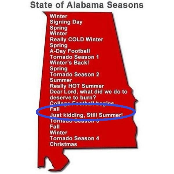
Okay, so it’s an Alabama meme but it basically applies to most of the Deep South. But we’re currently in this part of the season where a large cold front moves in, we’re all happy to get a dose of cooler weather, but we’re not quite there yet. But there is some slightly good news and somewhat bad news. It’s going to be drier next weekend, and much less humid!
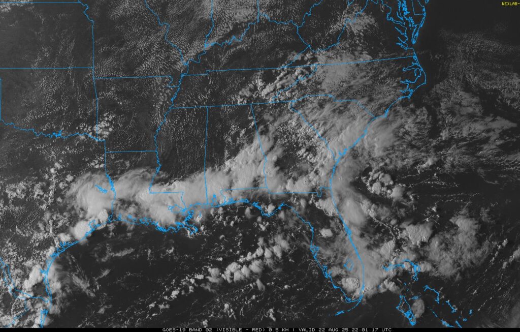
If you look at the satellite image above, you can see an identifiable line of storms along the Louisiana, Mississippi, and Alabama tri-state area near the coast. This is the stationary front slowly moving south. Some lingering showers are associated with this line and will move slowly south and dissipate overnight. Tomorrow, we’ll see some reduced rain chances since the front is out of the way. Highs will be in the low 90s and lows in the low 70s.

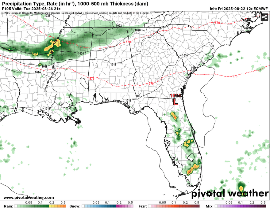
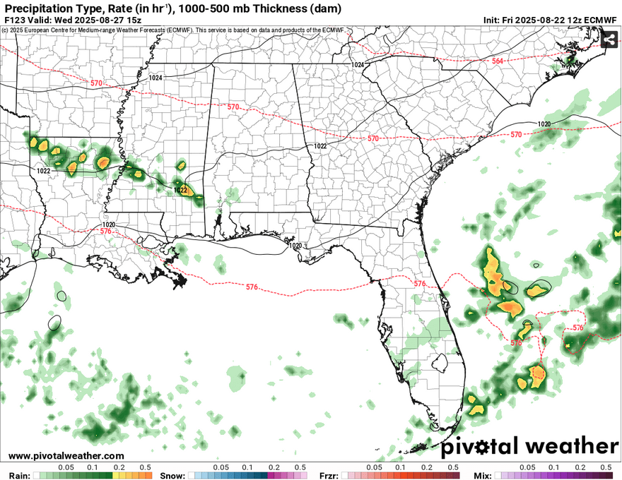
Sunday will also have a very small chance for rain, so expect more sunshine with maybe a pop-up thunderstorm or two. Monday will be another dry one with highs in the mid 90s and lows in the low 70s. Tuesday and Wednesday are a toss-up on when the rain will come in. A cold front from Canada will move in behind the stationary front that will be in the Gulf. As it does, an MCS line will move in between Tuesday and Wednesday and we may see a bit of that rain. So far, the GFS model shows rain moving in Tuesday while the ECMWF holds the front’s speed a bit and rain supposedly arrives Wednesday (I’ll have an update on this by Monday!). Some storms could even linger until Thursday morning. We’ll also see temperatures take a dive from here as well. Highs might just struggle to hit 90, so take that in! Will it still be hot? I’d say so.
Afterwards, we’re in for dry, but a little bit cooler!… so to speak. Upper 80s isn’t too bad after some high humidity and experienced temperatures in the 100s. Dewpoints are expected to drop into the low 60s and even the 50s in some areas across parts of the Deep South, so expect some dry conditions for the next several days. Highs in the upper 80s and lows decreasing from around 70 to the mid 60s.
Tropical Outlook
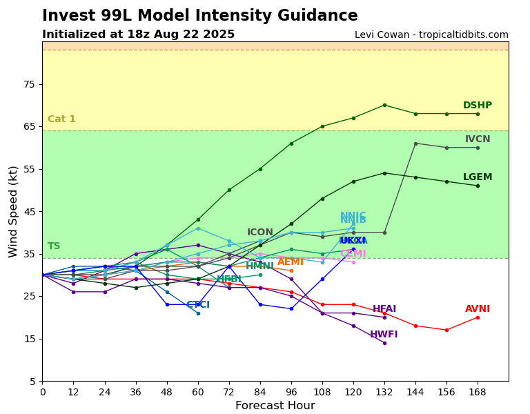
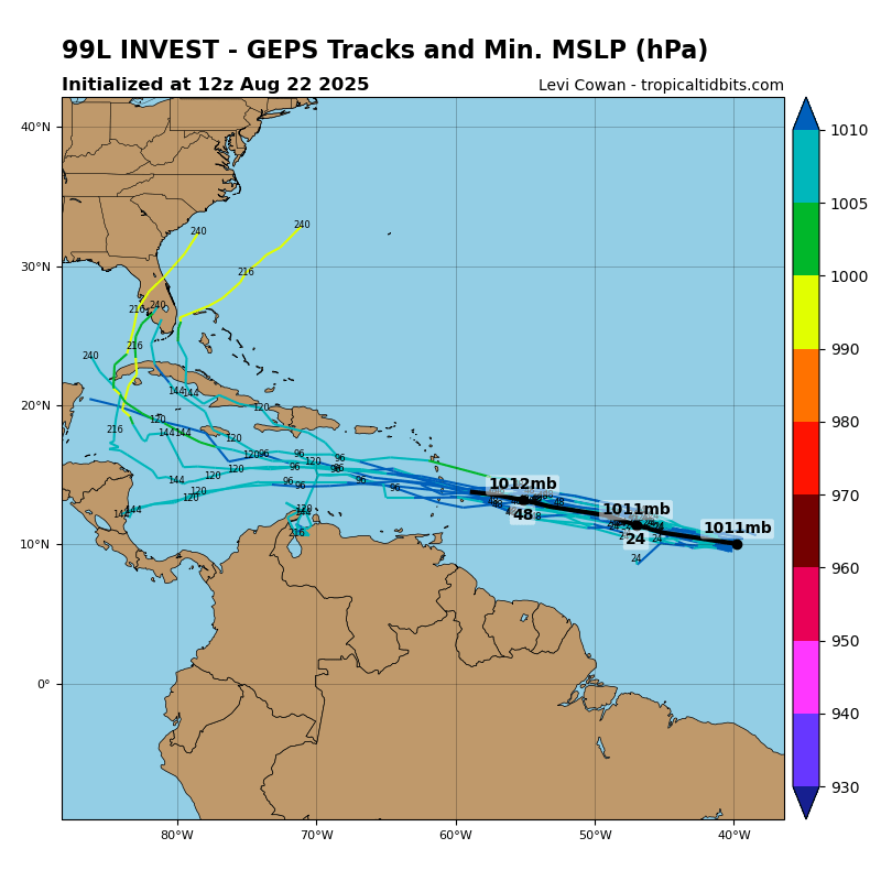
While Erin is on it’s way out to the far north Atlantic, there’s a couple more tropical invests that are developing in the Atlantic. The first, being tropical invest 90L, which is also forecast to curve up the north Atlantic. The one everyone’s had their eyes on in the South is invest 99L. So far, the National Hurricane Center shows this having a medium chance of forming into an organized system, namely a tropical depression.
Looking at the Spaghetti plots this looks to be mostly true. The average hovers just around tropical storm status over a period of 60 hours. The GFS Ensemble shows the system moving towards the Windward Islands with only a small amount of plots implying that it will move up towards the Gulf. It’s worth keeping an eye on in the next several days as it moves past the Windward Islands, but depending on shear and favorable conditions, it could be just another weak tropical system.
Regional Day-to-Day Forecast
Tonight – A 10 percent chance of showers and thunderstorms before sunset. Partly cloudy, with a low in the low 70s. Calm wind.
Saturday – A 20 percent chance of showers and thunderstorms in the afternoon. Sunny, with a high in the mid 90s. Calm wind becoming north around 5 mph.
Saturday Night – Mostly cloudy, then gradually becoming clear, with a low in the low 70s. Calm wind.
Sunday – A 20 percent chance of showers and thunderstorms in the afternoon. Sunny, with a high in the mid 90s. Calm wind becoming north around 5 mph in the afternoon.
Sunday Night – Mostly clear, with a low in the low 70s. North wind around 5 mph becoming calm.
Monday – Sunny, with a high in the mid 90s. North northeast wind around 5 mph.
Monday Night – Clear, with a low around 70. Northeast wind around 5 mph becoming calm in the evening.
Tuesday – Sunny, with a high in the low 90s. East northeast wind around 5 mph.
Tuesday Night – Partly cloudy with a slight chance of thunderstorms, with a low around 70.
Wednesday – Mostly sunny with a chance of thunderstorms in the afternoon, high in the upper 80s.
Wednesday Night – Mostly clear, with a low in the upper 60s.
Thursday – Sunny, with a high in the upper 80s.
Thursday Night – Partly cloudy, with a low in the mid 60s.
Friday – A slight chance of showers and thunderstorms. Mostly sunny, with a high in the mid to upper 80s.


I know no one reads these but the images need to be where you can enlarge them. The print is so small they’re unreadable.
I agree! I wish I could do more but the host website keeps them within a certain amount of spacing. I tend to use the gallery function to compare images but I can stick with full-size images from now on.