Howdy!
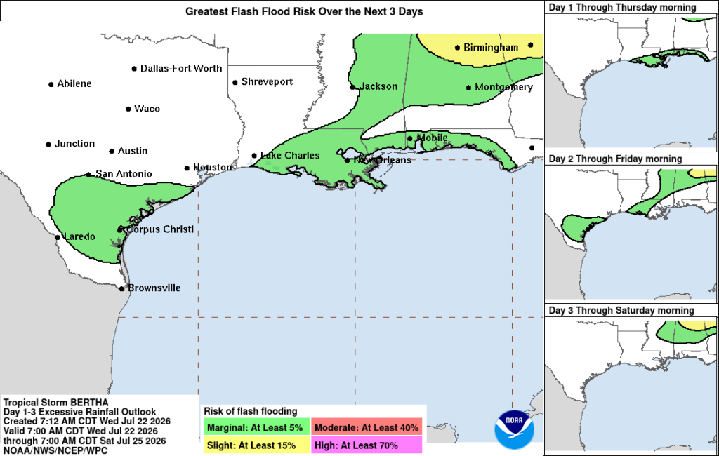
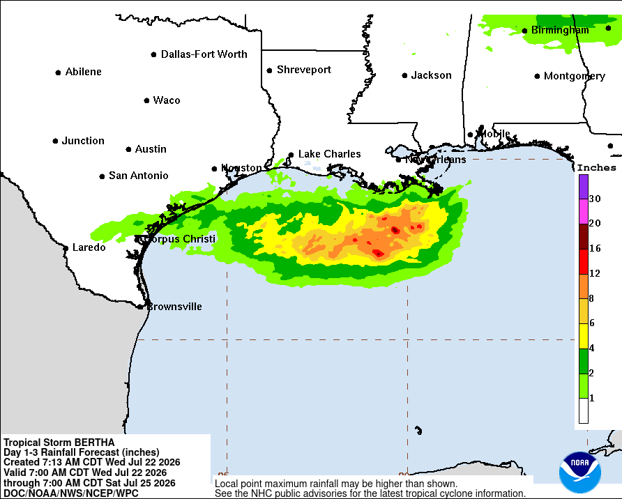
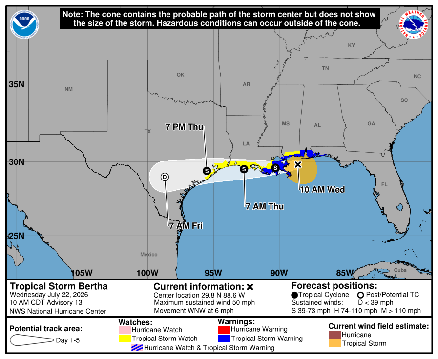
Tropical Storm Bertha is currently impacting the region, expected to produce some locally heavy rainfall and strong winds. Some localized flash flooding is possible, rain amounts ranging from 1-4 inches. By Friday, the storm will have dissipated and the heat will return to us.

TODAY/TONIGHT
The biggest concern in the weather currently is Tropical Storm Bertha as it propagates westward through the gulf, impacting our region. The center of the storm is currently moving into Louisiana, the main convective region being south of it due to some shear in the area. Max sustained winds are around 45 kts (or 50 mph), moving west at around 5 mph.
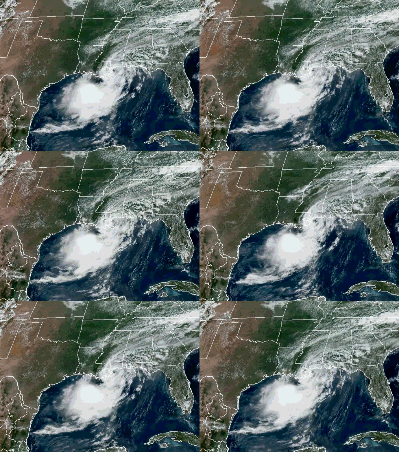
Tropical storm conditions are expected to continue for the gulf coast regions today and tomorrow. A coastal flood warning is in effect for the coasts of Mississippi and Lousisana. Some isolated areas of flash flooding are possible now until Friday for areas impacted by the storm. Along the immediate coast and offshore is where greater rainfall amounts are expected.
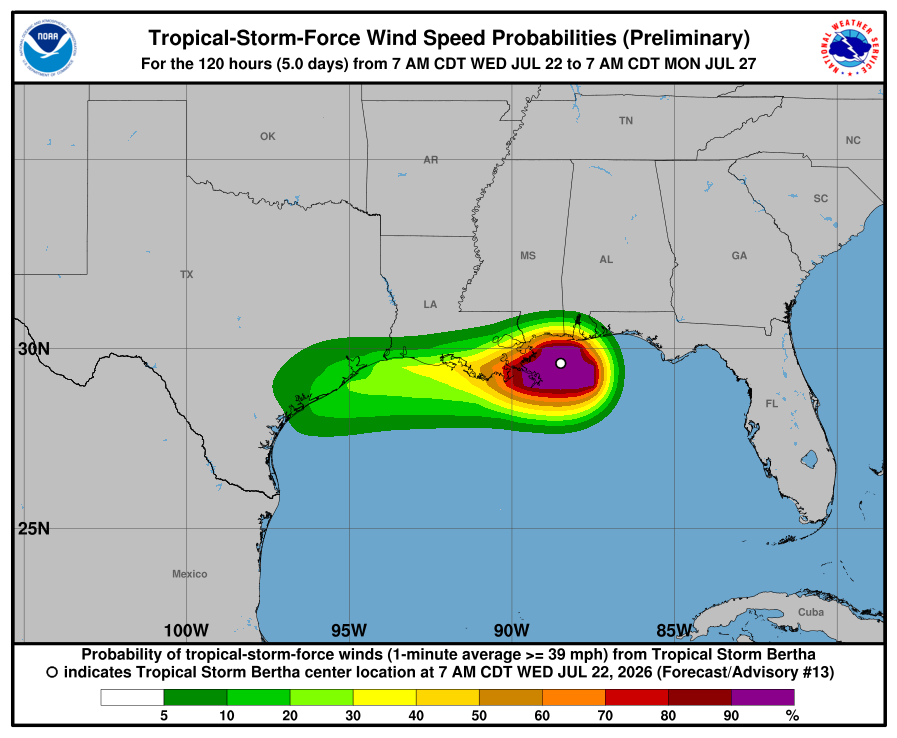
Strong winds are another concern associated with the storm. The greatest risk for tropical storm force winds (39 pmh) are areas along the gulf coast. Try not to travel and avoid these areas if you can until the storm has moved out of the region.
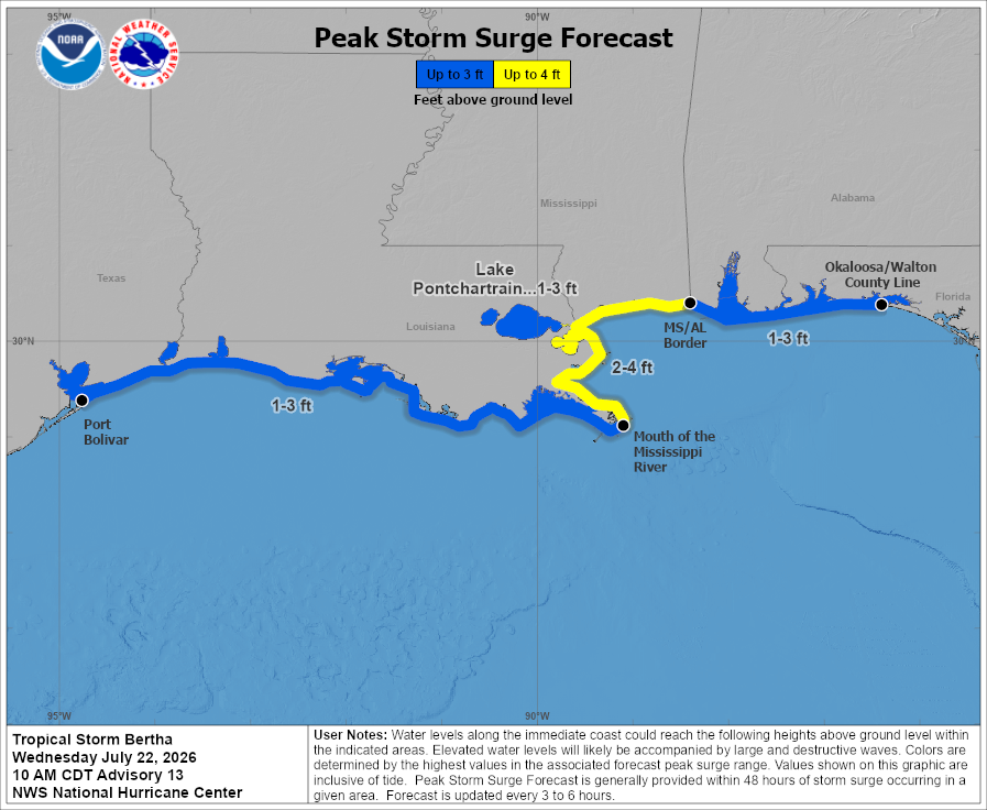
As with any tropical system, it is important to the amount of storm surge we are expecting from it. Most of the coast expects about 1-3 ft of storm surge, but the Mississippi coast and southeastern Louisiana coast, the storm surge will possibly be a bit more, from 2-4 ft. Please plan accordingly and see how this will impact the area you are in!
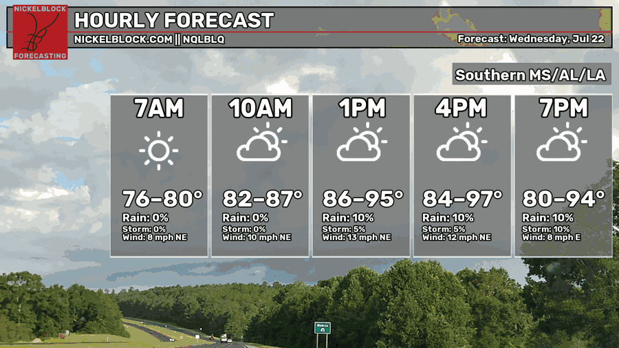
As far as temperatures go, a bit of a larger range from the 80s to upper 90s, depending on where rain and cloud coverage will be today. The heat will be here, just slightly under the heat advisory threshold.
TOMORROW
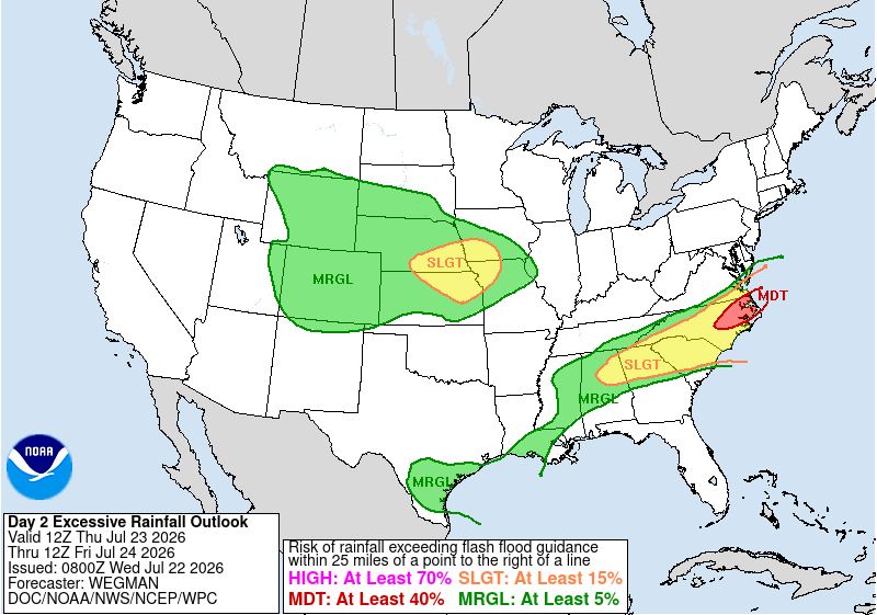
By tomorrow, Bertha will still be around for Louisiana. The main risks for excessive rainfall and flash flooding remain in southern Louisiana and portions of central/northern Mississippi and Alabama, though MS and AL are not associated with the tropical storm.
Despite the tropical storm, the heat is still here. Depending on the rain and winds, it will feel different for a lot of people. Areas more inland will experience warmer temperatures than along the coast (where tropical storm conditions are). It will just depend on how much cloud coverage areas inland will experience and if that will keep conditions feeling “cooler”.
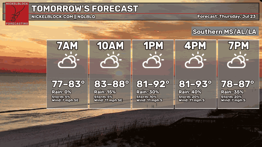
By tomorrow evening, the tropical storm will have moved out of the region and into portions of Texas. Moisture will still remain elevated, possibly enhancing rain rates in localized areas. Scattered showers and thunderstorms are possible tomorrow as the storm moves through and away.

FRIDAY
By Friday, Bertha will have weakened significantly as it impacts portions of Texas, dissipating by the end of the day. An upper-level ridge will be building, returning to a more typical summer weather pattern. Isolated to scattered afternoon showers and thunderstorms will return, sea breezes bringing that chance.
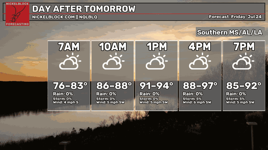
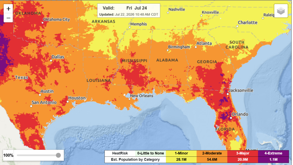
Highs start to build up once again all the way up to the high 90s for some areas, the heat never leaving. Moderate to major heat risk will be in effect for the region, heat index values in the 90s up to 100.
By this weekend into next week, the region will be under northwesterly flow between a ridge to the west and a trough extending into the eastern U.S. which could bring with it increased chance to see thunderstorms.

EXTENDED OUTLOOK
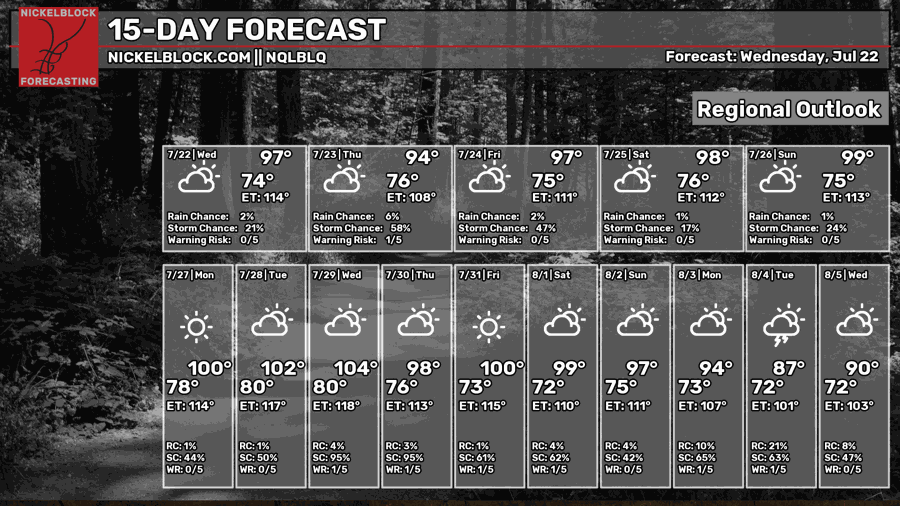
Temperatures start building back up once again, highs in the 100s by early next week. Isolated to scattered afternoon showers and thunderstorms are possible each day. Again, a more summer weather pattern that we expect for this time of year.
Like I mentioned, we might have an increased chance to see some thunderstorms by the weekend into early next week as the models point to us being between a ridge to the west and a trough extending into the eastern US. Depending on the strength of the ridge, it may surpress any widespread convective development and keep conditions very hot.
Any chance for rain will remain more to eastern portions of the region, western portions more influenced by the ridge and its subsidence that will decrease any chance for rain. This will continue to be monitored and we will see how it will develop.
For now, make sure to keep up with Tropical Storm Bertha and be safe! Limit the amount that you are traveling if you can. Stay dry and have a good rest of your day! And watch my video forecast!


