Overall Setup
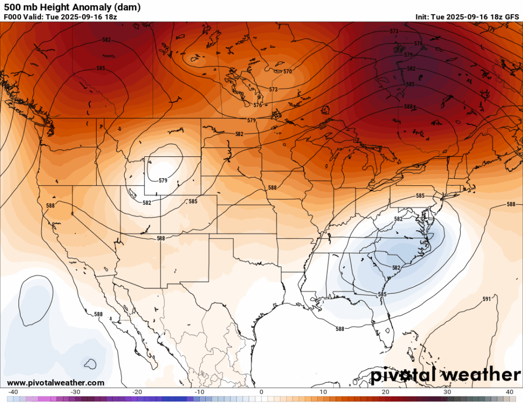
The 500 mb pattern features a Rex Block! This can be seen by the low pressure system (over the mid-Atlantic) being essentially blocked by the high pressure system over southeastern Canada, as well as a low pressure system over the Wyoming area being blocked by a high pressure system in southwestern Canada. Pretty cool to see!
Our area is seeing a little bit of an influence from the troughing in the mid-Atlantic which is the reason we are seeing some spotty heavy downpours this evening and might see some tomorrow.
While our region feels the influence from the trough, high pressure is still dominating, putting the cap on any significant rainfall. We really could use any rain we could get, and there isn’t many rain chances for this week, so cherish it if you get any!

Tonight’s Forecast
Again, those lucky enough to see a spotty rain shower tonight will see a very quick one midnight, followed by clearing skies and dry weather for the overnight. Some early morning fog is possible with our temperature and dewpoint reaching the same temperature by sunrise.
Tomorrow’s Forecast
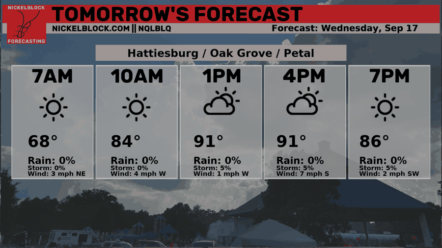
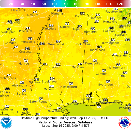
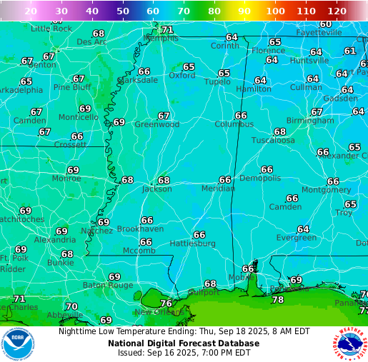
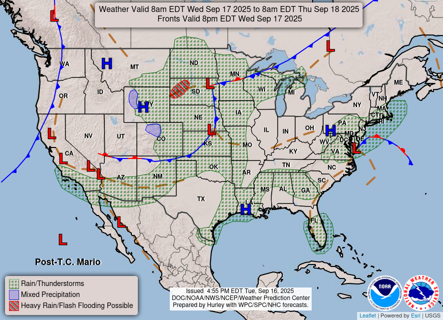
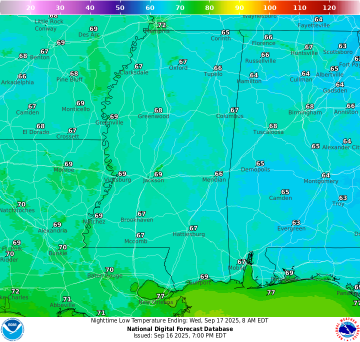
Much of the same is in the forecast for tomorrow with temperatures reaching the low 90s during the day and mid 60s at night. Some increase in cloud cover is expected by the time lunchtime comes around, with very isolated heavy showers and thunderstorms poping up around the region. Most will experience a dry day, similarly to today. You will notice that the humidity will back down in the afternoon with dew points only in the 50s!
Thursday’s Forecast
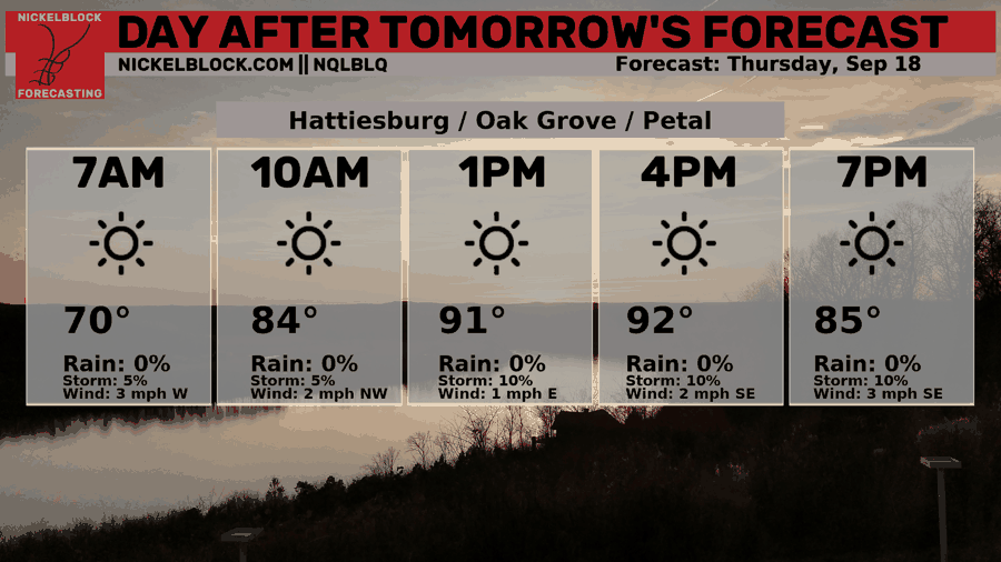
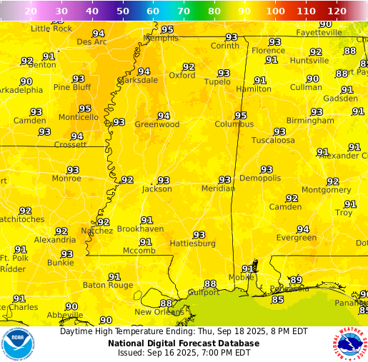
We may sound like a broken record, but seriously, Thursday will be dry too! High temperatures will also reach the lower 90s with lows in the mid 60s. Luckily, humidity also stays down on Thursday, which will make the heat feel not as extreme.
Extended Local Outlook
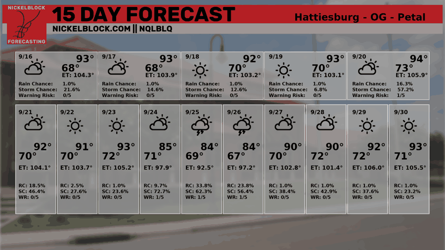
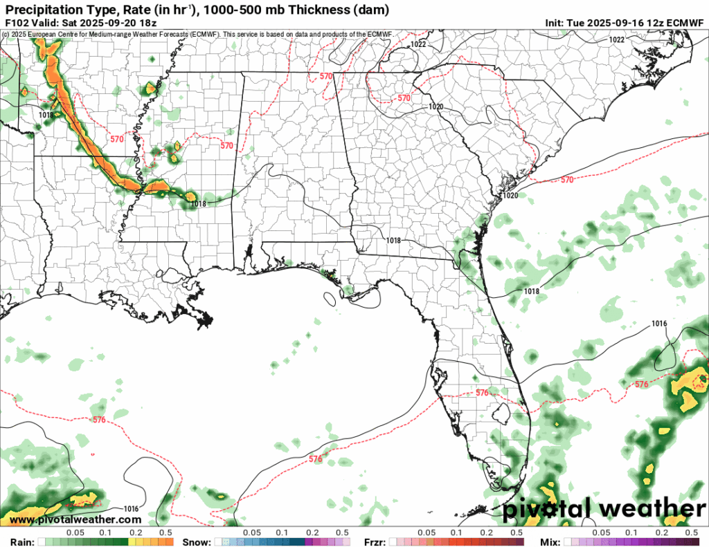
The latest model guidance shows Saturday shaping up to be pretty similar to what we saw today, with scattered showers popping up here and there. The difference is that coverage could be a little higher, so a few more spots may actually pick up some measurable rain. Still, it’s not looking like a widespread soaking unfortunately.
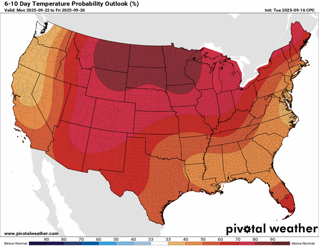
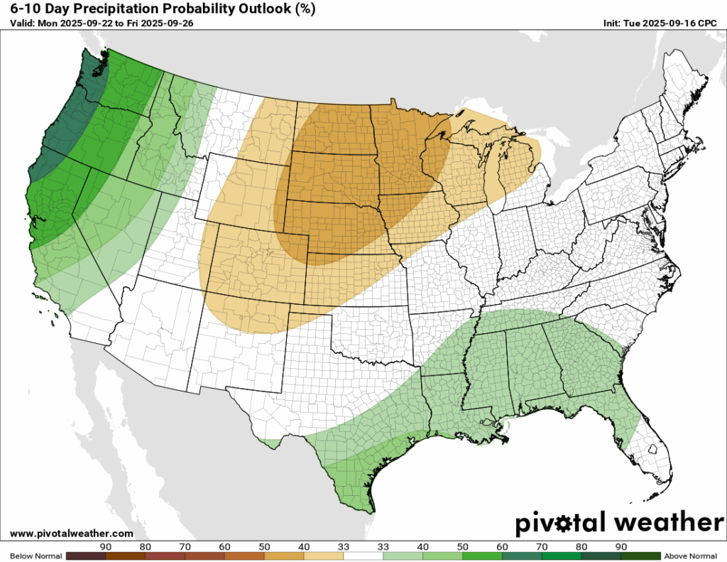
In the 6-10 day outlook, rainfall chances begin to return closer to average. A trough is expected to set up just north of the region, which would make the atmosphere more favorable for rain. Even with that pattern, temperatures are projected to stay above normal.

Latest Tropical Update
Atlantic:
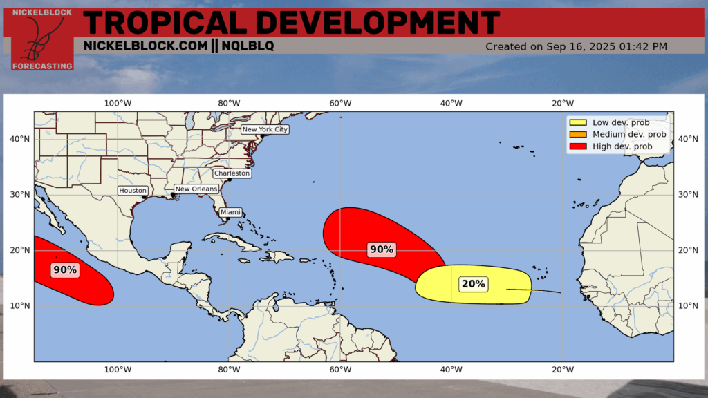
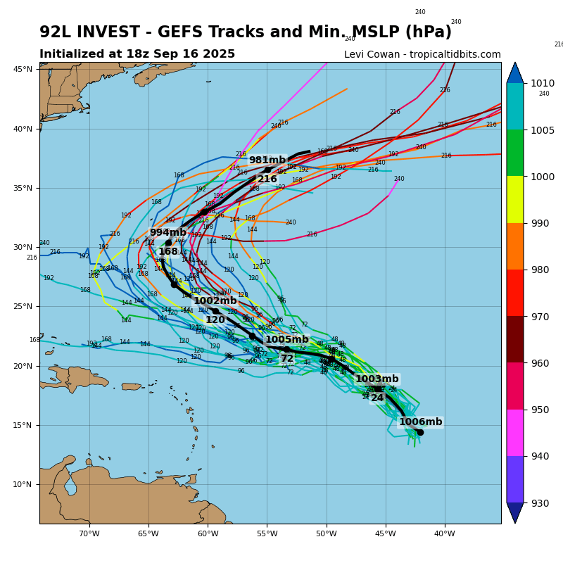
90 percent! Last time we saw that was when Invest 91L was given a high chance at developing, but then collapsed from conditions becoming no longer conducive. This time, we have Invest 92L, which is likely to become a tropical depression or tropical storm within the next day or two. Thankfully for the CONUS, an overwhelming majority of ensemble models show this tracking to the northwest and eventually turn out to sea. However, they do take the track awfully close to Bermuda. Expect an official NHC cone once this develops.
There is another area to watch highlighted by the NHC which is located just behind Invest 92L. This one only has a 20 percent chance of developing in the next week. Current guidance shows the energy from this being swept out to sea from an incoming trough from the CONUS, but there’s plenty of time for things to change.
Eastern/Central Pacific:
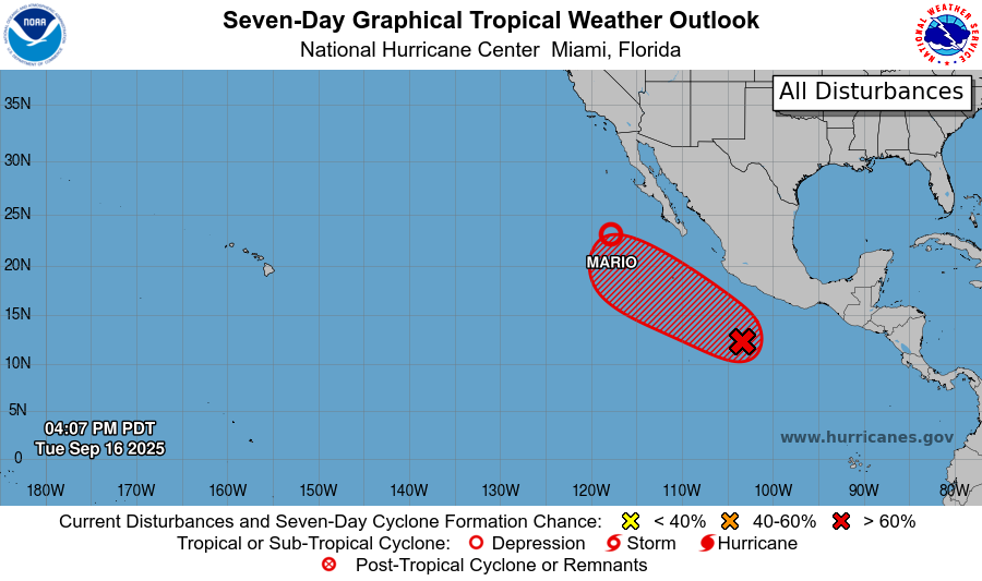
Tropical Storm Mario has been downgraded to Tropical Depression Mario, which currently has winds at 35 mph. Its energy and moisture will move into southern California by the end of the week. A Marginal risk of flash flooding is in place for the southwest region as a result.
An area to watch with a high chance of developing is trailing just behind Mario, and will likely take a similar track, and should stay a low end Category 1 hurricane at the most as it trails up the coast, but thankfully off the coast.
REGIONAL DAY TO DAY FORECAST
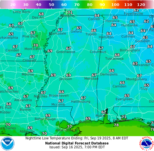
Tonight: Patchy fog after 5am. Otherwise, mostly clear with lows in the upper 60s. Calm winds.
Wednesday: Patchy fog before 8am. Sunny with a chance of isolated showers or thunderstorms in the afternoon. Highs in the low 90s. Winds light, becoming south-southeast around 5 mph. Chance of rain 20 percent.
Wednesday Night: Patchy fog after 5am. Otherwise, mostly clear with lows in the mid 60s. Calm winds.
Thursday: Patchy fog before 7am. Sunny with highs in the low 90s. Winds light, becoming east-southeast around 5 mph in the afternoon.
Thursday Night: Mostly clear with lows in the upper 60s. Calm winds.
Friday: Sunny with highs in the mid 90s. Winds light, becoming northeast around 5 mph.
Friday Night: Partly cloudy with lows in the upper 60s. Calm winds.
Saturday: Mostly sunny with highs in the mid 90s. Winds light, becoming east-northeast around 5 mph in the afternoon.
Saturday Night: Partly cloudy with lows in the upper 60s. Southeast winds around 5 mph, becoming calm.
Sunday: Sunny with highs in the low 90s.
Sunday Night: Mostly clear with lows in the upper 60s.
Monday: Mostly sunny with highs in the low 90s.
Monday Night: Partly cloudy with lows in the upper 60s.


