Overall Setup
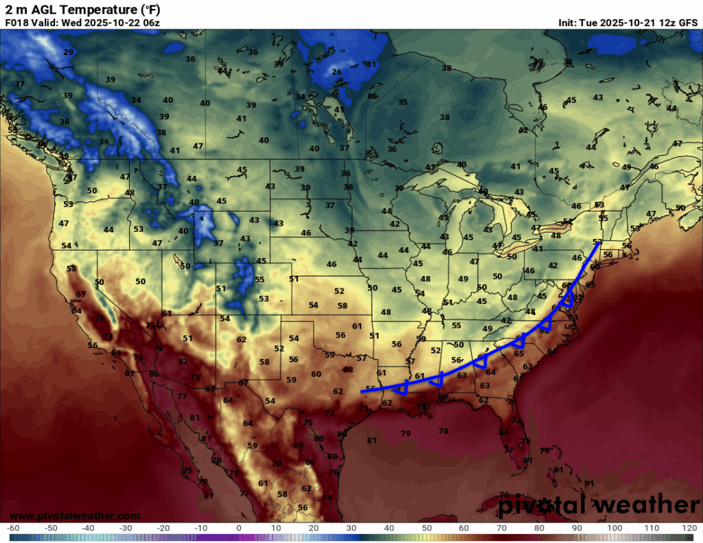
A cold front will move in from the north tonight into tomorrow, bringing some of the lowest humidity we’ve felt so far this season. Highs tomorrow will top out in the upper 70s, making for a noticeably cooler and more comfortable day. Behind the front, temperatures will finally start to feel more fall-like through next week. By Halloween week, some spots could even see highs dipping into the 60s!

Tonight’s Forecast
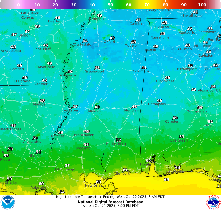
Low temperatures tonight will approach the 40s, especially those farther from the coast! A few spotty showers could sneak through very late tonight, but mostly dry conditions are expected for most areas.
Tomorrow’s Forecast: Wednesday, October 22
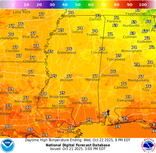
A clear and bright day is to be expected for tomorrow with very low humidity and temperatures only reaching the mid-to-high 70s, as we will be on the cold side of the front! It will feel like a perfect fall day. Lows tomorrow night will reach the mid-40s across much of our region, given the clear skies and northerly wind behind the front. You can expect morning temperatures to be cooler and cooler over the coming weeks.
Thursday’s Forecast: October 23
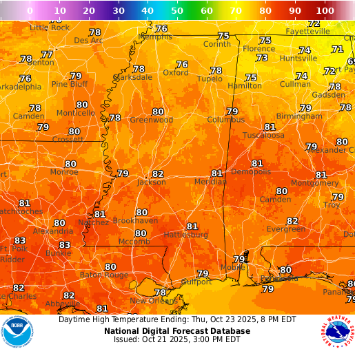
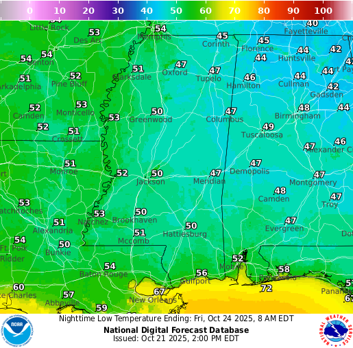
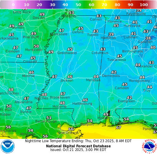
By Thursday, we warm up slightly with highs in the low 80s. The extremely low humidity levels will stick around and will allow skies to remain mainly sunny. Lows for Thursday night will sit in the low 50s.
Extended Local Outlook
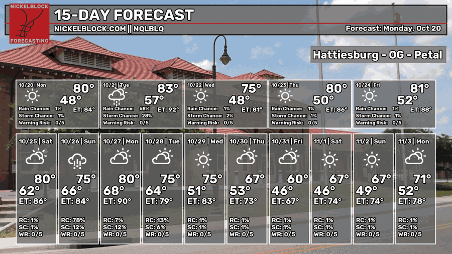
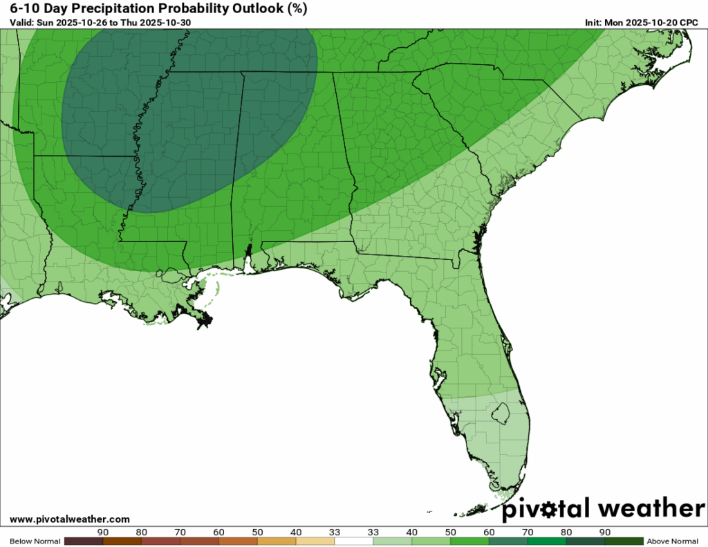
The humidity will make its return this weekend along with another chance of rain. Like last week, we could see some heavy showers or thunderstorms Saturday night into Sunday. We’re not concerned with severe weather this time, but if anything changes, we will be the first to let you know! After that, we are dry until another chance of rain on Wednesday next week, but models are still figuring that out.
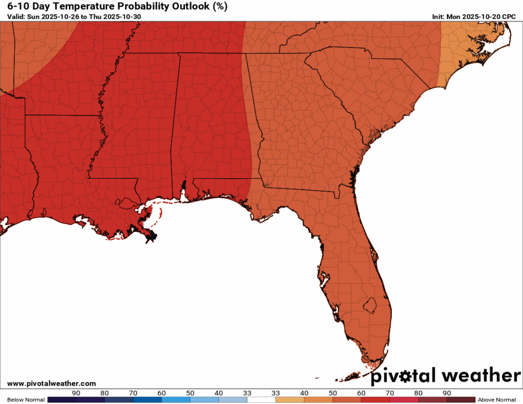
For our temperatures, it looks like we are done with the mid-to-upper 80-degree days. Temperatures next week are looking to be in the mid 70s and potentially 60s just in time for the week of Halloween!

Latest Tropical Update
Atlantic:
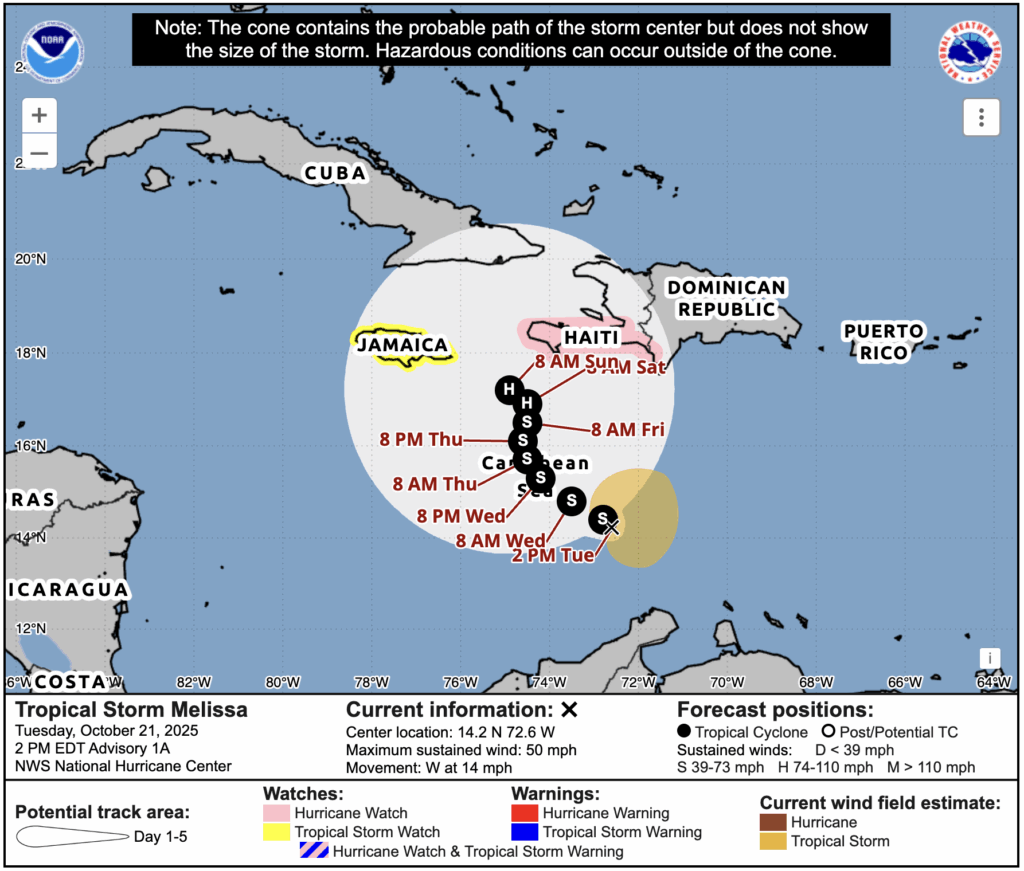
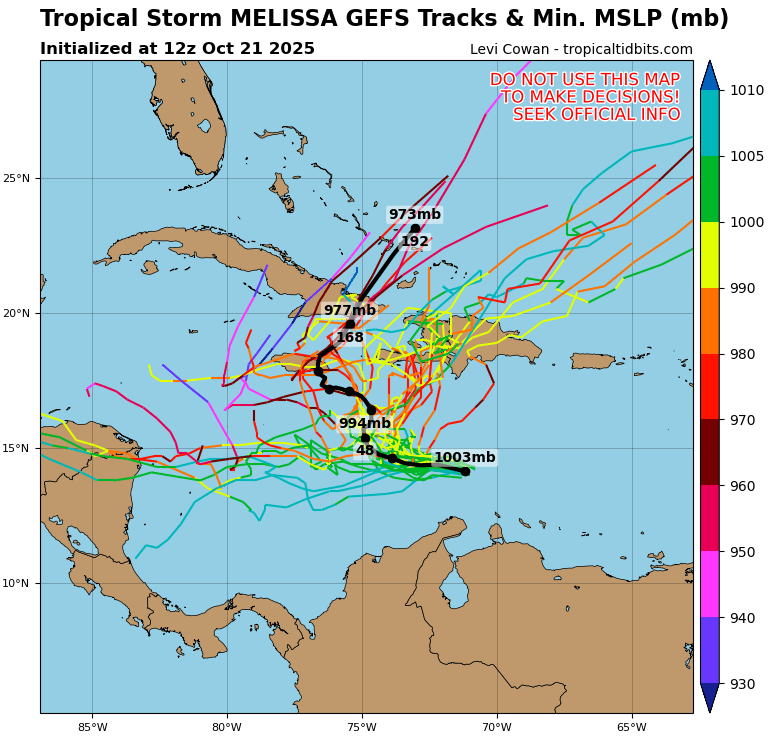
That area to watch that we have been talking about in the southern Caribbean has formed into Tropical Storm Melissa. It is forecast to wobble around in the Caribbean Sea through the weekend and potentially bring some tropical storm and hurricane impacts to Jamaica, Haiti, and the DR by next week. After that, the track is pretty unknown, with the spaghetti models showing a wide array of possibilities. These can be seen below:
Eastern/Central Pacific:
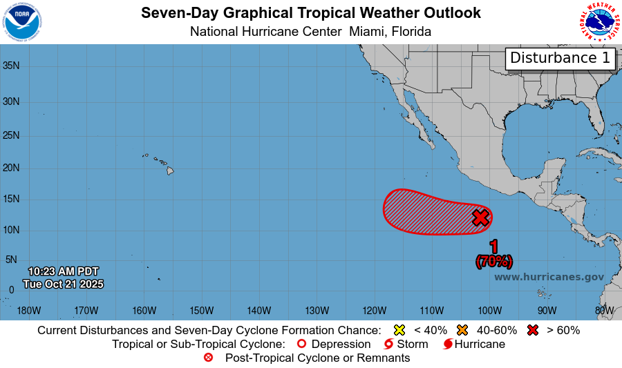
Only thing to note in the Eastern Pacific is an area to watch, which has a 70 percent chance of development within the next 7 days. Any development is expected to track out to sea and not impact any land.
REGIONAL DAY TO DAY FORECAST
Tonight: Partly cloudy with lows in the lower 50s. North winds 5 to 10 mph.
Wednesday: Sunny with highs in the upper 70s. North winds 5 to 10 mph.
Wednesday Night: Mostly clear with lows in the mid 40s. North-northeast winds around 5 mph, becoming calm overnight.
Thursday: Sunny with highs in the lower 80s. Calm winds becoming east-southeast around 5 mph in the afternoon.
Thursday Night: Mostly clear with lows in the upper 40s. Calm winds.
Friday: Sunny with highs in the lower 80s. Light east-northeast winds becoming east-southeast 5 to 10 mph in the morning.
Friday Night: Mostly cloudy with lows in the mid 50s. Southeast winds around 5 mph, becoming calm later in the evening.
Saturday: A 20 percent chance of showers and thunderstorms after 1 p.m. Mostly cloudy with highs in the lower 80s. Southeast winds 5 to 10 mph, with gusts up to 20 mph.
Saturday Night: A 50 percent chance of showers and thunderstorms. Mostly cloudy with lows around 60.
Sunday: Showers and thunderstorms likely, mainly before 3 p.m. Partly sunny with highs in the mid 70s. Chance of rain 60 percent.
Sunday Night: A 30 percent chance of showers. Mostly cloudy with lows in the lower 60s.
Monday: A 20 percent chance of showers. Partly sunny with highs in the upper 70s.


