The weather has been absolutely fantastic today as we topped out in the upper 70s with clear skies. I loved being able to be outside for a bit at work and I hope y’all were able to as well. Overnight, temperatures will fall into the upper 40s for much of the area. Quite fall-like indeed!

Thursday’s Forecast
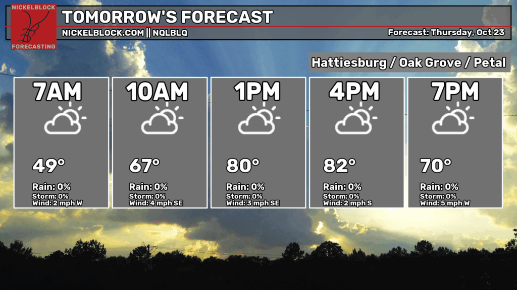

Thursday morning will be quite cool with temperatures in the upper 40s, so if you need a light jacket, bring it for the first part of the day. Afterwards, we’ll top out around 80 with some high clouds in the sky.
Friday’s Forecast
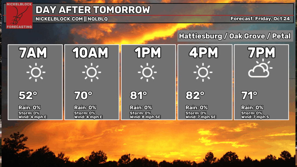
Friday will be a tad bit warmer in the morning with a low around 50. While the NQLBLQ model shows no clouds in the sky, I believe we’ll still see some upper level clouds moving in with the incoming front. Highs will top out in the low 80s and lows in the low to mid 50s.
The Weekend
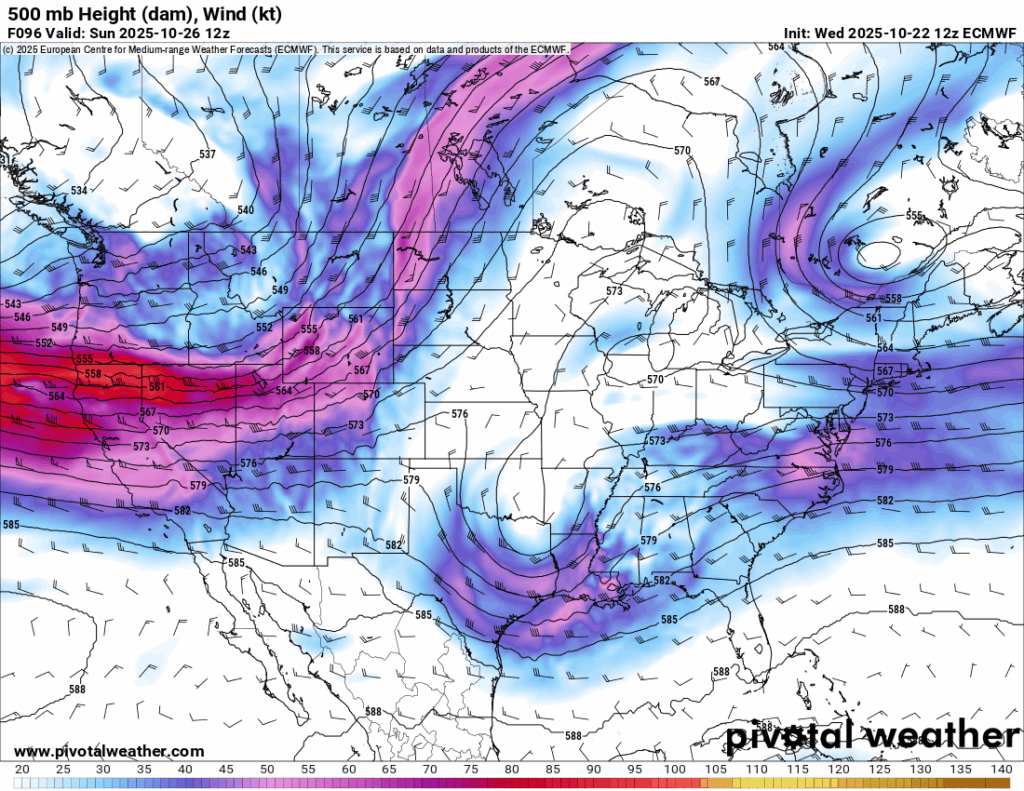
This weekend will be a wetter one with a shortwave trough and stationary front moving in. Severe parameters look fairly limited so far, but thunderstorms and heavy rain are possible. Considering the speed that this front is moving, it will be able to pull moisture from the Gulf and keep the rain coming for over a 24 hour period. While severe parameters look fairly low, helicity and shear are still present. Dewpoints are a little lower than normal which could limit the warm air intake.
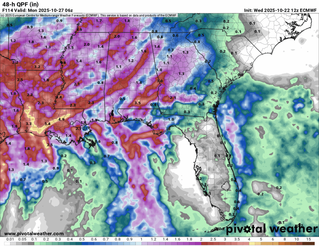
Rain chances look to be scattered on Saturday, but potent on Sunday. Expect scattered storms to move in by the afternoon and linger into the overnight hours. The highest amount of rain we’ll receive is in the mid-morning hours to the late afternoon on Sunday. On average, rainfall totals range around 1-2.5” across much of Mississippi and higher totals in Louisiana. The GFS has been more conservative since it’s moving things further west towards Louisiana. Overall, we’ll still see some rain.
Expect temperatures in the low 80s Saturday and lows around 60. Highs for Sunday will be in the mid 70s and lows in the low 60s.


