Overall Setup
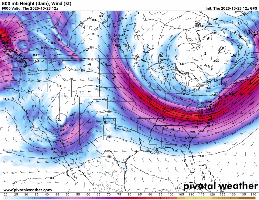
Aside from a few high clouds, skies are clear and humidity is low, making for a pleasant night across the region. We’re under a very dry northwesterly flow aloft, which is helping to keep conditions calm and comfortable. A trough currently over the Southwest will shift our way Saturday night into Sunday and bring a decent round of rain to Louisiana and possibly parts of our area as well. More details on that below.

Tonight’s Forecast
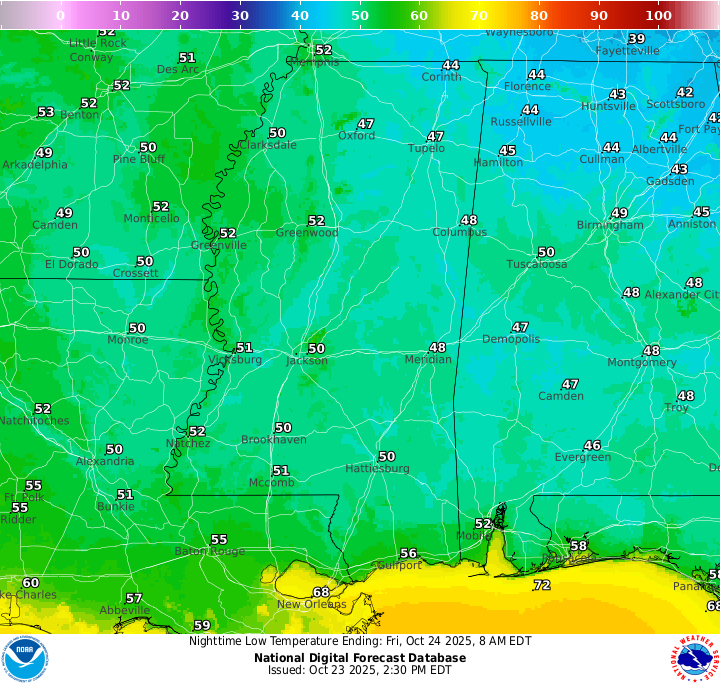
Tonight, there will be partly cloudy skies with lows near 50 in the mainland, and closer to 60 or even 70 towards the coast.
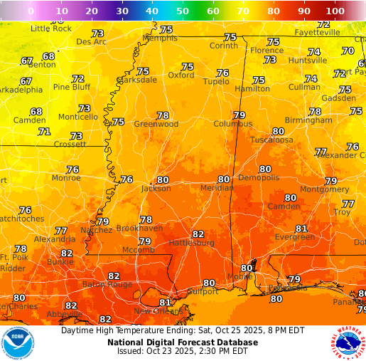
Tomorrow’s Forecast: Friday, October 24
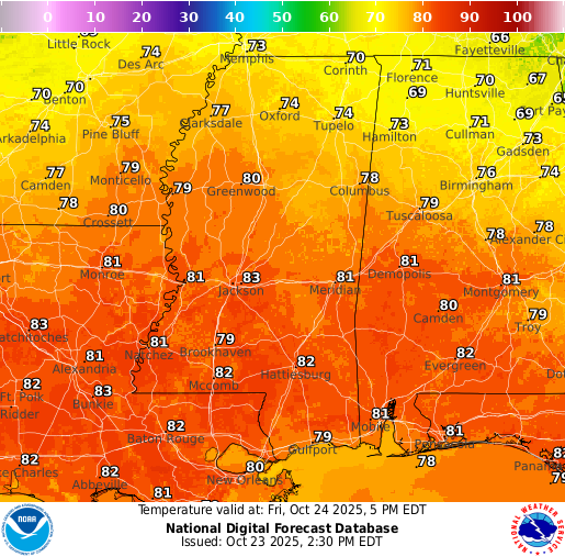
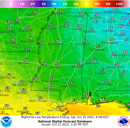
Dry conditions continue Friday, with highs in the upper 70s to lower 80s and lows in the mid 50s. Southern Louisiana will hold on to slightly warmer temperatures overnight.
Weekend Forecast: Saturday October 25 & Sunday October 26
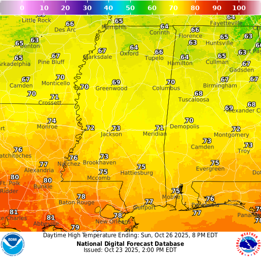
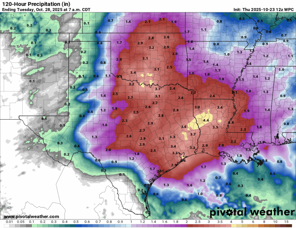
Rain will move in Saturday evening and continue through much of Sunday as the trough from the west slides across the region. Most of Louisiana will see the heaviest rain, with the WPC showing widespread 2-4 inch totals and locally higher amounts possible. Mississippi and western Alabama should see lighter but still beneficial rainfall, closer to 1 inch on average. Saturday will still be warm, with highs near 80, but once the rain moves in Sunday, temperatures will stay cooler in the low to mid 70s through the afternoon.
Extended Local Outlook
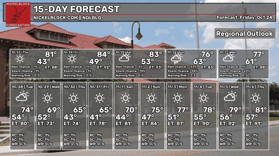
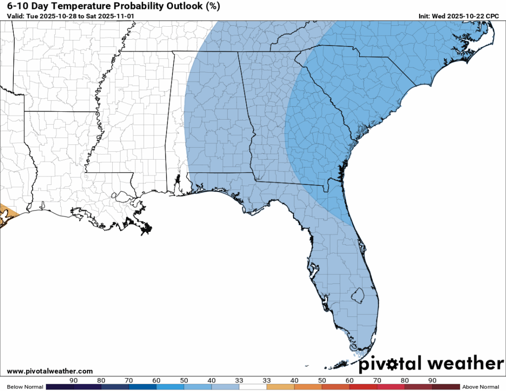
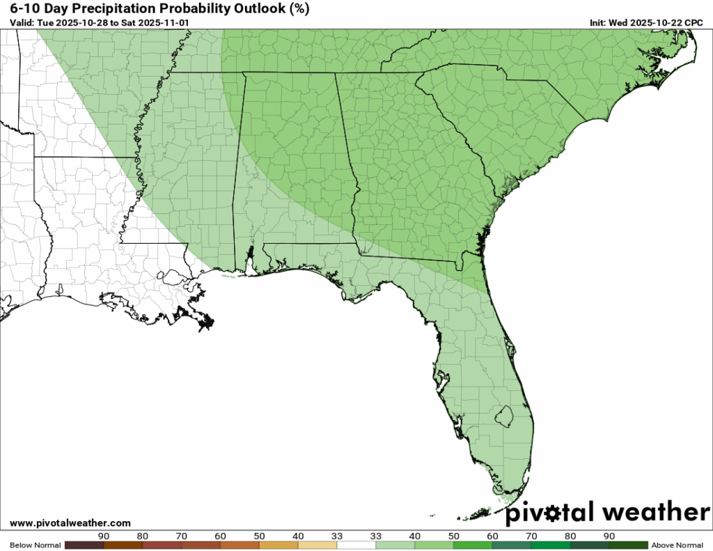
Looking ahead to next week, temperatures are finally trending cooler with highs in the low 70s early in the week and dropping into the 60s after that. Take a look at that Halloween high, just 62 degrees! The 6-10 day outlook shows near or slightly above average rainfall, but with our overall dry pattern, it would only take one or two rainy days to push us above normal. Overall, the setup stays mostly dry and seasonably cool.

Latest Tropical Update
Atlantic:
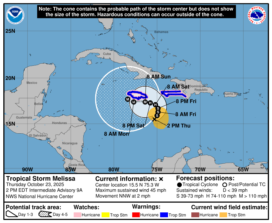
Tropical Storm Melissa remains nearly stationary in the Caribbean with little movement today. The latest forecast calls for a tremendous amount of rain across parts of the islands, and Melissa could strengthen into a major hurricane by the weekend.
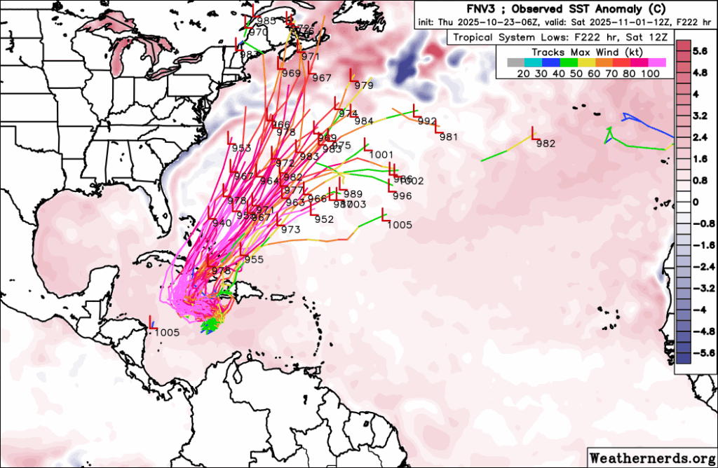
The GDM (Google DeepMind Model) currently shows a turn to the northeast and out into the open Atlantic, though there’s still some uncertainty with the track since it depends heavily on how strong the storm becomes. As of now, there’s no concern for the Gulf, as the trough moving in this weekend should help pull Melissa safely out to sea.
Eastern/Central Pacific:
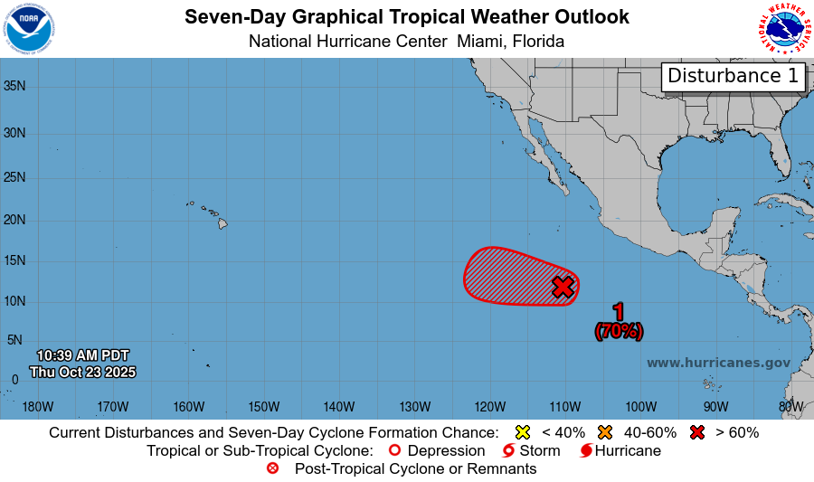
We still have the one area to watch in the Eastern Pacifc, now with a 70 percent chance of development in the next 7 days. Again, any development is expected to track into the open Pacific.
REGIONAL DAY TO DAY FORECAST
Tonight: Partly cloudy with lows in the lower 50s. Winds calm.
Friday: Sunny with highs in the lower 80s. Light and variable winds becoming east-southeast 5 to 10 mph in the morning.
Friday Night: Increasing clouds with lows in the mid 50s. East-southeast winds around 5 mph becoming calm.
Saturday: Partly sunny with highs in the lower 80s. Southeast winds 5 to 10 mph, with gusts up to 20 mph.
Saturday Night: A 70 percent chance of showers. Mostly cloudy with lows around 60. East-southeast winds 5 to 10 mph, gusting up to 20 mph.
Sunday: Showers likely and possibly a thunderstorm. Mostly cloudy with highs in the lower 70s. Southeast winds around 10 mph, with gusts up to 20 mph. Chance of rain 70 percent.
Sunday Night: A 40 percent chance of showers. Mostly cloudy with lows in the lower 60s. East-southeast winds around 5 mph becoming calm in the evening.
Monday: A 20 percent chance of showers. Partly sunny with highs in the upper 70s. North-northwest winds around 5 mph.
Monday Night: A 20 percent chance of showers. Partly cloudy with lows near 60.
Tuesday: A 20 percent chance of showers. Mostly sunny with highs in the upper 70s.
Tuesday Night: A 20 percent chance of showers. Partly cloudy with lows in the upper 50s.
Wednesday: Mostly sunny with highs in the lower 70s.


