Overall Setup
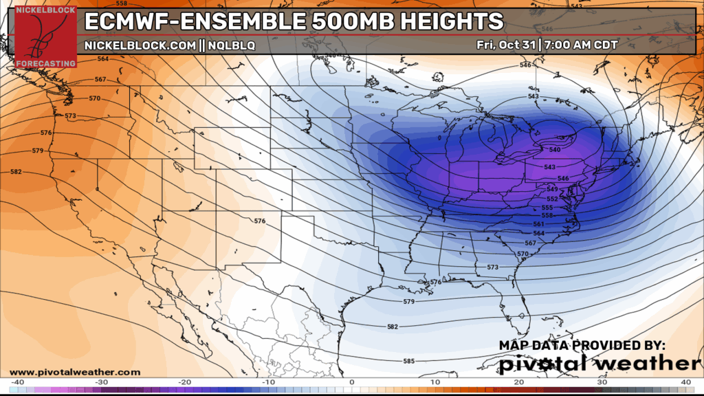
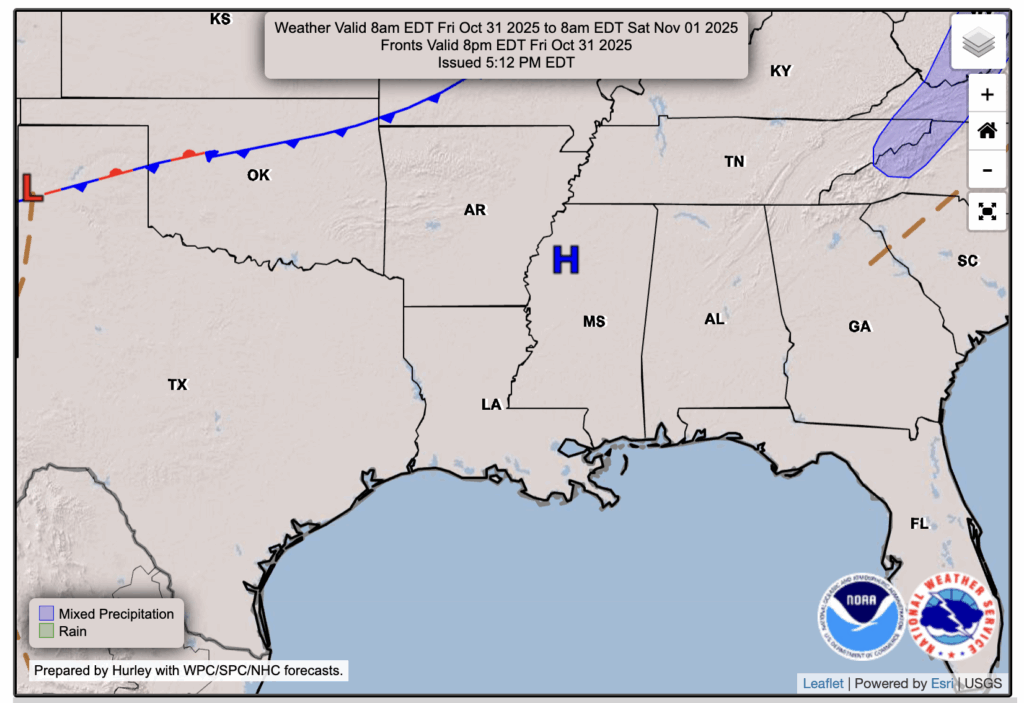
Halloween is tomorrow, and if you’re like me, it’s an exciting one to look forward to! The good news for trick-or-treaters is that conditions will stay dry, though it’ll be a bit on the chilly side. A broad trough at 500 mb is helping funnel in cooler northerly winds, while a strong area of high pressure overhead keeps us dry and cloud-free through the evening.

Tonight’s Forecast
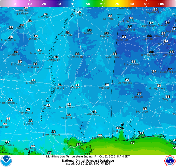
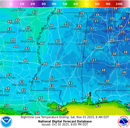
Tonight, skies will remain clear, and temperatures will drop quickly overnight. Lows will fall into the low 40s, with some upper 30s possible farther north. Patchy fog may develop toward sunrise, especially in low-lying areas.
Halloween Forecast: Friday, October 31
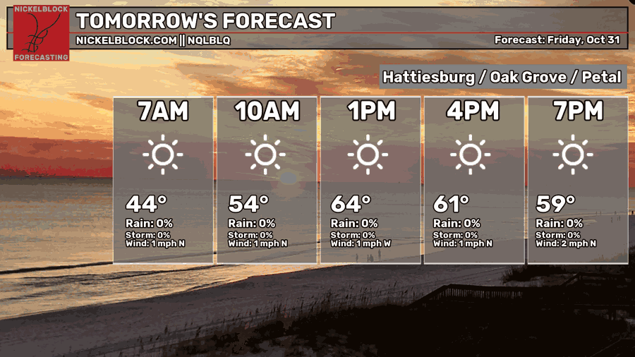
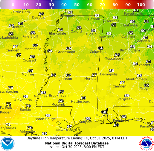
Halloween will be clear and dry, making for great trick-or-treating weather. Temperatures will start off in the low 60s before dipping into the 50s after sunset, so it might get a little chilly. If your costume doesn’t come with sleeves, it’s probably smart to sneak a jacket underneath, even if it slightly ruins the look. Have a happy Halloween!
Weekend Forecast: Saturday November 1 & Sunday November 2
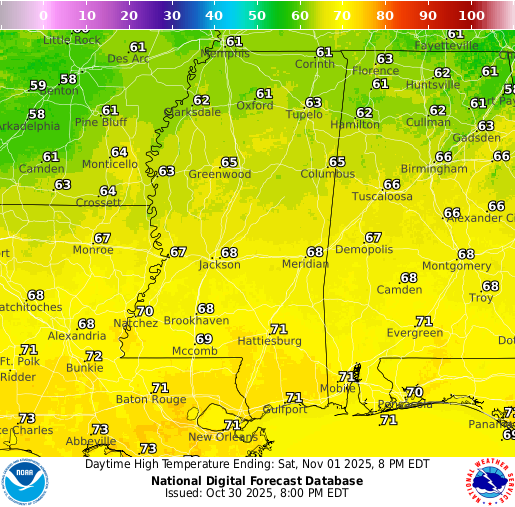
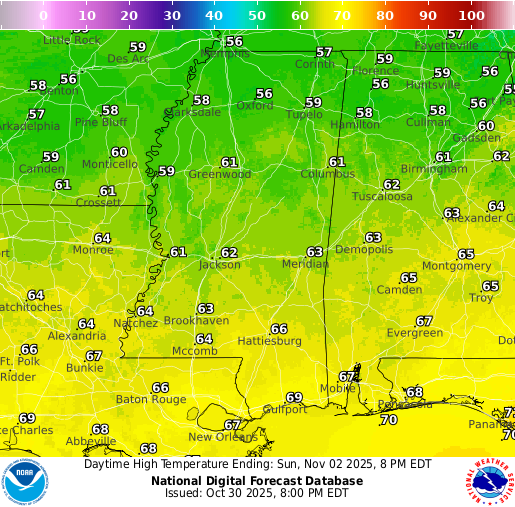
Things are still a little uncertain heading into the weekend. The GFS suggests a few isolated showers could pop up, while the Euro keeps the area mostly dry. Either way, we’re not expecting anything widespread. Saturday should reach near 70 degrees with more clouds around through the day, while Sunday looks a bit cooler in the mid 60s and a touch brighter. It’s not a washout by any means, but keep an eye on updates in case a few light showers sneak in.
Extended Local Outlook
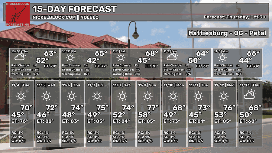
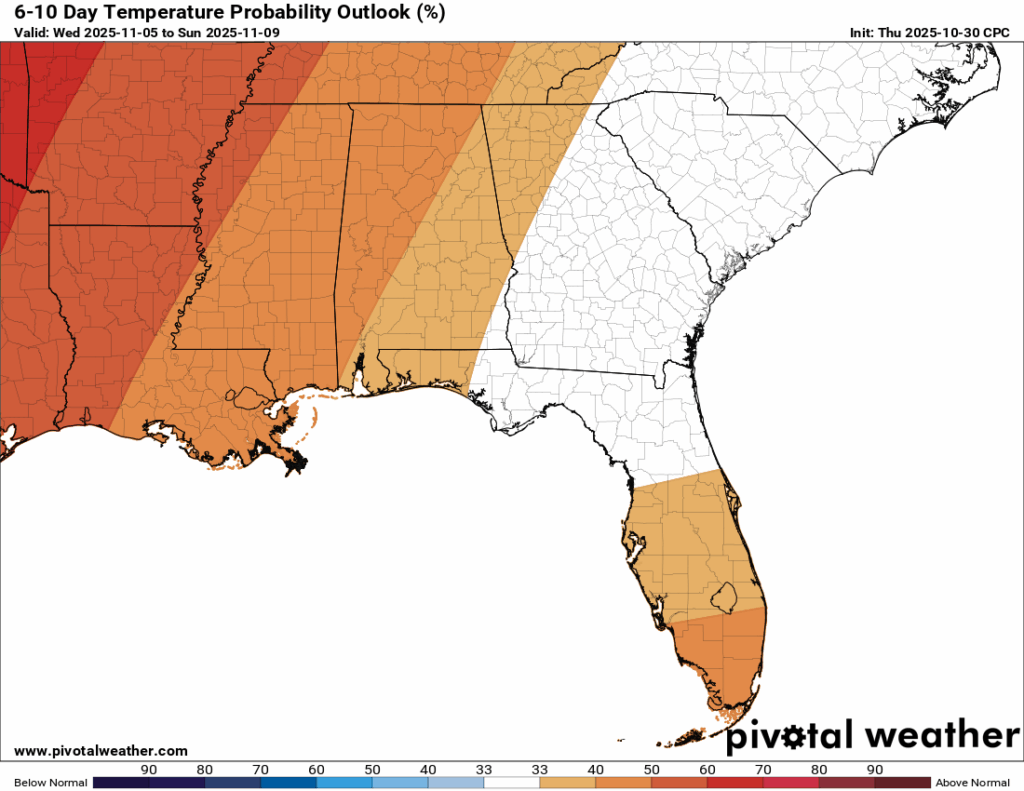
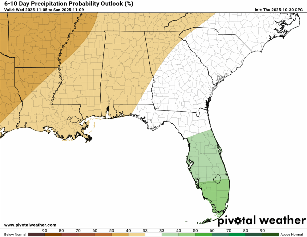
Looking ahead, temperatures will start to rebound as we move into next week. We’ll be seeing more 70s than 60s during the afternoons, and the longer-range outlook agrees. The 6-10 day temperature forecast shows a medium chance for above-normal warmth, and it’s also looking a little drier than usual. Overall, a nice stretch of weather on the way with more sunshine and comfortable conditions sticking around.

Latest Tropical Update
Hurricane Melissa
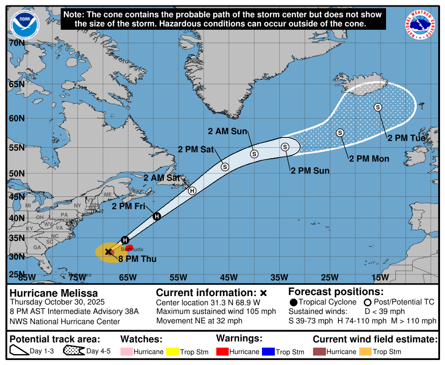
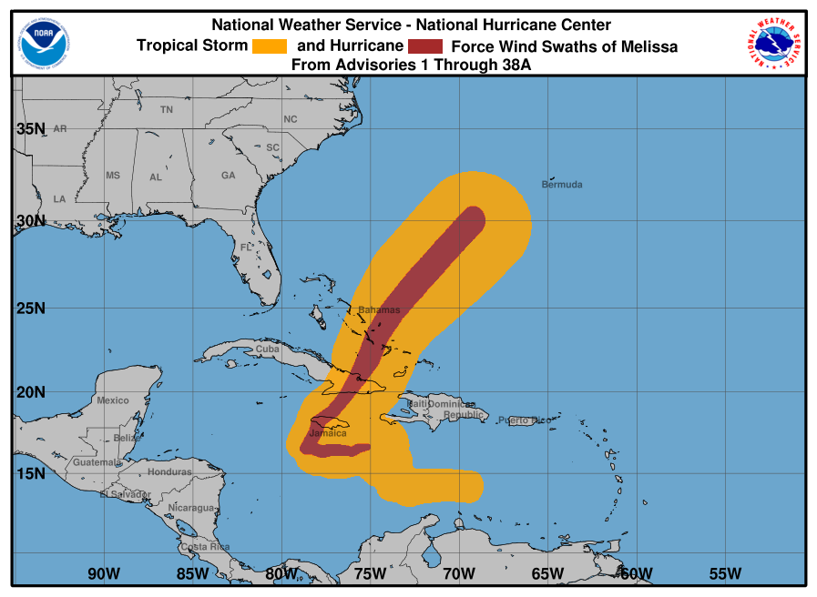
As of this post, Hurricane Melissa remains a Category 2 storm with sustained winds around 105 mph. It’s moving northeast and is expected to skim just north of Bermuda, bringing periods of heavy rain and strong, gusty winds. While a few hurricane-force gusts are possible, most of the island will likely experience tropical-storm conditions. After passing Bermuda, Melissa will continue out into the open Atlantic.
REGIONAL DAY TO DAY FORECAST
Tonight: Patchy fog after 5 a.m., otherwise clear. Lows in the lower 40s. Northwest winds around 5 mph, becoming calm in the evening.
Friday: Patchy fog before 8 a.m., then sunny. Highs in the upper 60s. Calm winds becoming north-northwest around 5 mph.
Friday Night: Clear with lows in the lower 40s. Calm winds.
Saturday: Mostly sunny with highs in the lower 70s. Light winds turning northeast around 5 mph.
Saturday Night: Mostly cloudy with lows in the mid 40s. Calm winds. Chance of rain 20 percent.
Sunday: Mostly sunny with highs in the mid 60s. North winds 5 to 10 mph. Chance of rain 20 percent.
Sunday Night: Mostly clear with lows in the lower 40s. North winds around 5 mph.
Monday: Sunny with highs in the upper 60s. North winds around 5 mph.
Monday Night: Mostly clear with lows in the lower 40s. Light winds becoming calm.
Tuesday: Sunny with highs in the lower 70s.
Tuesday Night: Clear with lows in the mid 40s.
Wednesday: Sunny with highs in the upper 70s.
Wednesday Night: Clear with lows in the upper 40s.
Thursday: Sunny with highs in the upper 70s.


