It was a very cool morning with temperatures around 40 across much of the Gulf South. Temperatures only warmed up to the low 60s which made it a very Autumn day. We’ll continue the fall weather, but not without a slight warmup as another front is gearing to move east into our neck of the woods by Friday.

Tomorrow
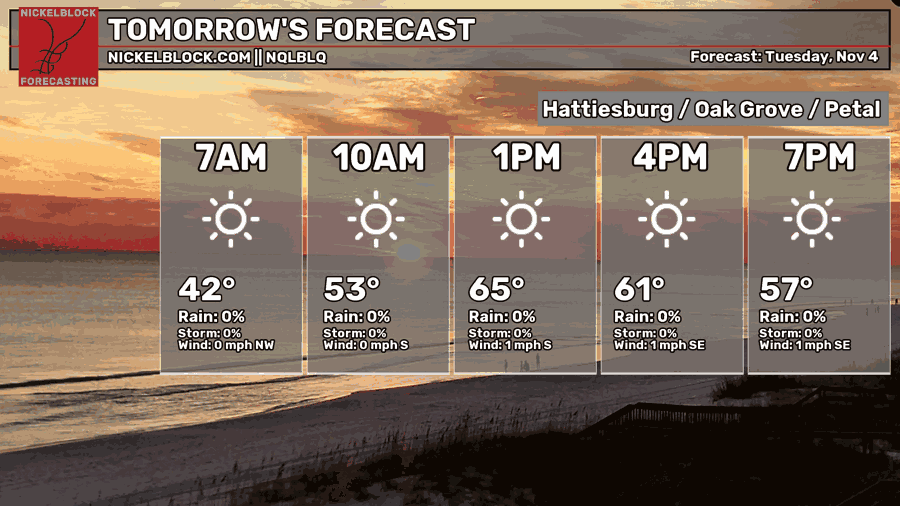
Overnight, temperatures will fall back into the low 40s with clear skies. We likely won’t see any clouds tomorrow with highs in the mid 60s and winds shifting towards the south, but we probably won’t feel much of the wind either.
Wednesday’s Forecast
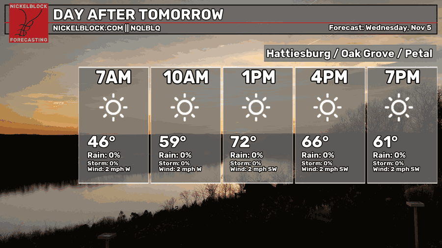
Wednesday will start off in the mid 40s and we’ll still be clear of clouds all day. Winds will shift towards the southwest a bit under 5mph for the day. Overall, a nice hump day!
Thursday and Friday
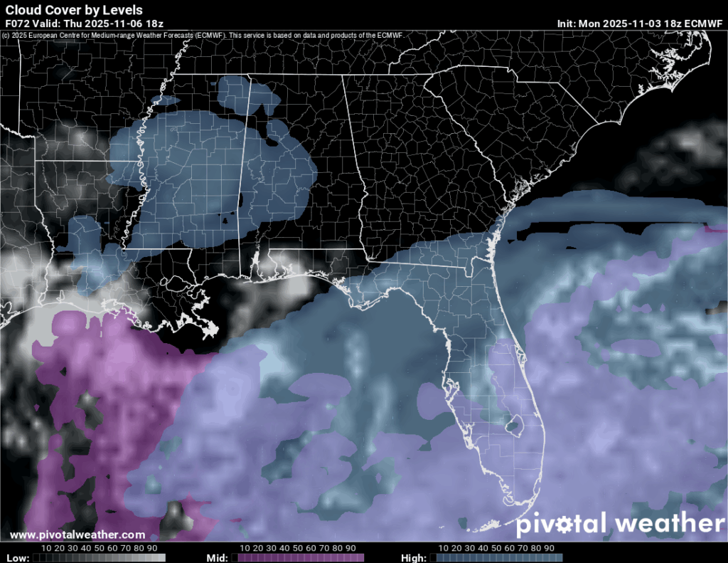
We’ll notice a slight uptick in temperatures as we reach the end of the week. Winds are still out of the south and upper level clouds will move in from the west. Highs will be in the upper 70s during the day, so a little warmer than usual. Overnight, we’ll see temperatures fall around 50.
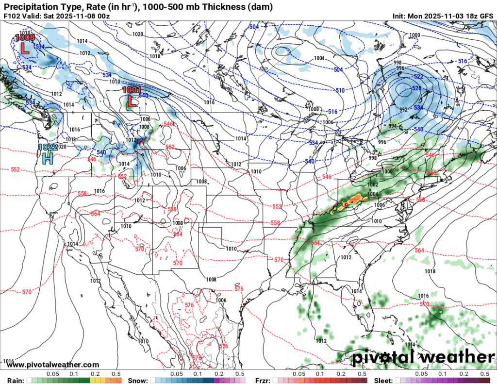
//Courtesy: Pivotal Weather
As we move into Friday, a long front will move in from the west and slowly head east. This will be a multi-part system with a few cutoff lows finishing the race across the eastern US. The first part will give us the rain chances on Friday into Saturday. Since the high pressure system is stretching out the low, southerly winds will contribute to the moisture flow and rain showers across parts of coastal AL/LA/MS. Other storms further north will be driven by the low pressure system. The SPC has not placed any severe outlooks on this system, however their outlook so far is near the Tennessee River valley.
The Skew-Ts suggest more of a low-level cloud rain event for us, however the instability begins to ramp up overnight into Saturday, but both models are suggesting only low level clouds. I’ll have an update Wednesday once models are closer to the event.
Bottom line for now: just some scattered rain showers, maybe a thunderstorm.

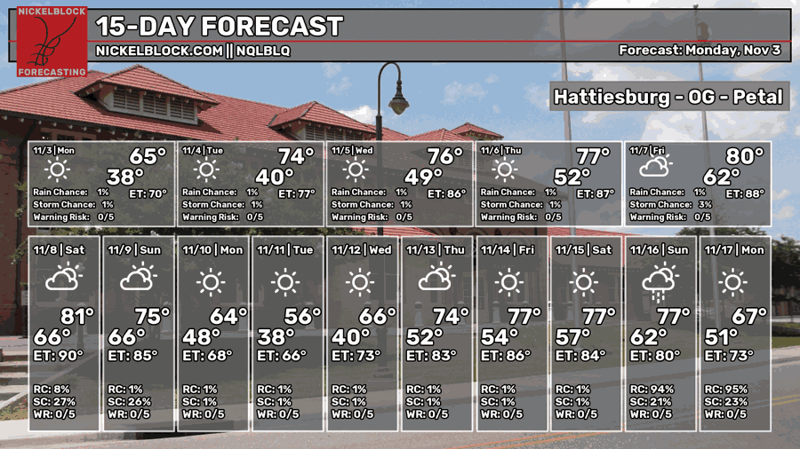
15 Day Forecast